

Maps & Atlases, Natural History & Color Plate Books
Officers

Caleb Kiffer
Specialist
caleb@swanngalleries.com
(212) 254-4710 ext. 17

David Rivera
Administrator
drivera@swanngalleries.com
(212) 254-4710 ext. 13
George S. Lowry
Chairman
Nicholas D. Lowry
President, Principal Auctioneer
924899
Andrew M. Ansorge
Vice President & Controller
Alexandra Mann-Nelson
Chief Marketing Officer
2030704
Todd Weyman
Vice President & Director, Prints & Drawings
1214107
Nigel Freeman
Vice President & Director, African American Art
Rick Stattler
Vice President & Director, Books & Manuscripts
Administration
Andrew M. Ansorge
Vice President & Controller
aansorge@swanngalleries.com
Ariel Kim
Client Accounting
akim@swanngalleries.com
Diana Gibaldi
Operations Manager
diana@swanngalleries.com
Kelsie Jankowski
Communications Manager
kjankowski@swanngalleries.com
Shannon Licitra
Shipping Manager
slicitra@swanngalleries.com
Maps


(ADRIATIC SEA.) Vincenzo Coronelli.
Carta Maritima del Golfo di Venetia In Quale si Contiene Tutte le Coste et Isole di Quello.

Venice, circa 1695
Double-page engraved chart of the coasts of Italy and Dalmatia. 19½x28¼ inches sheet size, extra wide margins; small repair at upper right corner, else very nice.
Estimate
$600 – $900


(ADRIATIC SEA.) Gerard van Keulen.
Pas-Caart van de Weder zythsche Zee-kusten soo van Italia als Dalmatia en Griecken Inde Golff van Venetien.

Amsterdam, circa 1720
Hand-colored double-page engraved chart of the coasts of Italy and Dalmatia. 20¾x24 inches sheet size; upper margin trimmed to the platemark, otherwise a nice example.
Estimate
$500 – $750


(AFRICA.) Edward Stanford; for The Society for Promoting Christian Knowledge.
Africa Published Under the Direction of the Committee of General Literature and Education Appointed by the Society for Promoting Christian Knowledge and of the National Society.

London, 1895
Large lithographed case map of colonial Africa. 60x53 inches overall, dissected into 48 segments and mounted to original linen backing with marbled paper self-wrappers; strong original hand-color in full; minor staining at several folds and other faint discolorations but overall excellent; cover remnants of original Stanford-labeled cloth case preserved; James B. Ford's Explorers Club bookplates to map verso (bearing "Sold By" stamp). Scarce, with one institutional example located.
Estimate
$700 – $1,000


(AFRICA.) Capt. A.J. Woodroffe.
Map of Southern Nigeria (Provisional).

London: Edward Stanford, 1905
Superbly detailed color-printed lithographed case map of coastal Nigeria from Lagos to Mount Cameroon. 33¼x62½ inches overall, segmented and mounted to original linen backing with marbled paper self-wrappers; minor wear but generally very good.
Estimate
$300 – $500


(AFRICA – ATLANTIC ISLANDS.) Arnold Colom.
de Vlaamsche en Canarische Eylanden.

Amsterdam, circa 1658
Double-page engraved chart of West Africa, the Iberian Peninsula, Canary Islands, Cape Verde, and the Azores. 22x25½ inches sheet size, ample margins; original hand-color in outline; double-backed on a sheet of contemporary laid paper as issued, slight edge wear and faint stains, collector’s ex libris blindstamp to upper corner.
Estimate
$600 – $900


(ALABAMA.) G.W. & C.B. Colton.
Colton’s Map of the State of Alabama.

New York, 1870
Large hand-colored lithographed pocket map within an ornate border of shells and foliation. 39x28¾ inches sheet size, folding into publisher’s 12mo format gilt brown cloth case; uncommon, and particularly well-preserved with bright original colors by county.
Estimate
$600 – $900


(AMERICAS.)
Two nineteenth-century European maps.

Vp, vd
- Eric Åkerland. Karta Öfver America. Engraved map of North and South America with an inset of Alaska on watermarked laid paper. 19x15 inches sheet size, wide margins with deckle edges; original hand-color; small closed tear at center, minor spotting at sheet edges. Stockholm, 1818.
- Carl Flemming. Nord America. Lithographed map of North America with original hand-color in outline from an early edition of the Sohr-Berghaus Hand-Atlas. 14¼x17¼ inches sheet size, wide margins; left margin reinforced on verso stabilizing small edge losses, scattered foxing. Glogau, circa 1847 (see delineation of Mexico, ie, pre-Treaty of Guadalupe Hidalgo).
Estimate
$250 – $350


(AMERICAS.) John Rapkin and others, for John Tallis.
North America. [and] Western Hemisphere.

London, [1851]
Together two finely hand-colored engraved maps, each decoratively bordered with vignettes of geographical, zoological, and cultural interest relating to the region. Approximately 14¼x10½ inches each sheet size; mounted to non-acidic board.
Estimate
$100 – $150

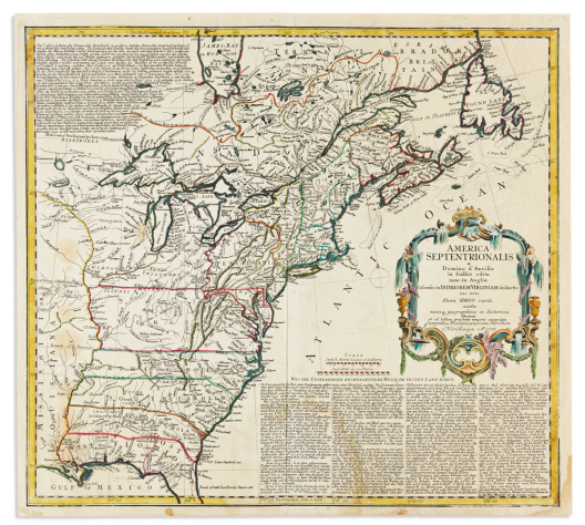

(AMERICAN COLONIES.) Homann Heirs; after Jean Baptiste d’Anville and Thomas Jefferys.
America Septentrionalis a Domino d’Anville in Galliis Edita Nunc in Anglia Coloniis in Interiorem Virginiam Deductis nec non Fluvii Ohio Cursu.

Nuremberg, 1777
Double-page engraved map of eighteenth-century North America east of the Mississippi River with geographical toponyms in English and explanatory essays in German. 19x20¾ inches sheet size, ample margins; nicely hand-colored in outline; scattered stains.
Estimate
$300 – $400


(AMERICAN ATLANTIC COAST.) Giovanni Brun; after Antoine Sartine.
Carte Reduite des Cotes Orientales de L’Amerique Septentrionale Contenant Partie du Nouveau Jersey, le Pen-sylvanie, le Mary-land, la Virginie, la Caroline Septentrionale, la Caroline Meridionale et la Georgie.

Rome, 1799
Large engraved chart of the North American eastern seaboard. 2 sheets joined, 24x34½ inches overall; original vertical folds, right and upper left margins neatly replaced with expert facsimile reinstatement to a small part of the latitude scale.
Rare Italian imprint of this excellent chart first prepared by the Depot de la Marine in 1778 for use by the French navy during the Revolutionary War. Completely re-engraved by Giovanni Brun in Rome, the Italian eliminates recognition to both Sartine and the Depot de la Marine, however the nomenclature remains entirely in French. The geography follows the original extremely closely, showing great detail of the coast from Philadelphia to northern Florida, as well as excellent inland information west to the Appalachian Mountains.
Estimate
$300 – $400


(AMERICAN SOUTHEAST.) Gerard Mercator; and Jodocus Hondius.
Virginiae Item et Floridae Americae Provinciarum, Nova Descriptio.

Amsterdam, 1623
Hand-colored double-page engraved map of the Outer Banks and American southeast with attractive sea decorations and native villages inset to the strapwork title cartouche. 15½x20½ inches sheet size, ample margins, Latin text on verso; archivally lined on verso with thin tissue, small area of lower margin expertly reinstated only narrowly affecting printed border. Burden 151, with signature “Ggggggg”.
Estimate
$1,500 – $2,500


(AMERICAN SOUTHWEST.) Josiah Gregg.
A Map of the Indian Territory Northern Texas and New Mexico Showing the Great Western Plains.

New York, 1844
Lithographed folding map, printed in black and green, from Gregg’s Commerce of the Prairies. 14x16 inches sheet size, wide margins, binding stub at right; neatly closed tear across center.
Estimate
$300 – $400


(AMERICAN ANTEBELLUM TRAVEL.) Wellington Williams.
Appletons’ New and Complete United States Guide Book for Travellers.

New York and Philadelphia: Appleton, 1850
Two works in one, comprising Northern and Eastern Traveller’s Guide, 313 pages, 30 engraved maps on 22 sheets (some folding and/or hand-colored), and Southern and Western Travellers’ Guide, 140 pages, 15 engraved maps on 9 sheets (some folding and/or hand-colored). 8vo, 6½x4½ inches, publisher’s gilt red cloth, a little shaken and chipped; first map of New York City with partial loss, other scattered fold repairs, ink stamp of Chas. S. Shultz in several places.
Estimate
$250 – $350


(ANSON’S CIRCUMNAVIGATION.) Isaak Tirion.
Nieuwe Wereld Kaart, Waar in de Reizen van den Hr. Anson Rondsom de Wereld met een Gestipte Linie Worden Aangewezen.

Amsterdam, circa 1750
Double-page engraved Mercator projection chart showing Commodore George Anson's track around the world (1740-1744). 16¾x21¾ inches sheet size, extra wide margins with untrimmed deckle edges; original hand-color in full; minor paper crinkle, though a very collectible example.
Estimate
$300 – $500


ARROWSMITH, AARON.
A Map of the United States of North America Drawn from a Number of Critical Researches.

London, 1796, additions to 1802 [but circa 1811]
Large engraved case map in four sections printed on “JWhatman 1811” watermarked wove paper. Dissected and mounted to original linen with contemporary printed bookseller’s labels of William Faden pasted to each verso; 25x28½ inches each section; 50x57 inches overall; nice original hand-color in outline; faint offsetting, a few scattered stains.
Attractive example of one of the great large-scale maps of the early United States, one generally considered to be a primary guide in the planning of the Lewis and Clark expedition. Stevens & Tree 79(e).
Estimate
$4,000 – $6,000


(ARCTIC.) Emanuel Bowen.
A Correct Draught of the North Pole and of All the Countries Hitherto Discovered, Intercepted Between the Pole and the Parallel of 50 Degrees.

London, circa 1744
Double-page engraved polar projection of the world. 16¼x18¼ inches sheet size, ample margins; attractively hand-colored in outline; minor offset and foxing.
Estimate
$200 – $250


(ANTARCTICA – THE FROZEN SEA.) Jacques Nicolas Bellin;
after Captain James Cook. Carte de l’Hemisphere Austral Montrant les Routes des Navigateurs les Plus Célebres.

Paris, 1780
Engraved polar-projected folding map of the Southern Hemisphere noting the tracks of a dozen early explorers from 1595 to 1775. 22¼x23¼ inches sheet size, ample margins; original folds, very faint offsetting but overall a nice example.
Estimate
$250 – $300


(asia.) willem blaeu.
Asia Noviter Delineata.

Amsterdam, circa 1640
Double-page engraved map of the Asian continent with carte-a-figures and city plan border panels. 17¼x22¾ inches sheet size, narrow margins; original hand-color in outline; mounted to acidic board with some staining, printer’s creases, and short edge repairs.
Estimate
$1,000 – $1,500


(asia.) matthaeus seutter.
Asia cum Omnibus Imperiis Provinciis Statibus et Insulis.

Augsburg, circa 1730
Double-page engraved map of Asia with two decorative allegorical cartouche designs. 21x24½ inches sheet size, ample margins; original hand-color; moderate foxing and appropriate signs of age.
Estimate
$150 – $250


(asia.) edward stanford.
Stanford’s Commercial Map of Asia.

London, circa 1930s
Large color-printed case map of Asia showing railway and steamship lines. 39¾x48 inches overall, segmented and mounted on original linen backing with leatherette self-wrappers and printed label; lower right corner darkened slightly, else fine.
Estimate
$150 – $200


(AUTOMOBILE MAP.) J. Barreau; for De Dion-Bouton.
Carte Routiere de Dion-Bouton. Normandie.

Paris, circa 1900
Color-printed lithographed road map of eastern Normandy with an Art Nouveau-styled advertising border design; verso with printed panels of illustrated automobile advertisements and local amenities. 33½x39¾ inches, dissected into 32 segments and mounted to original linen; overall very fine.
Estimate
$150 – $200


Braun, georg; and hogenberg, franz.
Calaris / Malta / Rhodus / Famagusta.

Cologne, [1572]
Double-page engraved sheet of Mediterranean fortifications from Civitates Orbis Terrarum. 14x19¾ inches sheet size, ample margins, Latin text on verso (slightly clipped); original hand-color; scattered surface abrasions.
Estimate
$150 – $200


BRAUN, GEORG; and HOGENBERG, FRANZ.
Group of 4 (and two halves) double-page engraved town views from Civitates Orbis Terrarum.

Cologne, [1572]
15½x21 inches or smaller, Latin and French text on versos, all but one with original hand-color.
-
(Grotto of the Cumean Sibyl / Abraham Ortelius and Georg Hoefnagel.) Hic est Introitus Antri Sibylle Cumane… / Vera delineatio lacus Aniani… Creases, plate separated horizontally at center and rejoined.
-
(Spain.) Granada. Various wear, creases and tear closures.
-
(Poland, Gdansk/Danzig.) Dantzigt. Faint mat burn and other surface soiling.
-
(France.) Orleans / Bourges. Center fold partially reinforced on verso.
-
(Spain.) Barcelona. Trimmed half sheet.
-
(Spain, Vélez-Málaga.) Velis Malaga. Trimmed half sheet.
Estimate
$400 – $600


(boston.) georges-louis le rouge.
Plan de Boston.

Paris, 1755
Small-scale engraved folding plan of the city with a keyed reference table of churches and wards. 8x10¾ inches sheet size, ample margins; original folds, excellent condition.
A fine example of this rare French and Indian War-period map of Boston from le Rouge’s “Recueil des Plans de L’Amerique Septentrionale”.
Estimate
$600 – $900


(boston.) jacques nicolas bellin.
Plan de la Ville de Boston et ses Environs.

Paris, circa 1757
Engraved folding map of Boston with a 16-point reference key at left. 9x12½ inches sheet size, wide margins; faint offset else nice.
Estimate
$150 – $200


(boston.)
A Plan of the Town and Chart of the Harbor of Boston.

London, 1775
Hand-colored engraved folding map from The Gentleman’s Magazine. 12½x14¼ inches sheet size, wide margins; faint mat tone.
Estimate
$250 – $300


(BRITISH COUNTIES.) William Hole; for Michael Drayton.
Two anthropomorphically decorated double-page engraved maps of Welsh and Midland counties along the River Severn from Drayton’s epic topographical poem, Poly-Olbion.

London, 1612
11x13½ inches each sheet size, ample margins; small edge closure.
Herefordshire / Part of Gloucestershire / Part of Worcestershire [and] Glamorganshire / Monmouthshire.
Estimate
$250 – $300


(british empire.) fosh & cross.
The British Commonwealth.

London, early 1940s
Large color-printed map of the world graphically showing British dominions and territories keyed with varying shades of red. 25x40 inches sheet size; mounted on modern poster linen stabilizing scattered closed tears.
Estimate
$400 – $600


(california.) didier robert de vaugondy.
Carte de la Californie.

Paris, circa 1777
Hand-colored engraved folding plate showing 5 historical mappings of California from Diderot and d’Alembert’s Encyclopaedie. 15¼x18¼ inches sheet size, wide margins, left edge trimmed for binding; an attractive example. McLaughlin 241.
Estimate
$200 – $250


(california – bay area.) m.g. king; for william j. dingee.
Map of Oakland, Berkeley, and Alameda.

San Francisco: Woodward & Taggart, 1878
Lithographed cadastral map with an inset of the greater Bay Area at upper right; place names and boundary lines overprinted in yellow; 21¾x29½ inches overall, mounted to original linen backing and folding into 8vo format plain cloth covers; corner creases but generally good, case neatly rebacked.
Issued to promote the early career of successful local real estate agent William Jackson Dingee.
Estimate
$800 – $1,200


(CALIFORNIA – SANTA BARBARA.)
Group of 3 charts relating to Santa Barbara.

Vp, vd
- James Imray & Son. Santa Barbara. Hand-colored engraved folding chart. 9¾x13 inches overall; a few spots of foxing. London, circa 1880.
- U.S. Coast Survey. Preliminary Chart of Eastern Entrance to Santa Barbara Channel California. Engraved folding chart showing part of the lower Channel Islands and an inset of Point Hueneme. 18½x24¾ inches overall; repair at upper margin. Washington, D.C., 1857.
- George B. Tolman. Map of the City of Santa Barbara, Cal.a., with References. Lithographed town plat with an extensive keyed table of notable buildings. 16½x11 inches overall, wide margins; period linen backing, dampstain, folds and creases with small losses at center. Santa Barbara(?), 1884. OCLC locates one example.
Estimate
$250 – $300


(canada.) covens & mortier; after guillaume de l’isle.
Carte du Canada ou de la Nouvelle France.

Amsterdam, circa 1730
Double-page engraved map of eastern Canada and the Great Lakes region with an ornate figural title cartouche. 22¼x26¼ inches sheet size, wide margins; hand-colored in outline; mounted to board, minor edge soiling.
Estimate
$400 – $600


(canadian fisheries dispute.) g.w. & c.b. colton.
Colton’s New Brunswick, Nova Scotia, Newfoundland, and Prince Edward I’d.

New York, 1871
Lithographed map of the Canadian Maritimes and Newfoundland annotated with contemporary manuscript distilling the 1871 Washington Treaty regulating commercial fishing in Fortune Bay and the Gulf of St. Lawrence. 16x19 inches sheet size, wide margins; uncolored save for those coasts outlined in the commentary; tanning and soiling, closed tears.
“The American fishermen have the right to take fish of every kind on the coasts colored [blue] [pink] [green]. They have also the right to dry and cure fish in the unsettled bays harbors and creeks of the coast colored thus [blue]. It is claimed that the French fishermen have also the right to take fish on the coast colored thus [pink]. The United States have renounced the liberty to take, dry or cure fish within three marine miles of the coasts, bays, creeks or harbors of the British Dominions in America not included in the above limits; but the privilege is reserved to American fishermen to enter such bays of harbors for the purpose of shelter and repairing damages there, of purchasing wood and of obtaining water, and for no other purpose whatever, under such restrictions as may be necessary to prevent them from taking, drying or curing fish therein, or in any other manner whatever abusing the privileges reserved them”.
Estimate
$80 – $120


(CANALS.) William G. Williams, U.S. Topographical Engineer.
2 large engraved plans of a proposed canal system between Lake Erie and Lake Ontario on the New York side of the Niagara River.

Washington, D.C., 1835
Survey for a Ship Canal Around the Falls of Niagara. 2 sheets joined, 50x37 inches overall, wide margins; folds, small amount of foxing.
Survey for a Ship Canal Around the Falls of Niagara. 2 sheets joined, 33x51 inches overall, wide margins; folds, scattered tears.
Estimate
$200 – $250


(caribbean.) johannes van keulen.
Pas Kaart Van de Caribes Tusschen I. Barbados en I. S. Martin.

Amsterdam, circa 1685
Double-page engraved chart of the Lesser Antilles Islands. 21½x26¼ inches sheet size, wide margins; stain and other light soiling to margins only.
Estimate
$500 – $750


(caricature map.) sagyo shishido.
Hitome de Wakaru Manga Sekai Genjo Chizu. [Cartoon Map of the Current World Situation].

Japan, Showa 7 (1932)
Large color-printed Japanese pictorial world map; verso printed with a smaller map and photographic depictions of international culture. 31x43 inches overall, folding into original pictorial printed envelope (a little clipped); partial reinforcements to a few fold versos.
An excellent Japanese manga cartoon map of the world relating political tensions and popular culture around the globe in the 1930s. Caricatures of notable period figures include Herbert Hoover, Al Capone, Babe Ruth, Jack Dempsey, Chiang Kai-shek, Stalin, Mussolini, Hitler, Hindenburg, Gandhi, Ramsay MacDonald, and many others.
Estimate
$1,800 – $2,200


(carolina.) george louis le rouge.
Nouvelle Carte des Cotes des Carolines Septentrionales et Meridionales.

Paris, 1777
Large double-page engraved chart of the North and South Carolina coastline including a prominent plan of Charleston, decorative ships, a radiant compass rose, and coastal elevations inset to the interior. 21¼x29½ inches sheet size, wide margins; ideal collectible condition.
Estimate
$1,000 – $1,500

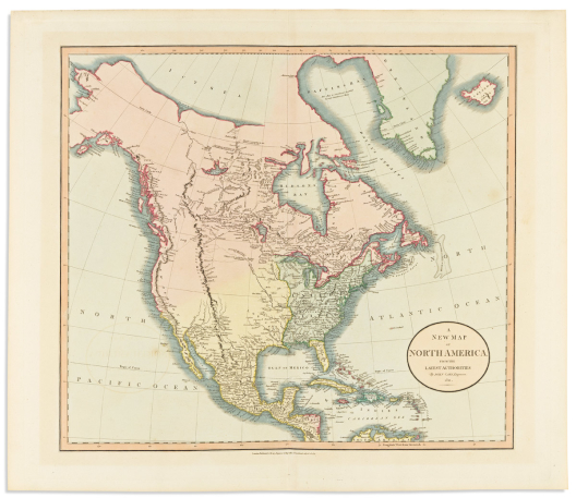

Cary, john.
A New Map of North America from the Latest Authorities.

London, 1811
Double-page engraved map delineating the United States east of the Mississippi River and very little recorded information within the vast territory to the west. 21½x24¾ inches sheet size, wide margins; original hand-color in full; faint mat toning, else quite fine.
Estimate
$250 – $300


(celestial.) ignace gaston pardies.
[Plate 6 - Constellations of the Southern Sky].

Paris, [1693]
Hand-colored double-page engraved celestial chart with flanking descriptive columns in Latin and French. 19x28¼ inches sheet size, top margin shaved to the neatline slightly affecting printed captions; minor foxing.
Estimate
$600 – $900

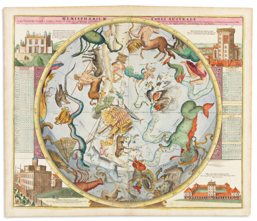

(celestial.) johann gabriel doppelmayr; and johann baptiste homann.
Hemisphaerium Coeli Australe.

Nuremberg, 1730
Double-page engraved constellation chart of the southern sky with tables and international observatories decorating the spandrels. 21x24¾ inches sheet size, wide margins; hand-colored with gold highlights; small closure at lower margin but overall a handsome example.
Estimate
$800 – $1,200


(celestial.) johann gabriel doppelmayr; and johann baptiste homann.
Sphaera Mundi.

Nuremberg, circa 1740
Double-page engraved diagram of mathematical celestial models with decorative globes and armillaries at each corner. 21½x25¼ inches sheet size, wide margins; original hand-color; small discoloration at center right, otherwise rather nice.
Estimate
$150 – $200


(celestial.) charles dien.
Uranographie Dressee sous l’Inspection de Monsieur Bouvard Astronome.

Paris, [1837]
Large engraved folding planisphere. 32x44 inches overall, dissected into 12 segments and mounted to original linen backing; heavy staining, tack points at upper margin, printed date excised at upper center fold joint (as issued), scattered pencil annotations; signed in ink by the author at the lower right of the northern hemisphere.
Rare chart offering detailed scientific knowledge of the astral skies in a straight-forward simplified presentation, abandoning the figural embellishment typically associated with early celestial maps. OCLC locates one example (BNF).
Estimate
$300 – $400

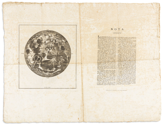

(CELESTIAL – MOON MAIDEN.) Giovanni Brun; after Giovanni Domenico Cassini.
[Lunar map broadside].

[Rome?, circa 1787]
Aquatint and engraved map of the moon’s surface on a sheet with two columns of letterpress describing Cassini’s rare 1679 lunar chart and several newer discoveries by late-eighteenth century astronomers. 17½x23 inches sheet size, wide margins with deckle edges; old folds, foxing.
Cassini’s large-scale map of the moon printed in 1679 was an influential scientific phenomenon. Even at the time of its publication copies were scarce and the copper printing plate was presumed lost for over 100 years. In 1787 Cassini’s heirs discovered the plate in the archives of the Imprimerie Royale and a new edition was struck; and along with it, a certain renewed interest to the greater public and scientific community.
The present Italian broadside is a piggyback on that re-kindled awareness of lunar cartography; Giovanni Brun reproduces the layout of the original with general faithfulness but gives us a greatly reduced model with topographical nomenclature added. One playful detail that is repeated from the original is a subtly hidden head of a woman peering out from the Promontorium Heraclides at lower right, a feature quasi-famously known as Cassini’s “Moon Maiden”.
Estimate
$300 – $400

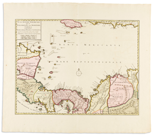

(central america.) reiner & josua ottens.
Nova Isthmi Americani, qui et Panamiensis item Dariensis Tabula.

Amsterdam, circa 1730
Double-page engraved map of Honduras, Nicaragua, Costa Rica, Panama and Colombia. 22x25 inches sheet size, extra wide margins with untrimmed deckle edge at top and bottom; original hand-color in full; a very nice example.
Estimate
$400 – $600


(CHARTS – 18TH CENTURY.) Edmund Halley, John Senex, et al.
Group of 4 engraved double-page or folding charts, from Atlas Maritimus & Commercialis.

London, 1728
- A Correct Sea Chart of the Whole World, According to Wright's, Commonly Called Mercator's Projection (Eastern half only). 2 sheets joined, 26½x32½ inches overall; repairs to verso, small loss at lower left.
- A New and Correct Chart of the Mediterranean Sea. 2 sheets joined, 20½x48 inches overall; top edge shaved to neatline, various folds, tears, and small paper losses.
- A Chart Describing the Coast of Great Britain and Ireland to the Straits of Gibralter and the Mediterranean Sea. 20½x24½ inches sheet size; margins brittle and chipped with slight loss to neatline and latitude bar at left.
- [10 inset plans of Mediterranean ports]. The Bay of Tunis, The Haven of Zea, The Haven of Meteline, Fogia Nova, The Gulf of Smyrna, Xio or Sio, The Bay of Scanderoon, The Bay of Famagusta, The Road before Tripoli, The Haven of Alexandria. 20x24 inches sheet size; minor edge wear and light offsetting.
Estimate
$400 – $600


Chatelain, henri.
Mapmonde ou Description Generale du Globe Terrestre.

Amsterdam, 1719
Hand-colored double-page engraved double-hemispheric world map with decorative spandrels including celestial diagrams at the top corners and printed glossary tables below. 14x19 inches sheet size, wide margins; minor sheet wrinkle but generally nice.
Estimate
$200 – $250


(chesapeake.) henricus hondius.
Nova Virginiae Tabula.

Amsterdam, circa 1640
Hand-colored double-page engraved map of the Delmarva Peninsula, Chesapeake Bay, and inland Virginia derived from Captain John Smith. 18x22¼ inches sheet size, wide margins; mounted to non-acidic card with stabilized repairs at upper left. Burden 228, state not identified.
Estimate
$800 – $1,200


(china.) johannes blaeu.
Quantung, Imperii Sinarum Provincia Duodecima.

Amsterdam, circa 1655
Hand-colored double-page engraved map of southern China including the Pearl River estuary and Greater Bay Area. 19x23 inches sheet size, wide margins; competently cleaned with small restorations.
Estimate
$1,200 – $1,800


(civil war.) j. calvin smith.
The New Naval and Military Map of the United States.

Philadelphia, 1863
Large hand-colored engraved wall map on 4 sheets joined. 68x69 inches overall; original linen backing with blue silk selvage, lower wooden roller only; varnish a little yellowed, upper edge with damages partly stabilized but in need of proper restoration.
Large patriotic map of Civil War-era North America within a decorative border of stars, vines, and 30 medallion portraits including Abraham Lincoln, other political leaders, and major Union military figures. The eastern geography of the United States is standard for the period, though further west we find several regions on the cusp of border change at the time of this publication: a wide New Mexico and Arizona Territory (becoming the familiarly-shaped separate territories in 1863); Nevada without its southern tip; one large Dakota Territory; a large cascading Washington Territory, but no Idaho Territory (1863), Montana (1864), or Wyoming (1868).
Insets of nationalistic scenes include flag bearers giving the response of the Army and Navy, an allegorical “Rescue of the Union”, Battle of Bunker Hill, a panoramic view of Washington, DC, the battle of ironclads Monitor and Merrimac; inset statistical maps show annual rainfall and temperature, distribution of plants, trees, and animals, distribution of slave and free colored populations, along with other tables, profiles and charts.
Estimate
$1,200 – $1,800

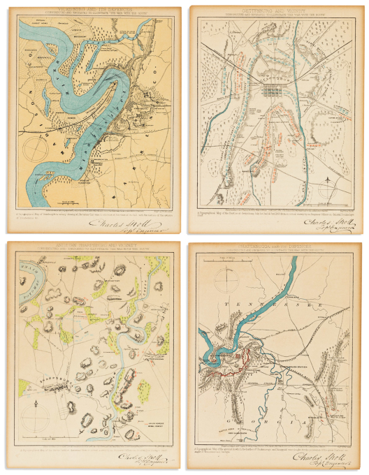

(civil war.) charles sholl, topographical engineer.
Group of 4 small-scale color-printed battle plans.

New York: Virtue, Yorston & Co, 1864
9¾x7½ inches each sheet size, a bit trimmed; minor age toning.
- Gettysburg and Vicinity.
- Vicksburg and its Defences.
- Antietam, Sharpsburg, and Vicinity.
- Chattanooga and its Defences.
Estimate
$200 – $250


(civil war.) charles magnus.
One Hundred & Fifty Miles Around Richmond.

New York, 1864
Large circular map centered on Richmond, VA lithographed in red and blue with subsidiary maps of southern regions and portraits of Union Generals Ulysses Grant, George Meade, and Winfield Scott Hancock. 28½x32¾ inches sheet size, wide margins; considerately conserved.
“Dedicated to the gallant soldiers fighting to suppress the Rebellion”. Stated 12th edition of Magnus’s popular general map, differentiated by various ancillary configurations. Inset maps here include the vicinities of Vicksburg, MS; Memphis/Nashville, TN; Knoxville, TN; Chattanooga, TN; Charleston, SC; Milledgeville, GA; Montgomery, AL; Galveston, TX; and a detail of the fortifications around Richmond.
Stephenson 632.5.
Estimate
$700 – $1,000

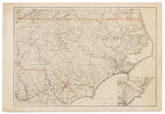

(CIVIL WAR – NORTH CAROLINA.) Adolph and Henry Lindenkohl; and George C. Krebs for the U.S. Coast Survey.
[North Carolina and adjacent parts of Virginia and South Carolina].

Washington, D.C., 1865
Large lithographed topographical map overprinted in red with touches of hand-color at the seacoast. 25¼x36¾ inches sheet size, wide margins; small paper chip to lower edge and other short marginal closures, else very nice. Stephenson 305a.7.
Estimate
$600 – $900


(colonial north america.) jacques-nicolas bellin.
Carte de la Nouvelle Angleterre, Nouvelle Yorck, et Pensilvanie.

Paris, 1757
Hand-colored double-page engraved map of the northeast region of North America. 9¾x14½ inches sheet size, wide margins; a nice example.
Estimate
$150 – $250


(COLONIAL NORTH AMERICA.) J.[ohn] Gibson, engraver.
The British Governments in Nth. America Laid Down Agreeable to the Proclamation of Octr. 7, 1763.

London: Gentleman’s Magazine, 1763
Small-scale engraved folding map of North America at the close of the French and Indian War with a large tract of "Land Reserved for the Indians" defined between the Appalachian Mountains and the Mississippi River; a detailed inset of Bermuda appears lower right. 8x9½ inches sheet size, lower margin shaved to the neatline; minor edge wear and short fold splits closed on verso. Jolly, Gent-170.
Estimate
$150 – $250


(colorado.) louis nell.
Nell’s Topographical Map of the State of Colorado.

Denver: Hamilton & Kendrick, 1895
Large well-detailed hand-colored lithographed map of the state. “Commercial Bond/1895” watermarked wove paper, 33x40 inches overall; archivally lined on verso with thin tissue flattening original folds, some staining and a small area at central fold intersection with minor loss.
Estimate
$400 – $600


(colorado – gold mining.) george s. clason.
Topographical Map Gilpin County Colo. Mineral Belt Gold Production $125,000,000.00.

Denver: Denver Lith. Co., circa 1906
Chromolithographed folding plan focused on the gold mining towns of Central City and Blackhawk (once dubbed the “Richest Square Mile on Earth”, now old-west-themed gambling resorts). 25x19 inches overall, folding into original printed envelope; faint show-through of verso-printed text (as usual), otherwise virtually faultless.
Estimate
$250 – $300


(colorado – gold mining.) phillips & desjardins.
Cripple Creek.

Denver: The Western Litho. Co., [1896]
Large chromolithographed birds-eye view of Cripple Creek, Colorado and a smaller inset of the neighboring town of Victor bordered by 20 vignettes of local mine smelting operations. 29x38¼ inches sheet size; two large closed tears, areas of reinstated paper loss at upper corners slightly affecting printed border.
Site of Colorado’s largest gold rush, with hundreds of millions of dollars of the precious metal successfully prospected in the 1890’s. This panorama was designed to promote the collective resilience of the district after it was fully rebuilt with modern amenities in a matter of months following a series of devastating fires in 1896. 5 copies found in OCLC. Reps, Cities on Stone (Amon Carter Museum), page 92.
Estimate
$1,500 – $2,500

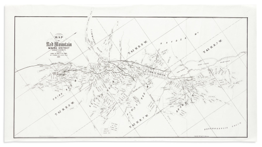

(colorado – gold mining.) w.a. sherman.
Map of Red Mountain Mining District Ouray County, Colo.

Ouray, CO, 1891
Large lithographed map of mining claims along the Silverton Railroad line in southwestern Colorado. Watermarked bank note paper, 20¾x38 inches sheet size; clean with no flaws of note.
Scarce plan promoting abundant mining opportunity in the mountainous terrain of southwestern Colorado. Over 200 prospector’s claims are noted in the stretch between Red Mountain and Ironton (both now ghost towns). OCLC locates 2 examples.
Estimate
$500 – $750


(COLORADO – GOLD MINING.) Wheeler, Hurlburt, F.L. Biddlecom, and W.A. Sherman, Civil and Mining Engineers.
Map of the Ouray Gold District, Ouray County, Colo.

Ouray, CO, 1890
Large color-printed lithographed map of mining claims in southwestern Colorado with local business advertisement cards printed at upper border. 2 sheets of watermarked bond paper joined, 35¾x62¾ inches overall; some staining and soft creases, small damages to the margins.
Scarce plat of the gold boomtown of Ouray connected from the north by the Denver & Rio Grande railroad branch with scores of named mining claims: Hardscrabble, Mugwump, White Elephant, Big Bob, Joe Dandy, Mephistopheles, Johanna, and Perhaps, to name just a few.
Estimate
$500 – $750


Colton, george woolworth.
Railroad Map of the Middle States.

New York, 1865
Large hand-colored lithographed pocket map centered on Pennsylvania with inset plans of the greater Philadelphia and New York City vicinities. 28x38½ inches overall, folding into publisher’s 12mo format gilt-lettered cloth case; separations at fold intersections with small areas of tape desiccate staining, covers with minor wear at spine caps. OCLC locates less than five examples. Modelski 91.
Estimate
$600 – $900


(cornwall.) gerard mercator; and jodocus hondius.
Cornubia, Devonia, Somersetus, Dorcestria…[etc.]

Amsterdam, circa 1630
Double-page engraved map of southwestern Britain. 17¾x22 inches sheet size, wide margins, Latin text on verso; a very nice example.
Estimate
$200 – $250


(devonshire.) peter schenk; and gerard valk.
Devoniae Descriptio / The Description of Devon-Shire.

Amsterdam, circa 1700
Double-page engraved English county map with decorative elements. 20x22¾ inches sheet size, wide margins; fine original hand-color; minor age spots but overall excellent.
Estimate
$150 – $200


(dakota territory.) chicago, milwaukee & st. paul railway co.
Map of Dakota Drawn from Official Plats of Public Surveys, and Published in the Interests of Immigration.

Chicago: Rand, McNally & Co. 1882.
Lithographed map of Dakota Territory with rail lines overprinted in red and river systems in blue; verso printed with 12 promotional panels including a smaller map of the company's branches. 24¾x18¾ inches overall, folds into self-wrapping pamphlet; minor edge wear though not much of a fault.
“DAKOTA the Land of Promise! Could the uninformed or incredulous see it, they would realize that the promised increase of immigrations had come, and with a force having no precedent in the history of our country; nor would they wonder at the great activity and prosperity of Dakota and her people, of which and whom they know and hear so little… Like all new countries, Dakota has a good, a better and its best portion, which may be geographically assigned to its Northern, Central and Southern Divisions, but that section famously known as “The Jim River Valley”, is not only an unsurpassed wheat growing land, but, beyond doubt, is the best on the globe for general farming, and now is the time to go there.” OCLC locates one example, Yale.
Estimate
$500 – $750


De l’isle, guillaume.
Carte d’Amerique.

Paris, 1722
Double-page engraved map of North and South America. 21x27½ inches sheet size, wide margins with untrimmed deckle edges; original hand-color in outline; minor edge soiling but a crisp attractive example.
Estimate
$400 – $600


De l’isle, guillaume, after.
L’Amerique Septentrionale Dressee sur les Observations de Mrs. de l’Academie Royale des Sciences.

Amsterdam: Covens & Mortier, circa 1730
Double-page engraved map of North America and the Caribbean. 19½x25 inches sheet size, ample margins; original outline hand-color with later additions; minor margin spots but overall very good.
Estimate
$400 – $600


De l’isle, guillaume, after.
Carte du Mexique et de la Floride.

Amsterdam: Covens & Mortier, 1722
Double-page engraved map of North America and the Caribbean. 21½x25½ inches sheet size, wide margins; strong original hand-color in outline; sensitively lined on verso to stabilize verdigris cracks (no losses), otherwise very attractive.
Estimate
$700 – $1,000

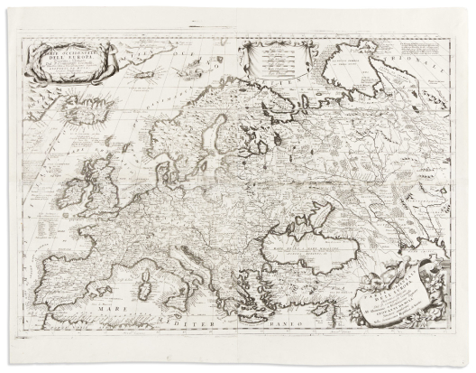

(europe.) vincenzo coronelli.
Parte Occidentale Dell’ Europa. [and] Parte Orientale Dell’ Europa.

Venice, circa 1690
Two double-page engraved mapsheets dissected and joined as one. 28½x36¾ inches overall, wide margins; clean, with no tears.
Estimate
$1,500 – $2,500


(europe.) cornelis de jode.
Nova Totius Europae Tabula.

Antwerp, 1593
Hand-colored double-page engraved map of the European continent and northern Africa with a decorative strapwork inset framing 20 figures in various regional dress. 15¼x20¾ inches sheet size, wide margins, Latin text on verso; centerfold flattened and reinforced, a few minor edge tears expertly repaired.
Attractive example of de Jode’s scarce map of Europe, notable for the massive “Terra Nova Zemla” sweeping across the Arctic with waterways and channels leading to an open north sea. Similarly of interest to the enthusiast of sixteenth-century cartographic curiosities will be the inclusion of three phantom islands in the north Atlantic seen here: Frisland, St. Brendan’s Island, and Hy-Brasil. It should also be noted that the printed date in the title block is inaccurately engraved and reads MDCXIII, whereas it should properly say MDXCIII.
Estimate
$3,000 – $5,000


(european case maps.)
Group of 4 eighteenth-century hand-colored engraved folding maps.

Paris, vd.
Dissected and mounted to original linen with green silk selvage. Sizes noted; minor staining but generally all nice.
- Alexis-Hubert Jaillot. Les Duches de Cleves, de Iuliers et de Limbourg (western Germany and Belgium showing Cologne and Maastricht). 38x28¾ inches.
- Alexis-Hubert Jaillot. Gouvernement General de Languedoc (southern France showing Toulouse and Montpellier). 31½x37 inches.
- Guillaume De L'Isle. Carte d'Artois et des Environs (northern France showing Amiens, Douai and Abbeville). 34x25½ inches.
- J.B. Nolin. Le Gouvernement General et Militaire du Lyonnois (eastern France, centered on Lyon). 32x25 inches.
Estimate
$300 – $400


(florida.) g.w. & c.b. colton.
Colton’s New Township Map of the State of Florida.

New York, 1869
Large hand-colored lithographed map of Florida with an inset of the West Indies and Caribbean. 28½x28 inches overall, folding into publisher’s 8vo format gilt and blind stamped cloth case; minor separations at a few fold intersections but a very attractive and crisp example with strong original colors. A scarce early edition.
Estimate
$700 – $1,000


(florida.)
Two lithographed pocket maps.

Vp, vd
The Kenyon Printing Company; for Roberts & Lynch Real Estate and Investments, Orlando. Map of Florida. Color lithograph with advertisement overprinted in red. 19½x19½ inches overall, folding into original printed card wrappers; generally fine. Des Moines, IA, 1921.
Carl Dann Real Estate Company. Map of Orlando, Florida. Minutely detailed lithographed plan of Orlando with subdivision and street indexes. 28x19 inches overall, folding into original printed card wrappers; verso printed with a map of the Southern Railway System; a few unobtrusive repairs. Np, circa 1920s.
Estimate
$200 – $250


(florida.) w.a. williams, c.e., from u.s. coast surveys.
Sketch of Pensacola Navy Yard and Fort Pickens.

Boston: L. Prang & Co., 1860s
Small-scale lithographed chart centered on Fort Pickens, Santa Rosa Island, with concentric circle distance markers at half-mile intervals. 11x14 inches sheet size, wide margins; foxing, creases, short repairs to verso. Stephenson, Civil War Maps 120.
Estimate
$200 – $300


(franco-prussian war.) a. welcker; for the
United States Hydrographic Office. Franco-German War Map No. 1-4.

[Washington D.C., circa 1870]
Together 4 lithographed maps of France and Germany. 15½x18 inches or smaller, wide margins; original hand-color in outline; backed on original linen, minor toning and edge soiling.
- No. 1. Territory Adjoining the Boundary Between Germany and France.
- No. 2. General Chart of Germany and the Adjoining Countries.
- No. 3. North-Eastern Part of France.
- No. 4. Paris and its Vicinity.
Estimate
$300 – $400


(franklinia.) william faden.
The United States of North America: With the British Territories and Those of Spain, According to the Treaty of 1784.

London, 1796
Double-page engraved map of eastern North America. 21¾x27½ inches sheet size, ample margins; original hand-color in full, cartouche likely later; marginal repairs, most notably to the upper edge, but not affecting image.
Sixth of fourteen succeeding states of Faden’s important map of the Republic, with political boundaries hand-colored to represent: Red, Great Britain; Yellow, The United States; Green, Spain; Blue, French fishery off Newfoundland; and Purple, the “Aborigines” or Indian lands.
This issue is one of the few from the sequence to include the aspirational region of “Franklinia or the New State of Franklin” in the Great Smoky Mountains. “Tannessee Governmnet” to its west is introduced, as is the label of “Washington, or the Federal City”, for the first time in this series. Stevens & Tree 80(f).
Estimate
$1,800 – $2,200


(french coast – dunkirk.) willem blaeu.
Afbeeldinge vande Vermaerde Seehaven ende Stadt van Duynkercken met der Omliggende Plactsen Sanden ende Droochten Afgeteeckent door Capiteijn Pieter Codde van Enchuysen.

Amsterdam, circa 1640
Large engraved folding chart of France's northern coast from Dunkirk to Waldam with an inset of Calais at lower right; the map is oriented with north facing downward, ie, viewing the coast as one would from sea. 2 sheets joined, 19½x30 inches overall, ample margins, French text on verso; original hand-color; scattered soiling and other minor appropriate signs of age.
Estimate
$150 – $200


(german empire.) christoph weigel.
Discus Cronologicus Omnium S.R.I. Electorum.

Nuremberg, 1718
Engraved circular broadside charting a historical timeline of monarchs of the German Empire from 1200 to 1716 with a movable volvelle arm. 17½x14½ inches sheet size; original hand-color; minor edge wear, unobtrusive repair to pointer.
Estimate
$200 – $250


(german empire.) louis stanislas d’arcy delarochette.
Map of the Empire of Germany, Including all the States Comprehended Under That Name: With the Kingdom of Prussia, &c.

London: Laurie & Whittle, 1794 [but after]
Large-scale engraved map of the German Empire with parts adjacent. 4 sheets of "JWhatman/1808" watermarked wove paper joined as two, 21¼x49 inches each part; very fine original hand-color in full; minor offset and age tone but generally a gorgeous example.
Estimate
$500 – $750


General land office.
Map of the United States and Territories, Showing the Extent of Public Surveys and Other Details.

Washington, DC, 1868 [but 1869]
Large hand-colored engraved case map of the continental United States locating military forts, railroads and regions of precious mineral deposits. 29½x56½ inches overall, mounted to original silk backing and folding into 8vo format gilt cloth case; some wear and small separations along folds.
Estimate
$400 – $600


(globes.) george philip & son.
Philips’ 18 Inch Terrestrial Globe.

London, circa 1930
Large library globe comprised of 12 chromolithographed gores and 2 polar calottes on a wooden sphere supported in a graduated brass meridian ring resting on a traditionally styled mahogany tripod stand with glazed compass stretcher. Approximately 46 inches overall height; globe with scattered abrasions and small damages but generally good, stand with minor repairs.
Estimate
$1,000 – $1,500


(globes.) h.b. nims & co.
The Franklin Terrestrial Globe.

Troy, NY, early 1870s
12-inch table globe comprised of 12 hand-colored engraved gores and a calibrated brass meridian on its cast-iron tripod base and wooden horizon band papered with engraved zodiacal ring. 18 inches overall height; “Fellows/1872” watermark visible within paper of the horizon; general age darkening with scattered nicks and scrapes.
Estimate
$700 – $1,000


(globes.) mims & knight.
The Franklin Terrestrial Globe.

Troy, NY, 1880s
12-inch terrestrial globe comprised of 12 hand-colored engraved gores and a calibrated meridian raised on an elaborate turned and carved mahogany library stand with the horizon band printed on sheet metal; 36 inches overall height; cracks, scrapes, and abrasions, the stand is nice. Sold as is.
Estimate
$300 – $500


(glorious revolution.) johannes van den avelen.
Waare Afbeeldinghe van de Rang en Ordre die de Nederlandsche Hulp-Vloot, Onder het Beleyd van S.K.H. de H.re P. van Orangie, Gehouden Heeft int Zeylen na Engeland; tot Herstellinge vande Onderdrukte Religie en Wetten, in de Koninkryke van Groot Brittanje; en ten Dien Eynde op den 11. November 1688, uyt Hellevoetsluys in Zee Geloopen.

Amsterdam: Carel Allard, circa 1688
Large double-page etched arrangement of the Dutch auxiliary fleet in sailing order with the arms of Orange at top center with the motto "Prot. Religion and Liberty" between a banner title in Dutch and French. 20¼x24 inches sheet size, short margins; center fold reinforced on verso, small edge nicks and tears.
Impressive portrait of the Dutch Navy organized into squadrons as they sailed into England on November 11, 1688, led by Dutch Stadtholder William of Orange. The Protestant William was summoned to challenge the indulgent Catholic crown of James II; a task peaceably achieved, thus fitting William and his wife Mary II (daughter of James) on the throne as more constitutional monarchists.
An example of the print in the Rijksmuseum collection includes a separate printed broadside key to the ships pasted below the image. William’s ship is at far left, labeled A, with his “Prot. Religion and Liberty” royal standard displayed aft.
Estimate
$400 – $600


(gold rush.) j.m. atwood.
Map of the United States, Canada, Mexico, Central America, and the West India Islands with a Portion of Venezuela & New Granada; Showing the Routes Overland and by the Isthmus to California & Oregon, Also the New Boundaries of California, Utah & New Mexico.

New York, 1851
Fine hand-colored engraved pocket map of mid-century North America highlighting the California Gold Regions and how to get there. 20½x24 inches sheet size, folding into publisher's 12mo format gilt and blind stamped cloth case; adhesive discoloration at left where attached to covers, otherwise excellent.
Estimate
$1,000 – $1,500


(great britain.) girolamo ruscelli.
Tabula Europae I .

Venice, 1561
Double-page engraved map of the British Isles. 9¼x12¼ inches sheet size, wide margins, Italian text on verso; excellent condition.
Estimate
$200 – $250


(greece.) joan and cornelis blaeu.
Graecia.

Amsterdam, circa 1645
Double-page engraved map of Greece with a decorative figural title cartouche. 20x23¾ inches overall, wide margins, French text on verso; trimmed to platemark and mounted to recto of another example (contemporary publisher’s correction, i.e. map beneath printed upside-down); minor soiling and edge wear.
Estimate
$300 – $400


(hispaniola.) casimiro nemesio de moya.
Mapa de la Isla de Santo Domingo y Haiti.

Chicago and London: Rand, McNally & Co., 1906
Large color-lithographed case map of the Dominican Republic and Haiti with tables and inset plans of Port-au-Prince and Santo Domingo. 45x69 inches overall, dissected and mounted on linen, folding into gilt cloth self-wrappers; age toned and oxidized, scattered worm track and edge chips.
Casimiro Nemesio de Moya (1849-1915) was an important figure in the history of the Dominican Republic: a politician, guerilla military leader, historian, geographer and surveyor. He published several books, but the present map is by far his greatest printed accomplishment. It was begun in 1900 during his political exile in St. Thomas and is the first official map of the island of Hispaniola. The map was officially adopted by the Dominican National Congress in 1905.
Estimate
$400 – $600


(holy land.)
Group of 10 sixteenth and seventeenth century engraved maps.

Vp, vd
European makers; various sizes, some hand-colored; condition mostly good.
- Girolamo Ruscelli. Soria et Terra Santa Nuova Tavola. Venice 1561.
- Sebastian Munster. Das Heilig Landt. Basel, circa 1590.
- Giovanni Magini. Palaestina vel Terra Sancta. Venice, circa 1597.
- Franciscus Quaresmius. Chorographia Terrae Sanctae seu Terrae Promissionis. Antwerp, 1639
- George Sandys. Hierusalem. London, 1673.
- Richard Blome. Canaan Comonly Called the Holy Land. London, 1687.
- Philippe de la Rue. Terra Promissa. Paris, circa 1650.
- Philippe de la Rue. Terra Chanaan. Paris, circa 1650. (2 copies).
- Philippe de la Rue. Regnum Salomonicu. Padua, 1696.
Estimate
$500 – $750


(holy land / antiquity.)
Group of 25 eighteenth and nineteenth century engraved maps.

Vp, vd
European makers; various sizes, some hand-colored; condition mostly good.
- Henri Liebaux. Carte de la Terre Promise. France, circa 1730.
- Raffaello Savonarola. Jerusalem. Padua, 1713.
- D’Anville. Carte de l’Egypte et de la Libye. Paris, 1738.
- D’Anville. Carte Pour Servir a l’Intelligence de l’Histoire des Assyriens, Medes, Babyloniens et Perses. Paris, 1739.
- D’Anville. l’Orient. Paris, 1740.
- Isaak Tirion. Nuova Carta di Irak, Arabi, Kurdistan, Diarbek, Turcomeannia, Siria, e Palestina. Amsterdam, circa 1740.
- Anon. Palestina Sive Terrae Sanctae Descriptio. Np, circa 1750.
- Anon. Aenae Trojani Navigatio. Np, circa 1780.
- Francois Fenelon. Carte des Voyages de Telemaque. Paris, circa 1780.
- Henri Chatelain. Suite de la Genealogie ou Chronologie des Rois, Patriarches et Prophetes du Troisieme Periode du Monde. Amsterdam, circa 1720.
- Henri Chatelain. Carte Pour Conduire a l’Inteligence de l’Histoire Sacree… la Geographie et la Chronologie de l’Histoire Sainte. Amsterdam, circa 1720.
- G.P. Chanlaire. Carta della Terra Santa. Paris, circa 1800. (2 copies).
- Paolo Santini. La Palestine, les Tribus, et Jerusalem. Venice, 1783.
- Louis Charles Desnos. La Judee ou Palestine. Paris, 1766.
- Christoph Weigel. Terra Sancta in XII Olim Tribus. Nuremberg, 1712.
- G.A. Maas, after Bachiene. Charte Worauf die Zwey Konigreiche Juda und Israel. Kleve, 1769.
- Rigobert Bonne. Carte des Douze Tribus d’Israel. Paris, circa 1770.
- W.A. Bachiene. De Beyde Koningryken Juda en Israel. Gorinchem, 1750.
- Thomas Kitichin, for John Blair. Palestinae seu Terrae Promissionis in Duodecim Tribus. London, circa 1780.
- Victor Guerin. Plan de Jerusalem. Paris, 1881.
- Pierre M. Lapie. Carte de la Palestine ou Terre Sainte. Paris, 1833.
- Karl Friedrich von Kloden. Karte von Palaestina. Berlin, 1817.
- Richard Palmer. The Dominions of David and Solomon. London, circa 1830.
- Richard Palmer. Ancient Jerusalem with the Land of Moriah. London, circa 1830.
- Richard Palmer. Canaan Showing the Relative Situation of the Allotments to the Tribes of Israel. London, circa 1830.
Estimate
$600 – $900


(holy land.) american sunday school union.
The Holy Land - A New Map of Palestine Illustrating the Union Bible Dictionary and Adapted to the Use of Clergymen, Sunday Schools & Biblical Students Generally.

Philadelphia: P.S. Duval & Son, 1839
Small-format wall map of Israel, Palestine, and Jordan engraved by J. Knight. 25¾x18½ inches overall; bright original hand-color; backed on period canvas with linen selvage at left and right, survives well with minimal wear. Not in Laor, OCLC locates one example.
Estimate
$400 – $600


(holy land.) johann bongars; after pietro vesconte.
[Untitled engraved folding map].

Hanau, 1611
Watermarked laid paper, 12x16¾ inches sheet size, wide margins; virtually flawless condition.
Scarce example of Bongars’ unedited seventeenth-century engraved rendering of this important Medieval map of the Holy Land, which, until the time of the present publication, was only seen in a 14th-century manuscript of Vesconte’s geography compiled by Marino Sanudo.
Estimate
$1,200 – $1,800


(holy land.) johannes janssonius; and georg horn.
[Regions of the 12 Tribes of Israel].

Amsterdam, 1658
Together six double-page or folding engraved mapsheets to form a large wall map. Folio sheets, a few margins trimmed to the neatline, Latin text on verso; original hand-color; general age browning, spots of cracked verdigris reinforced on verso, other small repairs.
Estimate
$1,500 – $2,500


(holy land.) juan bautista villalpando.
Vera Hierosolymae Veteris Imago.

Rome, 1604
Large engraved abstract perspective of ancient Jerusalem. Two sheets joined, 28½x31½ inches overall, wide margins; original folds, minor foxing and edge stain but overall a nice example of this scarce, wonderfully engraved plan.
Estimate
$800 – $1,200


Homann, johann baptist.
Totius Americae Septentrionalis et Meridionalis Novissima Repraesentatio.

Nuremberg, circa 1725
Double-page engraved map of North and South America with a pair of attractive figural cartouche designs. 20¾x24 inches sheet size, wide margins; original hand-color to the landmass, cartouche areas later; printer’s crease, center fold flattened and gently reinforced, minor edge repairs. 2nd state with a peninsular California.
Estimate
$600 – $900

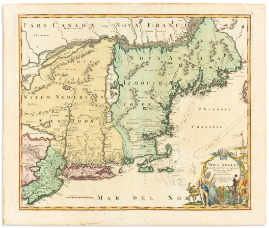

Homann, johann baptist.
Nova Anglia Septentrionali Americae.

Nuremberg, circa 1720
Double-page engraved map of New England. 21¾x26 inches sheet size, wide margins; original-hand color to the landmass, cartouche likely later; minor edge stain but overall a nice example.
Estimate
$700 – $1,000


Hondius, henricus.
Nova Virginiae Tabula.

Amsterdam, [1644]
Double-page engraved map of the Chesapeake Bay with anecdotal illustrations of indigenous people. 19x22¾ inches sheet size, wide margins, French text on verso; hand-colored in outline; large repaired tear at center, other small faults. Burden 228, State 1, “e”.
Estimate
$800 – $1,200


(iberian peninsula.) jasper nantiat.
A New Map of Spain and Portugal, Exhibiting the Chains of Mountains with Their Passes, the Principal & Cross Roads, with Other Details Requisite for the Intelligence of Military Operations.

London: William Faden, 1810
Large topographically detailed engraved case map in four sections, each segmented and mounted to original linen with printed Faden labels and vellum tabs pasted to versos. 22¾x32 inches each part; original hand-color in outline; light offsetting else fine; housed in publisher's moderately worn marbled slipcase with printed paper title label.
Estimate
$400 – $600


(iberian peninsula.) louis vivien de saint-martin.
Carte des Royaumes d’Espagne et de Portugal.

Paris: Andriveau-Goujon, 1831 (revised to 1834)
Large hand-colored engraved case map of Spain and Portugal with an inset plan of Cadiz. 30¾x40½ inches overall, segmented and backed on original linen with Andriveau-Goujon label and catalog sheet pasted on verso; folding into original gilt-lettered paper-covered slipcase; small stain at left, case moderately worn.
Estimate
$200 – $250

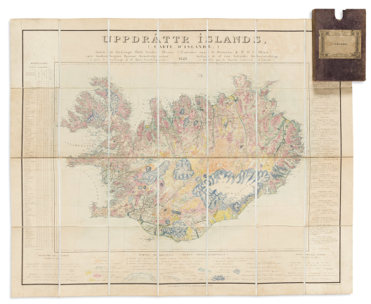

(ICELAND.) Olaf Nikolas Olsen, cartographer; Bjorn Gunnlaugsson, surveyor.
Uppdrattr Islands (Carte d’Islande).

Copenhagen, 1849
Lithographed topographic/geologic map of Iceland with title and data panels in Icelandic and French. 24x30 inches overall, segmented and backed on original linen with printed advertisement self-wrappers; folding into original cloth slipcase with printed Edward Stanford label pasted on; original hand-color in full; light toning and offset, Stanford stamp to lower margin.
Estimate
$500 – $750


(INDIA.) J.[ohn] and C.[harles] Walker.
A Newly Constructed and Improved Map of India, Compiled Chiefly from Surveys Executed by Order of the Hon.ble East India Company.

London: William H. Allen, 1846
Enormous engraved case map of the Indian subcontinent in 2 sections, each segmented and backed on original edged linen with green cloth self-wrappers. 32½x62 inches each part; fine original hand-color in full; minor darkening at folds but generally in exceptional condition; preserved in original 4to format patterned cloth slipcase with pictorial gilt spine label.
Estimate
$800 – $1,200


(iowa.) henn, williams & co.; and rufus l. barnes.
A Township Map of the State of Iowa.

Fairfield, IA and Philadelphia, 1855
Large hand-colored lithographed pocket map of Iowa. 21x34¾ inches overall, folding into publisher’s 12mo format gilt-and-blind-stamped red cloth case; short mends to upper fold verso, otherwise very nice.
Estimate
$300 – $400


(ireland.) john rocque.
A Map of the Kingdom of Ireland.

London: Laurie & Whittle, 1794 [but after]
Large engraved folding map of Ireland with a decorative title cartouche and several inset tables. 4 sheets of “JWhatman/1808” watermarked wove paper joined as two, approximately 26x39½ inches each part, wide margins; fine original hand-color in full; light offset and small spots of foxing, two repairs within image with no loss.
Estimate
$500 – $750


(ireland.) daniel augustus beaufort.
Ireland Civil and Ecclesiastical.

London: William Faden; and Dublin: William Allen, 1821
Large engraved case map of Ireland with a decorative title cartouche of putti in a harbor setting with a large cameo of King George III. 45½x35½ inches overall, segmented and backed on original linen; hand-colored in outline; without case, varnish yellowed and scraped in spots, edgeworn. Fourth edition.
Estimate
$200 – $250


(ireland.) j. cooke.
Cooke’s Royal Map of Dublin.

Dublin: Gerrard Tyrrell, 1836
Detailed engraved case map of Dublin bordered by 24 views of principal architecture. 19½x28 inches overall, segmented and mounted to original linen backing; folding into publisher’s 8vo format green cloth case with printed title/advertisement pasted to upper cover; original hand-color in part; minimal foxing, spine with a small repair.
Estimate
$500 – $750


(islands of britain.) gerard mercator; and jodocus hondius.
Anglesey / Wight Vectis Olim / Gernesay / Jarsay.

Amsterdam, circa 1630
Double-page engraved sheet of four maps (Isle of Anglesey, Isle of Wight, Guernsey, and Jersey). 17¾x22 inches sheet size, wide margins, Latin text on verso; a very nice example.
Estimate
$200 – $250


(istanbul / constantinople.) hartmann schedel.
Das Sechst Alter der Werlt Blat CXXX… Constaninopel.

Nuremberg, 1493
Hand-colored double-page woodcut view of Constantinople from the Nuremberg Chronicle. 17½x23¼ inches sheet size, wide margins, German text and woodcut figures on verso; scattered stains and small repairs.
Estimate
$700 – $1,000

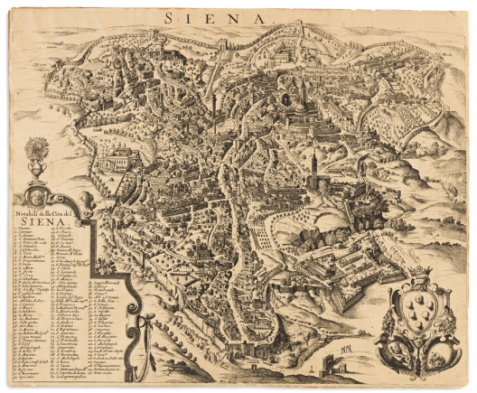

(italy.) wenceslaus hollar; after francesco vanni.
Siena.

[Cologne, circa 1635]
Etched and engraved perspective map of the Tuscan city of Siena with a 110-point reference key of notable locations. 14½x17½ inches sheet size, margins trimmed; blank verso; sheet lightly age toned, small edge repairs.
Estimate
$400 – $600


(italy – lombardy.) vincenzo coronelli.
Stato di Milano - Parte Orientale [and] Occidentale.

Venice, circa 1690
Large map of Lombardy centered on Milan and featuring Lakes Como and Maggiore. Two unjoined double-page engraved sheets of heavy laid paper, approximately 28¼x19½ inches each sheet size, nice wide margins; no flaws of note.
Estimate
$800 – $1,200


Janssonius, johannes; and abraham goos.
Americae Descriptio.

Amsterdam, circa 1630
Small-scale engraved map of the western hemisphere. 7x8¾ inches sheet size, wide margins, Latin text on verso; small loss in the upper [Alaskan] region neatly reinstated, otherwise nice.
Estimate
$250 – $300


Janssonius, johannes; after jodocus hondius.
America Noviter Delineata.

Amsterdam, 1652
Hand-colored double-page engraved map of the western hemisphere with two polar insets and plentiful decoration in the seas. 18½x22½ inches sheet size, wide margins, French text on verso; center fold flattened and reinforced on verso, a few small edge chips and closures, an attractive copy. Burden 192, Fifth state.
Estimate
$1,000 – $1,500


(japan.)
Dai Nihon Seizu.

Japan, Meiji 20 (1887)
Fine hand-colored engraved folding map of Japan with scores of inset plans, tables, diagrams, and vignette decorations on 4 sheets joined. 27¾x28 inches overall, folding into original yellow paper self-wrappers with printed paper title label; minor wear but in general excellent condition.
Estimate
$700 – $1,000


(japan – itsukushima.) kageshige mori.
Nihon Sankei no Hitotsu Itsukushima Ryokaku Benran Chizu.

Hiroshima, 1898
Color-printed lithographed map of Itsukushima with a central pictorial inset of the Torii Gate and shrine, border panel vignettes, and an indexed key printed on verso. 15¼x21 inches sheet size, wide margins; original folds, minor surface abrasions. East Asian Library, University of California, Berkeley Ha298.
Estimate
$200 – $250

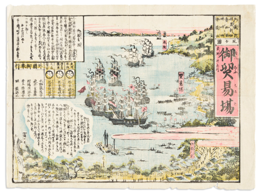

(japan – perry.)
Gokakoku Onboeki-Ba. [U.S. Commodore Matthew Perry’s arrival in Japan, July 8th, 1853.]

Japan, Kaei 6 (1853)
Fine color-printed woodblock kawaraban broadside depicting the entrance of Perry’s Black Ship squadron into Edo Bay. 14¼x19¼ inches sheet size, wide margins; folded, small defects at lower edge, else fine in condition and style.
Estimate
$1,500 – $2,500

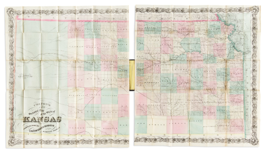

(kansas.) g.w. & c.b. colton.
Colton’s New Sectional Map of the State of Kansas.

New York, [1867] 1869
Large hand-colored lithographed two-panel pocket map of Kansas. 28x24½ inches each sheet size, 28x50 inches overall; folding into publisher’s 12mo format gilt and blind stamped cloth case, competently rebacked; scattered reinforcements to verso lightly discolored and seen through recto.
Estimate
$600 – $900


(kansas.) george f. cram & company.
Sectional Map of Kansas.

Chicago, 1870
Large hand-colored lithographed pocket map of Kansas and a small portion of northern Indian Territory. 27x35¾ inches sheet size, folding into publisher’s worn gilt and blind stamped cloth case; short fold separation at right, other points of minor wear; smaller color-printed folding map of Kansas tipped to front pastedown (8x10½ inches, 1888).
Earliest edition of this scarce map of Kansas showing the westernmost part of the state largely void of detail; editions published over the ensuing decade incorporate progressive development.
Estimate
$600 – $900


(kentucky.) g.w. & c.b. colton.
Colton’s Kentucky.

New York, 1873
Hand-colored lithographed pocket map of Kentucky and portions of its bordering states. 14½x23¼ inches sheet size, folding into publisher’s minimally worn 12mo format gilt-blocked cloth case; light adhesive discoloration at cover mount but generally a nice example.
Estimate
$300 – $400


Keulen, gerard van.
Pas Kaart van de Golff van Mexico.

Amsterdam, 1684 [but circa 1734]
Hand-colored double-page engraved chart of the Gulf of Mexico. 21¼x24¾ inches sheet size, ample margins; small stain at lower edge, else nice.
“The first sea chart of the western portion of the Gulf of Mexico detailing the coastal waters of present-day Florida, Alabama, Mississippi, Louisiana and Texas” – Burden 592, fourth state.
Estimate
$1,000 – $1,500


Keulen, johannes van.
Pas Kaart van de Kust van Carolina Tusschen C de Canaveral en C Henry.

Amsterdam, circa 1702
Double-page engraved chart of the southeast American coast from the Chesapeake Bay to northern Florida with an inset plan of Charleston and vicinity. 21x24 inches sheet size, ample margins; attractively hand-colored; a few points of worm track neatly filled and concealed. Burden 589, third state.
Estimate
$2,000 – $3,000


(lake parime – el dorado.) willem blaeu.
Guiana sive Amazonum Regio.

Amsterdam, circa 1640
Double-page engraved map of northeastern South America featuring the large mythical lake and lost city of gold. 15¾x20 inches sheet size, short margins, French text on verso; original hand-color in outline; light marginal stains but image clean and bright.
Estimate
$200 – $250


Laurie & whittle.
Group of 7 double-page or folding hand-colored engraved maps.

London, vd but circa 1810
Various sizes, on sheets of “JWhatman/1808” watermarked wove paper; fine original hand-color in full; light offset and minor edge chips, one unobtrusive repair.
-
A New Map of the Seat of War, Comprehending Germany; Poland, with its Dismemberments, Prussia; Turkey in Europe, Italy &c, from the Maps of Chauchard, Zannoni, &c.
-
Jamaica from the Latest Surveys; Improved and Enlarged by Thomas Jefferys Geographer to the King.
-
Kingdom of Hungary, Principality of Transilvania, Sclavonia, Croatia, with a Part of Valakia, Bulgaria, Bosnia and Servia.
-
A New Map of the Electorate of Bavaria.
-
A New Map of the Empire of Persia from Mons.r D’Anville.
-
The Kingdom of Prussia, and its Newly Incorporated Province of Polish Prussia Now Named Western Prussia; with the Territory of Dantzick; by John Roberts.
-
A Map of the Electorate of Brandenburg, Including Western Pomerania, and the Greatest Part of the Dutchies of Mecklenburg and Magdeburg.
Estimate
$600 – $900

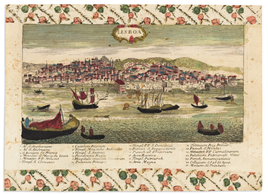

(lisbon.) francesco ambrosi.
Lisboa.

Bassano del Grappa: Remondini, circa 1780
Engraved view of Lisbon with a 25-point keyed reference table. 9¼x13 inches sheet size; original hand-color; scattered stains, upper and lower margins covered with strips of early hand-printed decorative paste-paper.
Estimate
$250 – $300


(london.) francois de belleforest.
La Ville de Londres.

Paris, 1575
Woodcut folding plan of Elizabethan London after Braun and Hogenberg. 15x21½ inches sheet size, wide margins; original folds flattened with minor reinforcements.
Estimate
$1,200 – $1,800


(london.) david loggan (engr.); after daniel king.
On St. Paul’s Cathedrall Represented by Mr. Dan. King.

London, 1658
Engraved broadside comprising an 8-stanza poem by Edward Benlowes in English and Latin surrounded by views and plans of Old St. Paul’s Cathedral with an oval portrait of Benlowes at bottom left and a keyed lower-panel panorama of pre-fire London. Watermarked laid paper, 15¼x18¼ inches sheet size, margins shaved to the platemark; moderate foxing and other small stains, repaired tear at right. Rare, with but a few institutional copies and none traced at auction.
Estimate
$600 – $900

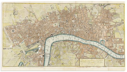

(london.) robert and james dodsley.
A New and Correct Plan of London, Westminster and Southwark, with Several Additional Improvements Not in Any Former Survey.

London, 1761
Hand-colored engraved map of London on heavy laid paper. 15x26¾ inches sheet size, narrow margins; original folds, skillful closed tears at right. Howgego 118.
Estimate
$200 – $250


(london.) william maitland.
A View of London About the Year 1560.

London, 1738
Hand-colored engraved perspective map of Elizabethan London on “LVG” watermarked laid paper. 16x19¾ inches sheet size, wide margins; original folds, generally nice. Howgego 8(b).
Estimate
$200 – $250


(london.) edward mogg.
Mogg’s Forty-Five Miles Round London.

London, 1843
Large engraved case map of London and environs. 39x47 inches overall, segmented and mounted to original linen backing with plain card self-wrappers; original hand-color in outline; minor wear but on the whole crisp and nice.
Estimate
$200 – $250


(london.) james wyld.
Wyld’s New Plan of London.

London, 1862
Hand-colored wood engraved pocket map of London with tables and architectural vignettes to the borders. Title in French, English, and German. 22x38¼ inches overall; backed on original linen and folding into 8vo format red cloth case; map overall fine, case showing age and just a little chewing to the foredge.
Estimate
$300 – $400


(london.)
Map of London Published with Cassell’s Family Paper.

London: Cassell, Petter and Galpin, circa 1862
Large well detailed lithographed plan of London. 26x32½ inches sheet size; backed with tissue stabilizing folds and small tears.
Estimate
$150 – $200


Lotter, tobias conrad.
Pensylvania Nova Jersey et New York.

Augsburg, circa 1750
Double-page engraved map of eastern Pennsylvania, New Jersey, New York and parts of an amusingly condensed New England with a large decorative title cartouche depicting a European (William Penn?) trading with native figures. 25¼x21 inches sheet size, wide margins; original hand-color; a few minor spots but generally excellent.
Estimate
$1,000 – $1,500


Lotter, tobias conrad; after albrecht carl seutter.
Diversi Globi Terr-Aquei.

Augsburg, circa 1770
Small-scale engraved double-hemispheric world map with astronomical charts set within the decorative spandrels. 8¼x10¾ inches sheet size, ample margins; original hand-color; minor edge soiling but generally very nice.
Estimate
$400 – $600


Lotter, tobias conrad; after albrecht carl seutter.
Nova Orbis Sive America Septentrionalis.

Augsburg, circa 1770
Small-scale engraved map of North America including California as an island and a decorative figural title cartouche. 8¼x10¾ inches sheet size, ample margins; original hand-color; minor edge soiling but generally very nice.
Estimate
$400 – $600


(louisiana purchase.) samuel lewis; and aaron arrowsmith.
Louisiana.

Boston, 1812
Hand-colored engraved map of North America west of the Mississippi River. 10½x9 inches sheet size, wide margins with binding holes at left edge; a fine example.
Estimate
$250 – $300

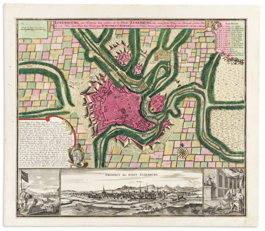

(luxembourg.) matthaeus seutter.
Luxembourg, Une Fortresse Tres-Celebre de la Duche de Cette Nom dans Pais-Bas.

Augsburg, circa 1730
Engraved plan of the fortified city with a panoramic perspective view inset below. 21½x24¾ inches sheet size, wide margins; originally bound on the left edge, i.e., no center fold; strong original hand-color; minor edge wear, else fine.
Estimate
$700 – $1,000


(manuscript maps.)
Small archive of hand-drawn surveys and property tracts.

Np, late eighteenth-early nineteenth centuries
20 sheets of various papers, approximately 17x13½ inches or smaller; stains, fold splits, other degradations.
-
Drafts or official copies from Surveyor General’s records, mostly concerning properties in Wayne County, Northeastern Pennsylvania adjacent to the Delaware River: [Shehawken Creek]; [Fork Mountain Pond, Crooked Creek]; [Damascus Township]; [Starrucca Creek]; etc.
-
Three plans of oil and coal tracts in north-central West Virginia on treated linen: Braxton County; Gilmer County; Ritchie County.
Estimate
$300 – $400


(MANUSCRIPT MAP – PENNSYLVANIA.) William Rittenhouse; and John Kunkle.
Plan of the Town of Mifflinsburg. Situate on the South side of the River Susquehanna; Opposite to 3 Islands, in Catawisa Township Northumberland County, (about 30 Miles above Sunbury & about the same Distance below Wilksbury,) in the State of Pennsylvania. Laid out by the Proprietaries of this land Mess. Wm. Rittinghouse & John Kunchel. [sic].

Eastern Pennsylvania, 1796
Ink on vellum, 22¼x24 inches at widest; old folds and expected soiling but overall good. Provenance: Christie's New York, June 10, 1993, lot 389.
The title here is misleading since there does exist Mifflinburg, Pennsylvania, approximately fifty miles to its west; however, the beginnings of the town of Mifflinville are represented by this original hand-drawn plat.
A tiny community on the banks of the Susquehanna River in Columbia County, Mifflinville’s layout hasn’t changed a great deal in the intervening 225 years since this document was drafted: the sparse north/south streets remain John, Mary, Ann, Market, Race, and Fair; the east/west streets shown here only to Fifth have expanded a whole two blocks up to Seventh. At the center of the map between Ann and Race streets we find “Burying Grounds” and indeed the town’s cemetery is still located in that spot, with a modicum of homes and scarce businesses built up around it.
Lettered references are keyed with an explanatory panel at the upper left: “A. A Market place, and in the Center of it a public building. B for an English College. C for a German College. D is the ground or places marked and laid out for the different denominations of Christian Societies. The vacant ground, in Front of the Town, is to be left open for use of the whole Town, except the use of the Ferry, and the Fishing is Kept for the Proprietors & is marked in the Plan F/M or for a Fish market”.
This is followed by an outline of Conditions for the town’s establishment: “There are 10 places laid out for the use of Churches & meeting houses of the different denominations of Societies & the first 12 Settlers of any Society shall have the first choice of one of said 10 places, for that purpose, & the next 12 Settlers of any Society shall have the same choice as before & so on until the 10 places are applied for the purpose aforesaid. The out Lots belonging to the East Liberty lay about a mile from Mifflinsburg. April 8th 1796”.
The industry and commerce which the proprietors surely imagined for the future of their town never much materialized and at no point has her population grown far beyond 2,000 residents; but from a historical standpoint it is delightful to compare this birth-certificate document to the Mifflinville of today and observe how closely it still resembles Rittenhouse and Kunkle’s original 18th-century plan.
For an extensive history of the town (with mention of the present document) see J.H. Beers, Historical and Biographical Annals of Columbia and Montour Counties, Pennsylvania, 1915, pages 249-252.
Estimate
$1,000 – $1,500


(MANUSCRIPT MAP – PRAGUE.) Gregers Daa Trellund.
Wahrhaffter und Accurater Entworffener Plan un Grund-Riss der Hauptstadt Prag in dem Konigreiche Bohmen. Wie Solche von dem Kayserlichen Koniglichen Preussischen Auxiliar Trouppen im Monath September Ao 1744 belagert und erobert worden.

[Prague, circa 1744]
Pen, ink, and colored wash on "Honig" watermarked laid paper edged in silk ribbon. 11¾x16½ inches overall; old folds with a few reinforcements, minor age spotting.
Superb contemporary manuscript plan of the bombardment of Prague by Frederick the Great during the War of Austrian Succession. The map of the fortified city, drafted by Prussian military lieutenant and engineer Gregers Daa Trellund, offers exceptional detail with a minutely penned 54-point reference table at the upper right.
Estimate
$1,200 – $1,800


(maryland.) maryland geological society.
Map of Maryland Showing State Road System and State Aid Roads.

[Baltimore], 1922
Large color-printed lithographed case map of Maryland’s highway system (showing rapid development under Federal funding) with detailed inset plans of Washington, D.C., and Baltimore. 36x52¼ inches overall, segmented and mounted to original linen backing with cloth self-wrappers; minor wear only.
Large format official maps of nascent American highway construction are uncommonly seen on the market.
Estimate
$300 – $400


(MASSACHUSETTS – REVERE BEACH.) E.R. Howe.
The Point of Pines • Revere, Mass. On the Atlantic Ocean, Eight Miles North East of Boston. The Most Beautiful Sea Shore Resort in New England - Bathing, Boating, Pic-Nic Grounds. Music Day and Evening. Electric Lights and Fire Works. Board by the Day or Season.

Boston: Forbes Co., circa 1880
Large lithographed panorama of the Revere Beach peninsula with broadside advertisement for the 19th-century vacation and entertainment spot. 21x27 inches sheet size, wide margins; acidic age toning, small chips and closures to the very edges. OCLC locates one example, Boston Public Library.
Estimate
$400 – $600


(mediterranean sea.) henri michelot and laurent bremond; after.
Nouvelle Carte Generalle de la Mer Mediterranee Dediéè in Monseigneur Le Chevalier d’Orleans.

Marseille: Joseph Roux [but elsewhere, circa 1830s?]
Large engraved chart of the western Mediterranean Sea on "JW[hatman]" watermarked wove paper, 23¼x28½ inches sheet size, wide margins; unobtrusive repairs and faint stains.
An unusual restrike of the left portion of Michelot and Bremond’s 1727 multi-sheet wall map; here their credit has been erased and replaced with that of Francois Berthelot and the publisher’s imprint altered to Joseph Roux: both of whom were working in the eighteenth century, but the plate apparently survived with the present example struck in the first half of the nineteenth.
Estimate
$300 – $400


Mercator, rumold.
Orbis Terrae Compendiosa Descriptio.

Duisberg, 1587 [but 1609 or later]
Double-page engraved double-hemispheric world map. 15½x19½ inches sheet size, French text on verso; faint original hand-color in outline; approximately half-inch of printed loss to the left and right edges, backed on tissue stabilizing other damages. Shirley 157. Sold as is.
Estimate
$600 – $900


Merula, paulus.
Totius Orbis Cogniti Universalis Descriptio.

Leiden, 1605
Hand-colored engraved double-hemispheric world map with zodiac spheres and other details inset to the baroque patterned spandrels. 11¾x20 inches sheet size, trimmed to platemark and neatly laid into margins of deckle-edge laid paper (i.e. 14x21¾ inches overall); original folds.
Estimate
$1,000 – $1,500


Meurs, jacob van.
Novissima et Accuratissima Totius Americae Descriptio.

Amsterdam 1673
Decorative engraved map of the western hemisphere from Olfert Dapper’s German edition of Montanus’ America. 17¾x21¾ inches sheet size; a strong dark impression, issued folding but now mounted flat to acidic board with repairs and a small edge loss at left. Burden 430.
Estimate
$300 – $400


(mesopotamia / persia.) martin waldseemuller.
Quinta Asie Tabula.

Strasbourg, 1513 or after
Double-page woodcut map of present-day Iraq and Iran between the Persian Gulf and Caspian Sea. 14¾x20½ inches sheet size; text and architectural elements from the 1525 Fries edition of Ptolemy anomalously printed on verso; shaved with some loss to printed extremities.
Estimate
$400 – $600


(minnesota.)
Property of the North St. Paul Land Co.

St. Paul: Pioneer Press, circa 1888
Large chromolithographed cadastral map of the enclave of North St. Paul from South St. (Ave.) to Silver Lake. 42x28 inches overall; original folds, small corner loss at upper right, manuscript annotations in red ink at lower margin. OCLC locates one example (Minnesota Historical Society).
Estimate
$300 – $400


Mitchell, samuel augustus.
Mitchell’s New National Map, Exhibiting the United States with the North American British Provinces, Sandwich Islands, Mexico and Central America, Together with Cuba and other West India Islands.

Philadelphia: S. Augustus Mitchell, 1857
Hand-colored engraved wall map of North America with several inset historical vignettes and tables. 4 sheets joined, 65x65 inches overall; original linen backing with wooden rollers; various stains, cracks and paper flaking. sold as is.
Estimate
$300 – $400


Moll, herman.
America.

London, circa 1730
Engraved folding map of North and South America showing trade winds and California as an island. 16x10 inches sheet size, wide margins; minor edge stains but overall nice. Early state with “Vol. 3 p. 129” at upper right not burnished out.
Estimate
$400 – $600


Moll, herman.
New England, New York, New Jersey and Pensilvania.

London, circa 1729
Small-format engraved map of New England on watermarked laid paper. 9¼x14¾ inches sheet size, wide margins; light toning to margins.
A nice uncolored example of Moll’s “Post Road” map depicting the route and operations of the first colonial New England postal system from Philadelphia to Portsmouth, Maine. McCorkle 729.2
Estimate
$350 – $450


Moll, herman.
A Map of New England, New York, New Jersey and Pensilvania.

London, 1730
Engraved folding map of colonial New England from David Humphreys’s An Historical Account of the Incorporated Society for the Propagation of the Gospel in Foreign Parts. 14¼x16½ inches overall, narrow margins; original folds, light browning and offset, closed tear at mount point.
Estimate
$400 – $600

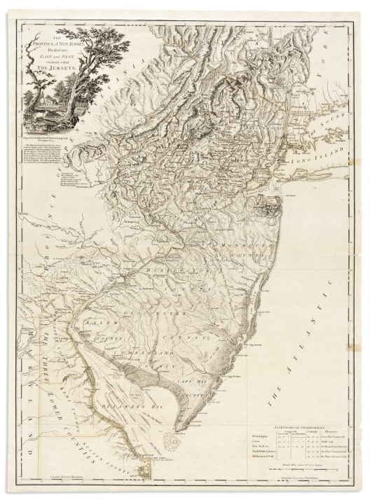

(new jersey.) william faden.
The Province of New Jersey, Divided Into East and West, Commonly Called The Jerseys.

London, 1777
Large engraved map of New Jersey, the Delaware Bay, and New York City. 31½x23¼ inches sheet size; original hand-color in outline; upper margin competently replaced, center fold strengthened on verso, minor edge stains at right.
No previous map had depicted knowledge of the region with such definitive detail or scale. Stevens & Tree 37(a), first state.
Estimate
$4,000 – $6,000

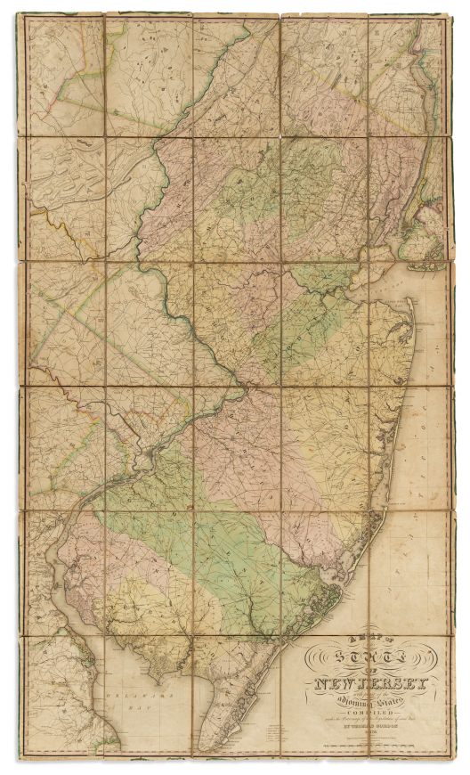

(new jersey.) thomas gordon.
A Map of the State of New Jersey with Part of the Adjoining States Compiled Under the Patronage of the Legislature of Said State.

Trenton, NJ: the author; and Philadelphia: H.S. Tanner, 1828
Large hand-colored engraved case map, the first officially commissioned mapping of New Jersey and the standard for 19th-century cartography of the state. 57¼x33½ inches overall, dissected into 30 segments and mounted to original linen backing with marbled paper self-wrappers; light soiling and other signs of age but a good example with original color by county.
Estimate
$1,500 – $2,500


(new jersey.) william kitchell; and robert pearsall smith.
Topographical Map of the State of New Jersey Together with the Vicinities of New York and Philadelphia and with Most of the State of Delaware.

Philadelphia: H.G. Bond, 1860
Hand-colored engraved wall map of New Jersey on 4 sheets joined. 68x58 inches overall; original linen backing with ebonized wooden rollers; yellowed varnish, stains and other damages, wants restoration.
Well-detailed and decorative map of the Garden State compiled by state geologist William Kitchell as an update to Thomas Gordon’s first official map of New Jersey (1828).
Estimate
$300 – $400


(new jersey.) marcus smith.
Map of Morristown, Morris County, N.J.

New York: M. Dripps, 1850
Large hand-colored engraved map of Morristown with an inset plan of “The Park” (Morristown Green) and vignettes of important local architecture. 38½x30 inches sheet size; original linen backing, darkened varnish with soft creases, small cracks and edge chipping; despite flaws, condition is somewhat better than usual for wall maps of the kind.
Scarce historical map of central Morristown in 1850 identifying early local property ownership, town layout in perspective to Lakes Speedwell and Pocahontas, and even the site of George Washington’s headquarters in the winter of 1776-77. OCLC identifies one example (Princeton University), no copies traced at auction.
Estimate
$500 – $750


(new mexico territory.) william r. morley.
Morley’s Map of New Mexico.

Cimarron, New Mexico: Harry Whigham and G. A. Bushnell, 1873.
Large lithographed pocket map with original hand-color in outline. 25¼x25¾ inches overall, folding into publisher’s 12mo format gilt-lettered cloth case with printed advertisement label pasted in; covers with minor wear at spine caps, map with a few short separations at fold intersections and sheet edges but overall very nice.
“This, the first privately published map relating only to New Mexico listed by Phillips, is especially good for boundaries of private land grants, and military reservations. Many proposed routes of railroads are shown” (Streeter Sale 470).
Estimate
$7,000 – $10,000


(new york.) john homer french.
The State of New York from New and Original Surveys.

Syracuse, NY: Robert Pearsall Smith, 1860
Large hand-colored lithographed wall map of New York with many inset views and detail maps. 4 sheets joined, 67x73 inches overall; original linen backing with wooden rollers; varnish yellowed, various stains, cracks and paper flaking, lower dowel detached. Sold as is.
Estimate
$300 – $400


(new york.) david h. burr.
Hudson River & Vicinity.

New York: John Disturnell, 1834
Engraved strip map of the Hudson River from lower Warren County to New York City. 24¾x4½ inches extended, folding into publisher’s 12mo format gilt-blocked roan case; original hand-color in outline; unobtrusive mend to one of the folds but overall a little darling. First edition, and scarce in any format.
Estimate
$400 – $600

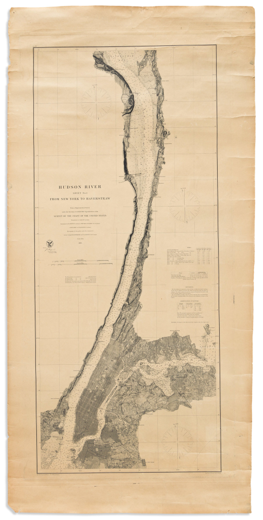

(new york city.) united states coast survey.
Hudson River Sheet No. 1 From New York to Haverstraw.

Washington, D.C., 1865
Large chart of the lower Hudson River with the topography of New York City engraved in minute detail. Heavy wove paper, 46½x22¾ inches sheet size, wide margins; moderately age toned, soft creases and edge wear.
Estimate
$300 – $400


(new york city.) sduk; and charles knight.
New York.

London, circa 1850
Engraved map of lower Manhattan, parts of Brooklyn and two inset architectural vignettes. 14x17 inches sheet size; original hand-color in outline; faint mat line, otherwise nice.
Estimate
$150 – $200


(new york city.) matthew dripps.
Map of the Five Cities of New York, Brooklyn, Jersey City, Hoboken & Hudson City.

New York: D.T. Valentine, 1860
Large hand-colored lithographed map of NYC. Two sheets joined, 48½x28½ inches overall; original folds, light toning and offsetting, small reinforcements to verso of fold intersections and other short closures but generally nice.
Estimate
$300 – $400


(new york – long island.) j. chace, jr.; and robert pearsall smith.
Map of Suffolk Co., L.I. New York.

Philadelphia: John Douglass, 1858
Hand-colored lithographed wall map of eastern Long Island from Huntington to Montauk Point patterned with over 30 inset town plans and vignettes. 4 sheets joined, 51x60 inches overall; original linen backing with stains and edge fray - wants restoration.
Estimate
$400 – $600


(north america.) alexander keith johnston; and edward stanford.
Stanford’s Library Map of North America.

London, 1863
Large engraved case map of Civil War period North America. 68x61 inches overall, dissected into 48 segments and mounted to original linen with silk selvage and blue paper self-wrapper; fine original hand-color in full; lightly toned and offset, small crease at upper right margin but overall quite nice; folding into publisher’s moderately-worn gilt and blind stamped morocco covers.
Published during the height of the American Civil War and defining the Union and Confederate states with green and pink wash.
First edition with date-correct territorial border arrangements: West Virginia is not yet separate from Virginia, New Mexico and Arizona are within one wide expanse, there is no Montana Territory, Idaho Territory is without its northern portion but encompasses a large area to its east (later Wyoming) - great changes to these particular political divisions would occur the year this map was published or very shortly thereafter.
Estimate
$1,000 – $1,500

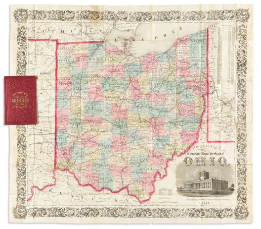

(ohio.) j.h. colton.
Colton’s Railroad & Township Map of the State of Ohio.

New York, 1856
Hand-colored engraved pocket map of Ohio with a fine vignette of the state capitol, all surrounded by an ornate foliate border. 26x29 inches, folding into publisher’s 12mo format gilt lettered cloth case; discoloration at left where mounted to covers, otherwise excellent.
Estimate
$200 – $250

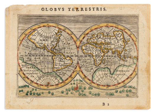

Ortelius, abraham.
[Globus Terrestris.]

Antwerp, circa 1601
Miniature hand-colored engraved double-hemispheric map of the world with a charming topographical landscape below and sky above, from Epitome Theatri Orteliani. 4¼x6 inches sheet size, ample margins, verso with ovation to Philip II in Latin; small edge stains and closures.
Estimate
$150 – $200


Ortelius, abraham.
Typus Orbis Terrarum.

Antwerp, circa 1613
Double-page engraved map of the world with elaborate strapwork border design. 15¾x20½ inches sheet size, ample margins, unusual blank verso;</i> continents with modest original hand-color in outline; generally excellent. Shirley 158; Van den Broecke 3.2.
Estimate
$3,500 – $5,500


Ortelius, abraham.
Americae Sive Novi Orbis, Nova Descriptio.

Antwerp, 1573
Double-page engraved map of the Western Hemisphere. 15x20¼ inches sheet size, narrow margins, Latin text on verso; original hand-color with later additions; a bevy of hairline cracks stabilized on verso, other small repairs. Burden 39; Van Den Broecke 9.2.2 1573L(A)2 (75 copies printed).
Estimate
$800 – $1,200

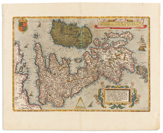

Ortelius, abraham.
Angliae, Scotiae, et Hiberniae, sive Britannicar : Insularum Descriptio.

Antwerp, 1608 or 1612
Double-page engraved map of the British Isles. 18¼x22½ inches sheet size, wide margins, Italian text on verso; original hand-color; a very attractive example. Van den Broecke 16.3 1608/1612I10.
Estimate
$700 – $1,000


Ortelius, abraham.
Barbariae et Biledulgerid Nova Descriptio.

Antwerp, 1573
Hand-colored double-page engraved map of northern Africa and western Mediterranean Sea. 15¾x21¾ inches sheet size, wide margins, Latin text on verso; center fold flattened and gently stabilized at upper edge. Van den Broecke 176 1573L(AB)69 (80 copies printed).
Estimate
$250 – $300


Ortelius, abraham.
Cypri Insulae Nova Descript.

Antwerp, 1579
Hand-colored double-page engraved map of Cyprus with an inset of Lemnos. 16¼x21 inches sheet size, wide margins, Latin text on verso; marginal staining at lower corners. Van den Broecke 149 1579L(B)71.
Estimate
$600 – $900


Ortelius, abraham.
Geographia Sacra.

Antwerp, 1603
Double-page engraved map of ancient geography detailed with a miniature inset of the modern world. 16¾x21 inches sheet size, wide margins, Latin text on verso; original hand-color in full; closed tear at lower margin and minor edge wear but generally an attractive example. Van den Broecke 179 1603Lj.
Estimate
$500 – $750


Ortelius, abraham.
Italiae Novissima Descriptio.

Antwerp, 1584
Hand-colored double-page engraved map of Italy with attractive decorative elements including a large allegory of a gallivanting Neptune and mermaid. 17¼x21 inches sheet size, wide margins, Latin text on verso; a few discreet repairs but on the whole very nice. Van den Broecke 118 1584L64.
Estimate
$600 – $900


Ortelius, abraham.
Natoliae Quae Olim Asia Minor / Aegypti Recentior / Carthaginis Celeberrimi Sinus Typus.

Antwerp, 1595
Double-page engraved sheet with three maps comprising Turkey and Mediterranean islands, the Nile River delta, and ancient Carthage. 17x21 inches sheet size; wide margins, Latin text on verso; fine original hand-color in full; no faults. Van den Broecke 174.2 1595L112.
Estimate
$250 – $300


Ortelius, abraham.
Persici Sive Sophorum Regni Typus.

Antwerp, 1579
Double-page engraved map of the Persian Gulf, Iran, Afghanistan, and Pakistan. 16½x21¾ inches sheet size, wide margins, Latin text on verso; original hand-color in full; small loss of flaked verdigris at upper center, else fine. Van den Broecke 167.1 1579L(B)85.
Estimate
$250 – $300


Ortelius, abraham.
Group of 26 double-page engraved European regional maps,

Antwerp, 1595
from Theatrum Orbis Terrarum. Approximately 17x21¼ inches each sheet size, wide margins, Latin text on verso; excellent original hand-color; generally fine condition.
-
Thietmarsiae, Holsaticae Regionis Partis Typus / Oldenburg Comit. (Schleswig-Holstein, Germany / Oldenburg, Germany).
-
Holsatiae Descriptio /Rugiae Usedomiae et Iulinae Wandalicarum Insularum Vera Descrtiptio. (Schleswig-Holstein, Germany / Rugen Island, Szczecin Lagoon).
-
Buchaviae, sive Fuldensis Ditionis Typus / Waldeccensis Comitatus Descriptio Accuratissima. (Central Germany / Fuld and Waldeck regions).
-
Braunsuicensis et Luneburgensis Ducatuum Vera Delineat / Norimbert Agri, Fidissima Descript. (Brunswick-Lüneburg / Nuremberg).
-
Saxoniae Misniae, Thuringiae, Nova Exatissimaque Descriptio. (Saxony state, Germany, centered on Meissen/Dresden).
-
Turingiae Noviss / Misniae et Lusatiae Tabula. (Thuringia, Saxony states, Germany).
-
Hennebergensis Ditionis Vera Delineatio / Hassiae Descriptio. (Henneberg / Hesse state, Germany).
-
Carinthiae Ducatus et Goritiae Palatinatus Wolf Lazio / Histriae Tabula a Petro Coppo Descr / Zarae, et Sebenici Descriptio. (Southern Austria, Drava River / Istrian Peninsula / Zadar and Sibenik, Croatia).
-Rhetiae Alpestris Descriptio, in Qua Hodie Tirolis Comitatus / Goritiae, Karstii, Chaczeoae, Carniolae, Histriae, et Windorum Marchae Descrip. (Tyrol, Rhaetian Alps / Istria, Croatia, Slovenia).
-
Schlavoniae, Croatiae, Carniae, Istriae, Bosniae, Finitimarumque Regionum Nova Descriptio. (Croatia, Bosnia Herzegovina).
-
Ungariae Loca Praecipua. (Hungary, Slovakia).
-
Pedemontanae Vici Norumque Regionum. (Piedmont, Italy).
-
Veronae Urbis Territorium. (Verona region, Italy).
-
Patavini Territorii Corographia / Tarvisini Agri Typus. (Padua, Venice / Treviso, Gulf of Venice).
-
Ducatus Mediolanensis, Finitimarumq Regionu. (Northern Italy, Milan, Lake Como).
-
Salisburgensis Jurisdictionis. (Salzburg, Austria/Germany).
-
Namurcum Comitatus. (Wallonia, Meuse River, Belgium).
-
Oost Ende West Vrieslandts Beschryvinghe Utriusque Frisiorum Regionis Novissima Descriptio. (Friesland, Netherlands).
-
Lutzenburgensis Ducatus Verissima Descriptio. (Luxembourg).
-
Basiliensis Territorii Descriptio Nova / Sueviae. (Switzerland/Southeast Germany, Basel, Bodensee).
-
Frisia Orientalis. (East Friesland, Germany).
-
Mansfeldiae Comitatus Descriptio. (Germany, Mansfeld).
-
Daciarum, Moesiarumque, Vetus Descriptio. (Ancient Dacia and Moesia, ie present-day Bulgaria and Romania).
-
Bavariae, Olim Vindeliciae, Delineationis Compendium. (Bavaria, Germany).
-
Palantinatus Bavariae Descriptio / Argentoratensis Agri Descriptio. (Bavaria, Regensburg / Strasabourg).
-
Austriae Descrip. (Austria, Vienna).
Estimate
$2,000 – $3,000


(PACIFIC NORTHWEST – IDAHO TERRITORY.) [William H. Knight]; and H.H. Bancroft & Company.
Bancroft’s Map of Oregon, Washington, Idaho & British Columbia.

San Francisco, 1864
Large engraved wall map of the Pacific Northwest. 33½x38¼ inches sheet size; original hand-color in full; mounted on modern canvas stabilizing scattered cracks and creases, edge repairs with a small area of lower foliate border reinstated in facsimile; small faded ink stamp at lower margin "Bancroft Library, University of California - withdrawn".
“The great “Map of the Pacific States”, originated in 1863 by William H. Knight, proliferated in 1864 into a whole family of notable maps, automatically establishing the rising H.H. Bancroft house as the greatest map publisher of the Pacific Coast. So large in size are these maps and so overflowing with detail, it is utterly impossible to describe their minutiae” (Wheat).
Indeed, the geographical information is rich, showing Indian regions, established territorial counties and towns, military forts, mountain peaks, prairies, valleys, lakes and river systems, stage roads such as “Mullan’s Wagon Road from Walla Walla to Fort Benton”, “Emigrant Route to Oregon”, the “Proposed Northern Pacific Railroad” line, and a gold region at the Canadian border of the Rockies. Western Montana, on the cusp of becoming its own territory, is still part of Idaho.
Scant institutional copies; last auction appearance at Streeter (#3916). Wheat, Transmississippi, 1092.
Estimate
$1,200 – $1,800


(paris.) melchior tavernier.
l’Isle de France et Lieux Circo[n]voysins.

Paris, circa 1630
Double-page engraved map of the Île-de-France. 16x22 inches sheet size, wide margins; small stain at lower edge else a nice example with a strong dark impression.
Estimate
$200 – $300


(paris.) nicolas de la mare; antoine coquart; and nicolas de fer.
Group of 4 double-page engraved plans of Paris from Traité de la Police.

Paris, 1705
Approximately 18x22 inches each sheet size, narrow margins; small stains and repairs.
From a series of 8 maps chronicling the urban development of Paris. This lot comprising: Cinquieme Plan de la Ville de Paris, Sixieme Plan de la Ville de Paris, Septieme Plan de la Ville de Paris, and Huitieme Plan de la Ville de Paris.
Estimate
$300 – $400


(peloponnesus.) nicolas de fer.
Cette Carte est Faite pour l’Intelligence des Affaires des Turcs et des Venitiens dans le Peloponese Aujourd’huy la Moree et les Isles de Zante, Cefalonie, Ste. Maure, Cerigo, &c.

Paris, 1715
Double-page engraved map of Morea and vicinity with insets of fortified harbors. 20x28½ inches sheet size, wide margins; original hand-color in outline; unobtrusive vertical printer's crease at center, else fine.
Estimate
$600 – $900


(pennsylvania / maryland / delaware.) james smither, engraver; for the american philosophical society.
[A Map of part of Pennsylvania, Delaware and Maryland].

Philadelphia, 1771
Engraved folding map encompassing the area between Baltimore, Philadelphia, Reading and York, PA with proposed connections of several roads and canals. 14x17 inches sheet size, deckle edge at right; faint offsetting, original folds pressed flat, left edge nicely reinstated where originally trimmed and bound.
Published as an accompaniment to “An abstract of sundry papers and proposals for improving the inland navigation between Pennsylvania and Maryland” which appeared in Volume I of the Transactions of the American Philosophical Society. The unusual apparatus shown at left is a device used for cutting files and is designated Fig 2, i.e., to illustrate another article in the same publication. Wheat & Brun 300, third state with Turkey Pt. and Pursusey Isl. added to the upper Chesapeake Bay.
Estimate
$1,200 – $1,800


(philadelphia.) nicholas scull; and george heap.
A Map of Philadelphia and Parts Adjacent.

London: Gentleman’s Magazine, 1753
Engraved folding map of the city and surrounding areas along the Delaware and Schuylkill Rivers. 14½x12 inches sheet size, right margin trimmed to platemark; lightly toned, a few fold lines with minor verso closures.
Estimate
$300 – $400


(philadelphia.) currier & ives.
Birds Eye View of Philadelphia.

New York, 1875
Small folio hand-colored lithographed view of Philadelphia centered on City Hall. 13x17 inches sheet size, wide margins; fine original hand-color with touches of gum arabic; Library of Congress copyright and “microfilmed” stamps at lower margin, one small edge mend, else a very attractive example of a scarce print.
Estimate
$1,200 – $1,800


(pictorial maps – manuscript.) peter reynolds furse.
Some of the Story of Southern Ontario.

Hampton, New Brunswick, 1963
Pen and ink map of Ontario from Lake Huron to Montreal drawn on an untrimmed deckle-edged sheet of “JWhatman/1959” watermarked wove paper; 27¾x40½ inches overall; minimal margin soiling with one small closure at lower edge.
Manuscript notation pasted to the lower left margin reads: “First hand-coloured Edition. Limited to 300. Copy number: ~”; such a label would implicate publication, though we have been unable to trace any record of a printed example.
Peter Furse was a British Navy officer who began his service in World War I at age 17, during which time he received his first exposure to map drafting. After the war he continued his education at the University of Cambridge and when World War II came, he again served with the Royal Navy, ultimately elevating to the rank of Lieutenant Commander. After spending several years in Africa, Furse and his wife Barbara settled down in the village of Hampton, New Brunswick, Canada. There he spent his retirement years creating and publishing well-studied whimsical pictorial cartography in the mid-1960s.
Here Furse has rendered an incredibly detailed manuscript map that richly describes the regional history of southern Ontario from the age of discovery to the mid-twentieth century. A small sampling of the illustrated anecdotes includes:
1849 the first sod turned for Great Western Railway, at London; 1883 the first free public library in Ontario at Guelph; 1755 the first Canadian Navy on Lake Ontario; 1779 the first farms built on Niagara peninsula; 1952 an oil pipeline from Manitoba & refinery completed at Petrolia; 1922 U.S.A. prohibition, $65,000 bootleg wrecked on Long Point, Lake Erie, not one bottle for customs;1854 the first “strike” by Canadian labor, printers in Toronto; 1875 World’s first telephone by Alexander Graham Bell at Brantford; 1813 U.S. burned Queenstown & Niagara, British burned Buffalo in retaliation; 1615 Pere le Caron built the first European house in Ontario. One room combining living & chapel, in which he said the first mass in the Province, at Carhagouha; 1866 the first Ontario gold rush at Marmora; 1535 Cartier used “Canada” to describe the region. 1791 named “Upper Canada”. 1840 “Western”, 1867 “Ontario”.
Estimate
$1,500 – $2,500

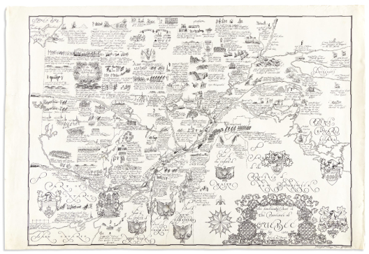

(pictorial maps – manuscript.) peter reynolds furse.
The Southerly Part of the Province of Quebec.

Hampton, New Brunswick, 1963
Pen and ink map of Quebec from Hudson’s Bay to Prince Edward Island drawn on an untrimmed deckle-edged sheet of “JWhatman/1959” watermarked wove paper; 27¾x40½ inches overall; minimal margin soiling with one small closure at left edge.
Peter Furse was a British Navy officer who began his service in World War I at age 17, during which time he received his first exposure to map drafting. After the war he continued his education at the University of Cambridge and when World War II came, he again served with the Royal Navy, ultimately elevating to the rank of Lieutenant Commander. After spending several years in Africa, Furse and his wife Barbara settled down in the village of Hampton, New Brunswick, Canada. There he spent his retirement years creating and publishing well-studied whimsical pictorial cartography in the mid-1960s.
The present manuscript is so well-accomplished it begs to assume there was a publication, though we have been unable to trace any printed examples. Here Furse has rendered an incredibly detailed manuscript map that richly describes the regional history of southern Quebec from the age of discovery to the mid-twentieth century. A small sampling of the illustrated anecdotes includes:
1611 Henry Hudson, who had wintered near Rupert House, & wished to continue his voyage, was abandoned by his crew who could not put up with more hardship & privation; 1652 Governor Duplessis killed by Iroquois; 1535 Jacques Cartier, first European to climb Mount Royal; 1806 First timber raft down Ottawa River from Gatineau; 1613 Champlain to Alumette Island because Nicholas Vigaud reported having seen the Western Ocean 10 days from Quebec; 1851 Y.M.C.A., the first in America, at Montreal; 1912 “Grand Trunk Pacific” reached Ontario; 1809 First steamer on Canadian waters, U.S.-owned “Vermont” on Lake Richelieu; 1663 Earthquake in Montreal; 1505 Thomas Aubert first European in [St. Lawrence] River; 1860 Test-drilling for oil. Bears roll in natural oil-pool to deter insects and then rub against trees leaving a patch for which prospectors to look; 1606 Lescarbo charted the Gulf; 1764 First Quebec newspaper - “Quebec Gazette”; 1842 Webster Ashburton treaty settled boundary [with Maine]; 1703 Madame de Repigny made first Maple Syrup.
Estimate
$1,500 – $2,500


(pictorial maps – manuscript.) peter reynolds furse.
The Maritime Provinces of Canada.

Hampton, New Brunswick, 1963
Pen and ink map of New Brunswick, Nova Scotia, and Prince Edward Island drawn on an untrimmed deckle-edged sheet of “JWhatman/1959” watermarked wove paper; 27¾x40½ inches overall; minimal margin soiling and short edge closures, adhesive residue from an removed limitation label at lower left margin.
Peter Furse was a British Navy officer who began his service in World War I at age 17, during which time he received his first exposure to map drafting. After the war he continued his education at the University of Cambridge and when World War II came, he again served with the Royal Navy, ultimately elevating to the rank of Lieutenant Commander. After spending several years in Africa, Furse and his wife Barbara settled down in the village of Hampton, New Brunswick, Canada. There he spent his retirement years creating and publishing well-studied whimsical pictorial cartography in the mid-1960s.
The present manuscript was published circa 1963 with lithographed examples located at the Tides Institute Museum of Art, and (as of November 2021) one copy on offer by a Canadian mapseller. That printed map measures approximately 2/3 smaller than our original drawing.
The map is painstaking in its arrangement of regional information and illustrative charm; a small sampling of the illustrated anecdotes includes:
1580 Sable Island, first settlement. 40 convicts landed by first Governor, de la Roche. 12 survivors; C1810 222 negroes to Freetown, Sierra Leone at their own request. Freetown was started by British abolitionists in 1787, 34 years before U.S.A. started Liberia; 1524 Verrazano exploring, in “Dolphin”, reported U.S.A. to be a narrow strip. Contemporary maps show “The Gulf of Verrazano” where (inland) Carolina, Virginia, Maryland & Pennsylvania should be; 1753 1,600 German colonists to Lunenburg; 1761 First ship built in Yarmouth, “James”. Later built more tonnage per head than any other place in the world; 1849 “Pony Express” Halifax-Digby for first formed “Associated Press”; 1765 First Agricultural Show in the Maritimes at Windsor; 1604 de Monts, Champlain, Pontrincourt, Pontgrave explored Fundy, 1605 they explored Annapolis Basin; 1612 Chief Membertou baptized; 1534 Cartier 1st fur trade at Baie des Chaleurs; 1745 Georgetown [PEI] destroyed by New Englanders; 1656 First settlers - Nicholas Denys reported Caribou; 1785 Last Walrus seen, Magdalen I.; 1820 Indian couriers carried mail between Halifax & Sydney; 1715 The impregnable fortress of Louisbourg built; 26 July 1758 Generals Amherst & Wolfe with Admiral Boscawen took Louisbourg for the last time; C1000-1121 Eric the Red, Bishop Eric of Iceland in search of Vineland; and there is also a large embellished panel at left describing “Events, for the illustration of which, space is lacking”.
Estimate
$1,500 – $2,500


(pictorial maps.) american pioneer trails association.
Group of 3 Old West-themed color-printed pictorial maps.

Manchester, N.H., vd
- Irvin Shope. The Trail of Lewis and Clark 1804-1806. 18x32 inches sheet size; some foxing at right. 1945.
- J. Rulon Hales. Mormon Trail Opened and Charted as a Wagon Road in 1846-47. 20¼x30 inches sheet size; dampstain at lower right, some edge wear. 1947.
- Irvin Shope. The Old Oregon Trail. 17¾x25 inches sheet size; faint stain at lower right margin. 1959.
Estimate
$300 – $400


(pictorial maps.) carroll barnes.
The Great Smoky Mountains National Park.

Offset lithographed pictorial map printed in green. 14½x19 inches overall, folding into printed self-mailer with a 60-point tourist checklist on verso; short separation at right fold, else fine.
Barnes’ various National Park maps enter the market with relative frequency, though we have had no success locating another copy of this wonderful Great Smoky Mountains illustration; not in Rumsey, not in WorldCat.
Estimate
$300 – $400


(pictorial maps.) the crawfords.
Group of 21 hand-printed textile maps.

Jamestown, RI, late 1940’s/early 1950’s
Variously colored screen-prints on cotton fabric. Approximately 12x18 inches each; occasional light foxing.
Mid-20th-century pictorial placemat maps hand-fashioned by little-known husband and wife printers, George and Margaret Crawford, at their home in Jamestown, Rhode Island.
- Mt. Desert Island, Maine
- Nantucket
- Martha’s Vineyard
- Westchester and Rockland Counties New York
- Northern New Jersey
- Adirondacks, Thousand Is., New York
- Watch Hill (South County), Rhode Island
- New Orleans, Louisiana
- The Great Lakes
- Hartford, Connecticut
- Northern California and Nevada
- Finger Lakes, New York
- The State of Texas
- The State of Washington
- Vermont
- North Carolina
- Door County, Wisconsin
- The Lakes of Maine and the White Mountains
- The Main Line, Suburban Philadelphia
- Fort Benning, Georgia
- Lake Erie
Estimate
$500 – $750


(pictorial maps.) everard a. mcavoy.
The Empire State Offers to Tourists and Vacationists the Greatest Variety of Attractions in America.

Albany: Bertrand T. Fay for the New York State Hotel Association, 1932
Color-printed pictorial map of New York with an inset of Long Island; verso printed with advertisements, promotional text, and color vignette self-wrapper. 22½x27¼ inches overall; small damage to spine of outer pamphlet cover with a short closure at fold.
Estimate
$100 – $150

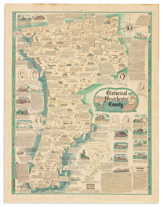

(pictorial maps.) robert j. seymour; and merritt l. ryder.
Historical Westchester County.

Np, 1950
Color-printed pictorial map of Westchester County, New York. 22x17 inches sheet size, wide margins; old folds, lightly toned.
A veritable history book of the region on a single sheet: copious illustrated excerpts detailing indigenous, colonial, and Revolutionary War-period figures, sites, and events. OCLC locates one copy, Fenimore Art Museum.
Estimate
$500 – $750

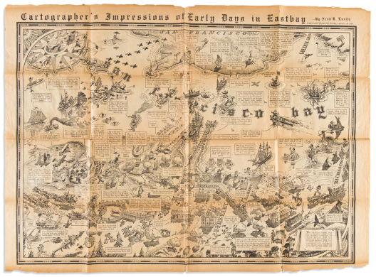

(pictorial maps.) fred r. lundy.
Cartographer’s Impressions of Early Days in Eastbay.

Oakland: Oakland Tribune, Sunday, February 18, 1934
Newsprint map of San Francisco Bay full of pictorial charm and historical anecdotes. 22½x31 inches sheet size; small separations at a few fold intersections, paper toned and a bit friable.
Estimate
$300 – $400

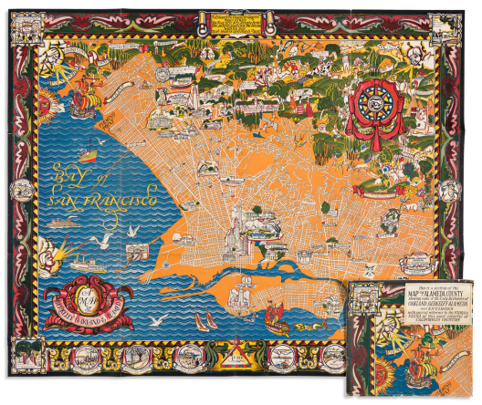

(pictorial maps.) michael baltekal-goodman; and eugene neuhaus.
A Map of Berkeley Oakland & Alameda.

Berkeley: Gather Gate Bookshop, [1930]
Large color-printed pictorial map of Berkeley and the East Bay. 34½x42½ inches overall; folding into original printed envelope sleeve; crease and small hole at lower left corner but overall a nice example with only minor wear.
Estimate
$700 – $1,000


(pictorial maps.) robert ball.
A Part of Virginia Showing Jamestown Williamsburg and Yorktown with Historical Events from 1585-1781.

Williamsburg, VA: The Williamsburg Restoration, Inc., 1939
Offset lithograph with hand-coloring. 17¾x24¼ inches sheet size, ample margins; minor edge wear but overall excellent.
Attractively designed pictorial map of Virginia from the Chesapeake Bay to Richmond detailing events from Captain John Smith’s dealings with the natives to the culmination of the Revolutionary War at Yorktown.
Estimate
$200 – $250


(pictorial maps.) george washington bacon.
Bacon’s Chart of Useful Knowledge.

London, circa 1905
Color-printed world map surrounded by copious charts, tables and illustrations of time, space, history, topography, evolving modes of transportation, architecture, national flags, and figural portrayals of cultures around the globe. 41x31½ inches overall; original linen backing with ebonized wooden rollers; varnish lightly yellowed, scattered cracks and chips with minor loss.
Estimate
$250 – $300


(pictorial maps.)
Group of 8 early 20th-century color-lithographed pictorial maps.

Vp, vd
28x37½ the largest, 15¾x19½ the smallest; each mounted to board and darkened with varnish, small scattered scrapes and scratches, a few with lower imprint trimmed. Sold as is.
- Coulton Waugh. A Map of Cape Cod Wherein is Shown ye Discovery and Settlement of the Same; with the Tracks of ye Pilgrims Carefully Prepared According to Mourts Relation. 1926.
- Coulton Waugh. Cape Ann and the North Shore. A Map Displaying the Hardy Maritime Development of These Historic Parts. 1927.
- Harold Haven Brown. The Picture map of the Holy Land. 1928.
- Margaret Whiting Spilhaus. Africa. Circa 1925 (Cape Times, with George Philip & Son imprint pasted on).
- Griswold Tyng. Map of the Eastern United States. 1929.
- James Daugherty, et al. This World of Ours Showing the New National Boundaries. 1929.
- M.C. Bridgman. A Chart of the Eastern Way. And the Spirit of God Moved Upon the Face of the Waters. 1926.
- Helen Bodley. A Map of Concord, the Old Musketaquid Plantation. 1928.
Estimate
$500 – $750


(polar projection.) rigobert bonne; and nicolas desmarest.
Group of 4 double-page engraved polar-projected world maps.

[Paris, 1787]
11¼x16¼ inches each sheet size, wide margins; vertical adhesive stain at left edges.
- 22 - Mappe-Monde sur le Plan de l’Equateur. Hemisphere Septentrional.
- 23 - Mappe-Monde sur le Plan de l’Equateur. Hemisphere Meridional.
- 24 - Mappe-Monde sur un Plan Horisontal, Situe a 45d de Latitude Nord. Hemisphere Oriental.
- 25 - Mappe-Monde sur un Plan Horisontal, Situe a 45d de Latitude Sud. Hemisphere Occidental.
Estimate
$200 – $250


(polar.) after henricus hondius.
[Polus Antarcticus].

Amsterdam: Jansson or De Wit, circa 1660s-1680
Double-page engraved map of the southern hemisphere with figural decoration in the spandrels. 18¼x20¾ inches sheet size, ample margins, blank verso; fine original hand-color in full; lower center fold reinforced on verso, flattened creases, small repair at center affecting one printed letter. Late edition with the title cartouche removed and additions of Tasman’s discoveries.
Estimate
$600 – $900


(puzzle maps.) jean vincent marie dopter.
Set of 8 hand-colored engraved map puzzles.

Paris, circa 1850s
Mounted on wood panels and dissected into interlocking jigsaw pieces, edged in green paper; 11x15 inches each; housed in a custom rosewood box with inlaid title “Atlas”; repaired crack to bottom of case, interior with minor foxing and a slight mustiness; all maps complete and with original blue card supports.
- World
- France
- Europe
- Asia
- Africa
- North America
- South America
- Oceania
Estimate
$1,500 – $2,000


(railroads.) atchison, topeka and santa fe railroad.
Pointers on the Southwest. Description of the Cities, Towns, and Country along the Line of the Atchison, Topeka & Santa Fe and Western Connections in Kansas, Colorado, Utah, New Mexico, Texas, Old Mexico, Arizona and California.

Topeka: A.E. Sexton, 1883
[iv], [86] illustrated pages of commentary and advertisements, with a folding map of the company's branches. Publisher's pictorial wrappers, 8x4 inches; unblemished condition.
Estimate
$150 – $200


(railroads.) henry worrall; for the atchison, topeka and santa fe railroad.
The Arkansas Valley Route from the Missouri River to Colorado & New Mexico.

St. Louis: Woodward, Tiernan and Hale (printers), 1876
Detailed wood-engraved pocket map of the route across Kansas and Colorado with a fine bannered panoramic view of the overland tracks crossing the plains along the Arkansas River from Kansas City to Pikes Peak; verso decked out with timetables, advertisements, and illustrated puffs of regional highlights. 11¼x31 inches overall, folding into printed self-wrappers; minor wear.
Estimate
$500 – $750


(railroads.) rand, mcnally & co.
Geographically Correct Map of the Chicago, Milwaukee & St. Paul Railway.

Chicago, [1878]
Lithographed pocket map of the north central United States with advertised lines overprinted in red, a small inset plan of the business district of Chicago at upper right, and panels of timetables and advertisements printed on verso. 14¾x32½ inches overall, folding into printed card self-wrappers containing an 8-page guide to the major hotels of Chicago; front cover detached, fold separations at map left, minor edge staining, Library of Congress copyright stamps, 1879, to front wrapper. No copies traced in OCLC or auction records.
Estimate
$300 – $500


(railroads.) rand, mcnally & co.
The Northern Pacific Railroad – Completed September 8, 1883.

Chicago, 1883
Large hand-colored lithographed map of the transcontinental line and its branches from the Great Lakes to the Pacific Northwest. 2 unjoined sheets, 25x56 inches overall, folding loose into publisher’s 8vo format gilt-lettered red cloth case; minor strengthening to a few fold intersections and small marginal spots but overall excellent condition. OCLC locates 6 examples.
Estimate
$500 – $750


Robert de vaugondy, didier.
Amerique Septentrionale, Dressee sur les Relations les plus Modernes des Voyageurs et Navigateurs, et Divisee Suivant les Differentes Possessions des Europeens.

Paris, 1750
Double-page engraved map of North America with a decorative figural title cartouche. 19¾x26½ inches sheet size, ample margins; hand-colored in outline delineating the possessions of the English, French, and Spanish; minor wear and age spots.
Estimate
$350 – $450


Robert de vaugondy, gilles.
Partie de l’Amerique Septentrionale qui Comprend le Cours de l’Ohio. Le Nlle. Angleterre, La Nlle York, Le New Jersey, La Pensylvanie, Le Maryland La Virginie, La Caroline.

Paris, 1755
Double-page engraved map of the American Colonies balanced on the corners with a Rococo title cartouche and inset map of Carolina. 20¼x27¼ inches sheet size, ample margins; original hand-color in outline; small spots of light dampstain and filled worm track to margins only, image crisp and clean; colloquial title stenciled in ink on verso.
Estimate
$400 – $600


(rome.) matthaeus seutter.
Veteris et Modernae Urbis Romae Ichnographia et Accurata Designatio.

Augsburg, circa 1730
Double-page engraved plan of Rome with first-rate elements of detail and decoration. 21½x24¾ inches sheet size, wide margins; original hand-color; scattered stains kept to the sheet edges and easily matted over, image crisp and fine.
Estimate
$700 – $1,000


(rome.) venenzio monaldini; and pietro ruga (engraver).
Nuova Pianta di Roma Moderna Estratta Dalla Grande del Nolli.

Rome, 1843
Fine engraved case map of Rome with inset diagrams. 24½x34 inches overall, dissected into 32 segments and mounted on original linen backing; excellent condition; original marbled paper case with printed label for the English Reading Room and Circulating Library of M. Piale in Rome pasted on.
Estimate
$200 – $250


(russia.) charles price; and thomas jefferys.
A Correct Map of Moscovy.

London: Thomas Jefferys, [1711] [but circa 1750]
Large engraved folding map of European Russia with Moscow at lower center. 2 sheets joined, 38½x26½ inches overall; original hand-color in outline; general toning, edge wear, and small repairs.
Wildly (*not Wildey) esoteric late strike of the Price plates which Jeffery’s acquired mid-century.
Estimate
$200 – $250


(russia – moscow.) matthaeus merian.
Moscua.

Frankfurt, circa 1640
Hand-colored double-page engraved plan of Moscow on heavy laid paper. 11½x14¼ inches sheet size, ample margins; minor signs of age but an attractive example.
Estimate
$400 – $600


Scherer, heinrich.
Repraesentatio Geographica Itineris Maritimi Navis Victoriae.

Munich, 1700
Double-page engraved world map on a north polar projection showing the track of Ferdinand Magellan’s circumnavigation of the globe and a decorative portrait of his ship Victoria in the lower left spandrel. 10¾x15 inches sheet size, wide margins; faint discoloration at center fold but generally a crisp, clean, and attractive example. Shirley 626.
Estimate
$600 – $900


Scherer, heinrich.
America Borealis.

Munich, circa 1700
Engraved folding map of North America showing California as an island and characteristic topographic details. 10½x15½ inches sheet size, wide margins; fine condition.
Estimate
$500 – $750


Schonsperger, johann.
Secuda Etas Mundi. [World map].

Augsburg, 1497
Woodcut map of the ancient world on a folio sheet of Latin text. 4x5¾ inches map size, 11¼x8 inches sheet size; ink marginalia, small edge repairs.
Reduced version of Hartmann Schedel’s world map from the 1493 Nuremberg Chronicle. The miniaturized map loses little of its original detail, though the left-hand panel of odd creatures is left off. A rare incunable map which Shirley (20) notes as “less frequently found than the larger original”.
Estimate
$1,200 – $1,800

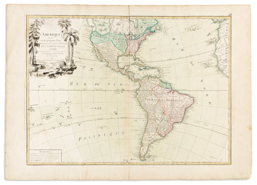

(sea of the west.) jean janvier.
L’Amerique Divisee in ses Principaux Etats.

Paris: Jean Lattre, 1790
Double-page engraved map of North and South America with a landscape title cartouche adorned by native dwellings and accoutrements. 21½x30½ inches sheet size, wide margins; original hand-color; excellent condition with expected signs of age.
“Augmentee du voyage de Cook en 1782” - with the islands of the South Pacific re-engraved and offering a more accurate update to that region than appears on the 1769 edition.
Estimate
$400 – $600


Senex, john.
A Map of Louisiana and of the River Mississipi.

London, 1721
Double-page engraved map of North America, an English version of De Lisle’s landmark publication three years prior. 20½x24¼ inches sheet size, wide margins; hand-colored in outline; small area of dampstain at lower right margin, otherwise fine with minor expected signs of age.
Estimate
$1,000 – $1,500


(south america.) tobias conrad lotter.
America Meridionalis.

Augsburg, circa 1770
Double-page engraved map of South America with early navigators’ tracks and a decorative figural title cartouche . 21x26 inches sheet size, wide margins; strong original hand-color; a little more than moderate foxing.
Estimate
$200 – $250

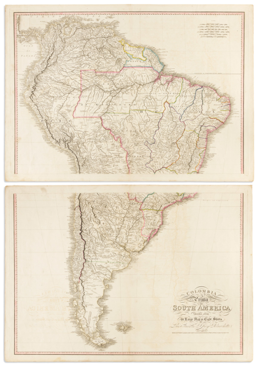

(south america.) william faden.
Colombia Prima or South America Drawn from the Large Map in Eight Sheets By Louis Stanislas D’Arcy Delarochette.

London, 1811
Large brilliantly detailed engraved map of South America on two unjoined sheets. 23¼x32½ each part, wide margins; original hand-color in outline; faint offset and a few minor worm holes else a very handsome example.
Estimate
$300 – $500


(south carolina.)
A New and Accurate Map of the Province of South Carolina in North America.

London, 1779
Hand-colored engraved folding map from The Universal Magazine. 13x11½ inches sheet size, left margin wide, others trimmed to the plate; small repair at lower edge, other modest age wear.
Estimate
$250 – $300


(southwest united states.) william m. bradley.
Arizona and New Mexico.

Philadelphia, 1886 [1887]
Hand-colored lithographed map in pocket format. “Molino Mexicano/Papel de Hilo” watermarked paper, 18¾x23½ inches overall, folding into publisher’s 8vo format printed card wrappers; fold versos reinforced, else good.
Estimate
$150 – $200


Speed, john.
Italia.

London: George Humble, 1626
Hand-colored double-page engraved map of Italy with carte-a-figures and city plan border panels. 16½x21 inches sheet size, ample margins, English text on verso; stains and repairs, including a large closed tear at lower right.
Estimate
$300 – $400


Speed, john.
The Kingdome of Great Britaine and Ireland.

London: Sudbury & Humble, 1611 or after
Hand-colored double-page engraved map of Great Britain with inset views of London and Edinburgh. 15½x20½ inches sheet size, ample margins, English text on verso; minor edge repairs not affecting image.
Estimate
$1,000 – $1,500


(texas – land grants.) texas & pacific railway company.
Nolan County Texas.

Fort Worth: Daily Democrat (printed by), circa 1876-1880
Lithographed plat with points of hand-color (indicating unsold land). 21½x16¾ inches overall, folding into verso-printed self-wrappers with panels of promotional essays; minor wear.
Estimate
$250 – $300

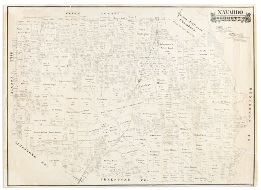

(texas – land grants.) texas general land office.
Navarro County. State of Texas.

St. Louis & New York: A. Gast, 1888
Large lithographed cadastral plat of the county centered on Corsicana. 32x44 inches sheet size, ample margins; various repairs.
Estimate
$250 – $300


(tierra del fuego.) willem blaeu.
Tabula Magellanica qua Tierrae del Fuego, cum Celeberrimis Fretis a F. Magellano et I. Le Maire.

Amsterdam, circa 1640
Double-page engraved ornamental map of southern Patagonia and the Tierra del Fuegan archipelago. 20¼x24¼ inches sheet size, wide margins, Latin text on verso; original hand-color in outline; moderate toning, center fold flattened and archivally reinforced on verso.
Estimate
$300 – $400

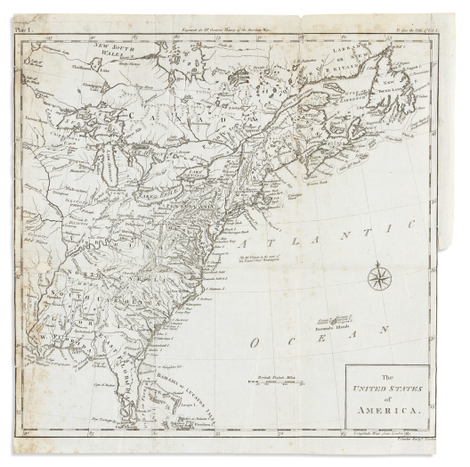

(united states.) thomas conder, engraver.
The United States of America.

London, 1788
Engraved folding map of North America east of the Mississippi River from William Gordon’s The History of the Rise, Progress, and Establishment of the Independence of the United States of America. 12¼x12¼ inches sheet size, left edge shaved to neatline, right edge partially trimmed for binding; light foxing, short repairs including a small loss at left image.
Estimate
$150 – $200


(united states – atlantic coast.) aime robiquet.
Carte de la Cote des Etats-Unis Comprise Entre la Nouvelle-Ecosse et la Floride.

Paris, 1861
Large engraved chart of the North American Atlantic coast from Nova Scotia to Florida with insets of Charleston Harbor, the Delaware River, New York Bay, and southern Florida/Bahamas. 29x42 inches overall, wide margins; touches of original hand-color at lighthouse points; scattered repairs and a few pencil triangulations; Marseille chart-seller’s ink stamp at lower title, Robiquet’s blindstamp to lower right margin.
Estimate
$250 – $300


(united states – atlantic coast.) depot general de la marine; after edmund blunt.
Carte de la Cote Orientale de l’Amerique Septentrionale … d’Apres les Cartes Publiees en 1828 par l’Hydrographe Americain E. Blunt.

Paris, 1834
Large double-page engraved chart of the American Atlantic coast from New York to northern Florida with insets of New York Bay and the entrance to the Chesapeake Bay. "D/J" watermarked laid paper, 27x38½ inches sheet size, wide margins; deacidified with remnant stains.
Estimate
$400 – $600


(united states – ordinance of 1784.) charles delamarche.
Etats-Unis de l’Amerique Septentrionale.

Paris, 1785
Double-page engraved map of the United States. 20¼x26¾ inches sheet size, ample margins; original hand-color; faint mat stain and one small repair at lower left, desiccated mounting tape residue to verso edges, but generally nice.
Attractive French map bearing an interesting table at lower right which outlines the 13 United States “subtracted” from the British Empire in 1776, plus Vermont. A further paragraph notes the formation of 10 additional states, a group proposed and named by Thomas Jefferson in 1784: Silvania, Michigania, Chersonesus, Arsenistpia, Metropotamia, Illinoia, Saratoga, Washington, Polypotamia, and Pelisypia. Jefferson’s plan for these new states was not adopted by Congress but parts of his Land Ordinance passed, leading to the creation of the Northwest Territory a few years later in the area which roughly comprises today’s Ohio, Indiana, Illinois, Michigan, Wisconsin, and Minnesota.
Estimate
$600 – $900


(united states – history.) timothy and edward hooker ensign.
Ensign’s Travellers’ Guide, and Map of the United States.

New York: T. & E.H. Ensign, [1840] 1846
Large engraved map of the United States bordered with inset city plans, tables, presidential portraits and patriotic historical vignettes. 5 sheets joined, 27½x41 inches overall; original hand-color; original linen backing with ebonized wooden rollers; age toned, but generally nicer than commonly found.
Unusually well-preserved example of Ensign’s decorative historical wall map - an uncommon edition of 1846 (of the many editions, the first to represent Texas statehood). A few notable modifications here being Humphrey Phelps’s credit erased from the title and the portrait of George Washington at lower right has been replaced by the newly elected James K. Polk.
Estimate
$1,200 – $1,800


(united states – wall map.) james hamilton young; and samuel augustus mitchell.
Mitchell’s National Map of the American Republic or United States of North America. Together with Maps of Thirty-Two of the Principal Cities and Towns in the Union.

Philadelphia, 1846
Hand-colored engraved map on 4 sheets joined. 40x49½ inches overall; staining at upper and left areas, a few small damages within the map, varnished, wooden rollers detached.
Estimate
$300 – $400


(united states – wall map.) wellington williams; and s. augustus mitchell.
Mitchell’s New National Map, Exhibiting the United States with the North American British Provinces, Sandwich Islands, Mexico and Central America, Together with Cuba and Other West India Islands.

Philadelphia, 1862
Hand-colored engraved wall map with ornate foliate border design and inset historical vignettes. 62x64 inches overall; original linen backing with ebonized wooden rollers; yellow varnish, soft creases and wear, more so at upper edge but generally better than average condition.
Estimate
$800 – $1,200


Valck, gerard.
l’Amerique Septentrionale & Meridionale.

Amsterdam, circa 1700
Hand-colored double-page engraved map of the Western Hemisphere decorated by scenes of regional peoples engaged in trade with Europeans. 18¼x24½ inches sheet size; faint mat line, center fold gently reinforced on verso but a nice example of a fairly scarce map. Burden 713.
Estimate
$1,000 – $1,500


(venice.) leandro alberti.
[Venetia].

Venice, 1588
Small-scale double-page woodcut plan of Venice from Isolario Appartenenti Alla Italia. 7¾x11½ inches sheet size, wide margins; Italian text on verso showing through as usual, but overall very nice.
Estimate
$300 – $400


(venice.) jan lansvelt; after vincenzo coronelli.
Venetien.

[The Hague, 1699]
Engraved folding perspective plan of Venice. 15x20 inches sheet size, left margin partly shaved for binding; original folds, overall very nice.
Decorative birds-eye map of Venice reduced from Coronelli’s composition of 1693. This copy shows the title and Venetian Lagoon labeled twice in engraved Dutch text; a variant of the map which is more commonly found with that lettering in French, included as a fold-out in Jean Dumont’s “Voyages de Mr. du Mont en France, en Italie, en Allemagne, a Malthe, et en Turquie”.
Estimate
$800 – $1,200


(venice.) willem seiffert.
Pianta di Venezia.

Germany, 1859
Large lithographed map of Venice with keyed reference tables and views of the Grand Canal, Rialto Bridge, St. Mark’s Cathedral, and the Venetian Arsenal. Printed on linen with hemmed edges, 29x23½ inches overall; old folds and minor soiling but overall survives well.
Estimate
$500 – $750

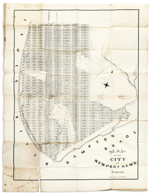

(virginia – hampton roads.) john c. rankin, jr.
Map of the City of Newport News. Virginia.

New York, circa 1895
Lithographed wall map of the city’s initial cadastral layout on 2 sheets joined. 55x42 inches overall, wide margins; occasional manuscript additions; fold separation with small paper loss at lower left, scattered stains. No copies traced in bibliographical, auction, or institutional records.
Estimate
$300 – $400


(virginia – slavery.) c.b. graham; after e. hergesheimer.
Map of Virginia, Showing the Distribution of its Slave Population from the Census of 1860.

Washington, D.C., June 13th, 1861
Large lithographed map of Virginia showing its counties shaded to indicate slave population as relative to white population with a supportive table at left. 22x29 inches sheet size, wide margins; stains, edge wear, and small puncture points at title area; ink annotation and gift inscription signed "W.R.P." (Major William R. Palmer, Topographical Engineer).
Estimate
$500 – $750

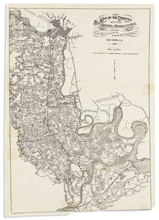

(virginia – civil war.) major general jeremy francis gilmer.
Map of the Country Between Richmond and Petersburg.

[New York, 1864]
Lithographed map of southeast Virginia along the Appomattox and James Rivers showing the region in fine topographic detail with property ownership and connecting railroad lines. 19x13½ inches sheet size, lower margin trimmed for binding; original folds pressed flat, a few short mends which have left desiccate traces to the thin paper.
Estimate
$200 – $250


Wells, edward.
Orbis Terrarum Cognitus Hodiernis Europaeis. [and]: Americae Australis Tabula.

Oxford, 1704 [or after]
Two miniature engraved maps (world and South America) from Wells’ edition of Dionysius’s Geographia. 4½x7½ inches each sheet size; small closure at lower margin of South America map, else nice.
Estimate
$100 – $150


(west indies.) thomas kitchin, after jean-baptiste bourguignon d’anville.
A New and Complete Map of the West Indies Comprehending All the Coasts and Islands Known by that Name.

London: Laurie & Whittle, 1794 [but after]
Large engraved folding map of the Caribbean, Central America, Mexico and southeastern United States. 2 sheets of "JWhatman/1808" watermarked wove paper joined, 21x35 inches overall, ample margins; fine original hand-color in full; small chip at lower left corner, minor offset and age tone but generally an excellent example.
Estimate
$500 – $750


(world war i.) the scarborough company.
Scarborough’s New Map of the World / Map of the West Front of the Great World War Showing Special Fields of Canadian Operations in France and Belgium. Farthest Advance Lines of the Opposing Armies and Change Agreed Upon by Peace Conference at Paris. Also New Map of Europe Showing All Boundaries Up-To-Date.

Ontario, Canada, circa 1918
Large color-printed double-sided statistical wall map. 39x61¾ inches overall, mounted on original metal rollers; soft creases, stain at upper edge.
Estimate
$200 – $250


(world.) alexey ilyin cartographic institute.
[Eastern Hemisphere / Western Hemisphere].

St. Petersburg, first part of the 20th century
Large color-printed lithographed Russian language world map. 35x63 inches overall, segmented and mounted to original linen backing; various stains and small paper chips.
Estimate
$150 – $250


(world.) d. griffing johnson; and joseph hutchins colton.
Colton’s Illustrated & Embellished Steel Plate Map of the World on Mercator’s Projection.

New York: J.H. Colton, 1853
Hand-colored engraved wall map of the world with an ornate decorative border design incorporating cultural portrayals and large city views. 6 sheets joined, 56x79 inches overall; original linen backing, ebonized wooden rollers detached but present; yellow varnish with scattered scrapes, abrasions, and edge wear.
“One of the great American World Wall maps of the period” – Rumsey.
Estimate
$1,000 – $1,500


(world.) joseph netherclift; for the church missionary society.
Missionary Map of the World Distinguishing the Stations of All Protestant Missionary Societies.

London, 1838
Large hand-colored lithographed double-hemispheric world map with approximately 300 global missionary stations keyed alphabetically in the spandrel tables. 30x61 inches overall, segmented and mounted to original green-edged linen with cloth self-wrappers; folding into 8vo format patterned green cloth slipcase with printed title label; minor stains and creases.
Estimate
$700 – $1,000


(world.) william & alexander keith johnston.
Johnstons’ Commercial and Library Chart of the World on Mercators Projection Showing the Position of Every Place of Commercial Importance, and the Chief Railways Steamship Routes & Telegraphs.

Edinburgh & London: W. & A.K. Johnsotn, circa 1907
Enormous color-printed lithographed case map of the world. 2 sections, each segmented and mounted to original silk-edged linen and folding into publisher's gilt-blocked morocco case with a 34-page index and advertisement booklet bound in; 58½x37 inches each section; map super fine, case with minor wear; Edward Stanford shop ticket pasted to inner booklet.
Estimate
$400 – $600


(WORLD – REPUBLIC OF TEXAS.) J.[ohn] & C.[harles] Walker.
To Her Most Gracious Majesty Queen Victoria, This Map of the World on Mercator’s Projection is Most Respectfully Dedicated.

London, 1840
Oversize engraved case map of the world surrounded by a border of separately printed tables relating statistics for scores of individual nations and geographic regions. 57x65½ inches overall, segmented and backed on original linen; folding into original roan case with brass clasp; original hand-color in full; map with faint offset but generally fine, case worn with perished spine (i.e. front cover detached).
Attractive world map offering a wealth of contemporary international statistical information. Notable for the presence of Texas as an independent Republic, separately colored, and with its own listing in the text panels (population 38,000).
Estimate
$2,500 – $3,500


Zuda rokashi (priest hotan.)
Nansenbushu Bankoku Shoka No Zu.

Kyoto: Uhei Bundaiken, 1710
Woodblock wall map of the world on 16 sheets joined. 45½x56½ inches overall, folding into worn self-wrappers; scattered staining, a few small spots of filled worm track.
The map is based on a Buddhist perspective of the world with India at the center. At its heart a whorl appears, symbolizing the four major rivers of the region: the Ganges, Indus, Brahmaputra and the Sutlej each originating from the heads of a horse, lion, elephant and an ox. Contemporary geography is related showing Europe as a series of islands in the upper left, China and Japan to the right, and South America depicted as an island in the lower right.
Estimate
$5,000 – $7,500
Atlases & Books with Maps


Beaujour, louis auguste.
Apercu des Etats Unis.

Paris, 1814
Engraved folding map, 272, [2] pages, and 17 letterpress folding tables. 8vo, 8x5 inches, contemporary calf-backed paste-paper boards, covers rubbed and partly split at front hinge; clean.
Estimate
$300 – $400


(BIBLICAL EXEGESIS.) Samuel Bochart.
Geographiae Sacrae Pars Prior Phaleg seu de Dispersione Gentium et Terrarum Diviosone Facta in Aedificatione Turris Babel. [and]: Geographiae Sacrae Pars Altera Chanaan seu de Coloniis et Sermone Phoenicum.

Caen: Pierre Cardonelli, 1646
3 (of 4) double-page engraved maps with toponyms in Latin and Hebrew. Folio, 13½x9 inches, modern leatherette, a bit scuffed; some dampstain and paper flaws, maps fine.
Estimate
$200 – $250


Bonnycastle, r.h.
Spanish America; or a Descriptive, Historical, and Geographical Account of the Dominions of Spain in the Western Hemisphere.

London, 1818
Aquatint and engraved folding geological plate, 2 engraved folding maps, xxix, [2], 336; vi, 359 pages. 2 volumes. 8vo, 9x5½ inches, original plain boards, rebacked in cloth with original printed spine label laid on; generally clean, plates with minor offset; armorial bookplate of Robert Muir.
Estimate
$350 – $450


(california – san francisco.) daniel hudson burnham.
Report on a Plan for San Francisco.

San Francisco: Sunset Press for the City of San Francisco, [1905]
211, [8] pages with a profusion of photographic views, plans, architectural proposals, tables and maps (many double-page or folding). 8vo, 10¾x8¼ inches, publisher’s gilt maroon cloth; minor wear but generally excellent.
Estimate
$1,000 – $1,500


Colton, george woolworth; and richard swainson fisher.
Colton’s Illustrated Cabinet Atlas and Descriptive Geography.

New York: J.H. Colton, 1859
Engraved allegorical frontispiece, 400, [2] pages, and 47 hand-colored lithographed plates of maps, plans and tables (complete). Folio, 15x12½ inches, publisher’s morocco-backed gilt lettered cloth, worn but not overwhelmingly so, a few quires shaken loose; light scattered foxing and edge soiling, maps generally nice with bright original colors.
Estimate
$1,000 – $1,500


(connecticut.) f.w. beers.
County Atlas of Litchfield Connecticut.

New York, 1871
Profusion of hand-colored lithographed map sheets (complete). Folio, 15½x13 inches, publisher's gilt and blind stamped cloth boards, spine defective; occasional small tears, map of Litchfield township split and separated. Sold as is.
Estimate
$250 – $300


De la feuille, daniel.
Atlas Portatif, ou le Theatre de la Guerre en Europe. Contenant les Cartes Geographiques avec le Plan des villes & Forteresses les plus Exposees aux Revolutions Presentes.

Amsterdam, 1702
113 (of 115) engraved maps and plates, plus 4 additional maps not listed in the index. Oblong 4to, 8x10 inches, contemporary vellum, soiled and sprung; large closed tears to title and second leaf, a few corners damaged; bookplate of Albert Fullarton Miller.
Attractive small scale maps of the world and continents with a detailed regional scope of Germany, France, Spain, Great Britain, Poland, the Netherlands, and Italy.
Estimate
$1,000 – $1,500


(england.) john cary.
Cary’s New Map of England and Wales, with Part of Scotland.

London, 1794
Engraved title, key map, 81 numbered mapsheets (without 62 and 80 as usual, i.e. the unnumbered title and key map), 85-page index, [3]-page subscriber’s list. Small folio, 12½x9½ inches, 20th-century half morocco, a little worn; original hand-color in outline; scattered foxing and offset.
Estimate
$300 – $400


(france.)
Composite atlas of eighteenth-century engraved mapsheets.

Vp, vd
Folio, 23x18½ inches, early drab portfolio boards, stained and disbound; maps with scattered stains and edge wear.
- Carte Géométrique des Routes de Postes de la Republique Françoise Dressée par les soins des Agens Nationaux des Postes aux Chevaux et Relais Militaires, sous l'Autorisation de la Commission des Transports, Postes et Messageries. Folding, strike a bit blurred. Paris, circa 1797.
- William Faden. France Divided Into Metropolitan Circles Departments & Districts; as Decreed by the National Assembly. Double-page, original hand-color in full. London, 1792.
- Louis Capitaine. Carte Geometrique des Routes de Postes de la France et de ses Pays Conquis Divisee en ses 96 Departements avec les Chefs Lieux de Cantons. 12 unjoined sheets; original hand-color in outline. Paris, circa 1795.
Estimate
$500 – $750


(geography.) l’abbé aloisius edouard camille gaultier.
A Complete Course of Geography, by Means of Instructive Games.

London, 1795
Two parts in one. Full-page engraved table of questions and 11 double-page engraved maps from various sources by William Faden (i.e. incomplete but with other supplied maps). Folio, 14¼x9¼ inches, nineteenth-century half morocco, spine gilt with geographical devices, contemporary bookseller’s ticket to front pastedown; partly disbound, a few text leaves defective, maps with edge wear and light offset, blank maps fully marked up by an early student in pencil.
Estimate
$80 – $100


(geography.) joseph scott.
A Geographical Dictionary; of the United States of North America.

Philadelphia: Archibald Bartram for Thomas Armstrong, 1805
Engraved folding map of the United States to the Mississippi River, showing the Northwest and Southwest Territories, iv, [approximately 600] pages. 8vo, 8½x5¼ inches, contemporary sheep with gilt morocco spine label, moderately worn but sound and attractive in a plain kind of way; map with a closed tear from gutter point, usual text browning; contemporary ink ownership inscription and commonplace manuscript bookplate.
Estimate
$200 – $250


(geography.)
Fanning’s Illustrated Gazetteer of the United States.

New York: Phelps, Fanning & Co., 1853
400 pages, including 46 full-page wood engraved state maps and city plans. 8vo, 9¼x6 inches, publisher’s blind stamped blue cloth, gilt-lettered spine, some wear to corners and spine caps; general age browning as a result of the poor paper quality used but still a respectable copy; contemporary ink ownership inscription to front pastedown.
Estimate
$150 – $250


Heylyn, peter.
Cosmographie in Foure Books Contayning the Chorographie & Historie of the Whole World… The 2nd Edition.

London: Henry Seile, 1657
Engraved additional title and 4 engraved folding maps (Europe, Asia, Africa, Americas). Small folio, 13½x9 inches, contemporary calf, spine defective, front board detached; maps with scattered stains and damages, each backed with modern stock. Sold as is.
Estimate
$250 – $350


Homann, johann baptist.
Neuer Atlas Bestehend in Einig Curieusen Astronomischen Mappen und Vielen Auserlesenen Allerneuesten Land-Charten über die Gantze Welt.

Nuremberg, 1710
Hand-colored engraved allegorical frontispiece, title-page with engraved world map device, contents list, and 45 double-page engraved charts and maps in fine original hand-colors. Folio, 20½x12½ inches, moderately worn contemporary calf-backed boards; each map backed on contemporary heavy grey paper, many with partial splits at center fold and thumb soiling at lower corners.
Early edition of Homann’s world atlas, complete as issued, with strong original hand-coloring.
Four additional maps presently bound at the rear:
-
Giovanni Battista Nolli; and Giovanni Battista Piranesi. La Topografia di Roma. Rome, 1748.
-
Johann Walch. Neue Himelsbeschreibung. Augsburg, 1804.
-
Freres Lotter. Carte de la France Divisée en les LXXXIII Départements. Augsburg, circa 1780.
-
Johann Walch. Carta d’Italia Secondo la Presento Costituzione. Augsburg, 1820.
Estimate
$3,000 – $4,000


(holy land.) adrian reland.
Palaestina, ex Monumentis Veteribus Illustrata.

Nuremberg, 1716
Engraved allegorical additional title, portrait frontispiece, 15 engraved maps, plates and tables (several folding). Thick 8vo, 9½x7 inches, contemporary marbled boards, fairly worn and serviceably rebacked; dampstain at lower corner and moderate foxing but maps generally clean; library bookplates.
Estimate
$250 – $350


(japan.) ino tadataka (after).
Kokugun Zenzu (Complete Atlas of Japan.)

Japan, Tenpo 8 (1837)
75 double-page color woodblock maps. 2 volumes. Small 4to format, 11X7¾ inches, original stitched yellow wrappers, a bit worn and without printed title labels; small points of wormtrack but plates clean with strong fresh colors.
Comprehensive atlas of regional Japanese maps based on the cartography of Ino Tadataka, who spent 17 years surveying the country on foot in the early nineteenth century.
Estimate
$1,500 – $2,500


Johnson, a.j.; and colton, j.h.
Johnson’s New Illustrated (Steel Plate) Family Atlas.

New York: Johnson and Ward, 1862
Engraved frontispiece, illustrated text, and a profusion of hand-colored mapsheets, mostly double-page (complete, including the New Military Map and American southwest showing “Arrizona”). Folio, 18½x15 inches, publisher’s morocco-backed gilt cloth, rebacked with original spine laid on; corner dampstain to first several leaves, other scattered spots throughout but generally clean, a few plates partly split at center.
Estimate
$700 – $1,000


(kansas.) louis h. everts.
The Official State Atlas of Kansas.

Philadelphia, 1887
Profusion of hand-colored lithographed maps and lithographed plates of prominent local estates, businesses, universities, public works, and livestock yards (numbered to 340, but many more), and 24 (of 25) hand-colored lithographed folding maps tipped in. Folio, 18x15 inches, publisher’s gilt-blocked cloth boards, rebacked and recornered in leatherette, new endpapers; preliminary leaves with tears and repairs, some folding maps showing irregular creasing, separations, and tears, others fine, map 31/32 and facing plate with jagged tears at center.
Estimate
$2,000 – $3,000


(louisiana territory.) henri joutel.
Journal Historique du Dernier Voyage que feu M. de la Sale fit dans le Golfe de Mexique, pour Trouver l’Embouchure & le Cours de la Riviere de Missicipi, Nommee a Present la Riviere de Saint Louis, qui Traverse la Louisiane.

Paris: Estienne Robinot, 1713
xxxiv, 386 pages, lacking the prescribed folding map but anomalously bound with "Carte de la Louisiane" from Antoine Le Page du Pratz Histoire, 1758, bound in at page 138. 12mo, 6½x4 inches, contemporary speckled calf, worn and partially split; moderate browning, "Feuillans de Paris" stamp and 19th-century ink ownership inscription to title-page.
Estimate
$1,200 – $1,800


(louisiana territory.) louis-narcisse baudry des lozieres.
Voyage a la Louisiane et sur le Continent de l’Amerique Septentrionale.

Paris: Dentu, 1802
Engraved folding map, viii, 382 pages. 8vo, 8½x5½ inches, modern plain paper boards with printed spine label to style; uncut; portions of title-page excised but reinstated from another copy (at an early time), scattered edge staining; bookplate of Otto Orren Fisher.
Estimate
$800 – $1,200


(louisiana territory.) francois barbe-marbois.
Histoire de la Louisiane et de la Cession de Cette Colonie par la France aux Etats-Unis de l’Amerique Septentrionale.

Paris: Didot, 1829
Hand-colored engraved folding map, [vi], 485 pages. 8vo, 8¼x5½ inches, early 20th-century half morocco, a little rubbed; moderate foxing, front endpaper cracked at gutter.
Estimate
$400 – $600


(manuscript school geography.) h. werner.
Elemente der Geographie.

Germany, 1850s?
23 full-page ink, graphite, and watercolor maps of world geography interleaved with manuscript explanatory text in German. Oblong folio, 10¾x13½ inches, original roan-backed marbled boards with manuscript title label, worn and stained; scattered damp and other stains, a few leaves defective.
Estimate
$500 – $750


Mela, pomponius; and solinus, caius julius.
Pomponii Melae de Orbis Situ Libri III. & C. Julii Solini, Polyhistor.

Basel: Sebastian Henricpetri, 1595
36 miniature woodcut maps of ancient geography on 32 sheets, [xxxii], 398, [2] pages, including blanks A8 and I8 and final colophon leaf with printer’s device on verso. 8vo, 6½x4¼ inches, early tooled calf, front board all but detached; several maps with small paper flaws but generally clean, ink gift inscription to front flyleaf; armorial bookplate of Hugh Cecil Earl of Lonsdale.
Estimate
$1,000 – $1,500


(mexico.) j.r. poinsett.
Notes on Mexico, Made in the Autumn of 1822.

London: John Miller, 1825
Engraved folding map, viii, 298, [2], 138 pages. 8vo, 8½x5½ inches, contemporary marbled boards, rebacked with original gilt spine label laid on; map offset and with a few closed tears, scattered foxing; Rochester Public Library perforated stamp to advertisement leaf; early bookseller’s ticket of Johnston & Wallace, Kingston, Jamaica to front pastedown.
Estimate
$250 – $300


(military - fortifications.) [d. miguel geli].
Album of finely hand-drawn studies for nineteenth-century Spanish forts and military bunkers.

[Spain, circa 1830]
Allegorical frontispiece [i.e., blank title-page], and 35 pen and ink sketches with grisaille wash on "JWhatman/1830" watermarked wove paper (one double-page, one large folding). Oblong folio, 12½x18½ inches, contemporary gilt calf with a panel of marbleized paper effecting tree calf laid on, stained and worn but reasonably conserved; later leaves dampstained, large folding plan heavily stained and backed on modern cloth; large folding plan signed "D. Miguel Geli ten graduado to dibujo" at lower left.
Estimate
$1,200 – $1,800


Mitchell, samuel augustus.
Mitchell’s New General Atlas Containing Maps of the Various Countries of the World, Plans of Cities, Etc.

Philadelphia: Mitchell, 1862
Letterpress title-page, list of maps, profusion of hand-colored engraved mapsheets, 28 pages of reference and statistical tables (complete). Small folio, 15½x12½ inches, publisher’s gilt-blocked morocco-backed cloth boards, worn and partly disbound; dampstain at gutter mostly concerning at the first several leaves, maps otherwise generally nice with bright colors. sold as is.</i>
Estimate
$500 – $750


Mitchell, samuel augustus.
Mitchell’s New General Atlas Containing Maps of the Various Countries of the World, Plans of Cities, Etc.

Philadelphia: Mitchell, 1870
Letterpress title-page, list of maps, profusion of hand-colored lithographed mapsheets, 31 pages of reference and statistical tables (complete). Small folio, 15½x12½ inches, publisher's gilt-blocked morocco-backed cloth boards, worn and partly disbound; moderate foxing. Sold as is.
Estimate
$400 – $600


Mitchell, samuel augustus.
Mitchell’s New General Atlas, Containing Maps of the Various Countries of the World, Plans of Cities, etc.

Philadelphia, 1872
Letterpress title-page, list of maps, profusion of full and double-page hand-colored engraved mapsheets, 31 pages of reference tables (ie, complete). Folio, 15½x13 inches, publisher’s gilt and blind stamped morocco-backed cloth boards, minimal wear; clean throughout and overall a very sharp copy.
Estimate
$700 – $1,000


(new jersey.) f.w. beers.
State Atlas of New Jersey.

New York: Beers, Comstock & Cline, 1872
118 (of 122) pages containing a profusion of hand-colored lithographed maps (lacking double-page map of Bergen and Passaic counties and full-page map of Hackensack). Folio, 15½x13 inches, publisher's worn gilt-stamped half morocco, front cover detached; light dampstain affecting approximately the first quarter of contents, otherwise decent with strong colors. Sold as is.
Estimate
$300 – $400


(new york.) asher & adams.
New Topographical Map of the State of New York.

New York, 1869
14 double-page lithographed mapsheets with fine original hand-color appended by a 10-page New York City business directory. Folio, 15x12½ inches, publisher’s gilt-blocked brown cloth, spine very worn, upper cover detached; minor toning with a few small edge tears but overall contents are nice.
Estimate
$300 – $400


(new york.) pomeroy, whitman & co.
Atlas of Chenango County, New York.

Philadelphia, 1875
Profusion of hand-colored lithographed mapsheets and lithographed views (complete). Folio, 15½x12½ inches, publisher’s roan-backed gilt and blind stamped cloth, edgeworn with spine foot slightly injured; generally clean with bright colors, scattered damages to lower margin.
Estimate
$200 – $250


(new york–long island.) f.w. beers.
Atlas of Long Island, New York.

New York: Beers, Comstock & Cline, 1873
Profusion of hand-colored lithographed mapsheets, several folding (complete). Folio, 16x13 inches, publisher’s morocco backed gilt-and-blind-stamped cloth, moderate wear, front cover detached; scattered foxing, closed tears to large folding map.
Estimate
$1,000 – $1,500


(new york – westchester county.) j.b. beers, & co.
County Atlas of Westchester New York.

New York, 1872
Profusion of hand-colored lithographed mapsheets (complete). Folio, 17½x15 inches, publisher's morocco-backed gilt-blocked cloth boards, worn, covers nearly detached; repairs along fold lines of large regional map, mostly clean with strong original colors. Sold as is.
Estimate
$400 – $600


(new york city.) e. robinson & r.h. pidgeon.
Robinson’s Atlas of the City of New York.

New York, 1885
43 hand-colored double-page lithographed ward maps of Manhattan and the Bronx (including two-part index key, i.e. complete). Folio, 19x15 inches, publisher’s morocco-backed gilt-lettered cloth boards, corners and spine fairly worn; contents clean.
Estimate
$1,200 – $1,800


(pennsylvania – dauphin county.) everts & stewart.
Combination Atlas Map of Dauphin County Pennsylvania.

Philadelphia, 1875
Profusion of hand-colored lithographed map and view sheets (complete as called for, but without the folding map of Harrisburg found in some copies). Folio, 17x14½ inches, publisher's morocco-backed gilt-blocked cloth boards, spine defective and covers detached; small corner loss to first half-dozen leaves. Sold as is.
Estimate
$150 – $200


(reference.) eran laor.
Maps of the Holy Land. Cartobibliography of Printed Maps, 1475-1900.

New York: Alan R. Liss, 1986
First edition of the standard reference on the subject. Oblong folio, 10x12 inches, publisher’s white-stamped brown cloth with dust jacket. Minor shelf wear but generally fine.
Estimate
$100 – $150


(reference.) charles de la ronciere.
La Decouverte de l’Afrique au Moyen Age. Cartographes et Explorateurs.

Cairo: Royal Geographic Society of Egypt, 1925
2 volumes. Facsimile plates of medieval portolan charts. Folio, 14¼x11 inches, contemporary half crushed morocco, minor wear; light toning to a few early leaves but generally very nice.
Estimate
$300 – $400


(reference.)
Imago Mundi. [Walter Ristow’s copy].

Vp, [1935]-2014
Volumes 1-66, plus Supplement to 2014; light wear; several volumes are Nico Israel reprint editions; about a third of the set are signed “Walter W. Ristow” either to front cover or front pastedown.
Estimate
$1,000 – $1,500


(travel.) pierre-marie-francois pagés.
Voyages Autour du Monde, et Vers les Deux Poles par Terre et par Mer.

Paris: Moutard, 1782
10 engraved folding plates and maps, 432; 272 pages. 2 volumes. 8vo, 8½x5½ inches, lightly worn nineteenth-century quarter calf over plain blue paper boards; uncut; third map with a pressure crack at platemark; an attractive set in desirable condition.
Estimate
$800 – $1,200

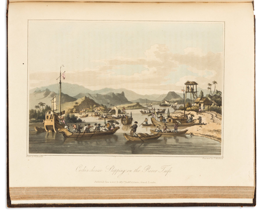

(travel.) john barrow.
A Voyage to Cochinchina in the Years 1792 and 1793.

London: Printed for T. Cadell and W. Davies in the Strand, 1806.
21 hand-colored aquatint plates and maps. 4to, 10¾x8 ½ inches, contemporary speckled calf, rebacked with original spine laid down; original colors to double-page plates oxidized and offset, but generally a tidy copy; armorial bookplate of Tory politician Edward Herbert, Viscount Clive.
Estimate
$1,000 – $1,500


(travel – american south.) george w. featherstonhaugh.
Excursion Through the Slave States.

London: John Murray, 1844
2 tinted lithographed frontispiece plates, 2 pictorial additional titles, engraved folding map, xxix, 357; x, 394, 8 (advertisement) pages. 2 volumes. 8vo, 9x6 inches, original blind stamped brown cloth, rebacked with original spines laid on; in general pretty clean, map with light offset and small tear at mount point.
Estimate
$500 – $750


(travel – arctic.) bernard o’reilly, esq.
Greenland, the Adjacent Seas, and the North-West Passage to the Pacific Ocean.

London: Baldwin, Cradock, and Joy, 1818
Engraved polar map frontispiece, 2 engraved folding charts, and 18 aquatint or engraved plates. 4to, 11x8½ inches, period tan calf with a simple gilt rule, rebacked preserving original gilt-labeled spine; scattered foxing (heavier to a few plates).
Estimate
$500 – $750


(travel – burma / myanmar.) michael symes.
An Account of an Embassy to the Kingdom of Ava, Sent by the Governor-General of India, in the Year 1795.

London, 1800
xxiii, [1], 503, [1] pages. Large 4to, 13x10½ inches, contemporary gilt calf, inelegantly rebacked with original spine laid on; minor foxing. WITH: Separate atlas volume containing 26 (of 28) engraved maps and plates. Small 4to, 10½x8½ inches, modern quarter calf; index leaf and plates 9 and 12 supplied in simple facsimile.
Estimate
$300 – $500


(travel – pacific.)

London: John Stockdale, 1798; 1800
The Voyage of La Perouse Round the World in the Years 1785...1788. Arranged by M.L.A. Milet Mureau. 2 volumes. 48 (of 51 engraved plates and maps). London: John Stockdale, 1798.
[and:]
Voyage in Search of la Perouse. Performed by Order of the Constituent Assembly, During the Years 1791...1794, and Drawn Up by M. Labillardiere. 2 volumes. 46 engraved plates and maps. London: John Stockdale, 1800.
8vo, mismatched later bindings, poorly repaired; scattered staining. Sold as is.
Estimate
$500 – $750


(travel guides.) t. awoki; and j. susuka.
Illustrated Guide Book for Travellers Round the World (Bankoku Meisho Zue).

Osaka: Awoki Szandow, Meiji 18-22 (1885-1889)
Set of miniature guidebooks profusely illustrated with steel engravings throughout, plus an engraved folding map of the world. 8 volumes. 12mo format, each approximately 6x4 inches, publisher’s cloth-backed pictorial paper-covered boards with marbled edges, sewing and gutta percha to one volume failed and split, otherwise very nice with only minor wear; map archivally lined on verso with thin tissue and loosely fitting into original folder; the set housed in an original custom wooden shelved cabinet case with sliding front cover.
The japanese equivalent to baedeker. An appealing set of Meiji guidebooks containing hundreds of engraved illustrations of places around the globe. Just to name a few, the images include scenes of New York City, Hawaii, American Indians, slave traders, whaling, an opium den and criminal punishment in China, the Tower of London, street scenes in Damascus, and much much more. This miniature athenaeum is deluxe complete with “The Map for Travellers Round the World”; all of which is stored in its delightful original wooden shelved library case.
Estimate
$1,800 – $2,200


Wytfliet, cornelis.
Histoire Universelle des Indes Occidentales.

Douai: Francois Fabri, 1607
3 engraved architectural titles, 19 double-page engraved maps, final leaf with woodcut printer’s device. Small folio, 11¾x8 inches, later morocco-backed marbled boards, a bit worn and cracked; text moderately browned with occasional dampstain affecting margins of only a few maps, scattered early marginalia.
Second French edition. Originally published in 1597, Wytfliet’s book was the first separate atlas devoted to the Americas and many of the fine maps are among the earliest of specific regions in North and South America.
Estimate
$5,000 – $7,500
Color Plate & Illustrated Books


(aeneid.) luigi ademollo.
Énéide Dessins Bas-Reliefs au Trait.

Paris, circa 1830
4 letterpress pages of condensed verse in French and 30 lithographed plates (including pictorial title) illustrating scenes from Virgil’s epic tale of mythological Trojan hero Aeneas. Large oblong folio, 10½x22 inches, original cloth-backed marbled boards, worn and rebacked preserving most of original spine, “Morel Poupeterie” ticket to front pastedown; staining, foxing, and foredege repairs. OCLC locates only 4 copies.
Estimate
$200 – $250


(american history illustrated.) william a. crafts.
Pioneers in the Settlement of America: From Florida in 1510 to California in 1849.

Boston: Samuel Walker and Company, 1876-1877
Profusion of wood engraved plates after F.O.C. Darley, William L. Shepard, Granville Perkins, and others. 2 volumes. Thick 4to, 11½x8½ inches, moderately worn contemporary pictorial gilt half morocco with binder’s ticket of J. Beacham, New York; two leaves with old tape repairs, but generally clean.
Estimate
$250 – $300


(architecture / design.) william and james pain.
Pain’s British Palladio: or, the Builder’s General Assistant.

London: I. and J. Taylor, 1793
4, 16 pages, 42 engraved plates, 4-page publisher’s catalog. Folio, 17x10½ inches, worn contemporary sheep plainly rebacked in cloth by Eggeling Bindery, New York (with ticket to front pastedown); various foxing and staining.
Estimate
$300 – $400


(birds.) jacob studer; and theodore jasper.
Studer’s Popular Ornithology. The Birds of North America.

New York, and Columbus, OH, 1881
117 (of 119) tinted and color-printed lithographed plates. Folio, 14½x12 inches, publisher’s gilt and ruled morocco, very worn, covers detached; lacking plates XXV and LI, occasional light dampstain but generally clean and suitable for a breaker.
Estimate
$200 – $250

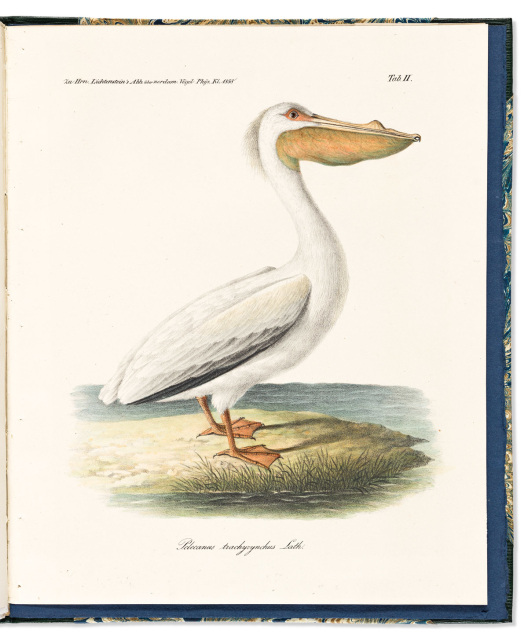

(BIRDS – CALIFORNIA.) Martin Heinrich Karl von Lichtenstein.
Beitrag zur Ornithologischen Fauna von Californien nebst Bemerkungen über die Artkennzeichen der Pelicane und über einige Vögel von den Sandwich-Inseln.

Berlin: Akademie der Wissenschaften, 1840
[iv], [35] pages (i.e. 417-451), and 5 hand-colored lithographed plates (two folding). 4to, 11x9 inches, modern half straight-grained morocco with gilt spine label; uncut; small tide mark to general title, otherwise very clean.
Scarce separate offprint from “Physikalische Abhandlungen der Koniglichen Akademie der Wissenschaften zu Berlin” concerning the avifauna of California - a presentation by the accomplished naturalist Lichtenstein to the German Academy of Sciences in 1838.
Estimate
$1,200 – $1,800


(botanical.) david dietrich.
Forstflora Oder Abbildung und Beschreibung der Für Den Forstmann.

Jena: August Schmidt, 1841, 1840
287 hand-colored engraved plates (130 [1-128, including 68 and 101 bis]; 157 [numbering 229 species]). 2 volumes. 4to, 10x8 inches, modern marbled boards with gilt paper spine labels; foxing to the text but plates generally clean with only a few printed on toned acidic paper.
Finely illustrated encyclopedia studying the native botany and mycology of German woodlands. Volume 1 with title-page dated 1841, volume 2 dated 1840. Nissen 487 (without a citation of an 1841 edition).
Estimate
$800 – $1,200

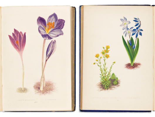

(BOTANICAL.) David Wooster.
Alpine Plants: Figures and Descriptions of Some of the Most Striking and Beautiful Alpine Flowers. [with:] … Second Series.

London: Bell and Daldy; and George Bell & Sons, 1872, 1874
108 chromolithographed plates after A.F. Lydon. 2 volumes. Publisher's gilt-pictorial blue pebbled cloth, spine caps chipped and other light wear; minor foxing mostly to text and interleaves, plates generally clean; bookplates and nineteenth-century gift inscription.
Estimate
$200 – $250


(botanical.)
The Highgrove Florilegium. Watercolors Depicting Plants Grown in the Garden at Highgrove.

London: Addison Publications for The Prince’s Charities Foundation, 2008-2009
124 offset color lithographs of watercolors by contemporary botanical illustrators. 2 volumes. Imperial folio, 26x19 inches, fine burgundy morocco-backed marbled paper boards, spine gilt in compartments, oval morocco title-piece with the Prince of Wales’s emblematic feather badge in gilt to upper covers; each plate with printer’s blindstamp and limitation in pencil at lower right, this copy number 105 of 175; condition as new.
Estimate
$3,000 – $5,000


(botany / mycology.) johann hegetschweiler.
Die Giftpflanzen der Schweiz.

Zurich, [1828]
38 hand-colored lithographed plates of poisonous plants and mushrooms native to Switzerland. 8vo, 8¼x7 inches, early 20th-century morocco-backed marbled boards with original red printed wrappers bound in, light rubbing; uncut; generally clean; Harvard University Library blindstamp to title-page, gilt spine blazon, and bookplate (duplicate, released).
Estimate
$300 – $400


(brazil – pernambuco.) francisco henrique carls.
[Album de Pernambuco e seus Arrabaldes].

Recife: F. H. Carls, [circa 1873]
Without title, 53 chromolithographed plates of landscape and town views, port scenes, farms, public squares and private villas in the state of Pernambuco, northeast Brazil. Publisher’s oblong red cloth portfolio with white moiré paper flaps, 14x18 inches, ruled in gilt and black with stamped corner pieces and blocked lettering, inner hinges somewhat worn but sound; plates loose as issued, 13½x17½ inches or slightly smaller; printer’s registration pinholes; light scattered foxing, several plates with early pencil annotations, one with a short margin tear and crease.
Handsome collection of scarce chromolithographs illustrating community life in the Pernambuco region of Brazil in the latter part of the nineteenth century. Francisco Henrique Carls (born Franz Heinrich Carls) emigrated from Germany to Brazil in 1858 and established his lithographic studio there in the 1860s. Plate counts found in Carls albums vary, sometimes with as few as 20. The present loose portfolio is a significantly large suite; the largest to come on the market in modern times.
Plate titles:
- Estação da Cidade do Cabo (Estrada de Ferro do Recife a S. Francisco).
- Uma Parte da Passagem da Magdalena.
- Jaqueira.
- Cidade da Escada. Tirada do Sitio Atalaya.
- Caxangá.
- Cidade de Santo Agostinho do Cabo.
- Sitio de João José Rodrigues Mendes. Ponte de Uchoa.
- Ponte de Uchôa.
- Soledade.
- Rua 1 de Março
- Olinda.
- Ponte do Recife.
- Vista de S. Antonio. Tirada em S. Amaro do Mirante da Casa do Sr. E. Burle.
- Vista de S. Antonio e Caes do Ramos. (Tirada do Recife).
- Ponte da Bôa Vista. Casa de Detençao. Hospital Pedro 2.
- Chacara do Commendador Luiz Gonçalves da Silva. Na Estancia (Tirada da Magdalena).
- Recife. (Tirada do Observatorio do Arzenal de Marinha).
- Povoação de Beberibe.
- Entrada Para a Estação de Cinco Pontas.
- Rua do Hospicio. Quartel. Collegio das Artes. Academia.
- Porto de Pernambuco. Caes da Companhia Pernambucana.
- Entrada da Barra do Recife.
- Sitio de Soledade (Amorim).
- Vista do Recife. Tirada do Observatorio.
- Apipucos.
- Theatro de S. Isabel. Assemblea Provincial. Gymnasio. Palacio de Presidencia.
- Pateo do Carmo.
- San Jose.
- Ponte da Passagem da Magdalena.
- Rua do Imperador.
- Pau d’Alho.
- Largo do Livramento.
- Hospital Portuguez de Beneficencia. (2 copies).
- (Tirada do Largo do Hospital Pedro II).
- Rua do Bom Jesus.
- Largo do Corpo Santo.
- Chacara do Negociante. Francisco Gonçalves Netto.
- Sitio do Sr. Edo Fenton. (Chacão).
- Propriedade do Dr. Augusto Frederico de Oliveira. (Ponte de Uchoa).
- Panorama de Uma Parte de Cidade do Recife. Tirado da Torre do Arsenal de Marinha.
- Rua Barão da Victoria. Matriz S. Antonio.
- Rua do Marquez de Olinda.
- Pateo do Terço.
- Rua da Aurora.
- Ponte de S. Izabel. Assemblea. Gymnasio.
- Olinda. (Tirada da Ladeira da Misericordia).
- Recife Drainage Compy. Estação das Cindo Pontas. Matriz S. Jose.
- Panorama de Olinda e Recife. Tirada da Ladeira da Misericordia.
- Panorama de S. Amaro e Uma Parte da Cidade do Recife. Tirado da Torre do Arsenal de Marinha.
- Igreja da Penha.
- Rua da Imperatriz. Matriz da Boa Vista.
- Continuação das Vistas da Passagem de Magdalena.
Estimate
$25,000 – $35,000


(caricature). vanity fair.
Approximately 230 chromolithographed caricature plates.

London, 1872-1874; 1891-1894
2 volumes. Folio, contemporary half morocco, first volume worn with covers detached; clipped and mounted to album leaves with pasted text clippings facing each plate; scattered foxing.
Estimate
$700 – $1,000


(carnevale.) hjalmar morner.
Il Carnevale di Roma.

Rome, 1820
Without title, 20 etched and engraved plates of the festival, costumes, and celebrations. Oblong folio, 11½x22½ inches, modern calf-backed patterned paper covered boards; dampstain, scattered foxing.
Estimate
$500 – $750


(cocktails.) paul iribe; for nicolas wine merchants.
Rose et Noir.

Paris, 1931
9 black and white soft-focus Art Deco plates with 8-leaf “Dialogue Moderne en Trois Temps et Trois Cocktails” chinwagging dialog booklet by René Benjamin loosely stitched in. Thin folio, 13x10¼ inches, publisher’s black wrappers with moderate wear; internally fine. Edition of 500.
Estimate
$150 – $200


(elgin marbles.) a.h. smith, for the british museum.
The Sculptures of the Parthenon.

London, 1910
94 (of 95) photogravure plates (lacking plate 39), with 70-page commentary booklet in original plain printed wrappers. Folio, 22¼x15 inches, loose plates and text volume kept in original gilt-blocked cloth portfolio; wear and repairs to folio flaps, plates clean.
Estimate
$400 – $600

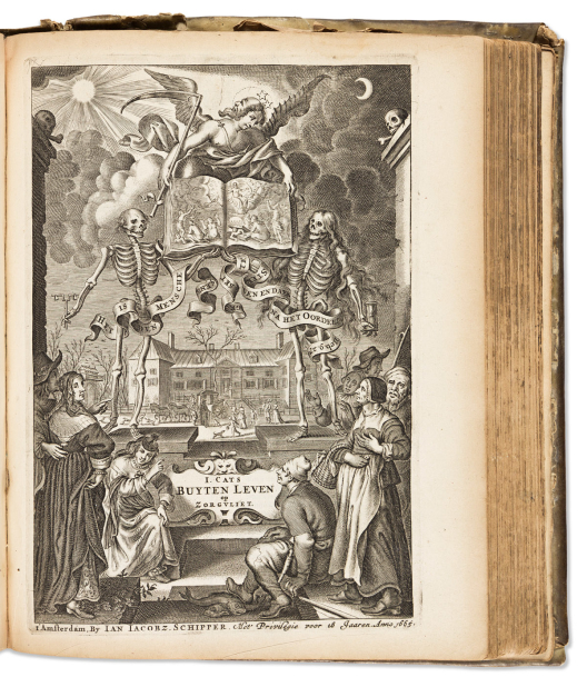

(fables.) jacob cats.
Alle de Wercken, Zoo Oude als Nieuwe, van de Heer Jacob Cats.

Amsterdam: J.J.. Schipper, 1665
Several works in one. Engraved portrait frontispiece, nearly 400 text engravings (a few full-page, i.e., additional titles). Thick 4to, 10x8 inches, contemporary vellum, chipped and repaired; occasional dampstain.
Estimate
$400 – $600


(fables.) jean de la fontaine.
Fables de la Fontaine, Edition Taille-Douce.

Paris: Lecointe, Pougin, Gouget, 1834
Two title-pages, dedications, portrait of Fontaine, epilogues, indices, and 247 illustrated leaves, entirely engraved. 2 volumes. 13½x10 inches, contemporary calf-backed marbled paper boards with gilt paper spine labels, some wear; moderate foxing and soiling.
Estimate
$400 – $600


(fashion.)
Large group of illustrated Parisian fashion periodicals.

Paris, vd
Generally good condition.
- Art-Goût-Beauté. Nos. 120, 140-144. Original printed wrappers with pochoir plates laid on, saddle bound with yellow cord. (6 issues, complete). Paris, 1930-1932
- L'Officiel de la Couleur des Industries de la Mode. No. 15 (8 numbered plates plus extras), No. 17 (12 numbered plates), No. 17 (12 numbered plates) [duplicate], No. 18 (8 numbered plates), No. 21 (12 plates). Original printed wrappers, plates with color swatches tipped on. (Each issue complete). Paris, 1951-1953.
- Cahiers Bleus. Nos. 1-5 (plus a duplicate No. 4). Original printed wrappers, plates with fabric swatches tipped on. (6 issues complete. Paris, 1952.
- Les Idees Nouvelles de la Mode [et des Arts]. No. 10, No. 7 (2 Année), No. 6 (4 Année), No. 11 (4 Année), No. 7 (5 Année), No. 4 (6 Année), No. 10 (6 Année). Original pochoir wrappers with silk ties, approximately 75 plates (i.e. issues variously incomplete). 1922-1927.
- Gazette du Bon Ton. No. 4; and No. 7. Original wrappers, 16 plates (each issue complete). 1921.
Estimate
$800 – $1,200


(fashion – hairstyles.)
Recueil de Coeffures Depuis 1589, Jusqu’en 1778. Avec des Vers Analogues a Chaque Costume; Collection Fort Desiree des Dames, et la Plus Complete qui ait Encore Paru en ce Genre; Suivi du Secretaire a la Mode a l’Usage du Beau Sexe.

Paris: Desnos, circa 1779
Engraved frontispiece and 31 (of 40?) engraved plates in original hand-color; 12mo, 4x2¾ inches, contemporary gilt red sheep with calf spine label, a bit worn and shaken; scattered dampstain and other signs of age, gutter repaired with tape at a few places.
Scarce miniature French fashion almanac, with a 40-page printed calendar and day planner by Desnos included at the back.
Estimate
$300 – $400

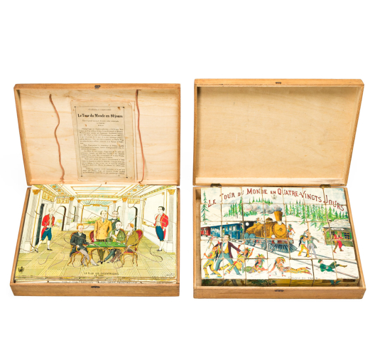

(games – around the world in 80 days.) e. chevalier.
Le Tour du Monde en Quatre-Vingts Jours.

Paris, 1928
5 (of 6) chromolithographed cartoons mounted to thin wood and dissected into jigsaw pieces each with an uncut key sheet and a 7-page explanation booklet, all reserved in original hinged wooden box with chromolithographed pictorial top. 10x14x2¾ inches overall; generally very good.
Together with: Le Tour du Monde en Quatre-Vingts Jours - Theatre Cubes. Another version of the puzzle though here the 6 scenes are dissected and mounted to each side panel of 35 two-inch wooden cubes, also housed in a pictorial hinged box; more worn than the jigsaw version and without the reference sheets and booklet.
Estimate
$300 – $400


(insects.) thomas say.
American Entomology, or Descriptions of the Insects of North America.

Philadelphia: Samuel Augustus Mitchell, 1824-25
Volumes 1 and 2 only. Engraved frontispiece, 36 hand-colored engraved plates. 8vo, 10x6½ inches, original pink boards with printed paper cover label, unsympathetically rebound in green cloth; uncut; light foxing and offset, new tissue interleaves tipped to each plate.
Estimate
$400 – $600


(investment schemes.)
Het Groote Tafereel der Dwaasheid, Vertoonende de Opkomst, Voortgang en Ondergang der Actie, Bubbel en Windnegotie, in Vrankryk, Engeland, en de Nederlanden, Gepleegt in den Jaare MDCCXX.

[Amsterdam, 1720]
71 engraved plates, most double-page or folding. Folio, 16x10 inches, contemporary mottled calf with gilt rules and central lozenge, boards detached, i.e. in need of binding; light edge wear and small tears, a few engravings clipped and laid down as issued.
Profusion of engraved broadsides pictorially reproaching several disastrous economic events of 1720, primarily satirizing the Dutch speculative mania that led to the Mississippi Bubble in France and the South Sea Bubble in England. Collation varies, but presently a large collection. Of note are maps of Louisiana and the Mississippi River valley, and the “Very Famous Island of Madhead”.
Estimate
$1,500 – $2,500


(japan – conchology.) hirase yoichiro.
Kai Senshu (The Illustrations of a Thousand Shells).

Kyoto, 1914-1922
400 indexed color-printed woodblock illustrations of shell and coral specimens on 80 double-page plates. 4 volumes. 8vo, 9¾x7 inches, leporello format in original silk boards with printed paper cover labels, minor wear; light offsetting.
Estimate
$800 – $1,200


(japan – erotica.)
Group of four turn of the twentieth century manuscript shunga.

Japan, vd
- Manuscript sketchbook; 13 leaves with 8 full-page drawings. 5x6½ inches, cord stitched wrappers.
- Manuscript sketch album; 10 double-page line drawings in leporello format (7 recto, 3 verso). 8½x6½ inches, patterned silk-covered boards; minor wear.
- Scroll of 12 ink and gouache paintings on silk sheets mounted to paper. 6½x117 inches including silk terminal edges.
- Silk strip painted with 12 panels. 2¾x46½ inches, loosely mounted to a slightly larger paper scroll.
Estimate
$500 – $750


(japan – hunting.)
Illustrated manuscript album of falconry, trapping, and butchering techniques.

Japan, circa 1800
70 leaves with over 25 full-page ink and wash drawings. 8vo format, 10½x7¾ inches, original paper wrappers with newer cord stitching; moderate to heavy worm track.
Estimate
$700 – $1,000


(japan – perry.)
Manuscript reports concerning Commodore Perry and international trade.

Japan, Kaei 6-7 (1853-54)
2 volumes. 8vo format, 10x6¼ inches, cord-stitched sheets; nicely preserved.
The first volume, a manuscript document with the cover illustrated by a seated Perry, also includes a profile bust of Commander Henry Adams and a sketched plan of the ceremonial meeting place where official treaties were signed.
The second volume contains four manuscript documents, including Japanese translations of official letters directed to the Japanese Emperor from President Millard Fillmore, Secretary of State Edward Everett and Commodore Matthew Perry. In his letter to the Emperor, Fillmore implores for harmonious commerce: “I have directed Commodore Perry to assure your imperial majesty that I entertain the kindest feelings toward your majesty’s person and government, and that I have no other object in sending him to Japan but to propose to your imperial majesty that the United States and Japan should live in friendship and have commercial intercourse with each other.”
Estimate
$600 – $900


(JAPAN – WORLD WAR II PROPAGANDA.)
Daitowa Senso Kaigun Bijutsu.

Japan, Showa 18 (1943)
35 mounted offset color plates with captioned tissue overlays. Oblong folio format, 12x16½ inches, original tied blue cloth portfolio with printed paper label on upper cover, light wear; mount cards with minor edge foxing but plates themselves bright and clean.
A beautifully illustrated album of Japanese World War II propaganda images. The scenes endorsing the bravery of the Japanese navy are extremely dramatic: the attack on Pearl Harbor, various Indonesian engagements, the Japanese attack on Clark Air Field, the Japanese occupation of Singapore, a Japanese submarine attacking the U.S.S. Lexington, Japanese Zeroes on the offensive, and a scene of captured Americans on Wake Island are only a few. Perhaps the most revealing is a chilling fantasy illustration appearing at the end picturing Japanese navy bombers in formation over New York City by Kokan Kojo.
Estimate
$700 – $1,000


(juvenile.)
Group of 18 early nineteenth-century English battledore primers.

Vp, England, circa 1820s-40s
Variously colored stiff cards, each folding into three recto/verso letterpress and woodcut-printed panels of illustrated alphabet lessons, literacy aids, and moralistic verse; 12mo format when closed; generally fine condition all around.
-
For a Good Child at School (The Infants Battledore) [urn on plinth]. Castle Cary: Printed and Sold by S. Moore.
-
For a Good Child (The Infants Battledore) [woman with ship’s anchor]. Castle Cary: Printed and Sold by S. Moore
-
A Present for a Good Child (The Infants Battledore) [two putti with wreath]. Castle Cary: Printed and Sold by S. Moore.
-
The “Prince Arthur” Battledore [bird of paradise, but with other cuts captioned “A Chinese Junk of War” and “Destruction of the Chinese Fleet”]. Eastwood: G. R. Barber.
-
The British Battledore; or, First Lessons [milkmaid with cow]. Alnwick: W. Davison.
-
English Battledore [man on a donkey]. Alnwick: W. Davison.
-
The Child’s Battledore [giraffe]. Alnwick: W. Davison.
-
Youth’s Battledore [full-length standing woman]. Alnwick: W. Davison.
-
Richardson’s New Royal Battledore [greyhound dog]. Derby: Thomas Richardson.
-
Richardson’s New Royal Battledore [church]. Derby: Thomas Richardson.
-
No. 4. New Battledore [hen, butterfly, rabbit]. Derby: H. Mozley and Sons.
-
[Untitled] [man playing a fiddle with “The Cake” text]. Banbury: J.G. Rusher.
-
[Untitled] [man on a walking horse with “The Good Boy” text]. No imprint.
-
The following five examples in custom cloth-backed paste-paper portfolio covers with manuscript lettered spine and bookplates of both Wilbur Macy Stone and James d’Alte Aldridge Welch.
-
The British Battledore; or, First Lessons [milkmaid with cow]. Alnwick: W. Davison.
-
The Child’s Battledore [giraffe]. Alnwick: W. Davison.
-
Youth’s Battledore [full-length standing woman]. Alnwick: W. Davison.
-
The New Royal Battledore [zebra]. Kettering: Joseph Toller.
-
My New Battledore [basket weaver]. Kettering: Joseph Toller.
Estimate
$1,000 – $1,500


(kalology.) mary anne schimmelpennick.
Theory on the Classification of Beauty and Deformity, and Their Correspondence with Physiognomonic Expression Exemplified in Works of Art, and Natural Objects.

London: John and Arthur Arch, 1815
38 lithographed plates with original wash color (lacking 2 folding charts). 4to, 11x8½ inches, original cloth, faded, worn, rebacked preserving the spine; offsetting, a few plates shaved with minimal loss to lower lettering.
“Taste is a branch of judgement, as imagination is of genius. As it is the province of imagination, by new combinations of sensible objects, to form new images, so it is that of taste, to select, or reject the combinations of imagination, according to the standard of beauty or deformity. In a word, taste is judgement exercised on the works of imagination. Taste is judgement applied to the discrimination of beauty from deformity. The question will then arise, What is beauty?”
Estimate
$150 – $200


(napoleon.) charles percier; and p.f.l. fontaine.
Description des Cérémonies et des Fêtes qui ont eu lieu pour le Couronnement de Leurs Majestés Napoléon avec S. A. I. Madame l’Archiduchesse Marie-Louise d’Autriche.

Paris, 1810
13 engraved plates. Large folio, 24¼x17 inches, contemporary cloth-backed red papered boards with a gilt stenciled Napoleonic monogram to upper cover, edges a little clumsily repaired, modern silk ties, "Tessier" binder's ticket to front pastedown, some damage to front endpaper, heavy foxing.
Estimate
$1,000 – $1,500


(native americans.) george catlin.
O-Kee-Pa: A Religious Ceremony; and other Customs of the Mandans.

Philadelphia: J.B. Lippincott & Co., 1867
vii, 52 pages, and 13 chromolithograph plates. 8vo, 10¼x7 inches, original gilt purple cloth, soiled and faded but sound; foxing, a little musty. First American edition.
“During this painful operation, most of these young men, as they took their position to be operated upon, observing me taking notes, beckoned me to look them in the face, and sat, without the apparent change of a muscle, smiling at me whilst the knife was passing through their flesh, the ripping sound of which, and the trickling of blood over their clay-covered bodies and limbs, filled my eyes with irresistible tears. When these incisions were all made, and the splints passed through, a cord of raw hide was lowered down through the top of the wigwam, and fastened to the splints on the breasts or shoulders, by which the young man was to be raised up and suspended. …He was thus raised some three or four feet above the ground, until the buffalo heads and other articles attached to the wounds swung clear, when another man, his body red and his hands and feet black, stepped up, and, with a small pole, began to turn him around. The turning was slow at first, and gradually increased until fainting ensued, when it ceased. In each case these young men submitted to the knife, to the insertion of the splints, and even to being hung and lifted up, without a perceptible murmur or a groan; but when the turning commenced, they began crying in the most heartrending tones to the Great Spirit, imploring him to enable them to bear and survive the painful ordeal they were entering on. This piteous prayer, the sounds of which no imagination can ever reach, and of which I could get no translation, seemed to be an established form, ejaculated alike by all, and continued until fainting commenced, when it gradually ceased. …what that double agony actually was, every adult Mandan knew, and probably no human being but a Mandan ever felt. …Each body lowered to the ground appeared like a loathsome and lifeless corpse. No one was allowed to offer them aid whilst they lay in this condition. They were here enjoying their inestimable privilege of voluntarily entrusting their lives to the keeping of the Great Spirit, and chose to remain there until the Great Spirit gave them strength to get up and walk away.”
Estimate
$2,500 – $3,500


(natural history.) frederick william beechey, et al.
The Zoology of Captain Beechey’s Voyage; Compiled from the Collections and Notes Made by Captain Beechey, the Officers and Naturalist of the Expedition, During a Voyage to the Pacific and Behring’s Straits Performed in His Majesty’s Ship Blossom… in the Years 1825, 26, 27, and 28.

London: Henry G. Bohn, 1839
xii, 180 pages (additionally 9*-13*), half-title, 44 beautifully hand-colored engraved plates of mammals, birds, fishes, crustaceans, reptiles and mollusks, 1 uncolored engraved plate (XLV, inserted?), and 3 hand-colored engraved geological plans and elevations. 4to, 11½x9 inches, publisher's plain green cloth with printed spine label, contents shaken with several quires and plates loose, covers detached; minimal foxing but plates generally clean; faults repairable.
Important early reporting on exotic Pacific species, many newly discovered, and illustrated by a fine collection of plates after Edward Lear, Johann Christian Zeitter, George Brettingham Sowerby, and James De Carle Sowerby.
Estimate
$7,000 – $10,000


(natural history.) louis-isidore duperrey, et al.
Zoologie. [Voyage Autour du Monde, Exécuté par Ordre du Roi, sur la Corvette de Sa Majesté, la Coquille, Pendant les Années 1822, 1823, 1824 et 1825.]

Paris, 1826-1830
Zoology atlas part II only. Half-title/index leaf clipped and marked with modern pen, 61 hand-colored engraved plates of reptiles, fish, shelled mollusks and marine invertebrates. Folio, 19½x12½ inches; library buckram disbound; moderate foxing and toning, a few short tears, corner of each plate with pale ink stamp "Scripps Institution for Biological Research".
Estimate
$2,000 – $3,000


(natural history.) charles catton, junior.
Thirty-Six Animals, Drawn from Nature, and Engraved in Aqua-Tinta.

London and New-Haven, 1825
34 (of 36) aquatint plates of mammalian subjects including lions, tigers, and bears. Folio, 16¼x10 inches, original worn marbled boards with red roan spine rebacked; foxing and stains, scattered repairs to text leaves.
American edition, here lacking plates 8 (Persian Cats) and 24 (Ermine).
Estimate
$500 – $700

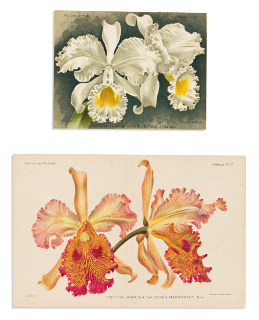

(orchids.) alfred cogniaux; and alphonse goossens.
Dictionnaire Iconographique des Orchidées.

Brussels, 1896-1907
Approximately 740 (of 826) fine small-scale chromolithographed plates, loose as issued in 15 modern 8vo format portfolio cases and one worn original case; several leaves of supplemental text and various original parts wrappers presently included; moderate foxing, toning, and edge wear.
Estimate
$2,000 – $3,000


(ROME.) Marco Sadeler; Giovanni Battista Falda; and others.
[Composite atlas comprising five seventeenth-century engraved series of Roman architecture].

Rome, latter half seventeenth century
Oblong folio, 9½x15 inches, contemporary mottled calf with gilt morocco title pieces to upper and lower covers, some rubbing but overall sound and attractive; scattered stains and foxing; bookplate of G.S. Cusin.
Marco Sadeler. Vestigi Delle Antichita di Roma Tivoli Pozzuolo et Altri Luoghi. Engraved allegorical title-page and 50 full-page engraved plates; 3 additional engraved folding plates by Étienne Dupérac bound in. Rome: Giacomo de Rossi, 1660. Re-engraved plates after the 1606 Prague edition by Aegidius Sadeler.
and: Giovanni Battista Falda. Il Nuovo Teatro Delle Fabriche, et Edificii, in Prospettiva di Roma Moderna, Sotto il Felice Pontificato di N.S. Pap Alessandro VII. Parts 1-3. 3 engraved sectional title-pages, 3 engraved dedications, and 82 full-page unnumbered engraved plates. Rome: Giovanni de Rossi, 1665.
and: Giovanni Battista Falda(?) [Suite of 7 unsigned engraved plates of Italian churches]: S. Pietro di Roma in Vaticano; S. Pauolo; S. Bastiano; S. Giovanni Laterano; S. Chroce; S. Lorenzo; S. Maria Maggiore. [Rome, circa 1650?]
and: Giovanni Battista Falda. Le Fontane di Roma Nelle Piazze, e Luoghi Publici Della Citta, con li Loro Prospetti, Come Sono al Pesente. Parts 1-2. 2 engraved title-pages, two engraved dedications, and 45 full-page engraved plates. Rome: Giovanni de Rossi, [1691].
and: Giovanni Giacomo de Rossi; after Matthias Greuter, Francesco Corduba, and Gottfried de Scaichi. [Suite of eight etchings of Roman gardens and palaces]. Full-page, one folding. Rome, circa 1650.
Estimate
$5,000 – $7,500


(roses.) paul hariot.
Le Livre d’Or des Roses, Iconographie Histoire et Culture de la Rose.

Paris: Lucien Laveur, [1903]
[iv], 130, [5] pages profusely illustrated with wood engravings and 60 lovely chromolithographed plates of rose varieties on textured paper, each a with captioned interleaf. 4 volumes. Lightly worn original 4to-format green cloth-backed printed livraison portfolios with cloth ties; text unopened; modest age toning but no major damages, most plates with title written to verso in period(?) ink.
A handsome set, loose in original parts as issued.
Estimate
$800 – $1,200

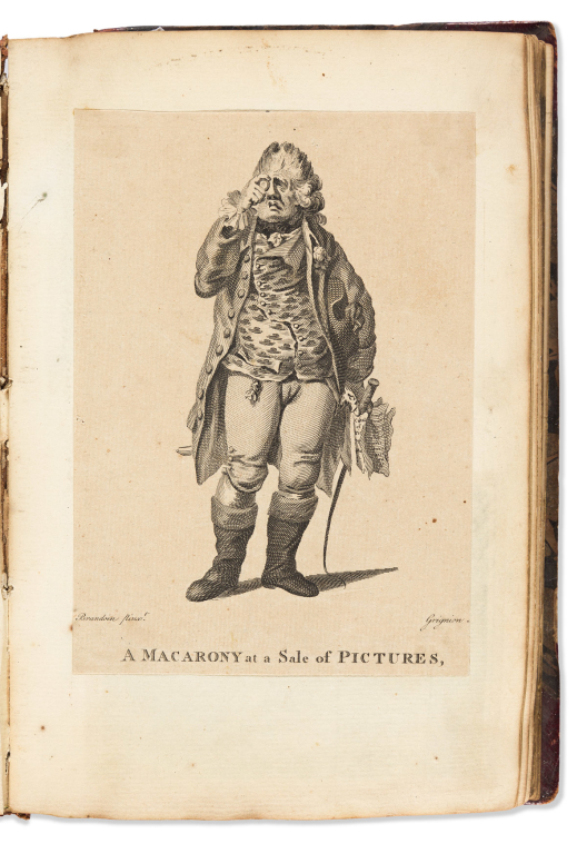

(scrapbook.)
Album of mounted engravings and title-pages [compiled by] early nineteenth-century Philadelphia printer and bookseller, James P. Parke.

Vp, assembled circa 1810-1820
Approximately 170 engraved, stipple, and aquatint plates clipped and mounted to leaves of "T Gilpin & Co/1810" watermarked laid paper. Thick 8vo, 9½x6¼ inches, contemporary morocco-backed marbled boards, spine worn and with some loss; scattered soiling and corner stains from tipping adhesive. James P. Parke, Philadelphia bookplate to front pastedown.
Interesting group of 18th/19th century engraved plates contemporaneously assembled from various American, British, and French sources collecting a variety of subject matter including botany, natural history, mythology, political emblems, historical scenes, architecture, interiors, and portraits.
Many of the plates appear scarce, but to mention just a few:
Calendar for the Nineteenth Century, by David Mandeville. (Circular perpetual calendar with separate printed explanation broadside).
Tomb of Washington, engraved by George Murray after Gideon Fairman and William Rawle.
A Macarony at a Sale of Pictures, engraved by Charles Grignion after Michel Vincent Brandoin.
Radnor Church with Gen. Wayne’s Monument, engraved by Tiebout after Strickland.
William Penn’s treaty medal, engraved by Murray.
A suite of humorous reversible ambigrams by Harding.
Thomas Jefferson and James Madison, by Joseph Delaplaine.
Estimate
$500 – $750


SEM (Georges Goursat.)
Group of 70 folio lithograph and pochoir caricature plates (12 double-page).

Paris, circa 1900-1910s
With three printed portfolio covers, no spines; scattered dampstain and edge wear, pencil annotations.
Estimate
$1,000 – $1,500

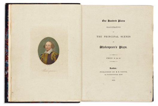

(shakespeare.)
One Hundred Plates, Illustrative of the Principal Scenes in Shakespeare’s Plays.

London: H.R. Young, 1819
Stipple and engraved portrait of Shakespeare, and 100 hand-colored stipple and engraved plates on heavy grey stock. 4to, 11½x9 ¼ inches; later half blue morocco by Zaehnsdorf, top edge gilt otherwise uncut, light wear and rubbing; clean with no tears or repairs. 4 copies in OCLC, not seen at auction since 1910.
Estimate
$2,500 – $3,500


(trade catalogs – années folles.) lancel.
Guide des Cadeaux.

Paris, circa 1927
Parisian gift catalog offering a wide assortment of luxury items from handbags and jewelry to table settings and smoking accessories; amusingly illustrated throughout by Zyg Brunner and others. 8vo format, 9½x6½ inches, publisher’s embossed silver-printed paper wrappers, minimal wear and staining; small abrasion to lettering of one section tab, else very good.
Estimate
$150 – $200
Historical Prints & Drawings


(allegory of senses.) georg balthasar probst.
Le Sentiment (Touch); L’Ouie (Hearing); Le Gout (Taste).

Augsburg, circa 1780
Together three (of five) hand-colored engraved vue d’optique plates showing people and animals experiencing various sensory stimulation within grand 18th-century European interiors. 13½x18 inches each sheet size, wide margins; original hand-color; small stains and minor edge wear.
Estimate
$150 – $200


(american waterfalls.) captain thomas davies, after.
Group of 5 engraved topographical scenes of North American waterfalls.

London, 1768
Heavy laid paper, approximately 17x23 inches each sheet size, wide margins with mostly untrimmed deckle edges; small archival repairs, a few extending into images.
Five of Thomas Davies’ unquestionably rare “Six Views of North American Waterfalls Dedicated to His Excellency Lieut. General Sir Jeffrey Amherst”:
- An East View of the Great Cataract of Niagara.
- A North View of the Pisaiack Falls, in the Province of New Jersey in North America.
- A North West View of the Cohoes, or Great Cataract of the Mohawk River, in the Province of New York in North America.
- A South East View of the Lower Cataract on the Casconchiagon or Little Seneca’s River, on Lake Ontario.
- A North West View of the Half Moon or Second Fall in the River Cosconchiagon on Lake Ontario.
- (presently excluding A South East View of the Great Cataract on the Casconchiagon or Little Seneca’s River, on Lake Ontario).
British army officer Thomas Davies was a pioneering artist of colonial North America, honing his skills while surveying (and skirmishing) in the wilderness of the northeast during the French and Indian War. The original watercolors Davies painted to serve as models for these engravings were produced during this period and persist as some of the earliest first-hand visual records of the region’s topography taken by a European.
“Views like those produced by Davies are not fanciful studio illustrations of idealized scenery, but renderings of nature observed, the landscape laid down in such a way that is both recognizable and informative… Davies’s landscape is not a drawing of a cascade with its fugitive light, bewildering movement, and overpowering noise; it is a drawing of a specimen, a waterfall catalogued and described in an inventory of the falls of Canada” - Victoria Dickinson, Drawn From Life: Science and Art in the Portrayal of the New World, pages 198-199, 201.
While Davies should naturally receive the lion’s share of acclaim for his trailblazing presence of time, place, and compositional abilities, major endorsement must be afforded to the skillful engraving of John Fougeron, Peter Mazell, and Thomas Morris, each translating to the plate with such fidelity the subtle nuances of flowing water, rocky strata, dense timber and overall feel for the unspoiled natural phenomenon of these waterfalls.
Estimate
$8,000 – $12,000


(anatomy.) cornelius huyberts, engraver.
Engraved diorama of pediatric skeletons and embalmed body parts.

Amsterdam, 1701
Folding frontispiece to Frederik Ruysch’s Thesaurus Anatomicus.15¾x14 inches sheet size, wide margins (left edge partially trimmed for binding); original folds, small closed tear at mount point else quite fine.
Estimate
$200 – $300


Audubon, john james.
American Golden Crested-Wren. Plate CLXXXIII. [Variant 3].

London: Robert Havell, [1836]
Hand-colored aquatint and engraved plate from Audubon’s Birds of America, on wove paper watermarked: “J Whatman/1836”. 38x25½ inches sheet size, binding edge at left; faint toning and edge stain. Provenance: City of New York (acquired 1850, the final set sold by Audubon, a year before his death; Sotheby’s October 18-19, 1985).
Estimate
$700 – $1,000


Audubon, john james.
American Redstart. Plate XL. [Variant 2].

London: Robert Havell, [1828] but 1838
Hand-colored aquatint and engraved plate from Audubon’s Birds of America, on wove paper watermarked: “J Whatman/1838”. 38x25½ inches sheet size, binding edge at left; faint offset and edge staining. Provenance: City of New York (acquired 1850, the final set sold by Audubon, a year before his death; Sotheby’s October 18-19, 1985).
Estimate
$800 – $1,200


Audubon, john james.
Black & Yellow Warbler / Flowering Rasp-Berry. Plate CXXIII.

London: Robert Havell, [1834]
Hand-colored aquatint and engraved plate from Audubon’s Birds of America, on wove paper watermarked: “J Whatman/1834”. 32x25¼ inches sheet size, a little trimmed; faint mat line and touches of foxing.
Estimate
$800 – $1,200


Audubon, john james.
Black Backed Gull. Plate CCXLI.

London: Robert Havell, 1835
Hand-colored aquatint and engraved plate from Audubon’s Birds of America, on wove paper watermarked: “J Whatman/Turkey Mill/1834”. 37x25 inches sheet size; small edge nicks and closures.
Estimate
$2,000 – $2,500


Audubon, john james.
Carolina Parrot. Plate 26.

London: Robert Havell, 1828
Hand-colored aquatint and engraved plate from Audubon’s Birds of America, on wove paper watermarked: “J Whatman/1830.” 38x25 inches sheet size, full margins with a strong platemark; an excellent example with ideal cream paper patina, no tears or other faults.
Audubon’s masterpiece composition of the now-extinct species.
Estimate
$80,000 – $100,000


Audubon, john james.
Ruby Crowned Wren. Plate CXCV.

London: Robert Havell, 1834
Hand-colored aquatint and engraved plate from Audubon’s Birds of America, on wove paper watermarked: “J Whatman/1836”. 38x25½ inches sheet size, binding edge at left; foxing and edge stain. Provenance: City of New York (acquired 1850, the final set sold by Audubon, a year before his death; Sotheby’s October 18-19, 1985).
Estimate
$500 – $750


Audubon, john james.
Yellow Bellied Woodpecker. Plate CXC.

London: Robert Havell, 1834
Hand-colored aquatint and engraved plate from Audubon’s Birds of America, on wove paper watermarked: “J Whatman/1836”. 38x25½ inches sheet size, binding edge at left; foxing and edge stain. Provenance: City of New York (acquired 1850, the final set sold by Audubon, a year before his death; Sotheby’s October 18-19, 1985).
Estimate
$700 – $1,000


Audubon, john james.
Fish Hawk or Osprey. [Plate 288].

[New York: Julius Bien, 1860]
Chromolithographed plate from the Bien edition of Audubon’s Birds of America. 39½x26½ inches sheet size; general age tone and scattered foxing, dampstain at lower edge, small closed tears; without plate number and lower right imprint (i.e., not trimmed but never printed).
Estimate
$1,500 – $2,500


Audubon, john james.
Great White Heron. Plate 368.

New York: Julius Bien, 1860
Chromolithographed plate from the Bien edition of Audubon’s Birds of America. 26¾x39¼ inches sheet size, wide margins with binding edge at top; minor age tone, overall a nice example.
Estimate
$2,500 – $3,500


Audubon, john james.
Iceland or Jer Falcon. Plate 19.

New York: Julius Bien, 1860
Chromolithographed plate from the Bien edition of Audubon’s Birds of America. 39½x26¾ inches sheet size, wide margins with binding edge at left; minor age tone, small repairs at upper and lower left corners.
Estimate
$3,000 – $5,000


Audubon, john james.
Red-Tailed Hawk. Plate 7.

New York: Julius Bien, 1860
Chromolithographed plate from the Bien edition of Audubon’s Birds of America. 39½x26½ inches sheet size; faint mat line and general toning, a few short edge closures.
Estimate
$2,000 – $3,000


Besler, basilius.
Sedum Vulgare, Pisum Magnum Peregrinum, etc. [and] Noli Me Tangere, etc.

[Eichstatt, 1613]
Together two hand-colored engravings from Besler’s Hortus Eystettensis. Folio sheets of unwatermarked laid paper, Latin text on verso; Sedum plate a little trimmed and with desiccated tape residue to verso edges.
Estimate
$800 – $1,200


(birds.) john gould.
Group of 3 hand-colored lithographs of hummingbirds

[London: second half 19th century]
from Monograph of the Trochilidae. Approximately 21x14½ inches each sheet size; touches of gum arabic, one with glazed metallic pigment; mat stain to third plate, others clean; each with separate leaf of descriptive letterpress text.
- Petasophora Anais [Columbian Violet-Ear].
- Hypuroptila Urochrysia [Golden-tailed Plumeleteer].
- Agyrtria Taczanowskii [Taczanowski’s Emerald].
Estimate
$400 – $600


(birds.) édouard travies.
Group of 6 hand-colored lithographed plates,

Paris and London, 1857
from Les Oiseaux les Plus Remarquables. Folio sheets; various foxing and toning.
- Le Martin Pecheur (Kingfisher).
- La Bergeronnette de Printemps (Yellow Wagtail).
- L’Oiseau de Paradis (Bird of Paradise).
- La Huppe (Hoopoe).
- Le King; Oiseau Mouche Sapho (American Hummingbirds).
- La Tourterelle (Turtle Dove).
Estimate
$600 – $900


Bingham, george caleb, after.
[Stump Speaking].

New Bedford, MA: C. Taber & Co., circa 1880s-90s
Reduced format (photogravure?) print of Bingham’s larger original. 13x17¼ inches sheet size, narrow margins; light age toning with a few scattered surface nicks.
Estimate
$150 – $200


(botanical.) louis-marin bonnet.
[Bouquet de Fleurs Variées dans un Verre].

Paris, circa 1780
Color-printed pastel-manner and stipple engraved bouquet of roses, carnations, and columbine in a glass vase. Watermarked laid paper, 15½x10½ inches sheet size; a fine example with wide margins.
Estimate
$1,000 – $1,500


(botanical.) richard earlom; after jan van huysum.
A Flower Piece. [and] A Fruit Piece.

London: John Boydell, 1778 and 1781
Together a fine pair of hand-colored Dutch still-life mezzotints. 22½x17 inches each sheet size, margins amply wide beyond the platemark; faint mat stains, small mostly marginal closures.
Estimate
$1,200 – $1,800


(britannia.) charles wilkin; after henri pierre danloux.
To the Brave Defenders of Great Britain; This Plate is Dedicated.

London, 1801
Large allegorical mezzotint and engraved plate celebrating contemporary British naval commanders and their victories. Laid paper, 26½x19½ inches sheet size, ample margins; minor surface soiling and small edge closures; “DL” monogram (i.e. Danloux) stamped in red at lower right. Appears rare, no copies in OCLC, however an example is held at the British Museum.
Estimate
$300 – $400


(california – gold rush.) charles kuchel; and peter s. duval.
San Francisco, 1850.

New York: Theodore T. Johnson, 1850
Color-tinted lithographed view of San Francisco. 13x14 inches sheet size, wide margins; large closed tear at right, original folds.
Estimate
$200 – $250


(caricature.) isaac cruikshank; after george moutard woodward.
A Long String of Resolutions for a New Year.

London: S.W. Fores, 1792
Etched panorama of 16 common figures captioned with their determination of personal change. 4 sheets of watermarked laid paper unjoined, 12¼x20½ inches each sheet size, quarter-inch margins from the platemark; edge repairs and minor soiling, small hole at lower title, mount residue to verso.
A tradition of the human condition just as worthy of satire today as it was 200 years ago:
“Resolv’d to visit no more watering places this summer, that being last year the principal occasion of my bankruptcy….. Resolv’d to conquer my wife!….. Resolv’d never more to look into a novel nor again put faith in man….. Resolv’d to purchase a new sett of sermons my old collection by frequent repitition being worn thread bare….. Resolv’d if possible to get my youngest son Bill into Parliament!….. Resolv’d to be married!!….. Resolv’d to be single….. If the people at our meeting minds no more what I larns them in my sarmons__Resolv’d to return again to the shop board….. Resolv’d to be as captivating as possible….. Resolv’d to live very abstemious….. Resolv’d not to drink so much in future….. Resolv’d to be meek no longer….. Resolv’d to turn away Betty having form’d a more desirable connection with Jenny….. Resolv’d to bid farwell to scandal….. Resolv’d to indulge the world with no more works of genius till better paid for them….. Resolv’d to lead a new life”.
2 copies at auction in the last 100 years.
Estimate
$1,000 – $1,500


Catesby, mark.
The Turkey Buzzard. Plate 6.

London, 1771 or after
Hand-colored engraved plate from Catesby’s Natural History of Carolina… on wove paper; 14¼x21 inches sheet size, binding edge at top; age toning, flattened crease at upper right.
Estimate
$200 – $250


Catesby, mark.
Rana Aquatica/Sarracena [Water Frog/Pitcher Plant]. Plate 70.

London, 1731
Hand-colored engraved plate from Catesby’s Natural History of Carolina… on Strasbourg Lily watermarked laid paper; 20x13¾ inches sheet size, binding edge at left; pale mat stain, otherwise fine.
Estimate
$700 – $1,000


Catesby, mark.
Sciurus/Cornus [Ground Squirrel (Chipmunk)/Wild Nutmeg]. Plate 75.

London, 1754
Hand-colored engraved plate from Catesby’s Natural History of Carolina… on “IHS Ivilledary” watermarked laid paper; 17½x14 inches sheet size, binding edge at right; strong oxidized original colors.
Estimate
$600 – $900


Catesby, mark.
The Purple Martin/Smilax [Greenbriar]. Plate 51.

London, 1731
Hand-colored engraved plate from Catesby’s Natural History of Carolina… on “IV” countermarked laid paper; 14¼x19¼ inches sheet size, binding edge at bottom; a few light spots of foxing, minor repair at lower right corner; with original descriptive text leaf (Strasbourg Lily watermark).
Estimate
$600 – $900


Catesby, mark.
The Red Wing’d Starling/The Broad Leaved Candle-Berry Myrtle. Plate 13.

London, 1731
Hand-colored engraved plate from Catesby’s Natural History of Carolina… on Strasbourg Lily watermarked laid paper; 12¾x18 inches sheet size; clean with strong original colors; with original descriptive text leaf.
Estimate
$600 – $900


Catesby, mark.
The Rice-bird/Rice. Plate 14.

London, 1731
Hand-colored engraved plate from Catesby’s Natural History of Carolina… on Strasbourg Lily watermarked laid paper; 13x17½ inches sheet size; one spot of foxing else clean with strong original colors.
Estimate
$400 – $600


Catesby, mark.
The Swallow Tail’d Hawk. Plate 4.

London, 1754
Hand-colored engraved plate from Catesby’s Natural History of Carolina… on “IHS Ivilledary” watermarked laid paper; 19½x14 inches sheet size, wide margins with binding edge at left; light foxing and mat toning; with original descriptive text leaf.
Estimate
$300 – $400


(CHARLES II – EL HECHIZADO.) Pierre Brissart.
[Ceremonie du Mariage de Charles II Roy d’Espagne avec Marie Louise d’Orleans].

[Paris, 1679]
Elaborate etched scene of the marriage ceremony of Charles II and Marie Louise in the chapel at Fontainebleau. 14¾x21½ inches sheet size, ample margins; light surface soiling, Russian ink stamp to verso.
Proof state, before the engraved title at upper margin, engraved legend below and numbered keys throughout.
Estimate
$200 – $300


(CIVIL WAR.) J[ames] Queen.
Citizens Volunteer Hospital, Corner of Broad St. & Washington Avenue, Philadelphia.

Philadelphia: P.S. Duval, circa 1862
Color-printed lithograph showing an exterior view and 10 interior vignettes of the Union military hospital neatly arranged within printed ornamental borders and draping American flags. 16¼x21¾ inches sheet size; moderately age-toned, small dampstain at lower margin; nicely presented in a contemporary gilt-fillet wooden frame with bubbled glass. OCLC locates 3 examples.
“James Queen produced some of the finest chromolithographs in America… His vision was filled with unusual composition, and his works convey a singular personality, something all too often missing from the lithographs of his competitors… One of the truly inspired American chromolithographers of the 1860s” (Peter Marzio, The Democratic Art, page 37).
Estimate
$500 – $750


(cuba.) charles dewolf brownell.
Two charcoal sketches heightened in white chalk: San Juan [and] Valley of Guamacaro.

[Cuba, circa 1850s]
Each monogrammed in the lower right image; 11¾x18½ inches sheet size, 12¼x19 inches sheet size, respectively; toning and mat burn, mount residue on versos.
Estimate
$300 – $400

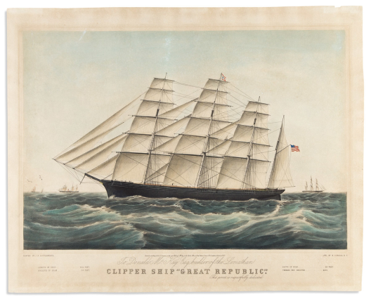

Currier, nathaniel; after j. f.[sic] butterworth [sic].
Clipper Ship “Great Republic”.

New York, 1853
Large folio hand-colored multi-stone lithograph after a painting by James E. Buttersworth celebrating the ship’s launch in 1853. 20½x25¾ inches sheet size; registration pinholes; competently conserved.
Estimate
$700 – $1,000


Currier, nathaniel; after fanny palmer.
American Winter Scenes. Evening.

New York, 1854
Large folio hand-colored multi-stone lithograph of guests arriving by horse-drawn sleighs to a social ball at the grand country hotel. 18¾x25 inches sheet size, ample margins; touches of gum arabic; registration pinholes; general age toning but still nice with an antique feel. New Best 50, Large Folio, No. 19.
Estimate
$1,500 – $2,500


Currier & ives; after arthur fitzwilliam tait.
American Speckled Brook Trout.

New York, 1864
Large folio chromolithograph of a fine catch and angling gear with touches of hand-color and gum arabic. 20x24 inches sheet size; mat stain, several repairs.
Estimate
$300 – $400


Currier & ives; after [f.f. palmer], but j.e. buttersworth.
Cutter Yacht “Maria” Modelled by R.L. Stevens Esq. Owned by the Messrs Stevens of New York.

New York, 1852
Large folio hand-colored multi-stone lithograph after a painting by James E. Buttersworth depicting the Cup yachts Maria and America racing in a heat. 21½x26 inches sheet size; light dampstain at lower edge, small repairs at upper corners, a bit faded.
Estimate
$800 – $1,200


Currier & ives; after george inness.
View on the Delaware. “Water Gap” in the Distance.

New York, 1860
Large folio hand-colored lithograph of bucolic farmland and a steaming locomotive along the Delaware River. 17½x24 inches sheet size, ample margins; fine original color with touches of gum arabic; moderately toned and foxed. Modeled on the Inness oil painting in the Montclair Art Museum collection.
Estimate
$700 – $1,000


Currier & ives.
Noah’s Ark.

New York, circa 1875
Small folio hand-colored lithograph of animals herded two by two onto the Biblical ark. 13½x17½ inches sheet size, wide margins; neatly repaired tear at image right.
Estimate
$250 – $350


Currier & ives.
Grand National Democratic Banner. Peace! Union! and Victory!

New York, 1864
Hand-colored lithographed campaign jugate promoting 1864 Democratic candidate George B. McClellan and his running-mate George H. Pendleton, adorned with vignettes of liberty, patriotism, booming industry and agriculture. 14x9¼ inches sheet size, narrow margins; archivally lined on verso stabilizing several repaired tears.
Estimate
$400 – $600


(fashion.) georges lepape.
[Suite of 12 pochoir plates finished by hand].

[Paris, 1921]
Without printed captions or plate numbers: (Proof?) set of the 12 plates illustrating Modes et Manières d’Aujourd’hui 1914-1919. 11x7¼ inches each sheet size; generally nice.
Estimate
$600 – $900


(fashion.) gazette du bon ton.
6 double-page pochoir plates from the magazine.

Paris, early 20th century
Images by Barbier, Lepape, Marty (2), and Brissaud (2). Each plate attractively presented in a custom double-mat.
Estimate
$250 – $350


(fashion.)
Large cluster of disbound illustrated French periodical text and approximately 75 pochoir plates,

Paris, early 20th century
mostly from Gazette du Bon Ton and Journal des Dames et des Modes.
Estimate
$300 – $500


(games.) mcloughlin brothers.
Chiromagica.

New York, 1870s
Enchanted trivia game comprised of interchangeable chromolithographed panels and dials magnetically interacting with a manicule spinner within a glass-paned slide-top wooden box. 11¾x11¾x2 inches overall; mounted directions card partly defective, hand-pointer detached from mount but able to be maneuvered into working position with a slight jostle.
Estimate
$100 – $150


(good behavior.)
Group of 20 mid-nineteenth-century American schoolchildren’s “Reward of Merit” certificate cards.

Boston, Providence, and other New England locations, circa 1840s
Engraved or otherwise-printed designs inscribed in ink from teacher to student (a few blank, several with hand-coloring). Various sizes, 3¼x5¼ inches or smaller; scattered stains and wear.
Estimate
$150 – $200


(hagiography.) franz kellerhoven.
Group of 50 fine chromolithographed plates of saints.

Paris, circa 1866
8vo format loose in modern binder, approximately 10¾x7½ inches each sheet size; many with gold printing; general age tone, one plate trimmed and damaged, other smaller margin flaws but images nice.
Estimate
$200 – $250


Hogarth, william.
Beer Street. [and] Gin Lane.

London, 1751
Together, two etched and engraved plates satirically contrasting the situation of consumers of the two alcohols. Heavy laid paper, 24x19½ inches each sheet size, wide margins with deckle edges at left, right, and bottom; faint mat tone. Paulson 185 and 186, third states.
Estimate
$1,000 – $1,500


(hudson river portfolio.) john hill; after william guy wall.
Group of 5 hand-colored aquatint and engraved plates.

New York: Henry I. Megarey, 1821-1825
Folio sheets; various stains and repairs.
- Rapids Above Hadleys Falls. No. 4.
- View Near Sandy Hill. No. 7.
- View Near Fort Miller. No. 9.
- Troy From Mount Ida. No. 11.
- View Near Fort Montgomery. No. 22 (first state, later changed to No. 18), and also the nicest condition of the present group.
Estimate
$800 – $1,200


(hudson river portfolio.) john hill; after william guy wall.
View from Fishkill Looking to West Point. No. 15.

New York: Henry I. Megarey, 1825
Large hand-colored aquatint of a magnificent early scene in the Hudson Highlands on heavy wove paper. 19¼x26 inches sheet size, wide margins; old mat line, else excellent. First state.
Estimate
$1,000 – $1,500


(japan – storytelling.)
Two sets of illustrated kamishibai street theater plates.

Japan, Showa 17 (1942)
Nankai No Sakimori. 20 offset color-printed cards in original portfolio case with printed title label. 10¼x14½ inches; minor foxing and edge wear but generally fine. A propaganda story for children telling of foreign invasion and retribution set in the Edo Period.
Tamashi No Senshi. 20 offset color-printed cards in original paper envelope. 10x14 inches; excellent, with bright colors. "Spirit of the Soldier" is focused on a veteran combatant navigating life and facing tests of his moral strength; he visits the Yasukuni Shrine and emphasizes the importance of honoring fallen soldiers.
Estimate
$400 – $600


(liberty.)
Piercing gaze of an emblematic woman adorned with a Phrygian cap and a federal eagle breastplate.

Np, probably late 19th century
Graphite on card, unsigned but skillfully drawn. 10½x7 inches overall.
Estimate
$150 – $200


(LONDON.) F[rancis] West.
A General View of the City of London, Next to the River Thames.

London, circa 1840
Hand-colored etched and engraved panorama of London, a nineteenth-century re-strike of the circa 1750s John Bowles plate. 12¼x18 inches, wide margins; faint mat stain, minor edge wear.
Estimate
$150 – $200


(marine.)
Group of 20 watercolor sketches and several albumen photographs.

Np, 1890s
7x10 inches or smaller, mounted to album cards, many captioned. with: A 1902 signed letter from W.L. Wyllie to William Smith Nicholson.
Estimate
$300 – $500


(marine.)
Navio de Tercera Linea a la Vela.

Np, mid-eighteenth century
Hand-colored engraved portrait of a Spanish galleon keyed to a legend identifying rigging components and other aspects of the ship. 15½x20 inches sheet size, narrow margins; minor wear and surface soiling.
Estimate
$200 – $250


(marine.) joao de souza.
Caderno de Todos os Barcos do Tejo, Tanto de Carga e Transporte Como d’Pesca.

Lisbon, 1785
Engraved title-page and 20 miniature engraved portraits of various cargo, transport, and fishing vessels found on the Tagus River in the eighteenth century. Laid paper, mostly 5¾x7½ inches each sheet size, a few trimmed shorter, several sheets watermarked “Serra”; archivally mounted to non-acidic card, various foxing and dampstain; ink ownership inscription to upper title margin: “William C. Leffingwell. February 1811. Bot in Lisbon”.
Charming suite of diminutive engravings of Portuguese river ships. Each plate is titled in Portuguese and further captioned in French (several with additional English captions added in early ink). OCLC cites 5 complete sets; the last record of public offering was Maggs, 1928, termed “very scarce”.
Together with a clipped note of early provenance: “May 1915: These little copper plate(?) engravings which I picked up at Goodspeed’s for a quarter, I thought worthy of good dress. (I would have given a quarter apiece for them!) - Charles Nelson Robinson.”
Estimate
$2,500 – $3,500


(military.) william h. huddy & peter s. duval.
Group of 20 lithographed plates from the U.S. Military Magazine.

Philadelphia, 1839-1842
Approximately 10x12½ inches each sheet size; strong original hand-coloring; scattered small stains and light offset, a few with mat burn and minor edge chipping but overall a nice-looking group. with:</i> Lithographed title-page and index leaf to Vol. 3, 6 original printed paper parts wrappers, and 37 leaves of text from Vol. 3, comprising pages 9-40, 49-72, 81-88, 91-100 (including descriptions to many of the present plates).
“The prints in this series, all of which were executed on the Duval press in Philadelphia, are in a class by themselves. Nothing of the sort has ever been produced in this country to approach them in their extraordinary combination of beauty and accuracy… Though scattered prints from this series exist in numerous public and private collections, complete sets are rare… Certainly it is possible that the assiduous collector could in time assemble a complete series of these prints.” (Frederick P. Todd, An Adventure in Military Lithography, The Magazine Antiques, November 1940, pages 212-214.
A decent selection here includes:
- Genl. David R. Porter, Governor of Pennsylvania.
- Major Fredk. Hambright.
- Capt. Wm. Z. Matheys. First Troop Montgomery County.
- Camp Kosciusko. Reading, Pa. May 19th, 1842.
- Reading Artillerists, of Reading, Pa.
- Military Execution. Frederick recognizes that it is his Brother Charles, whom he is drafted out to shoot for desertion.
- Camp Lafayette at York Pa. August 1841.
- York Penna. Rifle Corps.
- Macon Volunteers, of Macon, Geo.
- Jackson Rifle Corps, Lancaster Pa. Capt. F. Hambright.
- First State Troop, Philada. Co. Cavalry.
- Capt. Holman. Chester County Troop, Penna.
- H.S. Moorhead & Corps. “Lehigh Artillerists” of Allentown, Pa.
- First Baltimore Invincibles.
- The National Guard.
- Dauphin Guards Harrisburg, Pa.
- 1st Company of Montgomery Guards 51st Regt. N.Y. State Infantry.
- The National Greys.
- Albany Burgesses Corps.
- Camp Wayne. Pennsylvania Volunteer Encampment on the Paoli Battle Ground Sept. 19th, 20th, 21st, 22nd, 1840. (uncolored, with letterpress text below).
Estimate
$2,500 – $3,500


(museums.)
Two etched and engraved scenes of packed salon galleries.

Vp, late eighteenth century
Pietro Antonio Martini. Lauda-Conatum Exposition au Salon du Louvre en 1787. Etching on laid paper, 16x21¼ inches sheet size, dampstain at lower right, Russian ink stamp to verso.
Pierre Antoine Martini; after Johann Heinrich Ramberg. [Portraits of their Majesty's and the Royal Family Viewing the Exhibition of the Royal Academy, 1788.] Etching on laid paper, 13¼x19¾ inches sheet size, lower margin trimmed excising title, Russian ink stamp to verso.
Estimate
$150 – $200


(native americans.) george catlin.
Catching the Wild Horse. No. 4.

London, [1844]
Hand-colored tinted lithograph from Catlin’s North American Indian Portfolio. 16¾x27½ inches sheet size, wide margins; mounted to non-acidic board, light marginal foxing, presents well.
Estimate
$250 – $350

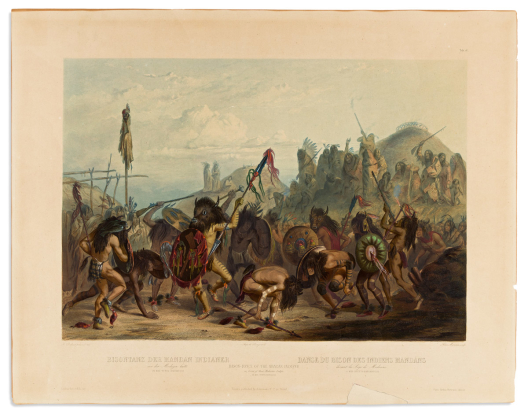

(native americans.) karl bodmer.
Bison-Dance of the Mandan Indians in Front of Their Medicine Lodge.

Paris, Coblenz and London, [1841]
Hand-colored aquatint and engraved plate from Prince Maximilian zu Wied-Neuwied's Travels in the Interior of North America. 16¾x21½ inches sheet size; Bodmer blind stamp at central imprint; fine hand-color with crackled gum arabic; general toning, several cracks and creases reinforced on verso, small area of lower margin with paper loss casually reinstated. Sold as is.
Estimate
$500 – $750


(native americans.)
Group of 26 mostly hand-colored engraved or lithographed book plates.

Vp, vd
Folio sheets and smaller, most mounted to non-acidic card, scattered foxing and mat stains. Images after artists including: George Catlin, Seth Eastman, Karl Bodmer, Theodor de Bry, Heinrich Balduin Möllhausen, and John Mix Stanley (U.S. Railroad Survey).
Estimate
$300 – $400


(new york city.) william james bennett; after john william hill.
New York from Brooklyn Heights.

New York: L.P. Clover, 1837 [but after]
Large hand-colored aquatint and engraved view of lower Manhattan across the East River. Printed on India paper and mounted to heavy stock, 24¼x35 inches sheet size, wide margins; conserved but showing a light mat tone.
“This stunning aquatint was conceived through the combined efforts of two of the most talented participants in nineteenth-century American printmaking circles: the young John William Hill (he was twenty-four years old at the time) and the master aquatint engraver William James Bennett. While maintaining undisputed harmony in the wide pictorial world he has constructed, Hill presents five different topographic spheres: a scene in Brooklyn, nautical activity on the East River, the dense settlement of Manhattan, the Hudson River, and the far-off shores of New Jersey. This he has done innovatively, without reference to the conventional devices of a foreground landscape, coulisse trees, or other border elements traditionally used in achieving a compact, pleasing design. …The copperplate that resulted from the collaboration of Hill and Bennett is still in existence. It was found at the turn of the twentieth century in the old establishment of Currier and Ives, where it had long served as a floor plate under a stove. As the sky was badly damaged, it was burnished out of the plate” – Deak, Picturing America, 463.
Estimate
$1,500 – $2,000


(new york city.) matthew dripps; after c. b. de st. memin.
A View of the City of New York from Brooklyn Heights in 1798.

New York, circa 1860
Engraved panorama of lower Manhattan on bond paper. 4½x59 inches overall, folding into publisher’s 12mo format half morocco case with the Seal of the City of New York stamped in gilt to upper cover; minor wear; bookplates of Benjamin DeForest Curtiss and Watertown Library to front pastedown (Curtiss sale, Swann 17 November 1977, lot 413, $200).
The St. Memin panorama, traditionally found in D.T. Valentine’s Manual for 1861 (and with that imprint), but here separately issued by Dripps and in a fabulous thematic publisher’s binding. “This panoramic view, on account of its size, and because of the accuracy of the drawing, gives the best depiction which we have of the East River front of New York at the close of the eighteenth century. It is also one of the few early views to give the names of the important buildings” - Stokes, Iconography III. 541, pl. 80a.
Estimate
$250 – $300

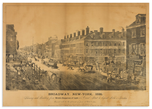

(new york city.) after thomas hornor.
Broadway, New-York, 1836, Shewing Each Building from Webb’s Emporium of Light Cor. Canal Street to Beyond Niblo’s Garden.

Np, circa 1900
Large photolithograph of the aquatint by John Hill. 20½x29½ inches sheet size; mounted to acidic board with resultant toning, other scattered stains and repairs; period wooden frame. Sold as is.
Estimate
$100 – $150


(new york city.) e.l. kling.
New York.

Tuttlingen, circa 1840
Tinted lithographed birds-eye view of New York City. 12¾x16¾ inches sheet size, wide margins; mat line, small closure at left edge.
Scarce German lithograph of Manhattan; not in Stokes, not in Eno. Reps 2632.
Estimate
$500 – $750


(new york city.) heine, kummer, and döpler; engraved by himely.
New-York.

New York, Paris, London, Berlin: Goupil & Co., 1851
Large aquatint bird’s eye view of Manhattan and vicinity on heavy stock. 30½x42 inches sheet size, wide margins; cleaned and de-acidified, several closed tears slightly affecting image but still very attractive and presentable. Reps 2659.
Estimate
$2,500 – $3,500


(new york city.) jacob ruppert.
Panoramic View of New York City and Vicinity.

New York, 1912
Chromolithographed birds-eye view of New York Bay, the five City boroughs, and eastern New Jersey with an advertisement banner for “Jacob Ruppert’s Knickerbocker Beer”. 21x28½ inches sheet size; mounted to original linen backing and ebonized wooden dowels; two water stains at upper right and other minor edge wear but overall unexpectedly well-preserved.
Estimate
$700 – $1,000


(new york city.) hughson hawley; attributed to.
[Trinity and United States Realty Buildings].

New York, circa 1907
Graphite, ink, and watercolor on paper. 53½x42 inches sight size; archivally attached to acid-free board with silk-covered duplex matting; stains and restorations; attractive gilt frame.
A dominant rendering of the magnificent Gothic-inspired Financial District skyscrapers designed by New York City architect Francis H. Kimball.
A signature cannot be located but the inimitable style and detailed focus of Hughson Hawley is seen in every block of curtain wall limestone and ornamental finial. Trinity Church and the Empire Building (also designed by Kimball) can be seen to the left of the Broadway façade; a wide-open plaza is to the right where Zuccotti Park currently exists; and an elevated train runs behind the buildings.
We have been able to trace several instances of the image reproduced in the early 20th century, though nothing close to the grand scale of this original watercolor. Its likeness is pictured and captioned in the January 26, 1907 Real Estate Record and Builders’ Guide on page 156; on several contemporary postcards or advertisement-type ephemera; and the Museum of the City of New York holds a photographic dry plate negative of the watercolor, credited to the Wurts Brothers.
In the lower margin there is some writing, “For Mr. Kimball…”, a line which appears to be something along the lines of original framing specifications rather than a gift inscription. Certainly Mr. Kimball would have wished to proudly display such an authentic and imposing illustration of one of his greatest architectural achievements.
Estimate
$5,000 – $7,500


(new york city.) minoru yamasaki associates.
World Trade Center Towers 1 and 2.

[New York, 1965]
Large blue-line diazo print of the Twin Towers’ elevation, structural cross-sections, and an overhead site plan of the plaza. Medium-grade bond paper, 24x36 inches sheet size; no tears.
Estimate
$300 – $400


(niagara falls.) hippolyte sebron, after.
Les Chutes Du Niagara / Niagara Falls.

Paris and New York, 1852
Large aquatint and engraved panorama with the Maid of the Mist steaming into the bowl and foreground figures dangerously close to the precipice. 25¾x39 inches sheet size; mounted to non-acidic card stabilizing several tears into the image, lower margin trimmed excising sub-title [La Fer a Cheval/The Horse Shoe] and imprint.
Estimate
$300 – $400

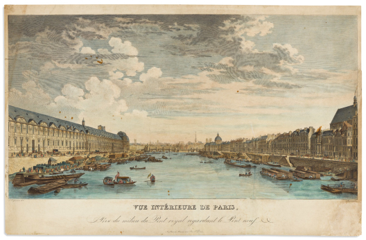

(paris.) louis nicolas de lespinasse, after.
Vue Interieure de Paris, Prise du Milieu du Pont Royal Regardant le Pont Neuf.

Paris: J.L.Bance ainé, circa 1840
Large hand-colored engraved view of the Seine River with the Pont Neuf in the distance and the Musée du Louvre at left. 16¼x25¼ inches sheet size, narrow margins; stains and repairs.
One of a series of views published by Lespinasse and Pierre Gabriel Berthault in the 1780s; here a restrike of the plate from the early nineteenth-century with the lower title register modified.
Estimate
$200 – $250


(PARIS – NOTRE DAME.) Jacques Rigaud.
[Autre vüe Particulière de Paris, Depuis Nôtre Dame, Jusques au Pont de la Tournelle où l’on Voit, dans l’Eloignement l’hôtel de Ville, St. Jean en Greve, St. Gervais, Et le Pont Rouge, Prise du Quay de Miramion].

Paris, eighteenth century
Vue d'optique engraving of Paris from a south-westerly vantage toward the Pont de la Tournelle and Notre Dame cathedral. Heavy laid stock, 12½x21¼ inches sheet size; original hand-color; margins (including title) painted black for zograscope operation, title in contemporary ink on verso.
Estimate
$200 – $250


(PARIS – NOTRE DAME.) J.F. Daumont; after Jacques Rigaud.
Vue de Paris Depuis Notre Dame Jusqu’au Pt. de la Tournelle Prise du Quay de Miramion, ou l’on Voit dans l’Eloignement l’Hotel de Ville l’Eglise St. Jean en Greve, Celle de St. Gervais et le Pont Rouge.

Paris, late eighteenth century
Vue d'optique engraving of Paris looking toward the Pont de la Tournelle and Notre Dame cathedral. Laid paper, 11¼x16½ inches sheet size; original hand-color; mounted to a later sheet stabilizing creases and a large tear at center left.
Estimate
$200 – $250


(post riders.) charles b. newhouse; and charles hunt (engr).
The Express Extraordinary.

London: G.S. Treger, 1839
Set of 6 finely hand-colored aquatint plates. Approximately 14¼x18½ inches each sheet size; mat stain, foxing, and small margin repairs but with brilliant original hand-coloring.
“I remember, one night in the winter of ninety nine, what a run I had for the Honor of Old England”.
A stirring illustrated narrative by a determined dispatch boy who overcomes weather, obstacle, and inconvenience to complete an overnight express run of his consequential messages to the Colonel at a far-off King’s Arms before day breaks.
Anderson catalog, 1922: “Exceedingly Rare. One of the most unusual and beautiful series of color prints.”
Estimate
$400 – $600


(postcards.)
Collection of approximately 1,000 postcards and embossed greeting cards.

Vp, early 20th century
Loose in albums, mix of used and unused, printed and real-photo; American and European subjects, but with a strong number relating to New York City and state; good portion addressed to Katherine (Kitty) Coyne, Englewood, NJ and/or her circle.
Estimate
$300 – $500


(prodigal son.) georg balthasar probst.
Group of 4 hand-colored engraved vue d’optique parable plates.

Augsburg and Bassano, circa 1780
Folio sheets, 13½x19½ inches or smaller; original hand-color; various trimming, folds, stains and edge wear; mixed editions.
Filius Deperditus Subulcus
Filius Deperditus Cum Patre Bona Dividens
Vale Filii Deperditi
Gaudium Patris Proper Filium Inventum.
Estimate
$150 – $200


(real estate.)
Buy Homes of J.W. Wilbur Co.

Hartford, CT: Calhoun Print, circa 1900
Large graphically appealing color-printed linocut(?) broadside advertising building plots available on the periphery of an expanding New England town. 29x42¼ inches sheet size, wide margins; one small closure within image and minor edge stains but overall excellent.
Estimate
$300 – $400


Redouté, pierre-joseph.
Lilas (Lilac).

Paris, 1827-1833
Hand-finished color-printed stipple engraving from Redouté’s Choix des Plus Belles Fleurs. 13x9½ inches sheet size with binding edge at left; fine.
Estimate
$300 – $400


Redouté, pierre-joseph.
Hemerocallis Fulva / Hemerocalle Fauve. Plate 16. [Orange Day Lily].

Paris, 1802-1816
Hand-finished color-printed stipple engraving from Redouté’s Liliacées. 21x14 inches sheet size with binding edge at right; modest age toning, small repair at upper margin; with separate leaf of letterpress text.
Estimate
$1,000 – $1,500


Redouté, pierre-joseph.
Iris Pseudacorus / Iris Faux-Acore. Plate 235. [Yellow Flag Iris].

Paris, 1802-1816
Hand-finished color-printed stipple engraving from Redouté’s Liliacées. 21x14 inches sheet size; light foxing at upper and lower sheet edges; with separate leaf of letterpress text.
Estimate
$700 – $1,000


Redouté, pierre-joseph.
Lilium Superbum / Lis Superbe. Plate 103. [Proud Lily].

Paris, 1802-1816
Hand-finished color-printed stipple engraving from Redouté’s Liliacées. 21¼x14¼ inches sheet size; overall very fine.
Estimate
$1,000 – $1,500


Redoute, pierre joseph.
Rosa Muscosa [and] Rosa Reclinata Flore Submultiplici.

Paris, 1817-24
Together two plates from Les Roses. Color-printed stipple-engravings finished by hand. 14¼x10¾ inches each sheet size with binding edge at left; minor toning but generally nice with unfaded colors; each with a duplicate uncolored plate on sepia paper and descriptive letterpress text leaves.
Estimate
$500 – $750


Roberts, david.
Group of 17 mostly hand-colored tinted lithographed plates from: The Holy Land… [and], Egypt and Nubia… [and], Picturesque Sketches in Spain.

London, 1830s-40s
Mix of folio plates and trimmed text leaves; a nice selection with occasional stains and small closed tears.
- Cairo From the Gate of Citzenib, Looking Towards the Desert of Suez.
- The Ravine.
- Ascent of the Lower Range of Sinai.
- General View of Esouan and the Island of Elephantine.
- Askalon (mounted to deluxe gilt-ruled card).
- Cordova (removed from card mount)
- Ascent to the Summit of Sinai.
- Gate of Victory and Minaret of the Mosque of El Hakim.
- Convent of Saint Catherine, Mount Sinai.
- The Gate of the Metwalis, or Bab Zuweyleh, Cairo.
- Rock of Moses, Wady-El-Leja, Mount Horeb.
- One of the Tombs of the Khalifs, Cairo.
- Tomb of St. James, Valley of Jehosephat.
- Excavated Mansions of Petra.
- Triumphal Arch Crossing the Ravine Leading to Petra.
- Entrance to the Chapel of Ferdinand & Isabella (Title-page to “Picturesque Sketches in Spain” but without lettering to the double-door). Mounted to original card.
- Duplicate of above, same treatment without title, and mounted.
Estimate
$1,000 – $1,500


(russia.)
Together two fine tinted lithographed album plates by Lemercier.

Moscow and St. Petersburg: Daziaro, circa 1850
Captioned in Russian and French; 15x19 inches each sheet size, wide margins; light foxing.
-
Environs de Moscou. No. 6. Vue du Couvent de Froitzko-Serguiewsk.
-
Moscou. No. 7. Vue du Kremlin, after Dmitry Indiessof.
Estimate
$400 – $600


(russia – imperial residence.)
Lustschloss des Kaisers von Russland Ohnweit Petersburg.

Np, circa 1825
Ink and watercolor drawing of an Imperial Russian pleasure palace on “JWhatman/1825” watermarked wove paper; undeciphered signature at lower right; 14½x18½ inches sheet size; small edge tears and creases, Russian ink stamp to verso.
Estimate
$300 – $400

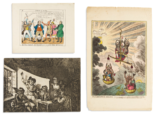

(satire.) james gillray, and others.
Group of 5 mostly hand-colored printed social and political satires.

London, vd
- James Gillray. The Cabinetical-Balance. Etching on "J Ruse/1803" watermarked wove paper. 18¼x11½ inches sheet size, wide margins; fine original hand-color; minor toning and short edge tears to the margins. London: H. Humphrey, 1806. BM Satires 10530.
- Charles Williams. The Last Stage of Cruelty, or, a Mercifull Example of Quaerism. Hand-colored etching on watermarked laid paper. 13¾x9½ inches sheet size, trimmed to the plate; generally fine. London: S.W. Fores, 1806. BM Satires 10637.
- Samuel de Wilde. [Frontispiece to The Satirist, Vol. I.] Hand-colored etching on wove paper. 6¾x13½ inches sheet size, trimmed to the plate; original folds, offset of the title-page at upper right. London: Tipper, 1807. BM Satires 10764.
- "William Tell." More Power to Paddy__or John Bull Bothered. Plate 9 from the series Hints & Hits. Hand-colored lithograph on wove paper. 8¾x11 inches sheet size, wide margins; minor wear. London: James McCormick, 1844.
- [Unidentified etching of British sailors drinking in a tavern.] Heavy laid paper, 9½x13½ inches sheet size, trimmed to the plate. Mid-to-late 18th century.
Estimate
$700 – $1,000


(satire.) valentine green; after william mason.
Scene in a Country Town at the Time of a Race.

London: F. Brydon, 1789
Large etched and aquatint plate of mid-street horse and carriage chaos. 19½x24½ inches sheet size, ample margins; grey wash by hand; marginal repairs, light age toning. BM Satires 8243.
Estimate
$300 – $400


(satire.) william austin.
Nature Display’d Both Serious and Comic in 12 Designs Dedicated to S. Foot Esqr.

London, 1773
11 (of 12) etched satirical plates on laid paper; sheets trimmed to various sizes, many to or within the platemark; a few with unprinted title words written in ink, remnants of mounting tabs on verso.
[1]. A Macaroni Ass Match Between the Cubs NB St_e Gamblers.
2. A Peep in the Garden at Hayes.
3. The Voluptuos. Luxurious. Spendthrift. Macaroni. From Holland. In. A. Breathing. Sweat.
4. Major G....n & Lady Landing at Southampton in Cripples Walk.
5. [Long] T[homas] & Madle G_d Going to the Pantheon in their Natural Masks.
6. [Hans Turbot] Quarelling with a Fishwoman at Southampton in Presence of Count Cork Skrew.
7. **** Returng from Reading Market in a Full Breese.
[8]. The Anatomist Overtaken by the Watch__Carrying Off Miss W- In a Hamper.
10. The Lucky Mistake or the Buck & Blood Flourishing Macaroni___Playing a Solo on the Jelly Glasses.
11. The Merits and Defects of the Dead by Their Ingenious Secretary.
12. A Flaw in the Ice or Stephens Dream of the Macaroni Bucks & Does Turn'd Topsy Turvy.
BM Satires 5112-5119; 5121-5123.
Estimate
$300 – $400


(satire – fashion.)
Inconvenience of Wearing Coffee Bag Skirts.

[New York: James S. Baillie, 1848]
Hand-colored lithograph of a trend-thrifty young woman stepping off a trolley car, her overskirt caught on the train door handle revealing her upcycled bustle. 15¾x12 inches sheet size; light mat stain, minor edge chipping. Provenance: Americana Collection of Donaldson, Lufkin & Jenrette, New York City.
Library of Congress and Huntington Library examples showing Baillie’s imprint below the title, here without.
Estimate
$250 – $300


(satire/costume.) charles williams, and others.
Group of 6 preparatory sketches.

[London, late eighteenth to early nineteenth centuries]
An Officer and Private of Russian Grenadiers. [and] Russian Chaplin in his Travelling Dress and a Kalmuck Tartar. Ink and graphite recto/verso on "JWhatman/1794 watermarked laid paper; 11x16 inches sheet size, creases and small tears; engravings were published by S.W. Fores, 1799.
Charles Williams. The Farmers Toast. Graphite and ink on "W Elgar" watermarked wove paper; 11¼x17 inches sheet size, creases, chips and stains; engraving published by S.W. Fores,1801. Verso with an unidentified drawing in the style of George Woodward.
Graphite drawing of two lords on unwatermarked wove paper, 14x10 inches sheet size, staining and creases.
The Jesuitical Showman. Graphite, ink and wash on Strasbourg Lily watermarked laid paper, 18x12 inches sheet size, staining and edge chips. "If to see my Show - you're willing. Give to me an English shilling. Quickly come, or I shall go. Doodle Doodle Doo. There you see the Queen of France. With the King she leads the dance. Guards behind, and Lords before. Pull out your Cash - or ill shew no more. Doodle Doodle Doo".
Estimate
$1,500 – $2,500


(sharks.) marcus elieser bloch.
Squalus Carcharias / The White Shark.

Berlin, circa 1790
Hand-colored engraved plate of the Great White Shark with diagrams of the tooth, mid-section, and jaws from Bloch’s Ichthyologie. “C&I Honig” watermarked laid paper, 10¾x18¼ inches sheet size, wide margins; minor edge stain but overall excellent.
Estimate
$250 – $350


(spoonbill.) cornelius nozeman; and christiaan sepp.
Platalea, Leucorodia.

Amsterdam, circa 1780
Hand-colored engraved plate of the Spoonbill with an overhead study of its unusual head and beak structure from Nederlandsche Vogelen. “D&C Blauw” watermarked laid paper, 20½x14¼ inches sheet size, binding edge at left; desirable condition.
Estimate
$200 – $250


(versailles.) jean mariette.
Le Derriere de l’Entree de Versailles.

Paris, circa 1680
Hand-colored engraved view of the rear courtyard of Louis XIV’s palace with a 17-point keyed legend. Laid paper, 10½x14 inches sheet size, wide margins; slightly toned.
Estimate
$200 – $250


(volcanoes.) william hamilton; and pietro fabris.
[A View of the Great Eruption of Vesuvius in the Night of the 20th of October 1767].

Naples, 1776
Engraved plate VI from Hamilton’s “Campi Phlegraei” on watermarked laid paper with rich, dramatic original hand-coloring. 12½x18 inches sheet size, wide margins; small closures at right edge otherwise a nice example of a scarce print.
Estimate
$500 – $750


(vues d’optique.)
Group of 11 hand-colored engraved European vues.

Paris and London, late eighteenth century
13x18 inches or smaller; various small imperfections.
-
The Church of St. Mary le Bow in Cheapside London.
-
Vue du Chateau de Belle Vue.
-
A View of the Royal Palace of his Catholick Majesty the King of Spain, Madrid.
-
A View of Panfilius’s Palace, St. Agnus’s Church & St. James’s Church of Spain in the Place of Navona at Rome. (Bowles & Sayer).
-
Vue Perspective de Revue de la Maison du Roy Cavalerie qui se fait tous les 3 ans au Trou d’Enfer a 4 Lieux de Paris.
-
3.e Nouvelle vue d’Optique representant les Jardins et le Palais du G.d Ecuyer de la Reine d’Hongrie dans le Fauxbourg St Joseph a Vienne.
-
Le Debarquement des Francois, pour l’etablissement de la Nouvelle colonie, dans le port de la nouvelle Cayenne ou la France Equinoxialle.
-
Vue Perspective de la Salle des Festins de Versailles en Rejouissance de la Paix en 1763.
-
105.e Vue perspective de l’interieur de la Superbe Eglise de St. Jean de Latran a Rome.
-
Vue de l’Hotel de Ville de Mareille du Cote du Port.
-
Vue du Palais Royale de Portiey a six milles de Naples vis a vis le Mt. Vesuze. Il est batie sur les ruines de la fameu. Ville d’Herculaine decou depuis peu.
Estimate
$250 – $350


(winslow homer.)
Archive of approximately 300 nineteenth-century periodical leaves with illustrations after Winslow Homer.

Vp, vd
Primarily wood engravings on newsprint excised from various publications including Appleton's Journal of Literature, Science, and Art; Scribner's Monthly; Every Saturday: An Illustrated Journal of Choice Reading; Harper's Weekly; Ballou's Pictorial; etc.; some duplicates; overall good but often clipped, with edge chips, stains or other scattered degradations; museum deaccession with each leaf individually kept in an archival sleeve.