

Maps & Atlases, Natural History & Color Plate Books
Officers

Caleb Kiffer
Specialist
caleb@swanngalleries.com
(212) 254-4710 ext. 17

David Rivera
Administrator
drivera@swanngalleries.com
(212) 254-4710 ext. 13
George S. Lowry
Chairman
Nicholas D. Lowry
President, Principal Auctioneer
924899
Andrew M. Ansorge
Vice President & Controller
Alexandra Mann-Nelson
Chief Marketing Officer
2030704
Todd Weyman
Vice President & Director, Prints & Drawings
1214107
Nigel Freeman
Vice President & Director, African American Art
Rick Stattler
Vice President & Director, Books & Manuscripts
Administration
Andrew M. Ansorge
Vice President & Controller
aansorge@swanngalleries.com
Ariel Kim
Client Accounting
akim@swanngalleries.com
Diana Gibaldi
Operations Manager
diana@swanngalleries.com
Kelsie Jankowski
Communications Manager
kjankowski@swanngalleries.com
Maps


(adriatic sea.) laurent fries; after martin waldseemuller.
Europae Tabula Quinta Continet Rhetiam & Vindeliciam, Noricum… Dalmatiam.

Vienna, 1541
Double-page woodcut Ptolemaic map of Italy and Dalmatia. 15¾x21 inches sheet size, wide margins, Latin text on verso; light stain and edge soiling.
Estimate
$200 – $250


(africa.) abraham ortelius.
Two double-page engraved maps of northern Africa in original hand-color.

Antwerp, 1603
-
Fessae, et Marocchi Regna Africae Celeberr. (Canary Islands, Morocco, Straits of Gibraltar). 16¾x21 inches sheet size, ample margins, Latin text on verso; original hand-color in full; overall nice with minor signs of age. Van den Broecke 177 1603L118.
-
Africae Propriae Tabula. (Algeria, Tunisia, Libya, with an inset of ancient Carthage). 16¾x21 inches sheet size, wide margins, Latin text on verso; original hand-color in full; small stain at lower margin. Van den Broecke 218 1603Lxxxij.
Estimate
$500 – $750


(africa.)
Two hand-colored double-page engraved eighteenth-century maps of the continent.

Nuremberg, 1715-1730s
-
Homann Heirs. Africa Secundum Legitimas Projectionis Stereographicae. 20¾x24¼ inches sheet size, wide margins; repairs at center fold and lower right corner.
-
Johann Baptist Homann. Totius Africae Nova Repraesentatio. 20½x23¼ inches sheet size, ample margins; small losses at center, stains, short repairs.
Estimate
$250 – $300


(alaska.)
Group of 12 eighteenth and nineteenth century engraved maps.

Vp, vd
-
Captain Cook/Henry Roberts. Chart of the NW Coast of America and NE coast of Asia Explored in the Years 1778 & 1779. 16½x27½ inches sheet size, ample margins (upper right reinstated where trimmed for binding); original folds flattened. London, 1784.
-
Captain Cook/Alexander Hogg. Chart of Norton Sound and of Bherings Strait Made by the East Cape of Asia and the West Point of America. 9x13½ inches sheet size, ample margins; minor stain. London, circa 1785.
-
Captain Cook/Alexander Hogg. A Chart of the North West Coast of America and North East Coast of Asia, Explored in the Years 1778 & 1779. 9¼x15 inches sheet size, ample margins; small edge repairs. London, circa 1785.
-
Captain Cook/Henry Roberts. Chart of Norton Sound and of Bherings Strait Made by the East Cape of Asia and the West Point of America. Wove paper, 11½x17 inches sheet size, wide margins; cleaned, original folds flattened. London, 1784 (or after).
-
La Perouse, after. Chart of the Northwest Coast of America. Explored by the Boussole and Astrolabe in 1786. 1st Sheet. 16½x21 inches sheet size, wide margins; center fold flattened. London: G.G. and J. Robinson, 1798.
-
La Perouse, after. Plan of Port des Francais on the North West Coast of America. (Lituya Bay). 16½x21½ inches sheet size, wide margins; center fold flattened. London: G.G. and J. Robinson, 1798.
-
La Perouse, after. Plan of the Entrance of the Port of Bucarelli on the North West Coast of America. 16½x21½ inches sheet size, wide margins; center fold flattened, minor nicks at lower edge. London: G.G. and J. Robinson, 1798.
-
Captain Cook/Alexander Hogg. Chart of Cooks River in the N.W. Part of America. (Anchorage). 9¼x14 inches sheet size, wide margins; small repair. London, circa 1785.
-
Captain Cook/Henry Roberts. Sketch of the Harbour of Samganooda on the Island Oonalaska. Wove paper, 10½x9 inches sheet size, wide margins. London, 1784 (or after).
-
Nathaniel Portlock. Plan of Graham’s Harbour and Coal Bay. 13½x18½ inches sheet size, wide margins; minor edge crinkle. London: John Stockdale, 1789.
-
John Thomson. Chart of the Northern Passage Between Asia & America. 21¼x27½ inches sheet size, wide margins; original hand-color in outline; foxing and offsetting. Edinburgh, 1816.
-
Otto Von Kotzebue, after. Chart of Behring’s Strait, Upon Mercators Projection. 8¼x9½ inches sheet size, wide margins; cleaned, original folds flattened. London: R. Phillips, 1821.
Estimate
$1,000 – $1,500


(american northwest.) la perouse; after.
Chart of the North West Coast of America

London: G.G. & J. Robinson, 1798
Explored by the Boussole & Astrolabe in 1786. 3rd Sheet. Double-page engraved chart of the California and Oregon coast including Monterey, San Francisco, Mendocino, and Trinidad. 16x20 inches sheet size, ample margins; center fold reinforced and discolored.
Estimate
$150 – $200


(american south.) abraham bradley.
[Sheet 3, from]: Map of the United States Exhibiting the Post-Roads,

Washington, D.C., 1804 (but circa 1812)
The Situations, Connexions & Distances of the Post-Offices Stage Roads, Counties, & Principal Rivers. Double-page engraved map of Louisiana and Mississippi Territory, Georgia, Florida, Tennessee, Kentucky and parts of North and South Carolina. Laid paper with a Strasbourg Lily/JGL watermark, 22x29½ inches sheet size, wide margins with untrimmed deckle edge; small separations at centerfold but overall handsomely preserved; "triplicate" ink stamp at lower margin.
Unused lower left section to a revised edition of Bradley’s significant 4-sheet wall map of the American Postal Roads. Without the context of the entire map the present sheet stands well on its own as a large, finely detailed presentation of the early Southern United States.
Estimate
$1,500 – $2,500


(american southeast.) herman moll.
Carolina.

London, circa 1740
Engraved map of colonial North America from St. Augustine to the Chesapeake Bay. 8½x12 inches sheet size, ample margins; minor closure at upper edge, else fine.
Estimate
$250 – $3,000


(american southeast.) pasquier jean valet; and pierre francois
Tardieu. Carte de la Caroline Meridionale et Septentrionale

Paris, 1806
Et de la Virginie. [and] Carte de la Floride et de la Georgie. Together two double-page engraved maps of southeastern American states from Mentelle and Chanlaire's Atlas Universel. 19¾x25¼ inches each sheet size, extra wide margins; original hand-color in outline; both fine.
Estimate
$400 – $600


(american west.) samuel augustus mitchell.
Oregon and Upper California.

Philadelphia, 1847
Engraved map of the vast regions of pre-territory Oregon and Upper California. 17x13¾ inches sheet size, wide margins with binding edge at left; original hand-color in full; minor age toning but overall excellent.
Estimate
$400 – $600


(americas.) christoph weigel.
Novi Orbis Sive Totius Americae cum Adiacentibus Insulis.

Nuremberg, circa 1725
Engraved map of the western hemisphere showing California as an island and a decorative figural title cartouche. 11¾x14½ inches sheet size, ample margins; original hand-color; small repair at lower center fold.
Estimate
$300 – $400


(americas.) herman moll.
A Map of America According to ye Newest and Most Exact Observations.

London, circa 1740
Engraved map of North and South America showing California as an island. 11½x7¾ inches sheet size, left margin narrow, others ample; minor wear at left edge.
Estimate
$200 – $250


(americas.) johannes de laet.
Americae Sive Indiae Occidentalis Tabula Generalis.

Leiden, circa 1630
Double-page engraved map of North and South America. 12¼x15½ inches sheet size, wide margins; hand-colored in outline; archivally lined on verso stabilizing small tears and margin loss at upper left. Burden 229.
Estimate
$400 – $600


(americas.) sebastian münster.
Die Neuwen Inseln. So Hinder Hispanien Gegeu Orient Bey Dem Land India Ligen.

Basel, 1550
Hand-colored double-page woodcut map of North and South America. 12x15 inches sheet size, wide margins; letterpress header in German on verso; several repairs and reinforcements, early ink inscription in German to verso. Burden 12, state 5.
Estimate
$800 – $1,200


(anatolia.) pierre mortier.
Natolia. Asia Minor Auctore Phi. de la Rue.

Amsterdam, circa 1700
Large folio engraved map of Turkey, Cyprus and coastal Syria. 20¼x24¾ inches sheet size, wide margins, blank verso; original hand-color; no center fold but previously bound plano at top edge, minor signs of age.
Estimate
$200 – $250


(arctic.) emanuel bowen.
A Correct Draught of the North Pole

London, circa 1744
And of All the Countries Hitherto Discovered, Intercepted Between the Pole and the Parallel of 50 Degrees. Engraved polar projection of the world. 16x20 inches sheet size, wide margins; original folds gently reinforced on verso.
Estimate
$200 – $250


(argentina.) pedro lopez; and c. carles.
Mapa de las Lineas Telegraficas de la Republica Argentina.

Buenos Aires: P.F. Van Damme, 1897
Large color-printed map exhibiting the proliferation of telegraph lines throughout Argentina in the late nineteenth century. 55x43½ inches overall, segmented and mounted to original linen backing; folding into 8vo format gilt cloth case; front cover and spine detached, map with minor toning.
Estimate
$200 – $250


(arkansas.) joseph hutchins colton.
Arkansas.

New York, 1859
Hand-colored lithographed pocket map. 13½x16¾ inches overall, folding into publisher’s 12mo format gilt and blind stamped cloth covers; minor browning.
Estimate
$300 – $400


Arrowsmith, aaron.
Chart of the Pacific Ocean.

London, 1798 [but circa 1800-1805]
Large engraved navigational chart of the coastlines of Russia, Japan, Korea, China, the Philippines, Indonesia, and Australia. 73¼x31½ inches overall, segmented and mounted to original linen backing with frayed silk selvage; original hand-color; “South Sea/West Part” vellum tab at lower edge; dampstains, separations along fold lines.
Western third of Arrowsmith’s monumental 9-sheet map of the Pacific Ocean, here in a middle edition with the publisher’s address at 24 Rathbone Place and without the portrait of Josef de Mendoza y Ríos to whom the chart is dedicated.
Greg Wood, Successive States: Aaron Arrowsmith’s Chart of the Pacific Ocean, 1798-1832, The Globe, Issue 70, 2012.
Estimate
$2,000 – $3,000


(asia.) jean janvier.
l’Asie Divisee en ses Princepaux Etats.

Paris: Jean Lattre, 1780
Large hand-colored double-page engraved map of the Asian continent, Indonesia, and a remarkably distorted island(?) of New Guinea. 21½x27½ inches sheet size, wide margins; heavy foxing, short closures.
Estimate
$250 – $300


(australia.) alexander kincaid.
New Holland & the Adjacent Islands, Agreeable to the Latest Discoveries.

London, circa 1790
Small engraved folding map of Australia showing Tasmania attached to the mainland, New Zealand, New Caledonia, and an inset plan of Port Jackson (i.e., Sydney Harbor). 8¼x9½ inches sheet size, ample margins; light offsetting.
Estimate
$300 – $400


(baltic sea.) nils stromcrona.
Hydrographisk Pass Charta Ofwer en Dehl af Ostersion,

Stockholm, 1737
Ifran Dantzig Forbi Heel och Pommerska Cousten med Landt-Rygen till Dasser Ofwer till Stefwens, Moon och en dehl af Seeland Forbi Ohresund. Derifran till Kotten Langs Skane, Bleking och Smaland Forbi Norreudden pa Oland till Wisby pa Gottland. Hand-colored double-page engraved chart of the Baltic coasts of Sweden, Denmark, Germany, and Poland. 22x25½ inches sheet size, ample margins; some early ink manuscript annotation, moderate soiling and foxing, pin-pricks from navigational use, parts of upper corners skillfully reinstated, backed with a sheet of heavy period paper.
Rare Swedish chart of the Baltic Sea from Gdansk [Dantzig] to Rugen on the European coast; and Copenhagen [Kopenhamn] to Oland and Gotland islands on the Scandinavian side.
Estimate
$300 – $400


(baltic sea.) nils stromcrona.
Hydrographisk Pass-Charta Ofwer en Dehl af Ostersion,

Stockholm, 1737
Ifran Reserhft Forbi Dantzig, Brusterort och Domesnees med Runoon och Rigiska Bochten till Stora Salis. Hand-colored double-page engraved chart of the Baltic coasts of Poland, Lithuania, and Latvia, also including the Swedish island of Gotland. 22x25½ inches sheet size, ample margins; moderate soiling, foxing, and surface abrasion, backed with a heavy sheet of period paper.
Rare Swedish chart of the Baltic coast from Gdansk [Dantzig] to Riga with a decorative shell cartouche supported by a pair of monstrous-looking dolphins.
Estimate
$300 – $400


(battle of porto bello.) homann heirs.
Portus Pulchri, in Isthmo Panamensi. / Scenographica Portus Pulchri.

Nuremberg, 1740
Engraved battle plan and view on one sheet depicting an important skirmish at Portobelo, Panama, during the War of Jenkins’ Ear. 22x12¾ inches sheet size, wide margins with untrimmed deckle edges; original hand-color; light age toning.
Estimate
$300 – $400


Bellin, jacques nicolas; after.
Group of 19 engraved maps from the Dutch edition of Bellin’s Histoire General des Voyages.

Amsterdam, 1770s
Full-page, double-page, and folding engraved maps; original hand-coloring; fairly foxed, most with an early ink annotation at lower margin.
-
Carte de la Caroline et Georgie. (North and South Carolina, Georgia).
-
Carte des Lacs du Canada. (Great Lakes).
-
Carte du Cours du Fleuve de St. Laurent. (Upper St. Lawrence River).
-
Suite du Cours du Fleuve de St. Laurent. (Lower St. Lawrence River/Lake Ontario).
-
Carte du Golphe de St. Laurent et Pays Voisins. (Newfoundland, Cape Breton Island, Prince Edward Island).
-
Carte du Lac de Mexico et de ses Environs. (Lake Texcoco/Mexico City).
-
Suite du Perou Audience de Lima. (Northern Peru).
-
Suite du Perou Audience de Charcas. (Southern Peru).
-
Carte Reduite du Detroit de Magellan. (Tierra del Fuego.)
-
Carte du Paraguay et Pays Voisins. (Argentina, Uruguay, Paraguay, Brazil).
-
Carte des Provinces de Tierra Firme, Darien, Cartagene et Nouvelle Grenade. (Panama, Colombia.)
-
Carte des Isles de Java, Sumatra, Borneo &c. (Malaysia, Indonesia).
-
Nouvelle Carte de l’Isle de Java. (Island of Java).
-
Carte des Royaumes de Siam, de Tunquin, Pegu, Ava, Aracan, &c. (Vietnam, Cambodia, Thailand, Myanmar).
-
L’Empire de la Chine. (China, Korea).
-
Carte des Costes de Perse, Guzarat et Malabar. (Arabian Sea).
-
Carte des Isles Maldives. (Maldives).
-
Nouvelle Carte du Royaume de Bengale. (Bengal, India and Bangladesh).
-
Carte de la Baye de la Table et Rade du Cap de Bonne Esperance. (Cape Town, South Africa).
Estimate
$400 – $600


(bermuda.) major general john henry lefroy.
Map of the Bermudas.

London: Edward Stanford,1872
Hand-colored lithographed wall map of Bermuda with inset diagrams and statistical tables on 4 sheets joined. 51½x60 inches overall; yellowed varnish, small cracks and losses, tack holes at upper and lower edges from former wooden roller rods.
An exceptional wall map of Bermuda published under direction of Sir John H. Lefroy, governor of the state from 1871-1877. OCLC locates one example, British Library; no previous market records, auction or otherwise.
Estimate
$1,200 – $1,800


(boston.)
Plan of the Town of Boston with the Attack on Bunkers-Hill in the Peninsula of Charlestown, the 17th of June 1775.

Newcastle upon Tyne: T. Robson, circa 1780
Small engraved Revolutionary War plan of Boston from John Murray’s An Impartial History of the Present War in America. 11¾x6 inches sheet size, ample margins; small paper repairs at upper edge.
Estimate
$200 – $250


Braun, georg; and hogenberg, franz.
Civitas Exoniae (Vulgo Excester) Urbs Primaria in Comitatu Devoniae.

Cologne, 1570s
Hand-colored double-page engraved plan of Exeter, Devonshire, from Civitates Orbis Terrarum. 15¾x19½ inches sheet size, wide margins, Latin text on verso; minor toning, small repair at lower center.
Estimate
$200 – $250


Braun, georg; and hogenberg, franz.
Damascus, Urbs Nobilissima ad Libanum Montem, Totius Syriae Metropolis.

Cologne, 1570s
Double-page engraved perspective plan of Damascus from Civitates Orbis Terrarum. 15¾x21¼ inches sheet size, wide margins, Latin text on verso; cleaned, flattened, re-colored.
Estimate
$200 – $250


Braun, georg; and hogenberg, franz.
Oxonium Nobile Anglie Oppidum Septenrionalem / Vindesorium Celeberrimum Anglia.

Cologne, 1570s
[Oxford / Windsor Castle]. Double-page engraved sheet of two decorative views from Civitates Orbis Terrarum. 16x20¾ inches sheet size, wide margins, Latin text on verso; original hand-color in full; small bit of worm track at upper margin, some verdigris cracked with no losses, still a very nice example.
Estimate
$500 – $750


Braun, georg; and hogenberg, franz.
Group of 4 double-page engraved town views from Civitates Orbis Terrarum.

Cologne, 1570s-1580s
Approximately 16x21 inches each sheet size, ample margins.
(Czech Republic, Znojmo). Znaymum vulgo Znaym, Moraviae Civitas Primaria. Original hand-color, French text on verso; minor stains, upper right corner repaired, ink marginalia in Arabic.
(France, Lyon/Vienne). Lugdunum volgo Lion/Vienna vulgo Vienne de France. Original hand-color, Latin text on verso; minor wear.
(England, Nonsuch Palace). Palatium Regium in Angliae Regno Appellatum Nonciutz, Hoc est musquam simile. Original hand-color, Latin text on verso; small repair at center otherwise nice.
(France, Cambrai). Cambray. Uncolored, blank verso; marginal wear.
Estimate
$500 – $750


Braun, georg; and hogenberg, franz.
Two double-page engraved town views from Civitates Orbis Terrarum with original hand-color.

Cologne, 1570s
-
Arras; Atrebatum, fertilissimae Artesiae Urbs primaria… (Arras, France). 15x19½ inches sheet size, ample margins, German text on verso; repair at center fold.
-
Charlemont; Landrechies; Avesnes; Beaumont. (Charlemont fortress, Landrecies, Avesnes, Beaumont - France). 16x21¼ inches sheet size, wide margins; Latin text on verso; overall nice with minor signs of age.
Estimate
$250 – $300


(british empire.) george philip & son, ltd.; and the london
Geographical Institute. Navy League Map of the British Empire.

London, circa 1930
Oversize chromolithograph map of the world delineating early 20th-century British colonial dominions by color and supported with statistical insets, tables, and pictorial graphs. 59½x79½ inches overall, segmented and mounted to period linen backing with plain paper self-wrappers; metal hanging grommets at top edge; a few fold separations, scattered flecks of white paint and other small stains.
Estimate
$1,200 – $1,800


(british isles.) richard blome.
A Generale Mapp of the Isles of Great Brittaine.

London, [1669]
Engraved folding map of Great Britain and Ireland. 15¾x20½ inches sheet size, narrow margins; original folds, minor soiling.
Estimate
$250 – $300


(bulgaria.) a. krivoshiev; freytag & berndt.
[Map of Bulgaria with Adjacent Countries].

Plovdiv: Hristo G. Danov, circa 1890
Massive color-printed Bulgarian-language map of the Baltic nation with parts of Turkey, Greece, North Macedonia, Kosovo, and Serbia. 9 sheets, each segmented and mounted on original linen backing with printed paper labels pasted to versos; 18x25 inches each part; folding and housed in original gilt-blazoned cloth card slipcase; case with chips and damages, map sheets with minor wear and foxing.
Estimate
$300 – $400


(california as an island.) joannes ribbius; and nicolas sanson.
Audience de Guadalajara, Nouveau Mexique, Californie, &c.

Paris, 1683
Small double-page engraved map of the North American southwest showing California as a large island. 8½x12¼ inches sheet size, upper and lower margins narrow, left and right wide; no flaws. Burden 327.
Estimate
$500 – $750


(california.)
Group of 3 full-page engraved charts from the English edition of La Perouse’s voyages.

London: G.G. & J. Robinson, 1798 [or after]
18x11 inches each sheet size, wide margins; minor foxing.
-
Plan of Port St. Francisco, in California.
-
Plan of the Bay of Monterey Situate in North California.
-
Plan of the Port of S. Diego in California. / Plan of the Port and Deparetement of S. Blas.
Estimate
$600 – $900


(california.)
Santa Rosa, Sonoma County California.

Oakland: Elliott & Co., Lithographers, 1885
Large lithographed birds eye view of the town of Santa Rosa with a 52-point legend below, surrounded by panels of architectural vignettes and a real estate broker’s advertisement. 24x31 inches sheet size, wide margins; moderate foxing and age tone, minor edge wear. Reps 405.
Estimate
$500 – $750


(california – oil fields.) e.m. douglas, ralph arnold,
et al; for the U.S. Geological Survey. Preliminary Geologic

Washington, D.C., 1907
and Structural Map of the Lompoc and Guadalupe Quadrangles, California Including a Large Part of the Santa Maria Oil District. Large chromolithographed geological map of Santa Barbara County from Point Sal to Cañada del Corral with a corresponding color legend keying rock composition, anticlinal and synclinal structure, oil wells in operation and abandoned. 23½x24½ inches overall, segmented and mounted to period linen backing; minor soiling and brief pencil annotations; ink inscription “Santa Maria Geologic, J.O. Nomland” to verso.
Detailed geological map examining petroleum development prospects in Santa Barbara County, California at the time the Lompoc, Orcutt (Santa Maria), and Cat Canyon Oil Fields were either in their early stages of detection or experiencing peak production. From the collection of noted American geologist, Dr. Jorgen O. Nomland.
Estimate
$500 – $750


(canada.) guillaume de l’isle.
Carte du Canada ou de la Nouvelle France.

Paris, 1703 [but circa 1718]
Double-page engraved map of eastern Canada and the Great Lakes region with a fine figural title cartouche in the blank northwest. 20x26¼ inches sheet size, lower margin trimmed within the neatline, other margins ample; original hand-color in outline; large tears repaired at upper center, spots of tape desiccation at each corner.
One of the most outstanding maps of Canada from the early 18th century. “De L’Isle’s careful research resulted in the first map of Canada to present the whole of the Great Lakes correctly” and the region is shown “much more realistically than in previous maps of Canada” (Kershaw). 5th state: Kershaw 312; Tooley, French Mapping 38.
Estimate
$700 – $1,000


(cape cod.) john henry bufford.
Plan of Falmouth Heights, Falmouth Mass.

Boston, 1873
Large lithographed map of real estate development along Grand Avenue at Falmouth Beach, ornamented with 6 vignettes of local architecture. 23x35 inches sheet size, wide margins; archivally lined on verso stabilizing old folds and edge tears.
Estimate
$400 – $600


(caribbean.) homann heirs.
Mappa Geographica Complectens I. Indiae Occidentalis Partem Mediam Circum Isthmum Panamensem.

Nuremberg, 1740
Double-page engraved map of the Caribbean and Gulf of Mexico bordered by insets plans of Panama, St. Augustine, Vera Cruz, Santo Domingo, and a view of Mexico City. 24¾x21 inches sheet size, right and upper margins a little short; original hand-color in outline; edge wear and printer’s crease, paper thinned and repaired within Mexico City.
Estimate
$250 – $300


(caribbean.) emanuel bowen.
A New and Accurate Chart of the West Indies with the Adjacent Coasts of North and South America.

London, 1740s
Double-page engraved map of colonial North America and the western Atlantic Ocean. 16x19¼ inches sheet size, wide margins; light offsetting.
Estimate
$200 – $250


(caribbean.) depot general de la marine.
Carte de la Partie des Antilles Comprise Entre St. Christophe et Porto-Rico.

Paris, 1843
Large engraved chart of eastern Puerto Rico, British and U.S. Virgin Islands, Anguilla, St. Martin, St. Barts, and St. Kitts on watermarked laid paper. 26½x38 inches sheet size, wide margins; clean and attractive.
Estimate
$300 – $400


Cary, john.
A New Map of North America. [and] A New Map of America.

London, 1806
Together two engraved maps of the western hemisphere. 22x25½ inches each sheet size, wide margins; nice original hand-color in full; minor edge stains but overall excellent; more commonly found in double-page format, these examples never folded, originating from an edge-bound flat atlas.
Estimate
$400 – $600


Case, tiffany, & co.
The United States from the Latest Authorities.

Hartford, circa 1850
Large hand-colored lithographed map of the United States showing expansive western Territories. 23¾x40¼ inches sheet size, left and right margins narrow, others wide; archivally lined on verso with thin tissue stabilizing original folds and two tears into left image, small point of left latitude border reinstated in neat facsimile.
Estimate
$300 – $400


(central america.) reiner & josua ottens.
Nova Isthmi Americani, qui et Panamiensis item Dariensis Tabula.

Amsterdam, circa 1730
Double-page engraved map of Honduras, Nicaragua, Costa Rica, Panama and Colombia. 22x25 inches sheet size, extra wide margins with untrimmed deckle edge at top and bottom; original hand-color in full; a very nice example.
Estimate
$200 – $300


(central europe.) ignaz heymann.
Postkarte von Deutschland und den Angraenzenden Laendern.

Vienna, 1808
/ Carte des Postes d’Allemagne des Pays et Limitrophes. Large engraved case map of continental Europe from eastern France to the Ukrainian border with a fine decorative title cartouche. 4 sections, 21x33½ inches each; segmented and mounted to original linen backing; original hand-color in outline; scattered fold separations, engraved shop tickets of “A.&W. Galignani, Paris” pasted to each part verso. Third edition.
Estimate
$200 – $250


Chatelain, henri.
Group of 9 double-page or folding engraved maps, mapsheets, and historical tables from Atlas Historique.

Amsterdam, circa 1720
Folio sheets; condition generally fine.
Estimate
$400 – $600


(china.)
Two small format seventeenth-century double-page engraved maps of China and Korea.

Paris, 1652; 1670
14½x9½ inches each sheet size, wide margins; original hand-color in outline; one minor edge repair.
-
Nicolas Sanson. Royaume de la Chine. Depicts Korea as an island and part of the Philippines.
-
Nicolas Sanson; and Pierre Mariette. Abbrege de la Chine du R.P. Bouyn Jesuiste. Scarce little map based on Polish Jesuit missionary Michal Piotr Boym’s geography of the region.
Estimate
$400 – $600


(china.) adolf stieler.
Charte von China Nach Murdochischer Projection.

Weimar and Gotha, 1800
Large double page-engraved map of China. 21x24 inches sheet size, wide margins; original hand-color; minor edge soiling and a few creases, contemporary ink title on verso oxidized and slightly showing through recto upper left.
Estimate
$200 – $250


(china.) henry ellis.
A Map of the Route of the British Embassy, from the Mouth of the Peiho River, to Pekin and from Thence to Canton.

London, 1817
Engraved folding map of eastern China between Hong Kong and the Yellow Sea from Ellis’s Journal of the Proceedings of the Late Embassy to China. 22x16½ inches sheet size, lower margin partly trimmed for binding, otherwise wide; original folds, foxing as common, small closed tear at lower binding point.
Estimate
$250 – $300


(civil war.) edmund and george william blunt.
E. & G.W. Blunt’s Corrected Map of Washington and the Seat of War on the Potomac.

New York, circa 1862
Hand-colored tinted lithographed map of Northern Virginia and central Maryland with Harper’s Ferry, Manassas Gap, and Washington D.C. outlined in red. 21x14½ inches sheet size, wide margins; horizontal fold at center, minor edge wear and closures. OCLC records less than 10 copies. Stephenson 677.
Estimate
$500 – $750


(civil war.) jean-rodolphe mayer.
Nouvelle Carte des Etats-Unis de l’Amerique du Nord… 2de Edition.

Geneva, 1861
Large hand-colored lithographed map of the United States with a keyed reference table numbering 42 states and territories grouped into free and slave-holding categories with population figures of each; those two factions delineated in pale red and blue outline. 23¾x33½ inches sheet size; mounted to contemporary French blue-backed green paper card, stains, chips, and soiling mostly keeping to the edges. Not in Stephenson; OCLC locates one example of this second edition (Bibliotheque Geneve) and only two examples of the first edition; no copies traced in market records.
Estimate
$400 – $600


(civil war.) p.s. duval & son.
Military Map of the United States & Territories

Philadelphia, 1861
Showing the Location of the Military Posts, Arsenals, Navy Yards, & Ports of Entry. Hand-colored lithographed pocket map delineating free states, border states, seceding states, old territories, and new territories by color with detailed listings of military posts and ports of entry by state in the border panels. 24x35 inches overall, folding into 8vo format gilt-blocked cloth case; minor staining, fold versos reinforced or repaired in places.
In addition to the early Civil War geographic and strategic information related, “This [map] is interesting for it must be one of the first to show the three new territories, Colorado (formed Feb. 28, 1861) and Dakota and Nevada (formed March 2, 1861). It gives the old boundaries of Oregon and Washington territories, as they were before the admission of Oregon as a state on February 14, 1859” - TWS. Streeter 3910; Stephenson 10.
Estimate
$300 – $400


(civil war – virginia.) major general jeremy francis gilmer.
Map of the Vicinity of Richmond, and Part of the Peninsula.

[New York, circa 1864]
Large lithographed map of eastern Virginia between the Pamunkey and James Rivers showing the region in fine topographic detail with property ownership and connecting railroad lines. 28x17¾ inches sheet size, lower margin trimmed for binding; original folds pressed flat, lined on verso with thin tissue.
Estimate
$250 – $300


(colonial north america.)
Group of 3 small format 18th-century engraved maps.

London, vd
-
The Royal Magazine; G. Rollos, engraver. A New and Accurate Map of the Present Seat of War in North America. 7¼x9½ inches sheet size, wide margins; hand-colored in full; original folds flattened. London, 1759.
-
Thomas Jefferys. A Map of Virginia and Maryland. 6½x8½ inches sheet size, ample margins; original folds flattened. London, 1766.
-
The Royal Magazine. A New Map of North America: Sheweing the Advantages Obtain’d Therein to England by the Peace. 8¼x10½ inches sheet size, wide margins; hand-colored; original folds flattened. London, 1763.
Estimate
$500 – $750


(colonial north america.) richard william seale.
A Map of North America with the European Settlements

[London, 1745]
& Whatever Else is Remarkable in ye West Indies. Double-page engraved map of North America featuring California as an island. 15½x18¾ inches sheet size, ample margins; small edge tears, minor stains.
Estimate
$600 – $900


(colonial north america.) john senex, charles price,
and John Maxwell. North America.

London, 1710
Large engraved map of North America on two sheets of laid paper joined. 39x26¾ inches overall, wide margins; original hand-color in outline; light edge browning with a few small repairs but overall a crisp collectible example. Stevens and Tree 61 (a) original issue.
Estimate
$2,000 – $3,000


(colonial north america.) jean-baptiste bourguignon d’anville.
Canada Louisiane et Terres Angloises.

Paris, 1755
Large hand-colored engraved wall map of eastern North America. 4 sheets trimmed and joined, 37x45½ inches overall, wide margins; light foxing; extra-illustrated with two hand-drawn compass rose, four hand-colored block-printed ships, and four small hand-colored engraved vignettes of regional interest clipped from Henri Chatelain’s “Description Des Castors” plate pasted on.
Estimate
$1,000 – $1,500


(constantinople.) tobias conrad lotter.
Plan von Constantinopel, mit der Umliegenden Gegend, und des Canals vom Schwarzen Meer.

Augsburg, circa 1770
Double-page engraved plan of the Bosporus Strait with a panoramic perspective view of Constantinople (Istanbul) inset below. 20x22½ inches sheet size, ample margins, blank verso; original hand-color; conserved and backed with thin tissue stabilizing several tears and areas of paper weakness.
Estimate
$250 – $300


(crete.) girolamo porro, engraver; for tomaso porcacchi.
Descrittione del l’Isola di Candia.

Venice, circa 1590
Hand-colored engraved map of the Greek island of Crete with enjoyable sea decoration set on a folio leaf from Pocacchi’s L’Isole piu Famose del Mondo. 11x7½ inches sheet size, ample margins; minor edge soiling.
Estimate
$100 – $125


(cuba.) francisco coello.
Isla de Cuba.

Madrid, 1851, 1853
Together two large engraved broadside maps with detailed inset plans, tables, and historical and statistical text panels. Each 32¾x43½ inches overall, segmented and mounted to original linen backing; folding into original 8vo format cloth slipcases with printed paper spine labels; original hand-color in outline; minor offset and foxing.
Estimate
$600 – $900


(denmark.) d.c. fester.
Generalis et Prorsus Nova Daniae Regni Tabula Geographica.

[Copenhagen], 1765
Engraved folding map of the Jutland peninsula and eastern islands. 25x20¾ inches sheet size, left edge shaved close, other margins ample; minor offset but overall excellent.
Estimate
$300 – $400


Doppelmayr, johann gabriel; and johann baptist homann.
Basis Geographiae Recentioris Astronomica.

Nuremberg, circa 1740
Double-page engraved double-hemispheric map of the world with astronomy-related spandrel decoration and tables. 21x23½ inches sheet size, wide margins; original hand-color; two large tears, well repaired.
Estimate
$300 – $400


(dutch east indies.) adrian j. bogaerts.
Algemeene Land-en Zee-Kaart van de Nederlandsche Overzeesche Bezittingen,

Breda: A.J. Bogaerts, 1857
met het Koningrijk der Nederlanden in Europa. Large engraved six-panel chart of Malaysia, Sumatra, Indonesia, West Papua, and southern Philippines. 19½x25¾ inches each section, segmented and mounted to original blue silk backing with printed part labels pasted to each verso; hand-colored in outline; minor toning at folds but overall excellent.
Estimate
$400 – $600


(eastern europe.) l. sagansan.
Carte des Voies de Communication de la Russie d’Europe et des Etats Voisins.

Paris, 1854
Large hand-colored lithographed map of central and eastern Europe. 41¾x39 inches overall, segmented and mounted to original linen backing with printed Longuet shop ticket pasted to verso; minor toning to lower half.
Estimate
$250 – $300


(england – county maps.) christopher and james greenwood.
Group of 4 double-page engraved decorative county maps.

London, 1829
Large folio, 24½x30 inches each sheet size, wide margins; attractive original hand-color; small splits at center fold areas, other minor edge wear.
- Map of the County of Berks (vignette of Windsor Castle).
- Map of the County of Surrey (vignette of Lambeth Palace & Church).
- Map of the County of Dorset (vignette of St. Mary’s Church, Sherborne).
- Map of the County of Kent (vignette of Canterbury Cathedral).
Estimate
$300 – $500


(florida panhandle.) joseph frederick wallet des barres.
The North East Shore of the Gulph of Mexico.

London, 1780
Large engraved coastal chart of western Florida from Apalachicola to Mobile Bay. 4 sheets of “LVG” watermarked laid paper joined, 30¼x84 inches overall; border in original hand-color; minor edge and fold repairs. Stevens 169B.
Estimate
$3,000 – $5,000


(france.) willem blaeu.
Gallia le Royaume de France.

Amsterdam, 1630s
Double-page engraved decorative map of France. 18¾x23 inches sheet size, wide margins, Latin text on verso; original hand-color in outline; foxing.
Estimate
$200 – $250


(georgia.) william g. bonner.
Bonner’s Pocket Map of the State of Georgia.

Milledgeville, GA, 1849
Lithographed pocket map of the peach state. 20¼x18 inches overall, folding into publisher’s gilt and blind stamped 12mo format cloth case; original hand-color by county and state line; light adhesive stain at mount but generally a crisp example of an early edition.
Estimate
$600 – $900


(german empire.) christoph weigel.
Discus Cronologicus Omnium S.R.I. Electorum.

Nuremberg, 1718
Engraved circular broadside charting a historical timeline of monarchs of the German Empire from 1200 to 1716 with a movable volvelle arm. 17½x14½ inches sheet size; original hand-color; minor edge wear, unobtrusive repair to pointer.
Estimate
$100 – $200


(german empire.) louis stanislas d’arcy delarochette.
Map of the Empire of Germany,

London: Robert Sayer, 1759
Including All the States Comprehended Under That Name: With the Kingdom of Prussia, &c. Large engraved map of the German Empire with parts adjacent. 41¼x48½ inches overall, segmented and mounted to original linen; original hand-color in outline; minor age tone at upper left.
Estimate
$200 – $250


(globes.) gilman joslin; after charles copley.
[16-Inch Terrestrial Library Globe].

Boston, 1852 [but 1870]
12 hand-colored engraved gores on a plaster sphere with calibrated brass meridian ring raised on a three-footed cast iron post with hand-colored engraved horizon ring. 40½ inches overall height; varnish darkened and crackled, scattered chips and scrapes, horizon repaired in places; without title cartouche but maker credits printed on horizon band.
Estimate
$1,000 – $1,500


(gold rush.) j.m. atwood.
Map of the United States, Canada, Mexico, Central America, and the West India Islands

New York, 1851
with a Portion of Venezuela & New Granada; Showing the Routes Overland and by the Isthmus to California & Oregon, Also the New Boundaries of California, Utah & New Mexico. Fine hand-colored engraved map of mid-century North America noting the California Gold Region and how to get there. 20¾x24¼ inches sheet size; issued folding but now flattened and archivally lined on verso with thin tissue, light stain at lower left.
Estimate
$600 – $900


(gold rush.) john rapkin and others, for john tallis.
Mexico, California and Texas.

London, [1851]
Hand-colored engraved map of southwestern North America with illustrated vignettes including prospectors “Gold Washing” and with that region of particular interest in Upper California highlighted. 10½x13¾ inches sheet size, ample margins; center fold reinforced, faint mat line, but overall nice.
Estimate
$150 – $250


(great britain.) gerard mercator; and jodocus hondius.
Group of 4 double-page engraved maps.

Amsterdam, circa 1630
17¾x22 inches each sheet size, wide margins, Latin text on verso; scattered edge wear, one center fold reinforced.
-
Cambriae Typus. (Wales).
-
Westmorlandia, Lancastria, Cestria, Caernarvan, Denbigh, Flint, Merionidh, Montgomery, Salopia, Cum Insulis Mania et Anglesy. (Northwest England and Wales, Island of Man.)
-
Northumbria, Cumberlandia, Et Dunelmensis Episcopatus. (Northern England, part of Scotland).
-
Scotiae Regnum. (Northern Scotland, Orkney).
Estimate
$400 – $500


(great britain.) willem blaeu.
Magnae Britanniae et Hiberniae Tabula.

Amsterdam, 1634 or after
Double-page engraved map of the British Isles. 20x23¼ inches sheet size, wide margins, blank verso; original hand-color in outline; marginal soiling, image clean.
Estimate
$250 – $300


(gulf of mexico – caribbean.) john gibson & emanuel bowen.
[An Accurate Map of North America…]

London: Sayer & Bennett, 1779
Lower section only. Two sheets joined, 21½x48 inches overall, wide margins; original hand-color in outline; closed tear at bottom edge.
Estimate
$400 – $600


(hawaii.)
Group of 7 eighteenth and nineteenth century engraved maps.

Vp, vd
-
La Perouse, after. Chart of the Parts of the Sandwich Islands. / Chart of the Sandwich Islands. 20¾x16¾ inches sheet size, wide margins; small stains. London: G.G. & J. Robinson, 1798.
-
Captain Cook/Rigobert Bonne. Carte des Isles Sandwich. 11½x16¼ inches sheet size, wide margins; small stains. Paris, 1780s.
-
William Harrison & Co. A New Chart of the Sandwich Islands; Including Owhyhee, Where Captn. Cooke Was Killed on Sunday the 14th of February 1779. 10x15½ inches sheet size, wide margins; old fold gently flattened on verso. London, 1784.
-
Captain Cook/Henry Roberts. Chart of the Sandwich Islands. Wove paper, 11½x19¼ inches sheet size, ample margins; cleaned, minor edge crinkle. London, 1784 (or after).
-
Captain Cook/Alexander Hogg. Chart of the Sandwich Isles. 9x14 inches sheet size, ample margins; no flaws. London, circa 1790.
-
George Cruchley/Gilbert Mathison. Chart of the Sandwich Islands. 8¾x10¾ inches sheet size, ample margins; minor foxing. London, 1825.
-
Dumont d’Urville/Ambrose Tardieu. Carte des Iles Hawaii. 10½x14¼ inches sheet size, wide margins; cleaned. Paris, 1834.
Estimate
$2,000 – $3,000


(holy land.) hartmann schedel.
Destruccio Iherosolime.

Nuremberg, 1493
Double-page woodcut view of Jerusalem from the Nuremberg Chronicle. 17¼x24 inches sheet size, wide margins, Latin text and other woodcuts on verso; light margin stains, binding holes at center fold.
Estimate
$700 – $1,000


(holy land.) abraham ortelius.
Terra Sancta.

Antwerp, 1592
Double-page engraved map of the Holy Land. 16x21¼ inches sheet size, wide margins, Latin text on verso; original hand-color in full; minor toning and early ink marginalia to the verso but overall a nice example. Van den Broecke 173.1 1592L105.
Estimate
$400 – $600


(holy land.) abraham ortelius.
Abrahami Patriarchae Peregrinatio et Vita.

Antwerp, 1603
Double-page engraved map of the Holy Land surrounded by a border of medallion vignettes illustrating scenes from the life of Abraham. 17½x21½ inches sheet size, wide margins, Latin text on verso; original hand-color in full; large closed tears. Van den Broecke 183.2 1603Lv.
Estimate
$300 – $400


(holy land.)
Large collection of approximately 45 small-format 19th-20th century engraved and lithographed maps.

Vp, vd
15x12 inches or smaller; generally excellent condition.
Estimate
$300 – $400


Homann, johann baptist.
[Double-page engraved sheet with title-page and two plates from Atlas Methodicus].

Nuremberg, 1719
21½x24½ inches sheet size, wide margins; original hand-color; light foxing and soiling.
Rather interesting uncut sheet of the first three engravings from Homann’s juvenile atlas: 1. allegorical title-page; 2. four celestial diagrams; 3. double hemispheric world map with California as an island.
Estimate
$300 – $400


Homann, johann baptist.
Nova Anglia Septentrionali Americae.

Nuremberg, circa 1720
Double-page engraved map of New England. 20¾x24¼ inches sheet size, wide margins; original hand-color; minor toning but overall a nice example.
Estimate
$800 – $1,200


(illinois.) henry acheson; for d.b. cooke & co.
Railway Guide for Illinois.

Chicago: D.B. Cooke, 1855
Shewing all the Stations with their Respective Distances Connecting with Chicago. Large lithographed pocket map of Illinois railroad lines in operation, as well as those in progress, corresponding to a side-panel index of towns and connecting service. 27¾x21 inches overall, folding into publisher’s 12mo format gilt and blind stamped cloth case; strong original hand-color in outline; minor browning along fold lines with invisible strengthening to a few places on the verso. Not at auction since 1966; Modelski 203.
Estimate
$800 – $1,200


(india.) homann heirs.
Peninsula Indiae Citra Gangem hoc est Orae Celeberrimae Malabar & Coromandel.

Nuremberg, 1733
Double-page engraved map of lower India and Sri Lanka with colonial flags lining the coast and a decorative provincial title cartouche. 24x19¾ inches sheet size, wide margins; original hand-color in full; closed tear at left, otherwise nice.
Estimate
$300 – $400


(india.) james rennell, surveyor.
A Map of the North Part of Hindoostan

London: Laurie & Whittle, 1794
or a Geographical Survey of the Provinces of Bengal, Bahar, Awd, Ellahabad, Agra and Dehli. Large engraved map of northern India and Bangladesh. 2 sheets joined, 29x42¾ inches overall, wide margins; original hand-color in outline; scattered stains and edge tears.
Estimate
$300 – $400


(india.) james rennell, surveyor.
A New Map of Hindoostan.

London: Robert Sayer, 1789
Large engraved map of the Indian subcontinent and Sri Lanka. 4 sheets joined as two, approximately 24½x57½ inches each section; original hand-color; soiling and staining, small loss to lower right image, restorable.
Estimate
$300 – $400


(indian ocean.) hendrick doncker.
Oost Indien Van Cabo de Bona Esperanca tot Ceilon.

Amsterdam, circa 1688
Double-page engraved chart of eastern Africa, Madagascar, the Arabian Peninsula, India, and Sri Lanka. 21x24¾ inches sheet size, narrow margins with lower edge shaved to the neatline; original hand-color in outline; double-backed on laid paper as issued; some border damage including small losses.
Estimate
$700 – $1,000


(italy.) gerard mercator.
Italia.

Duisberg, 1589 or after
Hand-colored double-page engraved map of Italy. 15½x19¼ inches sheet size, ample margins, French text on verso; center fold reinforced on verso,
Estimate
$300 – $400


(italy.) pierre mortier; after blaeu.
Verona. [and] Perusia Augusta.

Amsterdam, 1704
Together two double-page etched and engraved perspective town views (Verona and Perugia) with extensive keyed site legends. Approximately 16x21 inches each sheet size, margins trimmed; small repairs, edge chipping.
Estimate
$250 – $300


(japan – world war i.)
Taisho Map of the World Commemorating Japanese Involvement in World War I.

Japan, circa 1918
Large Japanese military propaganda scroll with an arrangement of color-printed map insets and photographic portraits of world leaders in power at the time of World War I. 3 sheets joined, measuring 62x30½ inches, mounted to decorative-printed borders with wooden and metal rollers and a silk tie, 76x34¼ inches overall; excellent condition.
Estimate
$1,500 – $2,500


(kansas territory.) otis b. gunn.
Gunn’s New Map of Kansas and the Gold Mines

Wyandott, Kansas Territory, 1859
Embracing all the Public Surveys up to the 6th Principal Meridian. Compiled from the Original Field Notes by O.B. Gunn. Large lithographed map of eastern Kansas with an inset map of the “Routes from the Missouri River to the Kansas [i.e., Colorado] Gold Mines”. 26¼x28½ inches overall; original hand-color in outline; issued folding now laid flat on archival linen, scattered staining and losses along original fold lines. First edition map, without the accompanying guidebook. Wheat 976; Howes G461 (noted “dd” or “superlatively rare”).
Estimate
$800 – $1,200


(kentucky.) j.t. lloyd.
Lloyd’s Official Map of the State of Kentucky.

New York, 1862
Compiled from Actual Surveys and Official Documents, Showing Every Rail Road & Rail Road Station with the Distances Between Each Station. Also the Counties and County Seats, Cities, Towns, Villages, Post Offices, Wagon Roads, Canals, Forts, Fortifications, &c. Large lithographed map of Kentucky with attractive original hand-color by county. 34x44 inches overall, wide margins; old folds with reinforcements to verso, small loss at center.
Estimate
$500 – $750


(kolkata.) indian surveyor general’s office.
Plan of the Town of Calcutta.

Calcutta, 1877 [but 1882]
Large hand-colored lithographed case map offering a substantial amount of 19th-century city detail. 51x41 inches overall, segmented and mounted on original linen backing with green selvage and marbled paper self-wrapper, folding into publisher’s 8vo format blue cloth case; minor soiling and silverfish abrasions mostly to the edges, early date in ink at upper left, partial bookplate to front pastedown.
Estimate
$600 – $900


(korea.)
Large manuscript map of the Kingdom of Joseon.

Np, early 19th century
Ink and watercolor on thin paper. 24x26¼ inches overall; archivally lined on verso.
Estimate
$500 – $750


(lake parime – el dorado.) gerard valk and peter schenk.
Guiana sive Amazonum Regio.

Amsterdam, circa 1700
Double-page engraved map of upper South America featuring the large mythical lake and lost city of gold. 21½x24¾ inches sheet size, wide margins, blank verso; original hand-color in outline; minor toning to sheet edges else nice.
Estimate
$200 – $250


(libya / tunisia.) gerard mercator.
Africae Tabula Secunda.

[Duisburg, after 1578]
Double-page engraved Ptolemaic map of the eastern Maghreb region of Africa and the central Mediterranean Sea. 16½x20½ inches sheet size, wide margins, Latin text on verso; original hand-color in outline; age toned with a light mat stain, small repair at lower center.
Estimate
$150 – $200


(london.) wenceslaus hollar, after.
The Prospect of London and Westminster Taken from Lambeth.

London, circa 1750
Large etched and engraved panorama on four untrimmed folding sheets of watermarked laid paper. Approximately14¾x18¼ inches each sheet size, wide margins, binding edges at left; practically faultless.
Estimate
$1,200 – $1,800


(london.) georg braun; and franz hogenberg.
Londinum Feracissimi Angliae Regni Metropolis.

Cologne, [1572]
Hand-colored double-page engraved plan of London from Civitates Orbis Terrarum. 15½x21 inches sheet size, wide margins, Latin text on verso; marginal stains, minor repairs.
Estimate
$2,000 – $3,000


(london.) johann baptist homann.
Accurater Prospect und Grundris der Konigl : Grosz Britanisch : Haupt un Residentz Stadt London.

Nuremberg, circa 1730
Double-page engraved map and view composite. 21½x24¾ inches sheet size, wide margins; original hand-color; mounted to card, otherwise fine.
Estimate
$700 – $1,000


(london.) george philip & son;
The London Geographical Institute. Philips’ New Library Map of London and Its Environs.

London, early 20th century
Large chromolithographed map of London with postal divisions and district boundaries printed in red and blue. 46¼x60½ inches overall, segmented and mounted to original linen backing with marbled paper self-wrappers; tidy and fresh with only minor wear.
Estimate
$250 – $300


(manuscript map.)
Mexique ou Nle. Espagne.

[France, early-eighteenth century]
Pen and ink drawn map of Mexico, the Gulf Coast and Florida on laid paper. 6¼x9¾ inches sheet size; original folds.
With a corresponding leaf of descriptive text extracted along with the map from an early eighteenth-century French manuscript work on geography.
Estimate
$300 – $400


(manuscript map.) a. rogers.
A Chart of the World According to Mercator’s Projections.

Np, circa 1790
Ink and watercolor on four joined sheets of “Potts & Reynolds” watermarked laid paper. 25x31½ inches overall; staining and small losses, mounted to later linen.
A curious and unusual eighteenth-century “chart” of the world centered on the mid-Atlantic. This appears to be an unfinished work in progress with the latitude and longitude lines drawn throughout, numerous cities and ports laid down, but with no landmasses delineated whatsoever: only the vaguest sense of the American coast, Europe, Africa and a small bit of Asia can be discerned from the placement of the toponyms. A triangulation at the east coast of North America bears the notation “page 29-38”, suggesting the maker was consulting a navigator’s guide, but no source text has been identified. The chart is almost certainly of American design, evidenced by the paper on which the map is drawn. Established circa 1788, the Stacy Potts & John Reynolds paper mill in Trenton, New Jersey was one of the earliest producers of hand-made paper in America.
Estimate
$1,200 – $1,800


(manuscript map – cape town.)
Vue de Cap de Bonne Esperence.

[Np, circa 1730s]
Pen and ink and watercolor wash on laid paper. 12¾x22¾ inches sheet size, ample margins; stain at right edge, backed with thin tissue stabilizing small tears.
Finely drawn arrangement of a harbor plan and three coastal views of the Cape of Good Hope, South Africa.
The plan demonstrates vessel routes in from the north and south, as well as soundings along the coast and around Robben Island. The elevations provide different vantages of the coastal topography witnessed from the sea - in addition to a tiny Cape Town, there are several notable labeled landmarks: Table Mountain, Lion’s Head, Lion’s Rump (Signal Hill), Robben Island, and Dutch East India Company fortifications and garrisons (Pentagone, i.e., Castle of Good Hope; Batterie - Chavonnes Battery). Large merchant ships are seen anchored in the harbor, most bearing the Dutch flag and others a British Red Ensign.
Estimate
$2,500 – $3,500


(manuscript map – sicily.)
Carta Topografica della Citta d’Agosta Co’suoi Contorni.

Np, late 18th-century
Pen, ink, and wash-colored plan of the ports and town of ancient Augusta on the Ionian coast of Sicily. Heavy laid paper, 22x32½ inches sheet size, wide margins; old folds, stains and small repairs.
Estimate
$700 – $1,000


(marine navigation.) james imray & son.
An Outline Chart of the World Intended for the Purpose of Marking Off a Ship’s Track.

London, 1855 [1883] [additions to 1889]
Large engraved piloting chart of the world with ink annotations carefully lining the courses of 13 late-nineteenth/turn-of-the-twentieth-century American voyages. 41½x78 inches overall, segmented and mounted to original linen backing with marbled paper self-wrappers; folding into custom card slipcase; generally fine condition.
Ship cruises named and keyed in various inks at the title:
- U.S.S. Constellation, Summers 1877 & 1879.
- O. & O.S.S. Gaelic, August 1880.
- U.S.S. Richmond, September 5, 1880-May 8, 1882.
- O. &. O.S.S. Oceanic, May 1882.
- U.S.C.S.S. Steadfast, October 21, 1882-May 22, 1883.
- U.S.C.S.S. Blake, May 22, 1883-November 29, 1885.
- U.S.S. Despatch, December 3, 1885-January 15, 1887.
- U.S.S. Thetis, January 15, 1887-February 1, 1890. (This course includes the extension of a small 3x9-inch flap of manuscript pasted on with additional surveys completed in northern Alaska).
- U.S.S. Baltimore, June 19, 1893-September 19, 1895.
- U.S.S. Concord, September 19, 1895-May 25,1896.
- U.S.S. Brooklyn, April 2, 1898-March 3, 1900.
- U.S.S. Villalobos, March 3, 1900-November 24, 1900.
- U.S.S. Scindia-Ajax, November 24, 1900-
Estimate
$300 – $400


(mediterranean.) tobias conrad lotter.
Carte Geographique Representant la Mer Mediterranee

Augsburg, 1770
ou la Seconde Partie du Theatre de la Guerre Entre les Russes et les Turcs. Large engraved map of the Mediterranean and Black Seas. 3 sheets joined, 20¾x51½ inches overall; original hand-color; margins shaved close with partial losses to printed neatline, small repairs.
Estimate
$350 – $450


Melish, john.
United States of America Compiled from the Latest & Best Authorities.

Philadelphia: M. Carey & Son, 1821
Engraved map of the United States from the east coast to the Missouri Territory and Rocky Mountains. 16½x21½ inches sheet size, narrow margins; original hand-color in outline; archivally lined on verso with thin tissue, small areas of filled loss, publisher’s imprint at lower edge partially shaved.
Estimate
$400 – $600


(mexico.) robert dudley.
Carta Particolare della Parte Ocidentale della Nuova Spagnia, e del la California.

Florence, 1646
Large double-page engraved chart of the Pacific coast of Mexico and the southern tip of the Baja California peninsula. 2 sheets joined, 21¾x30½ inches overall, wide margins; a few spots of light foxing but overall excellent condition.
Estimate
$1,500 – $2,500


(mexico.) henry schenk tanner.
A Map of the United States of Mexico,

Philadelphia, 1832 [but 1846]
As Organized and Defined by the Several Acts of Congress of that Republic. Large hand-colored lithographed map of southwestern North America with an inset plan of the roads from Vera Cruz to Mexico City and two tables of statistics. 2 sheets joined, 23½x29½ inches overall, wide margins; original folds flattened and archivally stabilized on verso, light vertical discolorations and minor wear at a few fold intersections, printer’s crease at lower left; original cloth covers detached but present.
Influential map of Mexico, Texas, and the American southwest during a period of great political boundary dispute within that region. “Second Edition, 1846” (i.e., 7th issue overall). Ristow, A La Carte, pages 207-208.
Estimate
$7,000 – $10,000


(mexico.) daniel lizars.
Mexico & Guatimala.

Edinburgh, circa 1830
Double-page engraved map of Mexico and the southeastern United States. 18x21¼ inches sheet size, wide margins, “1823” watermark at lower right; original hand-color in full; no flaws.
Estimate
$150 – $200


(middle east.) pierre lapie.
Carte de la Turquie d’Asie, de la Perse, de l’Afghanistan, du Belouchistan et de la Grande Boukharie;

Paris: C. Picquet, 1848
avec une Partie des Etats Voisins. Large engraved case map of modern-day Egypt, Levant, Turkey, Arabia, Iraq, Iran, Turkmenistan, Afghanistan, and Pakistan. 25¼x56 inches overall, segmented and mounted to original silk backing; original hand-color in outline; minor stains, tack holes at each corner, small fold separations; Andriveau-Goujon label pasted to verso.
Estimate
$400 – $600


(midwest.) george woolworth colton.
County & Township Railroad Map of the States of Wisconsin, Illinois, Missouri & Iowa.

New York, 1865
Large separately issued lithographed map within a decorative foliate border. 31½x28½ inches sheet size; original hand-color by county; old folds, small repairs and flattened creases, small area of loss at upper center.
Estimate
$400 – $600


(midwestern territories.) joseph f. moffette.
The Territories of Kansas and Nebraska:

New York: J.H. Colton, 1855
Being an Account of Their Geography, Resources, and Settlements, Etc., Etc., Etc… Accompanied by Elaborate Maps. 2 hand-colored engraved folding maps, 84, 36 pages. 12mo format, publisher’s gilt and blind stamped cloth boards; minor signs of age but overall very nicely preserved.
“…there are very many beautiful and splendid locations for farms and claims still to be taken”.
Uncommon early pocket guide promoting settlement in the expansive mid-nineteenth century “Kanzas” and Nebraska territories. Howes M716 (b).
Estimate
$1,200 – $1,800


(mining – south wales coalfield.) lt. col. thomas colby; and
Illtyd Thomas, Mining and Civil Engineer. South Wales Steam Coal

London, 1833 with corrections to 1889 [but 1891]
Collieries. Large electrotype map of southern Wales with lithographed over-print and hand-coloring. 33x38½ inches overall, segmented and mounted on original linen backing with marbled paper self-wrapper, folding into 8vo format gilt-blocked cloth case (front cover detached); minor wear; Board of Agriculture Ordnance Survey May and June ‘91 blindstamps to upper margin; oval ink stamp of Cheney, Eggar & Forrester, London (coal agents).
An interesting repurposing of the lower Welsh section of the Ordnance Survey of England, Wales and Part of Scotland. Cardiff publisher William Lewis has taken the extremely detailed Survey map as his base and lithographed to it the names of nearly 100 steam collieries operating in the South Wales Coalfield in the late nineteenth century. Each tract is neatly hand-colored and presents a striking geological profile of the activity happening at one of the world’s largest coal regions nearing the peak of its industry. No other copies located.
Estimate
$400 – $600


(miscellaneous maps.)
Group of 18 double-page or folding engraved European regional maps.

17th-18th centuries
Folio sheets; European makers.
-
Eugene Henry Fricx. Les Costes du Boulenois, et le pas de Calais (English Channel; Dungeness, Ambleteuse). Hand-colored; stain at center fold. Brussels, 1709.
-
Eugene Henry Fricx. Partie de l’Angleterre (southeastern England; Dover, Margate, Canterbury). Hand-colored; stains at lower edge. Brussels, 1709.
-
Eugene Henry Fricx. Les Embouchures de la Somme et de Bresle Riv. ou est St. Valeri, eu et Dieppe (northern France, Dieppe, Eu, Saint-Valery-sur-Somme). Hand-colored; faint stain at center. Brussels, 1709.
-
Nicolas Visscher. Tabula Exactissima Regnorum Sueciae et Norvegiae (Scandinavia; Baltics). Original hand-color in outline; marginal staining, repairs to center fold and other areas. Amsterdam, circa 1650.
-
Homann Heirs. Scandinavia Complectens Sueciae, Daniae, et Norvegiae Regna (Scandinavia; Baltics). Original hand-color in outline; generally very good. Nuremberg, 1776.
-
Johannes Janssonius. Marchia Media vulgo Mittel Marck in March : Brandenb (Mittelmark, eastern Germany, centered on Berlin). Uncolored; repairs, staining. Amsterdam, circa 1680.
-
Johannes Janssonius. Marchia Vetus vulgo Alte Marck in March Brandenburgioco (Altmark, northern Germany, centered on Bismarck and Osterberg). Uncolored; a few repairs, some staining. Amsterdam, circa 1680.
-
Johann Baptist Homann. Regnorum Hispaniae et Portugalliae (Spain and Portugal). Hand-colored; repair to lower center fold. Nuremberg, circa 1730.
-
Johann Baptist Homann. Regiae Celsitudinis Sabaudicae Status in quo Ducatus Sabaudiae Principatus Pedemontium et Ducatus Montisferrati (Italy, Piedmont; France, Savoy). Hand-colored; margins shaved to neatline, large closed tear. Nuremberg, circa 1720.
-
Johann Baptist Homann. Arena Martis in Belgio, qua Provinciae X Catholicae Inferioris Germaniae (Belgium, Luxembourg, northern France). Hand-colored; a nice example. Nuremberg, circa 1720.
-
Homann Heirs. Helvetia Tredecim Statibus Liberis quos Cantones (Switzerland). Original hand-color; dampstaining to edges. Nuremberg, 1751.
-
Homann Heirs. Septem Provinciae seu Belgium Foederatum (Netherlands). Original hand-color; dampstaining and creasing to edges. Nuremberg, 1748.
-
Frederick de Wit. Utriusque Alsatiae Ducatus Dupontii et Spirensis Episcopatus (Alsace region, centered on Strasbourg and the Rhine River). Original hand-color in outline; small repair to lower center fold but overall very nice. Amsterdam, circa 1690.
-
Justus Danckerts. Circuli Austriaci in quo Sunt Archiducatus Austriae Ducatus (Austrian Empire, ie, Gulf of Venice, Austria, Slovenia). Original hand-color in full; one small closed tear and minor signs of age but an attractive example. Amsterdam, circa 1690.
-
Guillaume de L’Isle. Caarte van t’Graafschap Vlaanderen / Carte du Comte de Flandre (western Belgium, centered on Kortrijk). Original hand-color in outline; original folds, minor edge wear. Paris, circa 1705.
-
Jan Huchtenburgh. Plan de Temiswar et ses Environs avec l’Attaque dans la Palanque et un Projet pour la Fortifier (keyed fortifications of Timisoara, Romania) from Jean Dumont and Jean Rousset de Missy’s “Histoire Militaire”. Hand-colored; original folds, minor wear. The Hague, 1729.
-
Jan Huchtenburgh. Plan et Projet de Fortifications pour Temiswar (keyed diagram of fortification walls of Timisoara, Romania) from Jean Dumont and Jean Rousset de Missy’s “Histoire Militaire”. Hand-colored; original folds, minor wear. The Hague, 1729.
-
Jan Huchtenburgh. Plan de la Ville de Douay et du Fort de l’Escarpe (keyed diagram of the siege of Douai, France) from Jean Dumont and Jean Rousset de Missy’s “Histoire Militaire”. Hand-colored; minor wear. The Hague, 1729.
-
Jan van Call, engraver. Plan du Passage des Lignes de Brabant, Forcees le 18 Juillet 1705 (keyed plan of the Battle of Elixheim) from Jean Dumont and Jean Rousset de Missy’s “Histoire Militaire”. Hand-colored; minor wear. The Hague, 1729.
Estimate
$1,000 – $1,500


(miscellaneous maps.)
Group of 19 double-page engraved maps.

Vp, vd
European makers, 17th-18th centuries.
-
Mercator/Hondius. Candia cum Insulis Aliquot circa Graeciam. (Crete and other Greek islands). 19½x23 inches sheet size, wide margins, Latin text on verso; original hand-color in outline; edge wear, map fine. Amsterdam, circa 1630.
-
Abraham Ortelius. Belgii Veteris Typus. (Low Countries in antiquity). 19½x3 inches sheet size, wide margins, Latin text on verso; minor toning but nice. Van den Broecke 1603Lxiiij. Antwerp, 1603.
-
Johannes Janssonius. Erpach Comitatus. (Erbach, Odenwald region, Germany). 19¼x23¼ inches sheet size, wide margins, Latin text on verso; original hand-color; offset of verdigris oxidation. Amsterdam, circa 1640.
-
Johannes Janssonius. Palatinatus Bavariae. (Bavaria, Germany, north of the Danube River). 19½x23¼ inches sheet size, wide margins, Latin text on verso; original hand-color; oxidation offset. Amsterdam, circa 1640.
-
Johannes Janssonius. Insulae Divi Martini et Vliarus Vulgo l’Isle de Re et Oleron. (Île de Ré, Île d’Oléron, western French coast). 19½x23¼ inches sheet size, wide margins, Latin text on verso; original hand-color; age toned, small tears. Amsterdam, circa 1640.
-
Nicolas Sanson. Harmonie ou Correspondance du Globe avecq la Sphere par les Points, Lignes, Cercles &c. qui se Descrivent en la Surface des Globes Terrestres et des Mappemondes pour Respondre a Ceux qui sont Imagines dans la Sphere Coeleste. (Double hemispheric juxtaposition of terrestrial cartography against celestial diagramming). 17½x22½ inches sheet size, wide margins; original hand-color in outline; backed on a heavier sheet of early paper, several repairs. Paris, 1659.
-
Jan Barend Elwe. Partie de la Nouvelle Grande Carte des Indes Orientales, Contenant les Terres du Mogol, Surate, Malabar, Coromandel… (India, Southeast Asia). 20½x25 inches sheet size, lower margin trimmed to the neatline; original hand-color; stains, edge wear. Amsterdam, 1792.
-
Justus Danckerts. Novissima et Accuratissima Helvetiae, Rhaetiae, Valesiae et Partis Sabaudiae Tabula. (Switzerland). 19¾x3¼ inches sheet size, narrow margins; original hand-color; stains, edge worn. Amsterdam, circa 1690.
-
Johann Baptist Homann. Regiae Celsitudinis Sabaudicae Status in quo Ducatus Sabaudiae Principatus Pedemontium et Ducatus Montisferrati. (Liguria and Piedmont regions, Italy). 20¾x24 inches sheet size, ample margins; original hand-color; minor edge toning else nice. Nuremberg, circa 1730.
-
Gilles Robert de Vaugondy. La Judee ou Terre Sainte Divisee en ses Douze Tribus. (Holy Land). 19½x26 inches sheet size, upper margin shaved close; original hand-color in outline; edge toning but map nice. Paris, 1750.
-
[Pierre Du Val]. Aegyptus Antiqua. (Libya, Egypt). 16¼x19 inches sheet size, left and right margins shaved within image; hand-colored; light stains. Paris, circa 1690.
-
Jacques Nicolas Bellin. Carte Pour les Voyages de Rubruquis, Marco Polo, Jen-kin-son, &c. (Europe, Asia). 10¼x16 inches sheet size, ample margins; hand-colored; original folds and binding tab. Paris, circa 1750.
-
Emanuel Bowen. A New and Accurate Map of Terra Firma and the Caribbe Islands. (Caribbean, upper part of South America). 16x20 inches sheet size, wide margins; original folds, stain and small paper loss at lower left corner. London, 1747.
-
Emanuel Bowen. A New and Accurate Map of Great Britain & Ireland. (British Isles). 16x21¼ inches sheet size, wide margins; original folds, stains and small paper loss at upper right corner. London, 1747.
-
Emanuel Bowen. A New and Accurate Map of the Empire of the Great Mogul. (India, Southeast Asia). 16x17½ inches sheet size, ample margins; generally good. London, 1747.
-
Edward Wells. A New Map of Present Italy, Together with the Adjoyning Islands of Sicily, Sardinia, and Corsica. (Italy). 18½x22¼ inches sheet size, wide margins; generally good. Oxford, 1700.
-
Mortier, Covens & Zoon. Nieuwe Kaart van het Departement van Texel, Verdeeld in VII Ringen. (North Holland). 14x10½ inches sheet size, wide margins; original hand-color; generally good. Amsterdam, circa 1790s.
-
Thomas Kitchin. Mexico or New Spain; in Which the Motions of Cortes May be Traced. (Mexico). 12½x15½ inches sheet size, narrow margins; hand-colored; original folds, small stains. London, 1795.
-
Thomas Jefferys. [Map of South America] (upper section only). Two sheets joined, 21¼x47½ inches overall, ample margins; original hand-color in outline; generally good. London, 1770s.
Estimate
$1,000 – $1,500


(mississippi river.) john ross.
Course of the River Mississipi, From the Balise to Fort Chartres.

London: Robert Sayer, 1772
Engraved folding map of the lower Mississippi River on two sheets joined. 44¾x15 inches sheet size, ample margins; original hand-color in outline with later additions; edges toned, oxidized pigment offset. Rare first issue, Stevens & Tree 31(a).
Estimate
$2,000 – $2,500


(mississippi bubble.) christoph weigel.
Novissima Tabula Regionis Ludovicianae Gallice Dictae La Louisiane.

Nuremberg, circa 1720
Double-page engraved map of French Louisiana with a pair of investment schemers pictured at the title cartouche. 14x18 inches sheet size, wide margins; original hand-color; scattered staining and small repairs. together with: partial copy of a German promotional broadside Geographische Beschreibung der Provinz Louisiana…, which encourages the purchase of shares in John Law’s Mississippi Company and is sometimes, but infrequently, found together with the map; torn with portions of central text column lost.
Estimate
$800 – $1,200


(missouri.) samuel n. gaston.
New Railroad and Township Map of Missouri and Eastern Kansas.

New York, 1859
Large lithographed pocket map. 21x29 inches overall, folding into publisher’s 12mo format gilt and blind stamped cloth case; original hand-color by county; minor browning. OCLC locates a single example of this 1859 edition.
Estimate
$600 – $900


Mitchell, s. augustus.
A New Map of Texas, Oregon and California.

Philadelphia, 1846
Engraved pocket map of the American territories west of the Mississippi River. 22¾x21 inches overall, ample margins; strong original hand-color in full; accompanying 46-page descriptive booklet in publisher’s 12mo format gilt roan case present but removed; folds reinforced on verso, small repair and light stain at original mount point.
An important emigrant guide map to the west, and one of the first widely-circulated maps of early Texas statehood. According to Wheat, the map was “among the first by a commercial cartographer to utilize the recent explorations that had bounded and determined the nature of the Great Basin. Because of its popularity, this map of the West exerted great influence, not only with the public but on other commercial cartographers”. The 46-page “Accompaniment” is regarded among the best contemporary descriptions of Oregon and California. Wheat, TMW 520.
Estimate
$4,000 – $6,000


Moll, herman.
A General Chart of the Sea Coast of Europe, Africa & America. According to E. Wright’s or Mercator’s Projection.

London, circa 1720
Hand-colored engraved map of the Atlantic Ocean and continents adjacent. 18x14 inches sheet size, wide margins; original folds, minor foxing.
Estimate
$300 – $400


Moll, herman.
A New Map of the North Parts of America claimed by France under ye Names of Louisiana, Mississipi, Canada and New France

London, circa 1720
with ye Adjoyning Territories of England and Spain. Large engraved map of colonial North America on two sheets joined. 24¾x41 inches overall, ample margins; original hand-color in outline with later additions; original folds with partial reinforcement on verso, closed tear at lower left, inset plan of the Mississippi River with unobtrusive copyist’s pinpricks.
Estimate
$3,000 – $4,000


Münster, sebastian.
Two double-page woodcut European town views.

Basel, circa 1550
-
(Florence, Italy). Florentia Nobilissima Hethruriae Civitas, Deformata ad Nostra Tempora. 10¾x15 inches sheet size, ample margins, Latin header and text on verso; hand-colored; small repairs and edge wear.
-
(Bern, Switzerland). La Ville de Berne Figuree Selon qu’elle est Auiourdhuy l’An 1549. 11½x15¼ inches sheet size, wide margins, French header and text on verso; a few spots of foxing.
Estimate
$250 – $300


(naples.) hartmann schedel.
Neapolis.

Nuremberg, 1493
Hand-colored woodcut view of Naples on a folio leaf from the Latin edition of the Nuremberg Chronicle. 16¾x11¼ inches sheet size, wide margins, Latin text and woodcut figures on verso; minor edge stains but overall nice.
Estimate
$150 – $200


(naples.) georg braun; and franz hogenberg.
Haec est Nobilis & Florens illa Neapolis, Campaniae Civitas.

Cologne, 1570s
Hand-colored double-page engraved perspective plan of Naples from Civitates Orbis Terrarum. 16x20¾ inches sheet size, wide margins, Latin text on verso; small unobtrusive hole at upper center border and other minor signs of age, else very nice.
Estimate
$500 – $750


(nebraska.) f. hirschfield, civil engineer.
Map of Nebraska Published by the State Journal Co., Lincoln, Neb.

Lincoln, NE, 1885
Large color-printed lithographed pocket map of the state of Nebraska. 23x40 inches overall, folding into original 12mo format gilt-blocked cloth case with a front pastedown comprising an 1884 census-by-county table; generally crisp and fine with only minor separations at a few fold intersections; several updated county names added in ink, two of which hand-colored.
Estimate
$500 – $750


(new orleans.) benjamin moore norman.
Norman’s Plan of New Orleans & Environs.

New Orleans: B.M. Norman, 1849
Finely detailed hand-colored engraved pocket map of New Orleans with an 86-point keyed reference panel. 17¾x24½ inches overall, folding into publisher’s 12mo format gilt-and-blind-stamped cloth case; light age toning, small area of ink graffiti to verso partly showing through recto; publisher’s printed shop ticket pasted to inside cover.
Separately published non-guidebook variant of Norman’s important map of mid-nineteenth century New Orleans, here without credit to the surveyor Henry Moellhausen at the title, and with 6 additional location sites given to the reference key.
Estimate
$2,500 – $3,500


(new orleans.) department of installation.
The World’s Industrial and Cotton Centennial Exposition…

New Orleans: Southern Lith. Co., circa 1884
Plan No. 2 Map of the City of New Orleans Showing Location of Exposition Grounds. Large lithographed map of New Orleans with numerous inset views and plans. 28x39½ inches sheet size, wide margins; archivally lined on verso, original fold lines with small stabilized losses and lightly tanned.
Estimate
$300 – $400


(new york.) john homer french.
The State of New York from New and Original Surveys.

Syracuse, NY: Robert Pearsall Smith, 1860
Large hand-colored engraved wall map of New York with many inset views and detail maps. 4 sheets joined, 68x73 inches overall; professionally conserved with small areas of border reinstatement; framed.
Estimate
$250 – $300


(new york.) colton family.
Colton’s Railroad & Township Map of the State of New York, with Parts of the Adjoining States and Canada.

New York, 1860 (1862)
Hand-colored engraved pocket map of New York within a decorative foliate border. 25x28 inches overall and folding into publisher’s 12mo format gilt lettered cloth case; some wear to spine, a few separations at fold intersections with small loss.
Estimate
$200 – $250


(new york – westchester county.) john bute holmes.
Map of Edge-Water, Delancey’s Neck, Long Island Sound Between the Villages

New York: A. Brown’s Lithography, 1854
of New Rochelle & Mamaroneck. To Be Sold at Auction by Anthony J. Bleeker on Thursday April 6th, 1854 at the Merchants Exchange in the City of N. York. Large lithographed plat of the small headland along the north coast of Long Island Sound between Larchmont Harbor and Mamaroneck Harbor advertising the land being offered for purchase. 24x39 inches sheet size, wide margins; unobtrusive closed vertical tear at center, minor edge wear.
Estimate
$250 – $300


(new york city – brooklyn.) benjamin franklin smith.
Brooklyn. N.Y. 1854.

New York: H. Fern & Co., 1853.
Large panoramic view of Brooklyn across the East River from lower Manhattan, engraved by Wellstood & Peters after Smith. 28¾x43½ inches sheet size, wide margins; professionally conserved and lined.
“Large and imposing in size, splendidly drawn from vantage points carefully selected to show each city to best advantage, skillfully [engraved] and printed by some of the best craftsmen of the industry, the Smith brothers’ views achieved a standard that equalled or surpassed the best work of its kind” (Reps, page 207).
Estimate
$2,000 – $3,000


(new york city.) after william burgis.
The South Prospect of the City of New York in America.

London, 1761
Engraved folding panorama of lower Manhattan from the August 1761 issue of The London Magazine. 7½x21 inches sheet size, left margin narrow; minor offset and foxing but generally very nice.
Estimate
$800 – $1,200


(new york city.) society for the diffusion of useful knowledge.
[SDUK]. New York.

London, 1840
Engraved map of lower Manhattan and parts of Brooklyn with two inset architectural vignettes. 13¼x16¼ inches sheet size, wide margins; original hand-color in outline; minor age toning else nice.
Estimate
$200 – $250
Currier & Ives
Founded by Nathaniel Currier in 1835, Currier & Ives was the major poster firm of the nineteenth century. James Merritt Ives joined Currier in 1857, and the two produced some of the most popular images of the period through 1907—with the bulk of their work being done in the 1860s. Together they published thousands of prints, in three folio sizes (small, medium and large) of scenes that are still sought by collectors today.


(new york city.) currier & ives; after charles r. parsons
and Lyman Atwater. The City of New York.

New York, 1876
Large chromolithographed aerial panorama of New York City with scores of locations referenced below the image. 27½x39¼ inches sheet size, wide margins; printer’s registration pinholes; minor edge toning and two small closures but overall an outstanding example of an exceptional print. Reps 2721.
Estimate
$6,000 – $9,000


(new york city.) [joseph shannon].
Group of 3 folding plates taken from the 1868 Manual of the Corporation of the City of New York.

New York, 1868
-
Map of the City of New York. Hand-colored lithographed strip map; 40x8 inches sheet size; original folds, chromolithographed title-page and engraved portrait of Shannon attached to lower edge verso.
-
New York and Environs. Detailed engraved bird’s eye view of New York City; 12½x16¾ inches sheet size, left margin trimmed for binding; original folds, minor edge toning.
-
Map of the Upper Part of the Island of Manhattan Above Eighty-Sixth Street Arranged to Illustrate the Battle of Harlem Heights. Lithographed map with touches of color printing; 16x24½ inches sheet size, left margin trimmed for binding; original folds, offsetting.
Estimate
$400 – $600


(north america.) philippe vandermaelen.
Carte d’Assemblage de l’Amerique Septen[trionale].

Brussels, 1827
Double-page lithographed map of North America with an inset of Alaska. 21½x28½ inches sheet size, wide margins; original hand-color; minor edge wear but overall very nice. Key map to volume 4 of Vandermaelen’s Atlas Universel.
Estimate
$250 – $300


(north america – wall map.) d. griffing johnson.
Johnsons’ New Illustrated & Embellished County Map of the Republics of North America

New York & Washington: D.G. & A.J. Johnson, 1857
with the Adjacent Islands & Countries. Large hand-colored engraved wall map of North America with inset city view border vignettes. 6 sheets joined, 70½x75 inches overall; cracks, creases, and tears professionally conserved; framed.
Estimate
$1,000 – $1,500


(northwest passage – the search for franklin.)
Chart of the North-West Passage

Edinburgh: W. & A.K. Johnston, 1853
Discovered by Capt. McClure H.M.S. Investigator 1850-1853… Third Edition with the Discoveries of the American Arctic Expedition Under Lieut. De Haven. Lithographed map of the Beaufort Sea and islands of the Canadian Arctic. 12¾x21 inches sheet size, ample margins; original hand-color outlining 9 different search expeditions; minor foxing; verso with a double-page map of North America.
Estimate
$400 – $600


(ohio.) commissioner of railroads and telegraphs.
Railroad Map of Ohio, Published by the State.

Columbus, OH: Columbus Lithograph Co., 1903
Large lithographed case map of Ohio with railroad lines overprinted in colors. 32½x28½ inches overall, segmented and mounted to original linen and folding into 8vo format gilt-blocked cloth case; light wear and a few small stains but overall good.
Estimate
$200 – $300


Ortelius, abraham; and philillpe galle.
Set of 5 miniature maps of the world and continents.

Antwerp, [1589]
Engravings with original hand-color. 4x5½ inches each sheet size, Latin text on verso; light finger soiling, one unobtrusive small repair.
Typus Orbis Terrarum Europa Asiae nova descr. Africae tabula nova Americae sive novi orbis nova descriptio
Estimate
$800 – $1,200


Ortelius, abraham.
Typus Orbis Terrarum.

Antwerp, 1598
Double-page engraved map of the world. 16¾x20½ inches sheet size, wide margins, Dutch text on verso; original hand-color; professionally conserved with repairs to margins and center fold, early ink mathematical notations on blank side of verso.
An unusual and scarce edition preserving the billowing cloud spandrel borders of plate 2 but also showing an updated geography eliminating the South American “bulge” as found in plate 3.
Shirley 153; Van den Broecke 2.3 1598D1 (25-50 copies printed).
Estimate
$4,000 – $6,000


Ortelius, abraham.
Americae Sive Novi Orbis, Nova Descriptio.

Antwerp, 1641
Double-page engraved map of the Western Hemisphere. 17½x22¼ inches sheet size, wide margins, Spanish text on verso; uncolored; center fold flattened, two minor edge closures.
extremely rare final state, with fewer than 10 examples known.
From the 1641 edition of the Theatrum Orbis Terrarum, published long after Ortelius’s death, this issue kept the last-used 1612 Spanish language verso text and was purportedly printed in a run of approximately 25 copies.
The present plate shows several subtle revisions to the 1612 edition, including the removal of the 1587 date at the lower left imprint, and the addition of the Strait of Le Maire with several other small alterations surrounding Tierra del Fuego.
Burden 64; Van den Broecke 11.2 1612/1641S5.
Estimate
$4,000 – $6,000


Ortelius, abraham.
Two double-page engraved maps of Mexico and the Caribbean.

Antwerp, 1584
17x21½ inches each sheet size, wide margins, Latin text on verso; fine original hand-color; some edge staining.
-
Hispaniae Novae Sivae Magnae. (Southern Mexico, Mexico City). Van Den Broecke 13 1584L6.
-
Culiacanae, Americae Regionis / Hispaniolae, Cubae, Aliarumquae Insularum. (Sinaloa, Mexico / Caribbean islands). Van Den Broecke 14 1584L7.
Estimate
$600 – $900


Ortelius, abraham.
Angliae, Scotiae, et Hiberniae, sive Britannicar : Insularum Descriptio.

Antwerp, 1579
Double-page engraved map of the British Isles. 16½x21¾ inches sheet size, wide margins, Latin text on verso; original hand-color; small stains and edge wear. Van den Broecke 16.1 1579L(A)8.
Estimate
$500 – $750


Ortelius, abraham.
Group of 6 double-page engraved maps.

Antwerp, 1603
-
Cambriae Typus. (Wales). 16¾x21 inches sheet size, wide margins, Latin text on verso; original hand-color in full; large closed tear at center. Van den Broecke 21 1603L13.
-
Picardiae Belgicae Regionis Descriptio. (Picardy, northern France). 16¾x21 inches sheet size, wide margins, Latin text on verso; original hand-color in full; light offset, minor signs of age. Van den Broecke 46 1603L30.
-
Aprutii Ulterioris Descriptio. (Abruzzo region, central Italy). 16¾x21 inches sheet size, wide margins, Latin text on verso; original hand-color in full; margin soiling, small repair at upper edge. Van den Broecke 138 1603L87.
-
Illyricum. (Istria, Slovenia, Croatia). 16¾x21 inches sheet size, wide margins, Latin text on verso; original hand-color in full; minor signs of age. Van den Broecke 144 1603L95.
-
Schlavoniae, Croatiae, Carniae, Istriae, Bosniae… (Slovenia, Croatia). 16¾x21 inches sheet size, wide margins, Latin text on verso; original hand-color in full; minor signs of age. Van den Broecke 145 1603L96.
-
Natoliae Quae Olim Asia Minor / Aegypti Recentior / Carthaginis Celeberrimi Sinus Typus. (Turkey and Mediterranean islands, Nile River delta, ancient Carthage). 16¾x21 inches sheet size, wide margins, Latin text on verso; original hand-color in full; minor signs of age. Van den Broecke 174 1603L115.
Estimate
$700 – $1,000


(ottoman empire.) pierre lapie.
Carte Generale de la Turquie d’Europe en XV Feuilles.

Paris: Charles Picquet, 1822
Enormous engraved map of western Turkey, Greece, and the Balkan Peninsula. 6 parts, approximately 78½x70 inches overall, segmented and mounted to original linen backing with printed James Wyld shop tickets pasted to each verso; folding into contemporary custom morocco-backed marbled paper slipcase; original hand-color in outline; box with some wear, maps crisp and clean.
Estimate
$700 – $1,000


(panama canal.) giosellino peverelli.
Panorama del Canale di Panama.

[Livorno, circa 1880s]
Hand-colored lithographed aerial plan of the isthmus and canal route. 14¼x18½ inches sheet size; lower margin shaved close to imprint, light foxing.
Estimate
$300 – $400


(paris.) johann trautner.
Paris.

Nuremberg, circa 1700
Unusual etched and engraved view of Paris with a 40-point reference key below. Laid paper, 11x14½ inches sheet size, ample margins; original hand-color; minor edge soiling.
Estimate
$300 – $400


(paris.) charles chardon.
La Ville Cite Universite de Paris - Paris de 1512 a 1547.

Paris, circa 1880s
Large heliographic facsimile of the now-unaccounted-for mid-sixteenth century “Tapestry Plan” of Paris. 2 sheets of heavy wove stock trimmed and joined, 37¾x43¾ inches overall, wide margins well past the platemark; horizontal fold, moderate age toning with a few spots of foxing but overall well preserved.
Supremely detailed topographical perspective of medieval Paris. Though this nineteenth-century photomechanically engraved facsimile is itself quite large, our representation is a mere 1/5th the size of the monumental original tapestry.
Estimate
$800 – $1,200


(peloponnesus.) nicolas visscher.
Peloponnesus Hodie Morea.

Amsterdam, circa 1690
Double-page engraved map of the kingdom of Morea with the title cartouche symbolizing the contemporary Venetian conquest over the Ottoman Turks. 20½x24 inches sheet size, wide margins, blank verso; nice original hand-color in outline; minor edge soiling, a few short repairs.
Estimate
$250 – $300


(philadelphia.) nicholas scull; and george heap.
A Map of Philadelphia and Parts Adjacent.

London: Gentleman’s Magazine, 1753
Engraved folding map of the city and surrounding areas along the Delaware and Schuylkill Rivers. 16x14 inches sheet size, wide margins, lower edge trimmed for binding; age tone, small stains and fold wear, faint offsetting.
Estimate
$300 – $400


(pictorial maps.) charles turzak & henry chapman.
An Illustrated Map of Chicago • Youthful City of the Big Shoulders •

Boston: Houghton Mifflin Company, 1931
Restless • Ingenious • Wilful • Violent • Proud To Be Alive! Large color-lithographed pictorial map of Chicago packed with humorous quips and vignettes. 22¾x37½ inches sheet size, ample margins; original folds; minor edge wear but overall an excellent example.
Estimate
$800 – $1,200


(pictorial maps.) d.e. bates.
Cunard R.M.S. Caronia / Great African Cruise 1950.

England, circa 1949
Color offset-printed pictorial map advertising the Caronia’s route on a two-and-a-half-month’s-long affair: departing New York for the Caribbean and South American coast, rounding Africa, into Mediterranean waters via the Suez Canal, along the coasts of Portugal and France, and ultimately reaching port at Southampton. 21½x26¾ inches sheet size; small repaired tears, minor edge wear. No other examples located. England, circa 1949
Estimate
$400 – $600


(pictorial maps.) john diakoff; g. primakoff; and p. sergeeff.
Map of China.

Harbin, China: Northern Trading Co., Ltd., 1931
Enormous chromolithographed map of China with profuse pictorial illustration, inset charts, reference tables, and scenic vignettes. 60x79½ inches overall, segmented into 16 panels and mounted on original linen backing; light age tone, tack holes along top and bottom edges, else very good.
Estimate
$1,000 – $1,500


(pictorial maps.) karl smith; for the linweave paper company.
The Growth and Development of America in Maps by Linweave.

Springfield, MA, 1957-1959
Portfolio of 4 color-printed pictorial maps on various paper stocks. 17½x22½ inches sheet size, wide margins, a few deckle edges; kept in original embossed and printed red paper folder; one map with minor edge tone else nearly faultless.
-
1492-1783, At the Close of the Revolutionary War.
-
1784-1844, Boundaries Established after the Louisiana Purchase and Florida Acquisition.
-
1845-1866, Boundaries at the Close of the Civil War.
-
1867-1960, Possessions Including Alaska and Hawaii.
Estimate
$400 – $600


(pictorial maps.) louise jefferson.
Africa, A Friendship Map.

[New York: Friendship Press,1945]
Offset color-printed pictorial map of Africa. 28¼x26¼ inches sheet size; margins shaved to decorative border, imprint at lower edge excised, backed on card.
Scarce pictorial by mid-twentieth-century African American illustrator and publisher Louise Jefferson, combining elements of tradition with changing socio-economic institution within the continent.
Estimate
$300 – $400


(pictorial maps.) r.d. handy.
Paul Bunyan’s Pictorial Map of the United States Depicting Some of His Deeds and Exploits.

Duluth, MN, circa 1930s
Color-printed lithographed pictorial map comically illustrating many geographically-defining incidents throughout the life of “America’s Only Folk-Lore Character”. 22x31¾ inches sheet size, wide margins; soft creases, a few small closed tears.
Estimate
$250 – $300


(pictorial maps.) the crawfords.
Group of 24 hand-printed textile maps.

Jamestown, RI, late 1940’s/early 1950’s
Variously colored screen-prints on cotton fabric. Approximately 12x18 inches each; occasional light foxing.
Mid-20th-century pictorial placemat maps hand-fashioned by little-known husband and wife printers, George and Margaret Crawford, at their home in Jamestown, Rhode Island.
Mystic Seaport Narragansett Bay Aquidneck Island [Newport] University of Vermont and State Agricultural College Southern Ohio Northern New Jersey Sandy Hook Bay and Shrewsbury River White Mountain National Forest Eastern Pennsylvania/New Jersey Pittsburgh and Vicinity Chesapeake Bay Southern Wisconsin-Michigan/Northern Illinois-Indiana Southern Illinois/Indiana/Western Kentucky Hudson Valley New York New Hampshire (Lake Region) Sakonnet-New Bedford [southern RI, MA] Providence [RI] State of Maine (North Coast) State of Maine (South Coast) Western Massachusetts, The Berkshires Massachusetts - North Shore - South Shore Michigan Peninsula Long Beach, New Jersey Wellesley College Campus and The Village Square
Estimate
$500 – $750


(pictorial map – manuscript.)
[New York City, Queens, 1776].

Np, mid-19th century
Pen and ink on heavy artist’s stock. 15¾x21½ inches sheet size, wide margins; vertical fold at center.
Manuscript draft of an unpublished pictorial map centered on the town of Newton (modern day Elmhurst, Queens). Roads, homes, and general topography are noted, with the setting of a Revolutionary War skirmish appearing in Brooklyn. The well-drawn map is unsigned but bears stylistic resemblance to pictorial maps of Long Island towns published by Catherine and Theodore Nelson in the 1940s-1960s.
Estimate
$250 – $350


(pictorial maps – entertainment.) hanna-barbera productions.
Official Yogi Bear Map of Jellystone Park.

Los Angeles, 1961
Large offset color-printed map of Yogi and Boo Boo involved in their characteristic shenanigans throughout Jellystone Park. 20¾x28¾ inches sheet size, wide margins; original folds as issued but otherwise near perfect. Issued the same year Yogi’s breakout animated television series entered American syndication.
Estimate
$400 – $600


(polar.) christoph weigel.
Facies Poli Arctici. [and] Facies Poli Antarctici.

Nuremberg, circa 1720
Together two double-page engraved charts of the globe’s northern and southern hemispheres. Approximately 13½x15 inches each sheet size, ample margins; original hand-color; scattered surface soiling, minor repairs.
Estimate
$300 – $400


(polar.) [benjamin bragg].
A Map of the Polar Circle.

London, 1817
Small engraved north-polar-projected world map showing exploration tracks within the “Icy or Great North Sea” from Benjamin Bragg’s fictitious Voyage to the North Pole… and Discovery of the Polar Continent. 6½x6½ inches sheet size, narrow margins; original folds, foxing.
Estimate
$150 – $200


(prague.) matthaus merian.
Wahrhaffte Contrafactur der Weit Berühmbten Königlichen Haupt Statt Prag in Böhmen,

Frankfurt, circa 1650
Wie Solche Jetziger Zeit im Wesen Steht / Praga. Engraved folding panorama on two sheets joined. 10x27½ inches overall, ample margins; a nice impression with minor reinforcement to fold verso.
Estimate
$300 – $400


(quebec.) william faden.
Plan of the City and Environs of Quebec with Its Siege and Blockade by the Americans.

London, 1776
Large engraved plan of American positions during their failed raid on the British stronghold at Quebec in the early stages of the Revolutionary War. 20½x27¾ inches sheet size, wide margins; backed on card, foxing and other stains, would restore.
Estimate
$700 – $1,000


(quebec.)
Group of 3 small-scale eighteenth-century engraved plans.

London, vd
-
John Andrews. A Plan of the City of Quebec 1771. 7x9½ inches sheet size, narrow margins; original hand-color; small stain at upper corner. London, circa 1770s.
-
John Trusler. Map of the City of Quebec. 8¼x9½ inches sheet size, ample margins; original folds gently reinforced on verso. London, circa 1790.
-
The Royal Magazine. [Thomas Jefferys]. An Authentic Plan of the River St. Laurence, from the Sillery to the Fall of Montmerenci. With the Operations of the Siege of Quebec. 8¼x10½ inches sheet size, ample margins; original folds gently reinforced on verso. London, 1759.
Estimate
$400 – $600


(railroads.) j.w. orr.
Map of the All-Rail Great Southern Mail Route.

New York, circa 1860s
Small lithographed map of railroad connections from New York to the southern states printed in blue with an inset table of distances printed in red. 6¾x8¼ inches sheet size, margins shaved to neatline; small defects. OCLC locates only two examples.
Estimate
$250 – $300


(railroads.) andrew h. kellogg; for the erie railroad company.
The Great Freight Route. A Commanding Territory for Manufacturing.

New York, 1926
Large color-printed lithographed map of the Erie Railroad connections from New York to Chicago, with an inset detailing the suburban branches within the New York City and New Jersey region. 18¾x48 inches sheet size, wide margins; laid down to acidic board. One institutional copy located.
Estimate
$200 – $250


(railroads.) jay cooke & company (financiers);
and The National Railway Publication Company. Map of the Northern Pacific Railroad

[Philadelphia, circa 1872]
and Tributary Country. Hand-colored lithographed map of the upper United States and Canada issued to promote land investment along the Northern Pacific Railroad and its branch lines; inset map on a north polar projection showing the railroad within context of international commerce. 24x33 inches overall, folding into 12mo format cloth case (front cover detached); margins shaved close, backed on period linen stamped “Cumberland Cheese Cloth”, a few fold separations with no loss. Not in Modelski.
Estimate
$800 – $1,200


(republic of texas.) james hamilton young.
A New Map of Texas, with the Contiguous American & Mexican States.

Philadelphia: S. Augustus Mitchell, 1836
Hand-colored engraved map of Texas with inset text panels relating information on its rivers, original empresario land grants, and general remarks on the country and regional politics. 13x15½ inches sheet size, narrow margins; folds, as issued, reinforced in places on verso, two small areas of upper margin and neatline replaced; original hand-color refreshed; without case.
Significant early map of Texas, here the second edition published in the first year of the Republic’s sovereign independence. Streeter Bibliography 1178A.
Estimate
$7,000 – $10,000


(republic of texas.) alexander keith johnston.
United States and Texas.

Edinburgh, 1844
Double-page engraved map of the eastern United States and an independent Texas. 21x25½ inches sheet size, wide margins; original hand-color in outline; minor foxing but overall very good.
Estimate
$400 – $600


(republic of texas.) john m. niles; and lorraine t. pease.
A Map of Mexico and the Republic of Texas.

Hartford, CT, 1838
Hand-colored engraved map of Mexico, an independent Texas, and part of the American southeast. 13½x17 inches sheet size, ample margins; original hand-color; repaired tears, small area of right border edge reinstated in facsimile. Streeter Bibliography 1285A.
Estimate
$300 – $400


(republic of texas.) society for the diffusion of useful
Knowledge. [SDUK]. Central America II. Including Texas, California

London, 1842
and the Northern States of Mexico. Engraved map of southwestern North America showing an independent Texas. 13¼x16¼ inches sheet size, ample margins; minor repair at right edge.
Estimate
$300 – $400


(united states - republic of texas.) james wyld.
Map of the United States and the Provinces of Upper & Lower Canada,

London, 1841
New Brunswick, and Nova Scotia, Compiled from the Latest Surveys and Other Authentic Information. Large engraved 4-sheet map of the United States with insets of Florida and North America. 48¾x75¼ inches overall, mounted and edged with period linen and folding into quarters; minor foxing and offset; Dutch National Archives ink stamp below title, their engraved inventory plate on verso.
Estimate
$3,000 – $4,000


(rhine river.) friedrich wilhelm delkeskamp, after.
Panorama des Rheins und Seiner Nächsten Umgebungen von Mainz bis Cöln.

[Frankfurt, circa 1826]
Folding etched panorama of the Rhine River between the German towns of Mainz and Cologne. 6 sheets of wove paper joined, 87x9 inches overall with a small fold-over flap; folding into 4to format roan-backed plain boards; minimal foxing. Without imprint.
Estimate
$250 – $300


(rome.) filippo trojani.
Carta Topografica del Suburbano di Roma.

Rome, 1839
Large engraved map of Rome and its surrounding area. 46x41½ inches overall, segmented and mounted to original linen backing; faint water stains.
Estimate
$200 – $250


(rome.) helmuth von moltke.
Carta Topografica di Roma e dei Suoi Contorni Fino alla Distanza di 10 Miglia

Berlin: Simon Schropp & Co., 1852
Fuori le Mura, Indicante Tutti i Siti ed Edifizii Moderni ed i Ruderi Antichi ivi Esistenti. Large detailed engraved map of Rome and its surrounding areas. 41x32¾ inches overall, segmented and mounted to original linen backing; faint foxing and water stain; Schropp’s shop label pasted to verso.
Estimate
$200 – $250


(savannah.) j.f. minis; after john mckinnon.
[Map of the Savannah, Georgia Common, Garden, and Farm Lands].

London: Stanford’s Geographical Establishment, 1904
Large lithographed layout of an early survey of Savannah, Georgia, circa 1800. 19½x28½ inches sheet size, ample margins; original hand-color in outline; foxing, minor edge wear. Reps, The Making of Urban America, figure 111.
Estimate
$400 – $600


Senex, john.
Group of 25 full-sheet and double-page engraved maps in fine original hand-color.

London, circa 1720
12 large two-sheet double-page maps measuring approximately 40x26 inches each; 13 unfolded full-sheet maps measuring approximately 20½x26 inches each; scattered repairs, some adhesive discoloration at center folds, a few margins shaved close.
Large double-page maps include:
- Europe
- Spain and Portugal
- Turkey in Europe
- France
- Africa
- Germany
- Denmark
- Ireland
- Great Britain
- [Belgium]
- The VII United Provinces
- Moscovy
Full-sheet maps include:
- A Map of Turkey, Arabia & Persia
- A Map of the Provostship and Vicounty of Paris
- Theatrum Historicum (2 parts, Occidentalis and Orientalis)
- A New Map of the Province of Hainault, Namur and Cambray
- A Map of the County of Flanders
- In Notitiam Ecclesiasticam Africae Tabula Geographica
- Tabula Italiae Antiquae
- A Map of Old & New Castile
- Graeciae Antiquae Tabula Nova (2 parts, Septentrionalis and Meridionalis)
- The Province of Artois
- Regionum Italiae Mediarum Tabula Geographica (Rome).
Estimate
$1,200 – $1,800


Seutter family; engraved by tobias conrad lotter.
Group of 25 small-scale double-page engraved maps.

Augsburg, circa 1740
8¼x12½ inches each sheet size, wide margins; original hand-color in outline; mostly very good.
Estimate
$500 – $750


(soviet union.) soviet people’s commissariat of internal
Affairs, Main Directorate of State Survey and Cartography;

Leningrad, 1936
and The All-Union Cartographic Trust. [Administrative Map of the European Part of the USSR]. Large color-printed Russian-language map of western Russia, Kazakhstan, Georgia, Azerbaijan, Ukraine, Belarus, and parts of the Baltic states. 54½x40½ inches overall, segmented and mounted to original linen backing; tack holes at each corner, minor toning.
Estimate
$250 – $300


Speed, john.
The Kingdome of Persia.

London: Bassett & Chiswell, 1676
Hand-colored double-page engraved map of modern-day Iran, Pakistan, and Afghanistan with carte-a-figures and city plan border panels. 16½x21¼ inches sheet size, ample margins, English text on verso; toning and mat stain, small area of lower margin reinstated with approximately one inch of yellow border in facsimile.
Estimate
$500 – $750

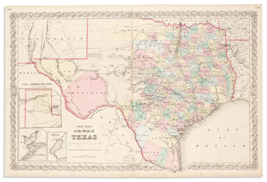

(texas.) joseph hutchins colton.
New Map of the State of Texas Compiled from J. de Cordova’s Large Map.

New York, 1866
Double-page lithographed map of Texas with attractive original hand-color by county. 18x27 inches sheet size, ample margins; light toning and offset.
Estimate
$200 – $250


(texas.)
Texas Engraved Expressly for the World in Miniature.

Np, circa 1860
Detailed small-format lithographed pocket map of eastern Texas. 14x11¾ inches overall, folding into original 12mo cloth case with “Texas S.N. Gaston” blocked in gilt to upper cover; original hand-color by county; short repairs to fold versos, small loss at fold intersection above title. OCLC shows two copies.
Estimate
$600 – $900


(title-pages.)
Group of 5 hand-colored engraved seventeenth-century atlas title-pages.

Vp, vd
-
Willem and Joan Blaeu. Novus Atlas, das ist Welt-beschreibung… Vierde Theil. 19¾x12¼ inches sheet size, wide margins; original hand-color heightened in gold. Amsterdam, 1646.
-
Willem and Joan Blaeu. Le Theatre du Monde ou Nouvelle Atlas… Seconde Partie. 19½x11½ inches sheet size, margins reinforced on recto; original hand-color heightened in gold. Amsterdam, 1638.
-
Willem and Joan Blaeu. Theatrum Orbis Terrarum, sive Atlas Novus. Partis Secundae pars Altera. 19¾x11½ inches sheet size, wide margins; original hand-color. Amsterdam, 1645.
-
Johannes Janssonius. Nouvel Atlas, ou Theatre du Monde. 19¾x11½ inches sheet size, wide margins; hand-colored; binding glue residue at left edge, ink “Admiralty Library Office” stamp at lower margin. Amsterdam, circa 1650s.
-
Nicolas Sanson. L’Europe. 10x13 inches sheet size, wide margins; hand-colored; stains, 18th and 19th century ink inscriptions. Paris, 1647.
Estimate
$200 – $250


(tokyo.)
Group of 3 color-printed folding maps.

Japan, vd
Tokyo Ezu. Color-printed engraved map of Tokyo on 4 sheets joined, 27¾x38 inches overall with a small flap depicting the city’s fire brigades attached at lower left; folding into original yellow paper self-wrappers with printed paper label; minor wear. Meiji 8 (1875).
Tokyo Zenzu. Color-printed engraved map of Tokyo with an inset of Yokohama and vignette border panels. 2 sheets joined, 20½x29 inches overall, folding into publisher’s cloth-backed printed board covers; minor wear. Meiji 24 (1891).
Relief Information Bureau of the Tokyo Imperial University. Map of the Fire of Tokyo. Color-printed map of Tokyo detailing the origination of the fires caused by the Great Kanto earthquake of 1923, the direction of the fire’s spread, and the numbers of residents who died as a result. 31x43 inches overall; minor wear at fold intersections. Taisho 12 (1923).
Estimate
$600 – $900


(transylvania.)
Two 17th-century hand-colored engraved maps of central Romania.

Amsterdam, 1630s
-
Mercator/Hondius. Transylvania. 18x21¼ inches sheet size, wide margins, German text on verso; light age tone, center fold reinforced on verso.
-
Mercator/Janssonius. Transylvania. 6¾x8¾ inches sheet size, wide margins, French text on verso; minor age tone and spots of dampstain.
Estimate
$200 – $250


(united states.) sherman & smith; for j.h. colton.
Colton’s Map of the United States of America,

New York, [1846] 1851
the British Provinces, Mexico and the West Indies. Showing the Country from the Atlantic to the Pacific Ocean. Attractive hand-colored engraved wall map of North America. 4 sheets joined, 52½x59 inches overall; professionally conserved and framed.
Estimate
$700 – $1,000


(united states.) james hamilton young; and
Samuel Augustus Mitchell. Mitchell’s Reference & Distance Map of the United States.

Philadelphia, 1834
Engraved wall map of the United States with inset city plans and a fine Federal Eagle vignette title cartouche. 9 sheets joined, 54½x70 inches overall; strong original hand-color in full; scattered stains, cracks and minor losses, upper wooden roller lost.
Estimate
$2,000 – $3,000


(united states.) laurie & whittle; after thomas jefferys.
The United States of America

London, 1794 (but after)
with the British Possessions of Canada, Nova Scotia, New Brunswick and Newfoundland Divided with the French, also the Spanish Territories of Louisiana and Florida According to the Preliminary Articles of Peace Signed at Versailles the 20th of Jany. 1783. Double-page engraved map of eastern North America with a United States flag surmounting the title cartouche. “JWhatman/1804” watermarked wove paper, 20½x28½ inches sheet size, wide margins; fine original hand-color delineating political boundaries; center fold reinforced, small edge repairs. Stephens & Tree 51(f).
Estimate
$700 – $1,000


(united states.) john russell.
The United States of America, According to the Treaty of Peace of 1784.

London, 1795
Small folding map of the United States with 15 states numbered and keyed at left from Guthrie’s Geographical Grammar. 8¼x9¾ inches sheet size, wide margins; original folds, small stain at right edge.
Estimate
$150 – $200


(united states.) john cary.
A New Map of the United States of America.

London, 1821
Double-page engraved map of the eastern United States on “JWhatman Turkey Mills” watermarked wove paper. 21¼x25 inches sheet size, wide margins; original hand-color; minor tone and staining.
Uncommon late edition of the map with significant Territorial updates from the original 1806 issue.
Estimate
$400 – $600


(united states.)
Group of 11 eighteenth and nineteenth century engraved maps.

Vp, vd
-
John Stockdale. Part of the United States of North America. 17¼x20 inches sheet size, ample margins, right edge trimmed for binding; scattered foxing, original folds reinforced on verso, closed tear at binding mount. London, 1798.
-
G.G. & J. Robinson. United States of America. 14½x19½ inches sheet size, wide margins; original hand-color in outline; acidic age toning. London, 1799.
-
Rigobert Bonne. Etats Unis de l’Amerique. 15x21½ inches sheet size, wide margins; original hand-color in outline; minor foxing. Paris, 1787.
-
Thomas & Andrews. A Map of North America from the Latest Discoveries. 6¾x8½ inches sheet size, wide margins; original folds flattened, binding edge at left. London, 1806.
-
Felix Delamarche, et Fils. Carte des Etats-Unis. 12¼x17½ inches sheet size, wide margins; original hand-color in outline; moderate foxing. Paris, 1811.
-
J. Assheton; and J. Shury. United States. 9¼x11¼ inches sheet size, wide margins; original hand-color in full; center fold flattened, minor toning. London, circa 1825.
-
S. Hall. United States. 9x11 inches sheet size, wide margins; original hand-color in full; center fold flattened. London, circa 1830.
-
Thomas Starling. United States. 8½x6½ inches sheet size (including attached city directory leaf); original hand-color in full; minor toning. London, 1833.
-
George F. Cruchley. United States with Upper & Lower Canada. 18½x14¾ inches sheet size, ample margins; original hand-color in full; minor spots of age. London, 1854.
-
J.H. Colton & Co. The United States of America. 18½x29 inches sheet size, wide margins; original hand-color in full; age toned, light stain at lower edge. New York, 1855.
-
George Philip & Son. United States. 21¼x27 inches sheet size, upper and lower margins narrow; original hand-color in outline; minor age tone. Liverpool, circa 1855.
Estimate
$1,000 – $1,500


(venice.) ludovico ughi.
[Nuova Pianta dell’Inclita Citta di Venezia Regolata].

[Venice, 1747]
Large engraved plan of Venice with Rococo cartouche decoration and an engraved key below. 25½x27½ inches overall, segmented and mounted to later linen; overall very good. First state without the printed title at lower left.
Estimate
$1,000 – $1,500


(venice.) pierre aveline; after.
Venise Ville Capitale de la Republique de Meme Nom en Italie.

Paris: Jean Francois Daumont [and] Esnauts et Rapilly, late 18th century
Etched and engraved perspective plan of Venice with a 37-point reference key. 13½x20½ inches sheet size, narrow margins; original hand-color in full; a few small repairs but still attractive.
Estimate
$600 – $900


(vienna.)
Topographische Erklärung des Panorama von Wien.

[Vienna, circa 1805]
Hand-colored etched cycloramic view of Vienna keyed with an octagonal legend of 68 letterpress points of interest. 10½x10¾ inches sheet size; old folds, minor stains, adhesive mount residue on verso. Few institutional copies found.
Estimate
$500 – $750


Visscher, nicolas.
Nova Tabula Geographica Complectens Borealiorem Americae Partem…

Amsterdam, circa 1696
[and] Carte Nouvelle Contenant la Partie d’Amerique la Plus Septentrionale… Large engraved two-sheet map of eastern North America from the Outer Banks of Carolina to the Grand Banks of Canada. 23½x21 inches each sheet size, upper and lower margins narrow, left and right wide; very fine original hand-color in full; minor edge soiling but overall an attractive example of the pair. Burden 731, second state with engraved mountains and trees added throughout the interior.
Estimate
$2,500 – $3,500


(world – communication and commerce.) anatole chatelain;
and Marie Davy; and A. Vuillemin. Planisphere Chatelain

Paris, 1888-1889
ou Carte des Voies de Communication Etablies dans le Monde Entier au Moyen de la Vapeur et de l’Electricite “World’s Steam and Electric Map”… Nouvelle Edition. Large hand-finished chromolithographed case map of the world with telegraph and shipping lines printed in blue and red and signified with international flag symbols. 51x69½ inches overall, segmented and mounted on original silk backing; folding into 4to format gilt-lettered blue cloth slipcase; minor wear.
Estimate
$200 – $250


(world – maritime interface.) eugene andriveau-goujon.
Planisphere Presentant l’Ensemble des Communications Terrestres et Maritimes,

Paris, 1876
Indiquant les Principaux Courants de la Mer, la Direction des Vents, e.t.c. Large engraved map of the world providing detailed study of steamship lines, telegraph cables, ocean currents, and wind directions. 38¼x53¾ inches overall, segmented and mounted to original linen backing with printed Goujon label pasted to verso; fine original hand-color in full; faint toning at folds, one small separation, else nice.
Estimate
$300 – $400


Zatta, antonio.
America Settentrionale Divisa ne Suoi Principali Stati.

Venice, 1774
Double-page engraved map of North America. 15x20¼ inches sheet size, wide margins; original hand-color in outline; minor binding glue stain at center fold, else very nice.
Estimate
$400 – $600


Zatta, antonio.
Il Mappamondo o sia Descrizione Generale Del Globo.

Venice, 1774
Double-page engraved double-hemispheric map of the world with decorative continental allegories in each spandrel. 15¼x19 inches sheet size, wide margins; original hand-color in outline; thin strip of antiquing to upper right edge, still a lovely example.
Estimate
$400 – $600


Zatta, antonio.
Il Mappamondo o sia Descrizione Generale Del Globo Ridotto in Quadro.

Venice, 1774
Double-page engraved map of the world on Mercator’s projection with the title cartouche incorporating a small terrestrial globe. 15¼x19¼ inches sheet size, wide margins; original hand-color in outline; small ink stain at lower edge, else nice.
Estimate
$300 – $400
Atlases & Books with Maps


(american exploration.) zebulon pike.
An Account of Expeditions to the Sources of the Mississippi,

Philadelphia: C.&A. Conrad, et al, 1810
and Through the Western Parts of Louisiana, to the Sources of the Arkansaw, Kans, La Platte, and Pierre Juan Rivers; Performed by Order of the Government of the United States During the Years 1805, 1806, and 1807. Engraved map of St. Anthony’s Falls, engraved oval portrait, (lacking folding maps and tables). 8vo, 8½x5½ inches, original calf with gilt spine label, chipped and worn, inner hinges reinforced with mulberry tissue; various stains and foxing; a fair reading copy of the first edition; bookplate of Otis T. Macomber, Gardiner, Maine.
Estimate
$400 – $600


(american southwest). william h. emory.
Report on the United States and Mexican Boundary Survey.

Washington: A. O. P. Nicholson, 1857
5 lithographed maps and charts (four folding, one hand-colored), 12 color-tinted lithographed plates, and 63 engraved plates. 4to, 11½x9¼ inches, publisher’s blindstamped brown cloth, rebacked; browning and foxing, occasional repairs. Volume 1 only, Senate issue.
Estimate
$300 – $400


Arrowsmith, aaron; and samuel lewis.
A New and Elegant General Atlas.

Philadelphia; Baltimore; Washington City; Petersburg; and Norfolk: Conrad et al, 1804.
Letterpress title, contents list, and 63 engraved maps (3 folding). 4to, 11x9 inches, original speckled calf backed marbled boards, moderate wear, upper hinge starting; scattered staining and various degrees of age toning, withdrawn ink stamp of the Buffalo & Erie Historical Society Library to title-page verso.
Estimate
$1,000 – $1,500


(benjamin franklin.)
The Complete Works in Philosophy, Politics, and Morals, of the Late Dr. Benjamin Franklin,

London: James Cundee for Longman, Hurst, Rees, Orme, and Brown; and J. Johnson & Co.,[1806]
Now Collected and Arranged, with Memoirs of His Early Life, Written by Himself… Second Edition. Engraved portrait, 3 engraved half-titles, 13 engraved plates (most folding, including a map of the Gulf Stream and other diagrams of his innovations), and a folding letterpress table describing “reformed alphabet” pronunciation. 3 volumes. 8vo, modern quarter black morocco, gilt spines, all edges black; scattered foxing and browning, but in presentable restored condition.
Estimate
$300 – $400


Bonne, rigobert; and guillaume thomas françois raynal.
Atlas de Toutes les Parties Connues du Globe Terrestre.

[Geneva?, circa 1780]
Letterpress title, [3], 28 pages, 50 double-page engraved maps (1-49, including 17bis), and 23 letterpress statistical tables (many folding). 4to, 10x8¼ inches, contemporary calf-backed speckled boards with gilt morocco spine labels, moderate wear; generally clean.
Estimate
$600 – $900


Camden, william.
Camden’s Britannia, Newly Translated into English . . . Publish’d by Edmund Gibson.

London, 1695
Engraved portrait frontispiece, 8 engraved plates of coins, and 50 double-page or folding engraved maps by Robert Morden. Folio, 15¼x9½ inches, contemporary paneled calf, quite worn, hinges cracked but holding; map contents list in early ink to front end leaf, a few minor tears but maps overall clean.
Estimate
$800 – $1,200


(canada.) crown land office.
Appendix to Report of the Commissioner of Crown Lands. Part II. Maps of Canada.

Toronto: Stewart Derbishire & George Desbarats, 1857
8 large multi-sheet lithographed folding maps. Small folio, 12¼x10 inches, publisher’s roan-backed printed blue boards, spine perished and needs rebinding; title and two maps loose but present; repairable tears without loss.
Estimate
$2,000 – $3,000


(captain cook.) john webber, et al.
[Atlas to] A Voyage to the Pacific Ocean.

[London, 1784]
2 engraved maps, 61 engraved plates. Folio, 22½x17 inches, contemporary boards, well-worn and partly disbound; dampstain and foxing, final section of plates loose and edge worn.
Estimate
$1,200 – $1,800


Carey, henry charles; and isaac lea.
A Complete Historical, Chronological, and Geographical American Atlas.

Philadelphia, 1823
53 numbered double-page engraved mapsheets, charts and letterpress tables (complete.) Folio, 18x12½ inches, attractively rebound to style in half calf; strong original hand-color; light offsetting and center fold discoloration, 20th-century ink inscription to front end paper.
Estimate
$3,000 – $5,000


(celestial.) alexander jamieson.
A Celestial Atlas Comprising a Systematic Display of the Heavens.

London: G.&W.B. Whittaker, 1822
Engraved title and dedication, 31 full-page engraved charts and diagrams (most with original hand-coloring). Oblong 4to, 9¼x11¾ inches, publisher’s plain boards with engraved title-piece to upper cover, rebacked and recornered in library tape, a few leaves loose; first un-numbered plate stained, otherwise clean.
Estimate
$700 – $1,000


(celestial.) e. otis kendall.
Atlas of the Heavens;

Philadelphia: Butler & Williams, 1844
Showing the Places of the Principal Stars, Clusters and Nebulae; Designed to Accompany the Uranography; or A Description of the Heavens. Title from covers. 18 double-page lithographed celestial charts and diagrams (most with original hand-coloring); 4to, 10x8¾ inches, publisher’s cloth-backed printed boards, darkened and worn, inner sewing undone; adhesive discoloration at center folds; early 20th-century purchase inscription to front endleaf.
Estimate
$200 – $250


(china.)
Todo Rekidai Shugun Enraku Chizu.

Japan, Tempo 6 (1835)
13 double-page color-printed woodblock maps illustrating historical Chinese dynastic shifts. 14x8 inches, leporello folio with yellow paper self-wrappers showing age, title label lost; moderate worm track.
Estimate
$1,000 – $1,500


(china.) edwin john dingle.
The New Atlas and Commercial Gazetteer of China.

Shanghai: North China Daily News & Herald, [1917]
28 color-printed maps and 18 color-printed statistical tables. Large folio, 21½x16½ inches, publisher’s gilt-blocked black cloth, rebacked with original spine laid on, water damaged and bowed; marginal dampstain and scattered edge repairs.
Estimate
$1,000 – $1,200


(civil war.) john bachmann.
Panorama of the Seat of War.

New York, 1861 [-1862]
Portfolio of 6 double-page chromolithographed panoramic perspective maps of Confederate states. Folio, 23½x17 inches, contemporary half morocco with gilt title piece to upper cover, moderately rubbed, hinges starting; foxing and offset, upper title of final plate a little shaved; Wagner Free Institute of Science blindstamp and withdrawn ink stamp to verso of first plate.
Rare bound collection of all six spectacular large-scale topographic vistas by nineteenth-century America’s most successful viewmaker.
- Birds Eye View of Virginia, Maryland Delaware and the District of Columbia.
- Birds Eye View of North and South Carolina and Part of Georgia.
- Birds Eye View of Florida and part of Georgia and Alabama.
- Birds Eye View of Louisiana, Mississippi, Alabama and Part of Florida.
- Birds Eye View of Kentucky and Tennessee Showing Cairo and Part of the Southern States.
- Birds Eye View of Texas and Part of Mexico.
“The panoramic map in fact became a popular and effective technique for conveying information about the Civil War. Early in 1861, the skillful artist and lithographer John Bachmann of New York City conceived the idea of producing a series of bird’s-eye views of the likely theaters of war. These visually attractive panoramas were easily understood and perhaps more meaningful to a public largely unskilled in map reading” - Stephenson, Civil War Maps, page 15; 1.7, 2, 23.5, 117.2, 304.6, 446.8.
Estimate
$10,000 – $15,000


(cleveland.) g.m. hopkins.
Plat Book of the City of Cleveland. Volumes 2, 3, & 4.

Philadelphia, 1937, 1933, 1932
37 hand-colored double-page lithographed maps (including index); 45 hand-colored double-page lithographed maps (including index); 52 hand-colored double-page lithographed maps (including index). 3 (of 5) volumes. Folio, 24x18 inches, publisher’s cloth with gilt morocco lettering pieces to upper covers, unprofessional repairs to spines of two volumes; generally clean but with occasional light soiling and hand annotations, printed update slips pasted on throughout.
Estimate
$500 – $750


(florida.) garcia lasso de la vega.
Histoire de la Conqueste de la Floride.

Leiden: Pieter van der Aa, 1731
[xxvi], 582 pages, 2 title-pages in red and black with engraved vignettes, engraved folding map, 9 engraved folding plates. 2 volumes in 1. 8vo, 7¼x5¾ inches, original plain blue boards with calf spine label, uncut, light wear; bookplate of The New Hampshire Historical Society.
Estimate
$300 – $400


(geography.) pierre d’avity.
Description General de l’Afrique [bound with:] Description Generale de L’Amerique.

Paris: Laurent Cottereau, 1643
Two engraved title-pages in red and black, two large engraved decorative folding maps by Petrus Bertius. Folio, 14x9 inches, period mottled calf, gilt spine with morocco lettering piece, neatly mended cover scuffs; skillful repairs to mount points of each map but overall very attractive.
Estimate
$1,500 – $2,500


(geography.) thomas salmon.
A New Geographical and Historical Grammar:

London: W. Johnston, H. Woodfall, J. Hinton, et al, 1764
Wherein the Geographical Part is Truly Modern; and the Present State of the Several Kingdoms of the World Is So Interspersed as to Render the Study of Geography Both Entertaining and Instructive. Engraved armillary plate and 22 engraved folding maps by Thomas Jefferys. 8vo, 8¼x5½ inches, contemporary gilt-ruled calf, worn but firm; text and maps clean.
Estimate
$400 – $600


(geography.) jedidiah morse.
The American Universal Geography,

Boston: Isaiah Thomas and Ebenezer T. Andrews: June,1796
or, A View of the Present State of All the Empires, Kingdoms, States, and Republics in the Known World, and of the United States of America in Particular. Celestial plate and 27 folding maps engraved by Amos Doolittle. 2 volumes. 8vo, 8½x5½ inches, original American calf with gilt morocco spine labels, light wear; general age tone and foxing, several maps with repairs to fold versos, maps of Europe and Africa partly defective. Volume 1, third edition; volume 2, second edition.
Estimate
$300 – $400


(geography.) daniel fenning; and joseph collier.
A New System of Geography: or, A General Description of the World.

London: S. Crowder, 1764-1765
Engraved allegorical frontispiece (damaged and laid down), and 56 (of 58) engraved maps and plates. Folio, 14x9 inches, contemporary calf, worn and repaired; toning, staining, and various other defects, discard stamps and bookplate of the Missouri Historical Society.
Estimate
$250 – $300


(geography / natural history / world cultures.)
Johann Daniel Friedrich Rumpf; and Georg Wilhelm Bartholdy. Gallerie der Welt,

Berlin, 1805
in Einer Bildlichen und Beschreibenden Darstellung von Merkwürdigen Ländern… Erster Band. (First volume). xiv, 426, 250 pages, 12 engraved plates (including frontispiece) and 4 engraved maps by Daniel F. Sotzmann, all with original hand-coloring. 4to, 10x8½ inches, red roan over marbled boards, rebacked with some spine chipping; minor foxing but generally clean.
Estimate
$300 – $400


(hungary.) robert townson.
Travels in Hungary, with a Short Account of Vienna in the Year 1793.

London: G.G. and J. Robinson, 1797
xviii, [2], 506 pages, hand-colored engraved folding map, engraved folding table, and 16 engraved plates. 4to, 10¾x8½ inches, contemporary tree calf with gilt morocco spine label, moderate wear but sound; scattered foxing and offsetting though not egregious.
Estimate
$300 – $500


(ireland.) george tyner.
The Traveller’s Guide Through Ireland.

Dublin: P. Byrne, 1794
[x], 99 pages, double-page engraved map. 8vo, 8¼x5¼ inches, contemporary calf-backed marbled paper boards, spine defective but sound; minor foxing, small corner loss to margin of page 29, “Wagner Free Institute of Science, Philadelphia” blindstamp to half-title and title-page.
Estimate
$400 – $600


(maritime commerce.) napoleon iii (louis-napoleon bonaparte).
Canal of Nicaragua:

London: privately printed by Mills & Son, 1846
or, a Project to Connect the Atlantic and Pacific Oceans by Means of a Canal. [4], viii, 70 pages, and 3 engraved folding maps by James Wyld (World, Central America, Nicaragua). 8vo, 9½x6 inches, richly gilt presentation morocco, neatly rebacked with original backstrip laid on; minor foxing, a few closed tears, upper margin of title-page inscribed.
Rare [unpublished] treatise by Napoleon III, written several years prior to his presidency of France, examining the feasibility of a man-made waterway through the heart of Nicaragua, illustrated with maps detailing the global advantages of opening such a channel.
Estimate
$500 – $750


(mexico.) antonio garcía y cubas.
Atlas Pintoresco é Histórico de los Estados Unidos Mexicanos.

Mexico, 1885
Tinted lithographic title-page (with decorative copyright on verso), and 13 double-page chromolithographed socio-statistical maps with relative illustrations. Large folio, 24½x15½ inches, contemporary morocco-backed gilt-blocked cloth boards, spine caps chipped and other light wear; scattered edge soiling, a few plates with small splits at lower center fold, two short margin tears.
“The maps and illustrations bordering them are superb. García Cubas was the preeminent Mexican cartographer of the nineteenth century” – Rumsey 2693.
Estimate
$2,500 – $3,500


(mexico – political satire.) daniel cabrera rivera,
Manuel Perez Bibbins, and Juan Sarabia. El Hijo del Ahuizote. Tomo 1; Num. 1-39.

Mexico City, August 1885 - May 1886
39 eight-page issues profusely illustrated by “Figaro” (i.e. Daniel Cabrera Rivera); many double-page spreads, one folding map. Small folio, 13x9 inches, contemporary roan-backed marbled boards, rubbed, spine starting; minor staining, map with closed tears; title-pages hand-colored.
Estimate
$400 – $600


Mitchell, samuel augustus.
A New Universal Atlas Containing Maps of the Various Empires, Kingdoms, States and Republics of the World;

Philadelphia, 1847
With a Special Map of Each of the United States, Plans of Cities, &c. Engraved pictorial title, contents leaf, and 73 engraved mapsheets with fine original hand-color (Oregon and Upper California unnumbered and not called for on the contents list). Folio, 17¼x14½ inches, publisher’s half roan over marbled paper boards, upper cover with gilt title piece, average wear, first quire pulled loose, spine casing separated; moderate foxing but still attractive with bright original colors.
Estimate
$1,500 – $2,500


Moll, herman.
[The World Described].

London, circa 1730
18 engraved multiple-sheet folding maps with original outline hand-color (i.e., incomplete; no beaver map, no codfish map). Tall folio, 25x12 inches, period calf boards, worn and disbound; major damage and stains, some maps with loss. sold as is.
Estimate
$1,200 – $1,800


(napoleon.)
Campagne des Francais en Italie, en 1800.

Leipzig, 1801
Stipple engraved portrait of Napoleon, [iv], 34 pages, 4 engraved folding maps differently hand-colored to illustrate the French invasion of northern Italy. 4to, 11x8½ inches, original plain blue paper boards, lightly worn and repaired; uncut; small stain to frontispiece.
Estimate
$250 – $300


(netherlands.) heyman van dyck.
Voorne Caart-boeck van alle de Dorpen, en Polders Gelegen Inden Lande van Oost, ende West Voorne.

[Amsterdam?], 1701
Elaborate double-page etched and engraved allegorical title by Romeyn de Hooghe, and 31 (of 32) double-page etched and engraved maps detailing property division in the Voorne region of southern Holland. Folio, 21x15 inches, modern quarter morocco over marbled paper boards, minor edge wear; lacking plate XIII; fine original hand-color throughout; verdigris offsetting and the occasional small repair, but overall quite nice; hand-colored engraved mid-18th-century tobacco label of Jan Bulte/Cornelis Kuyper “Drie Jonge Italiaanders” (Three Young Italians) pasted to inner board.
Estimate
$4,000 – $6,000


(netherlands.) nicolaas and jacob cruquius.
T Hooge Heemraedschap van Delflant.

Delft, 1712 [1750]
Atlas-format wall map of the vicinity of Delft and The Hague in western Netherlands. Double-page engraved key map in stunning original hand-color accented with gold, and 27 double-page engraved sheets (25 maps, 2 title banners). Folio, 22x14 inches, contemporary gilt-tooled mottled calf by the Star Bindery of the Hague, light wear; barely an internal fault; another example of the key sheet, uncolored, loosely inserted. Presentation copy to Gerard van Assendelft, secretary of the Delftlant Baljuwschap, as testified by a contemporary note on laid paper, signed on the reverse by his heirs and dated 1772.
Fine copy of one of the most comprehensive and impressively detailed achievements of large-scale 18th-century urban cartography. If joined, the wall map would measure over 8 feet wide, a scale large enough for a viewer to become immersed in the exacting detail of the illustrated towns and smaller villages, estates, homes and public buildings, personal gardens and agricultural fields, roads, dikes, dams, canals, polders, and other topographic features. The side panels are comprised of elaborate coats of arms for ten regional district officials; at the right is a spectacular compass rose featuring a world map and celestial elements; and the lower border is a decorative band representing domestic agriculture, hunting, fishing, beekeeping, etc., after designs by Arnold Houbraken.
The present binding can be identified as a work by the Hague-based Star Bindery (Sterbinderij) by comparison of several hand tools in use at that studio in the mid-to-late eighteenth century (van Leeuwen rolls II and IX; tools 4, 6, 17a, 17b, 22, 24, 28, 29, and 30). Jan Storm van Leeuwen, De achttiende-eeuwse Haagse boekband in de Koninklijke Bibliotheek en het Rijksmuseum, pages 101-102, 405-406; Dutch Decorated Bookbinding, vol. IIa, pages 145-155.
Estimate
$6,000 – $9,000


(new york city.) theodore fay; j.h. dakin; and william hooker.
Views in New-York and Its Environs

New York: Peabody & Co.; and London: O. Rich, 1831-1832
from Accurate, Characteristic, and Picturesque Drawings. Engraved pictorial title, profusion of vignettes on 13 engraved plates, hand-colored engraved folding map by Hooker, errata leaf; 7 parts in wrappers. 4to format, 11¼x9 inches, original printed paper wrappers, light wear and soiling, spine separations; staining and offset, text and rear cover to part 5 torn and separated.
Estimate
$1,000 – $1,500


(new york city.) city of new york, commissioners of the sinking fund.
The Wharves, Piers and Slips Belonging to the Corporation

New York: New York Printing Company, 1868
of the City of New York. East River. [and] North River. Engraved title-pages and 131 hand-colored lithographed plans of Manhattan waterfront, each with explanatory leaf printed in black and red. 2 volumes. Oblong 4to, 9½x12 inches, publisher’s full green morocco gilt with “Hon. R.B. Connolly” within decorative rules to upper covers, leather rubbed and scraped in places; minor foxing and offset, titles and endleaves with ink stamps of “Eugene F. Manning, 17 Battery Place, N.Y. City” (a few instances obscured with white-out).
Attractive set of this scarce assessment of the piers and bulkheads of mid-nineteenth century Manhattan’s waterfront along the East and Hudson Rivers with weighty provenance and association: Politician and New York City Comptroller under Boss Tweed, Richard Barrett Connolly (one of the Commissioners involved in the book’s enterprise, his name appearing in the printed list of each volume); and tugboat/transportation maverick Eugene F. Manning.
“… a report on the condition of the wharves, piers, and slips belonging to New York City. This report is in two volumes, one covering the East River from Whitehall to 130th St., and the other the North River, from Albany Street to 155th St. The report is illustrated by careful drawings of all wharves, piers, and slips, giving dimensions, construction, cost, present value, recommendations for alterations, extensions, repairs, etc.” (Stokes, Iconography, vol. 5, page 1929).
Estimate
$2,500 – $3,500


(new york city.) sanborn map company.
Pier Map of New York Harbor.

New York, 1922
Albumen aerial photograph of lower Manhattan to front pastedown, title-page, index, double-page hand-colored lithographed key map, and 67 hand-colored lithographed maps on double-page sheets minutely detailing New York City’s waterfront 100 years ago. Folio, 19x15 inches, publisher’s roan-backed cloth with gilt title piece to upper cover, well-worn with spine and corner leather perished but all holding firm; maps very good with minor thumb soiling and an occasional pencil annotation.
Estimate
$800 – $1,200


(new york city.) g. w. bromley & co.
Atlas of the City of New York - Borough of Manhattan. Volumes 2 and 3.

Philadelphia, 1928; 1930
Volume 2, 14th Street to 59th Street: Index map and 45 hand-colored double-page lithographed maps; Volume 3, 59th Street to 110th Street: Index map and 40 hand-colored double-page lithographed maps. Large folios, 23x18 inches, publisher’s plain cloth with printed cover labels, minor wear; maps backed on linen with numbered tabs as issued, 1952 overlay corrections pasted on, generally bright and clean.
Estimate
$500 – $750


Ortelius, abraham.
Nomenclator Ptolemaicus; Omnia Locorum Vocabula quae in Tota Ptolemaei Geographia Occurrunt, Continens.

Antwerp: Robert Bruneau, 1603
30, [5] pages, title with a miniature hand-colored engraved map of the eastern hemisphere. Folio, 17x11½ inches, modern calf-backed cloth with gilt title and date within a stamped lozenge to the upper cover; edge wear and staining.
Estimate
$300 – $400


(periodicals.) edward cave; [sylvanus urban, pseud.]
The Gentleman’s Magazine and Historical Chronicle… Volumes X through XVI.

London: 1740-1746
Engraved maps and plates. 7 volumes. 8vo, 8x5¼ inches, contemporary calf-backed marbled boards, worn but sound; occasional defective text leaves.
Estimate
$400 – $600


(philately.) the scott stamp & coin company.
The International Postage Stamp Album.

New York, 1896
7 chromolithographed maps (one double-page), and several hundred collector’s template pages hinged with over 1,300 mostly canceled nineteenth-century postage stamps comprising examples from over 150 nations and/or city-states (quite a few politically non-existent today). 4to, 12x9½ inches, original cloth-backed printed pictorial boards, well-preserved with light wear; 1895 gift inscription; small group of stamps, contemporary supplier’s offering sheets, and envelopes addressed to John J. Heard, Pittsburg, PA loosely inserted.
Estimate
$300 – $400


Quin, edward.
An Historical Atlas; In a Series of Maps of the World as Known at Different Periods… Forming Together a General View

London: R.B. Seeley and W. Burnside, 1836
of Universal History, from the Creation to the Present Time… Second Edition. 21 aquatint and engraved folding maps with original hand-color. 4to, 11x9 inches, publisher’s half calf over marbled paper boards with printed title-piece, spine lost, front cover detached; maps with minor flattened foredge creases but otherwise nice; bookplate and owner’s ink inscriptions to front pastedown and endleaf.
Estimate
$400 – $600


(reference.) carl i. wheat.
Mapping the Transmississippi West, 1540-1861.

Storrs-Mansfield, CT: Maurizio Martino; & Parsippany, NJ: About Books, [1995]
Numerous plates. 5 volumes in 6. Small folio, 12x9 inches, publisher’s green cloth with gilt spines, minimal wear. Reprint edition, limited to 350 sets.
Estimate
$200 – $250


(rhode island.) d.g. beers & co.
Atlas of the State of Rhode Island and Providence Plantations.

Philadelphia, 1870
135 pages with a profusion of hand-colored lithographed mapsheets. Folio, 16½x14 inches, modern morocco-backed green cloth boards; large folding map of Pawtucket with tears and repairs.
Estimate
$500 – $750


(spanish america.) tomas lopez.
Atlas Geographico de la America Septentrional y Meridional.

Madrid: Antonio Sanz, 1758
Engraved title, portrait, and 38 engraved maps and plans. 12mo, 5x3½ inches, contemporary mottled calf gilt, light wear; minor foxing but overall quite handsome.
Estimate
$5,000 – $7,500


(travel.) alexander drummond.
Travels Through Different Cities of Germany, Italy, Greece,

London: W. Strahan for the Author, 1754
and Several Parts of Asia, as far as the Banks of the Euphrates. 34 (of 35) engraved maps and plates, lacking large folding map of Cyprus. Folio, 15½x10½ inches, modern calf, spine sunned and stained; uncut; minor edge browning.
Estimate
$250 – $300


(travel – arctic.) william edward parry.
Journal of a Second Voyage for the Discovery of a North-West Passage

London: John Murray, 1824
from the Atlantic to the Pacific; Performed in the Years 1821-22-23 in His Majesty’s Ships Fury and Hecla. 31 aquatint and engraved plates and maps, 8 engraved folding charts and coastal elevations. 4to, 11x8½ inches, nineteenth-century worn half calf; moderate foxing; bookplate of Joceline Percy.
Estimate
$300 – $500


(travel – asia.) john bell.
Travels From St. Petersburg in Russia to Diverse Parts of Asia.

Dublin: Robert Bell, 1764
Engraved folding map showing the route from Moscow to Beijing with a decorative inset of the Chinese capital city. 2 volumes. 8vo, 8x5¼ inches, contemporary speckled calf with gilt spine labels, hinges to volume 1 cracked but holding; generally clean.
Estimate
$300 – $400


(travel – north america.) jean-francois de la harpe.
Compendio Della Storia Generale de’ Viaggi. Tomo Vigesimo Quinto.

Venice: Vincenzo Formaleoni, 1784
[Vol. 25 - America]. 280 pages, 6 folding maps of America and Canada engraved in Italian after J.N. Bellin. 8vo, 7½x5¼ inches, contemporary calf-backed paste paper boards with gilt calf spine labels, minimal wear; light offsetting; crisp impressions on extra-wide guards for easy reference while reading.
Estimate
$300 – $500
Color Plate & Illustrated Books


(algiers.) paul margueritte.
Alger-L’Hiver.

Algiers: J. Gervais Courtellemont & Cie, 1891
4], 56, [3] profusely illustrated journal pages, 16 photographic plates. Folio, 13x9¼ inches, gilt crushed red morocco by Zaehnsdorf, light rubbing, spine foot chipped; generally clean, contemporary ink gift inscription to front flyleaf.
Estimate
$250 – $300


(architecture – antiquity.) [robert wood.]
The Ruins of Balbec, Otherwise Heliopolis in Coelosyria.

London, 1757
Letterpress title, 28 pages, and 47 engraved plans and views illustrating ancient Roman temple ruins of Baalbek, Lebanon. Folio, 21½x15 inches, 18th-century calf-backed marbled paper boards, spine perished and covers detached; moderate age tone and foxing.
Estimate
$700 – $1,000


(asian book leaves.)
Examples of Oriental Calligraphy and Printing.

New York: Orientalia, Inc., 1920s [compiled]
Assortment of 16 manuscript and printed leaves with printed explanatory slips pasted on. Cloth-backed plain portfolio boards with printed paper label to upper cover, spine deteriorated but holding; specimens in original glassine envelopes, aged condition as compiled.
14th-19th century; each leaf as labeled by the compiler and not independently confirmed:
-
Leaf from a rare vellum Arabic manuscript of the 14th Century, expounding Muhammadan doctrine.
-
Leaf from a manuscript Koran of the 17th Century. The calligraphy is regarded as unusually fine.
-
Leaf from an old 3 volume Japanese work on Buddhism containing ceremonial and symbolic illustrations. Dated 1675.
-
Leaf from a six volume Chinese medical work of the 17th Century.
-
Leaf from the Saddharmapundarika, the text of Kumarajiva, in Chinese, copied by a Japanese priest named Joyen in 1834.
-
Double leaf from a Chinese Buddhist work expounding the Sanskrit Scriptures. Probably 18th Century.
-
Leaves from Robert Morrison’s copy of “Descrition Geographique, Historique, Chronologique, Politique, et Physique de l’Empire de la Chine et de la Taratrie Chinoise”, by the famous Jesuit missionary, Du Halde. Published at the Hague, 1736.
-
A printed page from a Japanese book, undated, but probably 18th Century. A popular edition of the Genji Monogatari, Japan’s first novel, whose author, Muraski no Shikibu, is compared to the English Novelist, Richardson.
-
Leaf from a Javanese rubricated manuscript of the early 19th Century giving the history of Rama (differing from the usual version). Although Muhammadanism is now the nominal religion of Java the myths and traditions of Hinduism have by no means been discarded. On the contrary Indian gods and heroes form the dominant theme in Javanese literature, drama and fold tales to the present day.
-
Leaf from a manuscript book of miscellaneous information compiled by a devout Japanese Buddhist. Seventeenth Century. Note that the thrifty scribe has written on the reverse side of paper already used.
-
Leaf of a Taliput manuscript in Tamil, from a Buddhist temple in Ceylon. Probably 18th Century. In India, Ceylon and Burma the leaves of the Taliput palm are used like Papyrus in Egypt. If the characters become indistinct rub lamp black into them with the finger, afterwards wiping off the surface of the leaf with a damp cloth.
-
Leaf from Indian religious manuscript containing extracts from the Puranas, in Sanskrit. 18th Century.
-
Leaf from a fine Sanskrit MS copy of the Puranas. Eighteenth Century. Note the precise characters and the regularity of the page.
-
A leaf from a Turkish work, (Hadji Khalifa), printed in Constantinople in 1733. Note that the borders are done by hand.
-
Buddhist prayer sheet in Manchu characters brought to this country by a traveller from Mongolia.
-
Double leaf from an old book (probably 18th Century) in Chinese characters, printed in Korea. Contains Buddhist Scriptures as interpreted by the Syen sect.
Estimate
$700 – $1,000


(australia.) david collins.
An Account of the English Colony in New South Wales,

London: T. Cadell and W. Davies, 1804
from its First Settlement in January 1788, to August 1801… Second Edition. Engraved frontispiece portrait, 1 (of 2 engraved charts), 20 (of 23) engraved plates (one hand-colored), 8 text engravings, xvii, [3], 562, [2] pages. 4to, 10x8 inches, modern cloth rebacked; scattered staining and repairs, “Hampshire Library” ink stamp throughout. sold as is.
Estimate
$250 – $300


(birds.)
Album of the Finest Birds of All Countries.

Philadelphia: Weik & Weick, circa 1860
Lithographed ornithological plates in the style of Édouard Traviès, all beautifully hand-colored and touched with gum arabic, captioned in English and German and arranged by continent nativity. Oblong folio, 10¾x14¼ inches, publisher’s pictorial moire boards, spine rebacked with plain cloth tape, light rubbing and soiling; scattered foxing and offset ghosting.
Estimate
$1,500 – $2,500


(bookplates.)
Collection of approximately 1,000 eighteenth to twentieth century bookplates, ownership labels, bookseller’s tickets, etc.

Vp, vd
Mostly British, various styles; engraved or otherwise printed; kept loose in divided archival binder sheets; scattered wear and tears, occasional verso residue from previous mountings.
Estimate
$1,000 – $1,500


(british genre.)
Two albums of engraved of costume, amusement, and sporting plates, mostly after [Francis Philip] Stephanoff.

London: Sherwood & Co., 1816
A Set of Humerous and Descriptive Illustrations to Twenty-One Engravings by Stephenhoff and Others, of the Sports and Pastimes of the People of England… In Continuation of Joseph Strutt’s. Letterpress title and 21 engraved captioned plates. 8vo, 8¾x5½ inches, publisher’s marbled paper-backed blue card wrappers with printed paper title slip pasted to upper cover, minor wear, inner hinges reinforced; minor soiling.
Together with:
Another suite of the same plates, here slightly larger paper, without title, but neatly hand-colored. 8vo, 9¾x6¾ inches, original cloth-backed plain boards, light wear; minor signs of age.
Estimate
$300 – $400


(caricature). vanity fair.
Approximately 230 chromolithographed caricature plates.

London, 1872-1874; 1891-1894
2 volumes. Folio, contemporary half morocco, first volume worn with covers detached; clipped and mounted to album leaves with pasted text clippings facing each plate; scattered foxing.
Estimate
$300 – $400


(caricature – periodical illustration.)
Three bound collections.

Vp, vd
Puck. 26 issues, Nos. 982-1007 (Vols. XXXVIII-XXXVIX). Chromolithographed titles and double-page spreads by Joseph Keppler, Louis Dalrymple, J. S. Pughe, Charles Taylor, and others. Folio, 13¾x10½ inches, publisher’s cloth boards, rebacked in library cloth; dampstain at lower edge. New York, January 1st - June 24th, 1896.
L’Eclipse. 130 issues, Nos. 271-400. Hand-colored wood engraved titles by Andre Gill. Folio, 18¾x12½ inches, worn marbled boards, rebacked with partial original backstrip laid on; minor edge browning. January 4, 1874 - June 25th, 1876.
Gil Blas Illustre. Second year, Nos. 1-52. Illustrated throughout by Theophile Steinlen and Albert Guillaume. Folio, 15x11 inches, publisher’s cloth over marbled boards, rebacked with original spine laid on; friable newsprint browned and edgeworn. Paris, January 3rd - December 25th, 1892.
Estimate
$700 – $1,000


(city views.) françois gosselin;
and Jean Frederic Wentzel; (Publishers). Album of 37 chromo or tinted lithographed views

Paris and Wissembourg, circa 1860s
of European and American cities and ports. Most with additional hand-coloring and touches of gum arabic. Oblong folio, 12x17½ inches, 19th-century cloth-backed marbled paper boards, lightly worn; intermittent foxing and edge soiling, a few closed margin tears, several plates shaved with printed titles partially trimmed, blue “Seine Colportage” import stamp to plate versos.
Chez Gosselin:
- Notre Dame de Paris.
- Vue Generale de la Place de la Concorde, (Paris).
- Le Chateau des Tuileries (Cote du Jardin) (Paris).
- Lyon (Partie Nord).
- Lyon (Partie Sud).
- Panorama des Quais du Rhone. Vue Prise du Cafe de Paris - Rive Gauche au Fleuve.
- Roma. Rome, (Italie).
- Florencia. Florence, (Italie).
- Nice.
- Hierosolyma. Jerusalem, (Syrie).
- Toulon, Port du Commerce. Toulon, Puerto del Comercio.
- Gibraltar (Espagne), Vue du Cote du Nord. Gibraltar (Espana), Visto del Costado del Norte.
- Marseille, Entree du Port.
- Boulogne, Entree du Port. Bolonia, Entrada de su Puerto.
- Londres, Pont de Londres. Londres, Puente de Londres.
- Le Havre, Vue Prise de la Jetee du Sud. Le Havre, Vista Tomada de Muelle Sud.
- Dieppe. Diepa.
- Cherbourg, Vue de la Rade. Cherbourg, Vista de la Rada.
- Vue de New-York et de l’Entree de la Riviere de l’Est, Prise de l’Ile Ellis. Vista de New York y de la Entrada del Ryo de l’Est, Tomada de la Isla Ellis.
- Oporto (Portugal).
- Lisbonne Vue Prise du Sud.
- Buenos-Ayres. Buenos-Ayres.
- Rio-Janeiro, Vue Prise du Convent de Ste Therese. Rio-Janeiro, Vista Tomada del Convento de Sa Teresa.
Wentzel:
- [Venice].
- Naples. Neapel.
- Jerusalem, Vue Prise de la Montagne des Oliviers.
- Bethlehem, Vue du Nord.
- New York.
- Londres. London.
- [Moscow].
- Constantinople. Constantinopel.
- Bale. Basel.
- Berlin.
- [Madrid].
- Bude & Pesth. Ofen & Pest.
Anonymous, with gold and black printed borders:
- Windsor Castle.
- Conway Castle.
Estimate
$2,500 – $3,500


(costume.) [william alexander].
The Costume of the Russian Empire… with Descriptions in English and French.

London: William Bulmer; for William Miller, 1804 [but after]
73 hand-colored stipple engraved plates (various watermarks, as late as 1829). Small folio, 14½x11 inches, contemporary gilt black morocco, moderate wear, front board separating, first quire partly loose; mostly clean.
Estimate
$300 – $400


(costume.) thomas mclean; publisher.
The Military Costume of Turkey.

London: Thomas McLean, 1818 [but after]
Engraved portrait frontispiece, hand-colored aquatint additional title (i.e. Grand Vizier plate), and 29 hand-colored aquatint plates (several watermarked “JWhatman Turkey Mill/1834”). Small folio, 14x10 inches, contemporary straight-grained green morocco gilt, moderate rubbing; minor foxing and offset.
Estimate
$500 – $750


(costume – italy.) b. serafino buonaiuti.
Italian Scenery;

London: Thomas McLean, 1823.
Representing the Manners, Customs, and Amusements of the Different States of Italy. 32 etched and engraved plates in fine original hand-colors, engraved leaf of sheet music to a Neapolitan dance. Folio, 14½x10½ inches, contemporary red morocco gilt, a bit rubbed though still attractive; moderate offsetting; “JWhatman/Turkey Mill/1823” watermarks.
Estimate
$500 – $750


(costume – switzerland.) joseph reinhardt.
Collection de Costumes Suisses.

London: W.T. Gilling, 1822
28 (of 30) hand-colored aquatint plates, lacking English title. 4to, 11x7½ inches, publisher’s worn marbled boards with printed paper title label, rebacked in library cloth; minor foxing and edge chipping, “Western Reserve Historical Society, Cleveland” bookplate with withdrawn stamp.
Estimate
$300 – $400


(crimean war.) angelo usigli, ed.
Guerra d’Oriente. Album Illustrato.

Florence, circa 1860
xii, 188 pages, hand-colored lithographed title, and 50 tinted lithographed plates and maps all nicely hand-colored and brushed with gum arabic. Folio, 14x10½ inches, 20th-century half calf, moderately rubbed; foxing and age toning.
Estimate
$300 – $400


(da vinci.) guiseppe bossi.
Del Cenacolo di Leonardo da Vinci.

Milan: Stamperia Reale, 1810
263, [1] pages, 7 etched or mezzotint plates. Folio, 15½x11½ inches, lightly worn 19th-century vellum-backed marbled boards with gilt morocco spine label, uncut; an occasional spot but generally clean.
Estimate
$600 – $900


[diderot, denis and jean le rond d’alembert.]
Plates from Volume 9 of Encyclopedie…

Paris, circa 1770
Approximately 130 engraved plates comprising themed illustrations of the workshops, tools, materials, and machines used in various smithing and manufacturing trades. Folio, 16½x10½ inches, contemporary mottled calf, spine repairs; scattered foxing and light age toning.
Estimate
$300 – $400


(fishes.) hugh m. smith.
The Fishes of North Carolina. (Volume II to the North Carolina Geological and Economic Survey Reports).

Raleigh: E.M. Uzzell & Co., 1907
xi, 453, [2] pages including profuse text illustrations and diagrams and 21 numbered plates (16 chromolithographic fish species; 5 photographic scenes of fishery commerce). 8vo, 10½x7¼ inches, publisher’s gilt-blocked red cloth, front cover starting at lower hinge, other light wear; contents fine; contemporary ink inscription to front endleaf erased but “June 29th, 1908” remaining.
Estimate
$400 – $600


(games.)
Group of 3 nineteenth-century juvenile entertainment sets.

Vp, vd
-
No title, no maker. Hand-colored engraved circular game board sectioned by hedges or paths of grass with a swan swimming in a fountain at the center; 30 hand-colored engraved triangular cards representing various botanical specimens. Laid paper, 13¾x14 inches, dissected into 8 segments and mounted on original linen backing; minor soiling but generally fine. French or German, early 19th century.
-
Arthus Bertrand. Box of 84 rectangular dyed bone markers or tokens, each with an engraved image and French phonetic lettering piece pasted to either side (20 yellow, 20 red, 20 blue, 24 white). Original pink card box with a decorative medallion vignette and Bertrand label pasted on; minor wear, sectional dividers loose. Paris, early 19th century.
-
Panorama. Original slide-top paper-covered wooden box with hand-colored engraved title panel pasted on which houses a set of 12 hand-colored engraved miniature views of Paris and Versailles with captions in French, German and English, and a mirrored optical device on a turned mahogany stand. Np, English?, mid-nineteenth century.
Estimate
$500 – $750


(japan – cookery.)
Group of printed and manuscript items relating to food preparation.

Japan, vd
Illustrated cooking scroll offering table presentation of various dishes. Ink, watercolor and gouache on 3 sheets joined; 7½x99 inches overall; some creasing and staining. 19th century.
Nenchu Sozai No Shikata. 220-page cookbook, 3 color-printed woodblock plates and other illustrations. 8vo format, 7x5 inches, publisher’s stitched pictorial wrappers, lightly soiled. Meiji 26 (1893).
Honzo Zufu. Offset color-printed facsimile of a 19th century monograph on mushrooms. Np, later 20th century.
Estimate
$400 – $600


(japan – erotica.)
Group of mid-to-late nineteenth-century shunga.

Japan, vd
Guidebook to sex along the Tokaido Road stations. 12 hand-colored woodblock plates with description panels. 9x6½ inches, later stitched plain paper wrappers; light staining. Circa 1860s.
12 ink, watercolor and gouache drawings. Oblong leporello, 5¾x9 inches, original worn blue silk wrappers. Circa 1860s.
20 mounted illustrations, including 12 ink and watercolor drawings on silk, otherwise printed. 7x9½ inches, stitched printed paper wrappers; scattered adhesive stains. Circa 1900
10 ink sketches on thin tissue backed with another sheet. 8x11 inches each; minor soiling. Latter half 19th century.
Estimate
$500 – $750


(japan – fan design.)
Large archive of Japanese fan designs and patterns, early 19th century through the 1950s.

Japan, vd
Set of 6 hand-painted fan leaves. Ink and gouache on paper. Approximately 6½x17½ inches each; some repairs, remnants of previous mounting on verso. Early 1800s.
Manuscript album of hand-drawn fan designs. 24 ink sketches. 5½x8 inches, cord-stitched plain paper wrappers; corner folds, minor worm track. Circa 1830.
Color woodblock album. 14 double-page woodblock scenes of Mt. Fuji and fan designs. 9¾x6¼ inches, worn paper wrappers; minor defects. Circa 1860.
Senmen Gafu. 26 very fine color-printed woodblock fan designs. 10x14½ inches, publisher’s boards, stained and rebacked with library tape; plates a little age toned but still nice. Circa 1890.
Meka Hyakusen Gafu. 2 volumes. 50 color-printed woodblock fan designs (including one large folding plate). 6½x10 inches, original stitched embossed blue wrappers with printed title slips, wear and stains; occasional worm track. Meiji 28 (1895).
19 hand-painted fan designs trimmed and mounted to black album leaves. 8x11 inches. Late 19th century, mounted later.
Collection of approximately 230 offset and block-printed fan templates. Roughly 5½x19 inches each; some edge wear and small tears but overall good. Scattered duplicates and/or repetition; most are standard in design, though one is hand-drawn showing the crossed flags of Japan and Manchukuo; another depicts a post-war occupation bar girl soliciting an American sailor with a beer advertisement on the verso; another unique design shows a collective pattern of stick-figures demonstrating 28 different sexual positions. Circa 1930s to 1950s.
Estimate
$500 – $750


(japan – foreign affairs.)
Small archive of material relating to commercial relations with the west.

Japan, 1840s-1850s
Manuscript report discussing foreign ships in Japanese waters. 21 pages with an ink drawing of a large clipper ship loosely inserted. 9¼x6½ inches, contemporary card wrappers, later stitching; scattered worm track, illustration fine. Appears to be a response to rising alarm in Japan in the wake of James Biddle’s arrival and attempt at negotiating with the Shogun. 1847.
2 volume manuscript report on foreign relations, approximately 100 pages. 9¼x6½ inches, cord-stitched leaves; various staining and worm track. Circa 1840s.
Woodblock kawaraban of Commodore Perry being introduced to the Shogun. 8x11 inches, ample margins; very minor foxing. 1854.
Estimate
$700 – $1,000


(japan – perry.) matthew calbraith perry; and francis l. hawks
Narrative of the Expedition of an American Squadron to the China Seas

Washington, D.C.: W.O.P. Nicholson, 1856
and Japan, Performed in the Years 1852, 1853, and 1854. 22 maps and a profusion of lithographed plates (lacking two: “Bridge of Cut-Stone, Shimoda, page 403, volume one; and Natural History plate 8, volume two). 3 volumes. 4to, 11½x9 inches, modern bindings with gilt paper spine labels; various dampstain and toning, large folding maps at rear of volume two with splits and tears.
Estimate
$400 – $600


(japan – propaganda storytelling.)
Three sets of illustrated kamishibai street theater plates.

Japan, Showa 16 & 17 (1942 & 1943)
Uesugi Yozan. 20 offset color-printed cards in original portfolio case with printed title label. 10¼x15 inches; minor soiling, some wear to envelope. A story of Samurai warriors working in the fields with ordinary people in order to help grow food; a metaphor to encourage citizens to contribute to Japan’s efforts in World War II. Showa 17 (1942).
Go Nin No Shoya. 20 offset color-printed cards in original portfolio case with printed title label. 10½x15 inches; light foxing and offset, some wear to envelope. A story of social interaction and the benefits of working together. Showa 16 (1941).
Ninomiya Kinjiro. 20 offset color-printed cards in original portfolio case with printed title label. 10¼x15 inches; minor foxing, some wear to envelope. A story relating the importance of government taxation, in this example, that of rice. Showa 17 (1942).
Estimate
$400 – $600


(japan – textiles.)
Archive of 19th and 20th century albums of original kimono design.

Japan, vd
59 detailed pen and ink sketches on thin paper tipped to album leaves. Leporello folio, 17¼x11½ inches, silk end-wrappers with manuscript title label, somewhat worn, hinges separated at a few places. Circa 1860.
Approximately 80 illustrations for textile and pottery design, many of natural history subjects. Most ink and watercolor tipped to album leaves. 10¾x8 inches, rubbed plain paper wrappers. Late 19th/Early 20th century.
Two small sketchbooks: Approximately 45 pages of pencil and ink sketches. 9½x6½ inches, worn printed wrappers; 12 pen and ink sketches and 3 clipped color printed cards tipped to album leaves. Small leporello format, 8x6½ inches, cloth self-wrappers. Late 19th/Early 20th century.
Disbound album of approximately 45 dyed silk pattern swatches and approximately 70 mounted pen and ink sketches on thin paper. Album leaves 13½x9½ inches. Late 19th/Early 20th century.
8 loose hand-painted or stenciled design samples, 27x31 inches the largest. Late 19th/Early 20th century.
Estimate
$800 – $1,200


(juvenile erudition.)
[Polytechnographie. Modèles Brevetés d’Ecriture Cursive et de Dessin].

[Paris, circa 1837-1838]
Calligraphic ink [title] leaf, 104 engraved pages of cursive script on varied subjects (52 with illustrated vignettes). Oblong folio, 6x17 inches, contemporary boards, rebacked, light wear; scattered foxing and soiling.
Some of the lesson subjects include writing and penmanship, celestial sciences, geography and travel, marine navigation, meteorology, geometry, architecture and building technology, classical mythology, botany, history, physics, world cultures, agriculture, industrial and mechanical innovation, ornithology, entomology, and natural history, fine arts, language arts, intellectual exercises, and commercial bookkeeping.
Estimate
$500 – $750


(kine.) emile baudement.
Les Races Bovines.

Paris, 1861
65 (of 87) tinted lithograph and photogravure plates of British and continental European cattle varieties. Oblong folio, 14x19½ inches, original morocco-backed green cloth, light wear, partly disbound; scattered marginal foxing but plates generally bright.
Estimate
$250 – $300


(levant.) john carne; and william bartlett.
Syria, The Holy Land, Asia Minor, &c Illustrated.

London, Paris, and New York: Fisher, Son & Co., [1836-1838]
3 engraved pictorial titles, 2 engraved maps, and 120 steel engraved plates after Bartlett. 3 volumes. 4to, 11¼x8½ inches, elaborate morocco-backed green cloth, richly stamped in gilt and blind, minor wear; moderate foxing but overall a very attractive set.
Estimate
$700 – $1,000


(mesoamerican civilization.) john l. stephens;
and Frederick Catherwood. Incidents of Travel in Central America, Chiapas and Yucatan.

New York: Harper & Brothers, 1855
Lithographed and engraved maps and plates delineating the ancient monuments and architecture of the pre-Columbian Indigenous cultures of the region. 2 volumes. 8vo, 9x6 inches, 20th-century quarter morocco, lightly worn; closed tear to folding map, minimal foxing.
Estimate
$200 – $250


(metalwork design – india.) samuel s. jacob; and
Thomas H. Hendley. Jeypore Enamels.

London: W. Griggs, 1886
16 pages, 28 chromolithographed plates. Small folio, 14¾x11 inches, publisher’s pictorial boards, rebacked in cloth with original spine remnant laid on, upper cover stained; generally clean.
Estimate
$800 – $1,200


(mexico.) casimiro castro, et al.
Mexico y sus Alrededores. Coleccion de Vistas Trajes y Monumentos.

Mexico: Establecimiento Lithografico de Decaen, 1855-1857
41 tinted lithographed images on 37 plates, including pictorial title; without letterpress title or text. Folio, 17½x12 inches, original gilt-blocked pebbled paper-covered boards, spine lost and front board detached; a bit more than moderate foxing, one plate with small loss to lower margin.
“This book, which went through a complicated evolution of editions from 1856 to 1869 (and beyond) that vary widely in content, is the single most important color plate book produced in Mexico in the age of lithography.” Miles & Reese, America Pictured to Life, 18.
“One of the most significant lithographic productions in the history of art… this is the most important work illustrating Mexico City in the nineteenth century.” Mathes, Mexico on Stone, pages 28-30.
Estimate
$2,000 – $3,000


(mineralogy – petrifaction.) antoine joseph dezaillier d’argenville.
L’Histoire Naturelle Eclaircie dans une de ses Parties

Paris: Chez du Bure, 1755
Principales, l’Oryctologie, qui Traite des Terres, des Pierres, des Metaux, des Mineraux, et Autres Fossiles. Including frontispiece, 26 full-page engraved plates illustrating various gems and minerals, coral formations, fossils of human, fish, woods and other plant life, as well as newly-discovered American birds and fish. 4to, 11½x8½ inches, lightly rubbed contemporary mottled calf, gilt spine with morocco lettering piece; a clean copy with nice provenance: Earl of Macclesfield Shirburn Castle armorial bookplate to front pastedown and embossed blindstamp to the first three leaves.
Estimate
$600 – $900


(native americans.) george catlin.
North American Indians Being Letters and Notes on Their Manners, Customs, and Conditions.

Edinburgh: John Grant, 1926
180 chromolithographed plates (including 3 maps, one folding). 2 volumes. Royal 8vo, 10x6½ inches, publisher’s richly gilt pictorial cloth, minimal wear, uncut, several plates bound out of sequence (as common); original worn dust jackets; overall a very sharp copy.
Estimate
$400 – $600


(native americans.) edward s. curtis.
The North American Indian. [Prospectus].

Boston: Charles Lauriat Co., 1935
Tri-fold printed brochure advertising the discounted sale of 19 remainder sets of Curtis’s monumental 40-volume photographic opus, complete with two insert photogravure plates and original pictorial outer envelope. 12¼x9¼ inches; minor wear only.
Estimate
$400 – $600


(natural history.) new york state forest, fish and
Game Commission. Fish and Game of the State of New York. Seventh Report.

Albany, circa 1902
100 chromolithographed plates including birds by Louis Agassiz Fuertes and John Livzey Ridgway, fish and crustaceans by Sherman Foote Denton, and animals by Oliver Kemp. 12x9½ inches sheet size, wide margins; loose in original gilt-blocked green cloth portfolio case, light wear; lower corner lightly bumped, one plate foxed, a few minor edge repairs but on the whole very sharp.
Estimate
$700 – $1,000


(natural history – juvenile.) hermann wagner.
Naturgemälde der Ganzen Welt.

Eßlingen: J.F. Schreiber, 1867
Bilder zum Anschauungs-Unterricht für die Jugend. III Theil. [vi], 33, [3] pages, and 48 tinted lithographed plates nicely finished by hand (on double-page spreads numbered I-XXIV). Small folio, 13x8½ inches, publisher’s cloth-backed pictorial printed boards, moderate wear, gutta percha failed; marginal soiling but images playful and bright.
Estimate
$150 – $200


(natural history – syria.) alexander russell.
The Natural History of Aleppo, and Parts Adjacent.

London: A. Millar, [1756]
Containing a Description of the City, and the Principal Natural Productions in Its Neighbourhood. 16 (of 17) engraved folding plates. Small folio, 11½x9 inches, library cloth; stains, offsetting, large tears to C1 and C2, lacking the sheep plate at page 52; duplicate-stamped Library Company of Philadelphia bookplate to front pastedown.
Estimate
$300 – $400


(new york city.)
The New Metropolis. Pictures of Old New York.

New York: D. Appleton, 1900
24 plates in passe-partout mounts. 2 volumes. Oblong folio, 13¾x16¾ inches, publisher’s gilt-stamped half morocco, lightly rubbed and soiled, silk ties lost; mounts age toned at edges; number CLIV of 250 copies.
Estimate
$400 – $600


(new york city – fresh water supply.) james c. spencer, et al.
Report to the Aqueduct Commissioners of New York City.

New York, 1887
Profusion of maps, tables, photographs, and schematic plans (many folding, several hand-colored) concerning the construction of the New Croton Aqueduct. Folio, 14x11½ inches, original gilt cloth, lightly rubbed; generally clean; “Compliments of Hamilton Fish, Jr.” (one of the project Commissioners) ticket bound at the front endleaf with gift inscription.
Estimate
$200 – $250


(ornament pattern.) frederick knight.
Knight’s Scroll Ornaments, Designed for the Use of Silversmiths,

London: Williams, Griffiths, and Ackerman, 1830s
Chasers, Die-Sinkers, Modellers, &c &c. 50 engraved plates (including title). 4to, 12x10¼ inches, modern red cloth; moderate foxing.
Estimate
$200 – $250


(paris.) ledot ainé.
Album de Vues de Paris et Ses Environs.

Paris, circa 1860s
30 captioned plates (29 tinted lithographs, 1 engraved). Oblong folio, 10x13½ inches, original gilt-lettered red pebbled paper boards, chip at lower corner, other minor wear; moderate foxing.
Estimate
$300 – $400


(paris.) fedor hoffbauer.
Paris A Travers Les Ages.

Paris: Firmin Didot, 1875-1882
Profusely illustrated text, 92 tinted lithographed plates and maps. 18x12¾ inches, loose in publisher’s cloth-backed red paper livraison portfolios with gilt blocking to upper covers, several spines split; scattered foxing, dampstain, and foredge wear.
Estimate
$400 – $600


(peepshow.)
La Fete du Bairam a Constantinople / Das Bairams-Fest in Constantinopel / The Bairam ad Constantinople.

Paris or Germany, early 19th century
Three-dimensional Turkish street festival comprised of 6 hand-cut hand-colored lithographed panels tipped to concertina-folded edge bellows and visualized against a backdrop vista with viewing possibilities at several angles through openings cut from the lithographed title cover. 6½x9 inches boxed; 32 inches fully extended; some scuffing to upper cover, one box edge lost, but overall very nice for an item of such delicate design.
Estimate
$1,500 – $2,500


(photography – italy.) fratelli alinari.
Over 425 captioned albumen photographs of the art and architecture of various Italian towns.

[Florence, late 19th century]
Mostly 10x7½ inch format, some larger; loosely cornered into album leaves; overall very good. 5 volumes.
Approximately 200 settings in Florence; 45 in Genoa; and apprxomately 190 subjects in Carrara, Vercelli, Novara, Como, Prato, Pistoia, Empoli, San Gimignano, Varese, Orvieto, Spoleto, Assisi, Perugia, Susa, Spezia, Lake Maggiore, and others.
Estimate
$2,000 – $3,000


(scrapbook – folk art.)
A family scrapbook of original drawings, watercolors, lithographs, and Peale Museum silhouettes

Philadelphia and environs, 1802-circa 1824
pasted in an 1802 volume of the Philadelphia newspaper Gazette of the United States. Folio, 20 x 12½ inches, contemporary half calf, worn with boards detached; first 24 leaves used as a circa 1820s scrapbook, followed by approximately 100 complete issues of the Gazette of the United States, plus some partial issues, with moderate wear.
This scrapbook was possibly kept by a descendant of Lynford Lardner (1715-1774), a close associate of the Penn’s who had an estate at Tacony near Philadelphia. As nearly as we can tell, the artists featured include his daughter Hannah Lardner (1756-1839), and granddaughter Elizabeth Lardner (1791-1877), whose mother was from the Saltar family. Original art includes: a watercolor of a rose by Elizabeth Saltar Lardner of Tacony; an ink and wash landscape by Miss Hannah Lardner of Tacony; two ink and wash views by Frances “Fanny” Saltar (1790-1880?) titled “Cootstown from the East” (of Kutztown, PA) and “A View Down the Lehigh River from Bethlehem Bridge”; two watercolors of flowers by Frances Saltar of Tacony, trimmed and laid in rather than mounted; an unsigned watercolor still life of shells; an unsigned pencil sketch of a ruined building; an unsigned pencil sketch of a residence; and a watercolor of flowers in an urn signed “S. Courlander.”
Also included are 20 silhouettes in a uniform format, 5 x 4 inches, all but three of them laid down on dark paper. Some bear faint embossed stamps reading “Museum,” which helps identify them as products of Peale’s Museum, run by the noted artist Charles Willson Peale. A formerly enslaved man named Moses Williams, who had been owned by the Peale family, secured his freedom in 1802 and then produced thousands of silhouettes for Peale’s Museum at 8 cents each. His remarkable story has only recently received attention. These works are not signed, and Peale may have employed other silhouettists in addition to Williams, but many, or all, of these portraits were likely by Williams. Three are captioned in manuscript: Mary F. Smith, “Lardner,” and “Country Cousin.”
Additional ephemera mounted in the scrapbook includes an 1824 engraved invitation to the Lafayette Ball; a set of French allegorical prints of the four seasons; 8 large hand-colored botanical engravings; and an engraved portrait of Lafayette by Longacre.
Most of the volume was never used as a scrapbook. The Philadelphia newspaper, Gazette of the United States, 16 February to 30 June 1802, is bound as fairly close to a complete run of approximately 100 issues, but 5 issues are missing, and 7 are incomplete. The 8 March issue has two black-bordered pages to mourn the death of Federalism at the hands of Thomas Jefferson. More traditionally, the black-bordered 26 May issue mourns the death of Martha Washington.
Estimate
$1,000 – $1,500


(sketchbook.)
Album of finely executed comic sketches.

London, circa 1870s
18 leaves of pen and ink drawings mostly taken from various 19th-century serial publications. Oblong 8vo, 7¼x10¾ inches, cloth-backed card covers; light wear.
Newsprint cartoons copied near verbatim to the line, from a few identified sources and artists: 5 Alls, A Collection of Stories (William Brunton); Alice in Wonderland (John Tenniel); Punch Magazine (Edward Linley Sambourne); Judy, or The London Serio-Comic Journal (Phiz); Girl of the Period Miscelleny; and others.
Estimate
$300 – $400


(spatial optics and physical perspective.) thomas malton.
A Compleat Treatise on Perspective.

London, 1776
Engraved frontispiece, 42 (of 46) engraved plates (most folding, several with moveable flaps), lacks title-page; publisher’s printed prospectus dated 1775 laid in at front. Folio, 14¼x9¾ inches, contemporary half calf over marbled boards, rebacked; soiling and staining.
Estimate
$300 – $400


(trade catalogs.) american radiator company.
Salesman’s binder profusely illustrating all manner of early 20th-century

Detroit and Buffalo, mid-1920s
home-heating options. Thick 4to format, 11x9½ inches, period gilt-blocked calf kalamazet mechanical binder, light wear; sectionalized by tabs to include everything from sales techniques, advertising templates, instructions and specifications, price sheets, specialty parts ordering forms, and many tipped in color-printed product booklets; minor foxing; initial leaf issuing the binder to salesman “K.B. Outerbridge”.
“It’s a clinker!!” …The Old Man would benefit from an upgrade.
Estimate
$250 – $350


(typography – art nouveau.) fortunato perilla.
Caratteri e Fregi Moderni. Con Esempi di Applicazioni Artistiche e Industriali.

Milan, 1905.
20 lithographed plates (several in colors). Oblong 4to, 8¼x12 inches, staple bound in color-printed wraps, spine and rear cover lost; occasional small stain. No copies located in OCLC or other database records.
Estimate
$500 – $750
Historical Prints & Drawings


(aeronautics - ballooning.)
Dieser grosse luft-ballon, mit welchem dermalen allhier sich befindender herr Blanchard

German, circa 1785
die gefahrliche luftreise von Engelland nach Frankreich in gesellschaftherrn doktor Jeffries… Woodblock illustration of Jean-Pierre Blanchard and John Jeffries in a hot air balloon, commemorating the first occasion to cross the English Channel in such a fashion; 8 lines of German text describing the event below. Laid paper, 15¼x13 inches sheet size; old folds and minor soiling. OCLC locates one example, Huntington Library.
Estimate
$300 – $400


Audubon, john james.
Common American Skunk. Plate XLII.

Philadelphia: Bowen, 1844
Hand-colored lithographed plate from Audubon’s Viviparous Quadrupeds of North America. Imperial folio, 26¾x20½ inches sheet size; small half-inch closure at left edge and a touch age toned but overall nice.
Estimate
$700 – $1,000


Audubon, john james.
Musk Ox. Plate CXI.

Philadelphia: Bowen, 1847
Hand-colored lithographed plate from Audubon’s Viviparous Quadrupeds of North America. Imperial folio, 21¼x27¼ inches sheet size with upper binding edge; touches of gum arabic; faint discolorations and small chips to the corners.
Estimate
$500 – $750


Audubon, john james.
Group of 7 hand-colored lithographs from Audubon’s Viviparous Quadrupeds of North America.

Philadelphia: Bowen, 1840s
Imperial folio, approximately 21½x27½ inches each sheet size, most with binding edge; scattered staining.
-
Douglasses Spermophile. Plate XLIX
-
White Weasel. Stoat. Plate LIX
-
Perry’s Marmot Squirrel. Plate LX
-
Little Harvest Mouse. Plate LXV
-
Dusky Squirrel. Plate CXVII
-
The Sewellel. Plate CXXIII
-
Yellow Bellied Marmot. Plate CXXXIV
Estimate
$800 – $1,200


Audubon, john james.
Iceland or Jer Falcon. Plate 19.

New York: Julius Bien, 1860
Chromolithographed plate from the Bien edition of Audubon’s Birds of America. 38x25 inches sheet size, wide margins; two repaired tears into image, archivally lined on verso.
Estimate
$1,800 – $2,200


Audubon, john james.
Bonaparte’s Flycatcher / Great Magnolia. Plate V. [Variant 2].

London: Robert Havell, [1830]
Hand-colored engraved plate from Audubon’s Birds of America on wove paper watermarked: “J Whatman/1830”. 39x26 inches sheet size, extra wide margins; pale mat tone, large flattened crease with a small separation at lower edge.
Estimate
$600 – $900


Audubon, john james.
Little Auk. Plate CCCXXXIX.

London: Robert Havell, 1836
Hand-colored aquatint and engraved plate from Audubon’s Birds of America. Wove paper, 17x24 inches sheet size; trimmed, light age toning and foxing.
Estimate
$300 – $400


Audubon, john james.
Pomarine Jager. Plate CCLIII.

London: Robert Havell, 1835
Hand-colored aquatint and engraved plate from Audubon’s Birds of America, on wove paper watermarked: “J Whatman/1836”. 25x38¼ inches sheet size, small surface scrape within left sky area, otherwise very nice.
Estimate
$700 – $1,000


Audubon, john james.
Uria Brunnichii. Plate CCXLV.

London: Robert Havell, 1835
Hand-colored aquatint and engraved plate from Audubon’s Birds of America, on wove paper with partial “JWhatman” watermark. 19x28 inches sheet size; trimmed, light age toning.
Estimate
$300 – $400


Audubon, john james.
Vireo Solitarius - Solitary Flycatcher. Plate 28.

London: Robert Havell, [1830]
Aquatint and engraved plate from Audubon’s Birds of America on wove paper watermarked: “J Whatman/1830”. 39½x26¼ inches sheet size, extra wide margins; pale mat line, two small closures at lower edge; plates are uncommonly found uncolored.
Estimate
$500 – $750


Audubon, john james.
Vireo Solitarius - Solitary Flycatcher. Plate 28.

London: Robert Havell, [1827]
Hand-colored aquatint and engraved plate from Audubon’s Birds of America on wove paper watermarked: “J Whatman/Turkey Mill/1827”. 37½x25 inches sheet size, binding edge at left; pale mat line, a few small closed edge tears.
Estimate
$500 – $750


Audubon, john james.
Group of approximately 85 hand-colored tinted lithographed plates

Philadelphia, [1850s]
from later editions of the octavo-sized Birds of America. Approximately 10½x7 inches each sheet size; scattered spotting, chipping and irregular binding edges; a few duplicates.
Estimate
$300 – $400


(bible stories – noah’s ark.)
Noe Egreditur ex Arca.

Bassano del Grappa: Remondini, circa 1768
Large hand-colored etched and engraved decorative scene depicting Noah in praise for the receding floodwaters as the animals return to land. 21¾x31½ inches sheet size; stains, small repairs. One of a group of six plates relating Noah’s saga in the book of Genesis.
Estimate
$250 – $300


(birds.) prideaux john selby.
Group of 13 hand-colored etched and engraved plates from Illustrations of British Ornithology.

London, 1817-1834
Folio sheets, 21x26 inches or smaller, many with 1820s “JWhatman” watermarks; scattered tears and soiling.
- Common Heron. Plate II.
- Roller. Plate XXXIV.
- Wryneck/Green Woodpecker/Greater Spotted Woodpecker/Lesser Spotted Woodpecker. Plate XXXVIII.
- Kingfisher, Male/Hoopoe. Plate XL.
- Bull Finch, Male/Bull Finch, Female/Common Sparrow, Male/Common Sparrow, Female/Green Finch/Chaffinch, Male/Chaffinch, Female/Mountain Finch, Male/Mountain Finch, Female/Lesser Redpole, Male. Plate LIV.
- Bimaculated Duck, Male. Plate LV.
- Hawfinch/Tree Sparrow/Common Linnet, Male/Common Linnet, Female/Mountain Linnet Male/Siskin, Female/Goldfinch, Male/Goldfinch Female. Plate LV.
- Long Tailed Duck. Plate LXI.
- Tufted Pochard, Male. Plate LXV.
- Eider Duck, Male. Plate LXX.
- Eider, Female. Plate LXX*.
- King Eider, Male & Female. Plate LXXI.
- Black Headed Gull, Summer Plumage. Plate XCII.
Estimate
$600 – $800


Bodmer, karl.
Bisonheerden und Elkhirsche am Obern Missouri.

Paris, Coblenz and London, [1839-1842]
[Herds of Bisons and Elks on the Upper Missouri]. Tableau XLVII. Aquatint and engraved plate from Prince Maximilian zu Wied-Neuwied’s Travels in the Interior of North America. Without English title; 17¼x23¾ inches sheet size; Bodmer blind stamp at bottom center; faint staining, partial binding tab at left.
Estimate
$500 – $750


Bodmer, karl.
Mundung des Fox-River (Indiana). [Mouth of Fox River (Indiana)]. Tableau V.

Paris, Coblenz and London, [1839-1842]
Hand-colored aquatint and engraved plate from Prince Maximilian zu Wied-Neuwied’s Travels in the Interior of North America. Without English title; 17¼x23¾ inches sheet size; Bodmer blind stamp at bottom center; touches of crackled gum arabic; minor marginal soiling, a few short closed edge tears.
Estimate
$500 – $750


Bodmer, karl.
Snags (Sunken Trees) on the Missouri. Tableau 6.

Paris, Coblenz and London, [1839-1842]
Aquatint and engraved plate from Prince Maximilian zu Wied-Neuwied’s Travels in the Interior of North America. 17¼x23¾ inches sheet size; Bodmer blind stamp at bottom center; pale foxing.
Estimate
$300 – $500


(boston.) joseph foxcroft cole.
South Boston, 1859.

Boston, 1859
Large hand-colored tinted lithograph view of Dorchester Heights, South Boston. 23½x32 inches sheet size, wide margins; conserved and archivally lined, closed tear into left image, repaired tears and areas of paper loss at lower margin. Reps 1371.
Estimate
$300 – $500


(boston.) j.w. rutter, after.
Iron Light House on Minots Ledge, Massachusetts Bay.

Boston: Fetridge & Co., 1851
From a Drawing for Which a Premium was Awarded at the Late Mechanix’s Fair. Lighted First Time Jany. 1st, 1850. Built Under the Direction of Capt. W.H. Swift, Late of the United States Engineers. Destroyed in the Gale of April 16th, 1851, Joseph Wilson and Joseph Antone, Assistant Keepers, Drowned. 3-stone tinted lithograph of the Minot’s Ledge steel-pier lighthouse within a trompe l’oeil window border. 23x17¾ inches sheet size, wide margins; printer’s registration pinhole at upper right; minor age toning or foxing, but no tears or other damages; attractive period Eastlake-style wood frame with ebonized details and gilt fillet. OCLC shows 3 institutional copies; one at auction.
Estimate
$500 – $750


(botanical.) basilus besler.
Papaver Spinosum, Chrysocome Peregrina, Ptarmica Vulgaris. [and]

[Eichstatt, 1613]
Pseudo Struthium, Pulegium Regium, Pulegium Cervinum. Together two hand-colored engravings from Besler’s Hortus Eystettensis. Folio sheets of unwatermarked laid paper, Latin text on verso; nice examples.
Estimate
$300 – $400


(botanical.) basilus besler.
Sedum Vulgare, Pisum Magnum Peregrinum, etc. [and] Noli Me Tangere, etc.

[Eichstatt, 1613]
Together two hand-colored engravings from Besler’s Hortus Eystettensis. Folio sheets of unwatermarked laid paper, Latin text on verso; Sedum plate a little trimmed and with desiccated tape residue to verso edges.
Estimate
$300 – $400


(botanical.) jean baptiste monnoyer.
Guirlande de Fleurs.

Paris: N. de Poilly, circa 1690
Together two striking double-page engraved floral garlands. 19x16½ each sheet size, narrow margins; old hand-color; small repair at upper right, light spotting and edge soiling.
Estimate
$400 – $600


(botanical.) william sharp.
[Secondary bloom phase from] Victoria Regia; or the Great Water Lily of America.

Boston, 1854
Large chromolithographed plate. 18¼x23¼ inches sheet size; registration pinholes, mounted to card, pale toning.
Estimate
$300 – $400


(botanical.) dr. robert john thornton.
The Sacred Egyptian Bean.

London, 1804 [but after]
Hand-finished color-printed aquatint and stipple-engraved plate from the folio edition of Thornton’s Temple of Flora. Heavy wove paper watermarked “HSmith/1810”, 23x17¾ inches sheet size, wide margins; minor age toning else very nice.
Estimate
$800 – $1,200


(botanical.)
Group of 4 large eighteenth-century watercolor studies.

Np, circa 1750s
Nicely accomplished botanical watercolors on laid paper (Strasbourg Lily and IHS Ivilledary watermarks), 21½x15 inches each sheet size; all signed “J Van Huysum” in later ink; some light creases and edge wear but no major tears or damages.
-
Arbutus; Folio Serrato. C.B.P. 460 (Arbutus, or Strawberry Tree.)
-
Ilex; Folio Oblongo Serrato. C.B.P. 422 (Narrow Leaved Oak).
-
Cedrus; Magna Sive Libani Conifera IB (Cedar of Lebanon).
-
Tilia; Foemina, Folio Majori C.B.P. 426 (Linden Tree.)
Estimate
$600 – $900


(china.) constance frederica gordon cumming.
Min River, Foochow, Pirate’s Village Ahn Ing Kay.

China, March 12, 1879
Ink and watercolor on heavy drawing stock, signed and dated lower right. 12¾x26¼ inches sheet size; minor soiling and edge wear.
Fine watercolor sketch of sampans and larger sailing vessels on the Min River near Fuzhou by Victorian travel author/artist Constance Frederica Gordon Cumming.
“Min River / Foochow / Pirate’s Village Ahn Ing Kay / near here there are said to be 300 houses addicted to robbing boats. CF. Gordon Cumming, March 12th 1879”.
The present drawing was not reproduced as such in Cumming’s 1886 “Wanderings in China” however pages 153-157 in volume one of that work are devoted to her March 12, 1879 journal recording in which she describes her experiences of the day relating to this particular spot on the river:
“…I was anxious to see something of Ahn-Ing-Kay, an exceedingly picturesque village which had attracted our notice on the way up by its many gabled houses, bearing so strange a resemblance to old houses in Chester. There are the same crossbeams of blackwood, filled in with white stone or plaster, but the grey tiled roofs assumed curves undreamt of by English builders, whether ancient or modern. These houses, which are two and three storeys high, stand high along the river’s broken bank, which here, as at many other villages, is crowned with noble old banyan trees, with great twisted stems and far-spreading roots.
…Supposing we were to spend the night here, we only returned to the boat at dusk, but found the boatmen in a fever of impatience, begging us to let them start at once, as this village bears such an evil reputation that no boat dares stay there after dusk! They affirm that the inmates of three hundred houses in this and the neighbouring villages are known to be simply pirates; in short, they insisted on starting instantly, which we accordingly did. The men rowed and poled for a couple of hours in the starlight, and then anchored in a quiet backwater at Min-Ching, where many other boats had already congregated for the night, and where we know we may now sleep securely”.
Estimate
$700 – $1,000


(civil war.) james queen.
View of the Philadelphia Volunteer Refreshment Saloons.

Philadelphia: Job T. Williams, 1861
Large chromolithographed series of interior and exterior scenes of the volunteer-run Union army relief station at Philadelphia, serving soldiers with hospital care, bathing, hot food, and other comforts as they returned from, or departed to, the southern battlefields; patriotically surmounted by draping American flags and a Federal Eagle. 26x33¾ inches sheet size, wide margins; foxing and soiling to the margins but image clean and bright, small closed edge tears; variant of the Library of Congress, Smithsonian, and Huntington Library examples with the lower left and lower right vignettes pasted over existing scenes.
“James Queen produced some of the finest chromolithographs in America… His vision was filled with unusual composition, and his works convey a singular personality, something all too often missing from the lithographs of his competitors… One of the truly inspired American chromolithographers of the 1860s” (Peter Marzio, The Democratic Art, page 37).
Estimate
$700 – $1,000


(civil war.) james queen.
Union Volunteer Refreshment Saloon, of Philadelphia,

Philadelphia: T. Sinclair, [1861]
Being the First Institution of the Kind in the United States. Organized May 27th, 1861. Large chromolithographed view of the volunteer-run Union army relief campus at Philadelphia with crowds cheering a regiment of troops departing for the southern battlefields. 26x33¾ inches sheet size, wide margins; foxing and soiling to the margins but image generally clean and bright, left edge a bit worn, other small closed tears; embossed blindstamp of the “Union Volunteer Refreshment Committee” at lower center.
Estimate
$600 – $900


(connecticut – new haven.) george durrie, after.
East Rock, New Haven. [and] West Rock, New Haven.

New York: Sarony & Co., 1853
Together two hand-colored tinted lithographed scenes spotlighting New Haven’s celebrated geological sentries. 19x24 inches each sheet size, wide margins; staining, toning, small repairs.
Estimate
$300 – $400


(connecticut – new haven.) benjamin francis smith.
New Haven, Conn. From Ferry Hill.

Boston: D.C. & B.F. Smith, 1849
Large lithographed panorama of New Haven with steamers and sailboats on the Quinnipiac River and East Rock at the right edge. 21¾x38 inches sheet size, wide margins; general age toning, well-repaired tear across lower image, backed on modern canvas. Reps 582. Few institutional copies, one in auction records.
Estimate
$800 – $1,200


Currier, nathaniel; after fanny palmer.
American Farm Scenes No. 1-4.

New York, 1853
Together, a series of 4 hand-colored lithographed vignettes of nineteenth-century American agrarian life, each appropriately themed to the seasons. Large folio, approximately 17½x24½ inches each sheet size; fine colors touched with gum arabic; stained, toned, chipped and in overall meager condition with lower titles excised. sold as is.
Estimate
$300 – $400


Currier, nathaniel; after fanny palmer.
The Village Street.

New York, 1855
Medium folio hand-colored lithograph of mid-nineteenth century American townsfolk at leisure. 14x18 inches sheet size, wide margins; nice original color touched with gum arabic; moderate age toning to the margins but image clean.
Estimate
$250 – $300


Currier, nathaniel.
Washington Taking Leave of the Officers of His Army, at Francis’s Tavern, Broad Street, New York, Decr. 4th, 1783.

New York, 1848
Small folio hand-colored lithograph of General George Washington raising a glass of wine as he announces the end of his military career to his friends and officers at Fraunces Tavern, lower Manhattan. 10x13¾ inches sheet size, ample margins; faint mat line and other soiling. Not found at auction since 1984.
Estimate
$400 – $600


Currier & ives; after george durrie.
Autumn in New England. Cider Making.

New York, 1866
Large folio hand-colored lithograph of a farmstead in fall with young men pressing heaps of collected apples; a scarce non-winter Durrie scene. 17¾x27¾ inches sheet size, wide margins; fine original color touched with gum arabic; light age toning, small edge closures, minor touch-up at one small spot of the sky. New Best Fifty Large Folio No. 18.
Estimate
$2,500 – $3,500


Currier & ives; after fanny palmer.
New York Bay. From Bay Ridge, L.I.

New York, 1860
Large folio hand-colored lithographed scenic view with New York Bay and part of lower Manhattan and Jersey City in the distance. 18x23¾ inches sheet size, wide margins; re-colored, minor corner repairs.
Estimate
$300 – $500


Currier & ives.
A Beautiful Pair.

New York, 1871
Small folio hand-colored lithograph of a fashionable woman trying on a new pair of boots with the mustachioed salesman offering his encouragement. 11¾x16 inches sheet size, wide margins; bright original color touched with gum arabic; overall fine.
Estimate
$200 – $250


Currier & ives.
American Field Sports: “On a Point”; “Flush’d”; “A Chance For Both Barrels”; “Retrieving”.

New York, 1857
Together a set of 4 large folio hand-colored tinted lithographs by Charles Parsons after A.F. Tait. Approximately 24x32 inches each sheet size, wide margins; fine original colors touched with gum arabic; one plate likely cleaned, still leaving a faint mat line, others with moderate age toning.
Estimate
$1,500 – $2,500


Currier & ives.
Bound Down the River.

New York, 1870
Small folio hand-colored lithograph of men on a Mississippi River flatboat with several steamers in the distance. 10¾x14 inches sheet size, wide margins; touches of gum arabic; light age toning else a nice example. New Best 50, Small Folio, No. 10.
Estimate
$400 – $600


Currier & ives.
Pacing Horse “Billy Boyce” of St. Louis.

New York, 1868
Large folio hand-colored lithograph of the jockeyed stallion pacing toward “the fastest time on record” at Buffalo Driving Park, August 1st, 1868. 23½x32½ inches sheet size, wide margins; faint mat tone and other scattered stains.
Estimate
$300 – $500


Currier & ives.
Prince and Lantern. In Their Great Match for $10,000 Two Mile Heats to Wagons.

New York, 1857
Large folio hand-colored two-stone lithograph of the harness racers trotting towards a large purse (Lantern was the victor). 22x30 inches sheet size, wide margins; touches of gum arabic; toning and staining to the margins, image fine.
Estimate
$300 – $500


Currier & ives.
The Celebrated Trotting Mare Hattie Woodward, Driven by Gus Wilson.

New York, 1881
Large folio chromolithograph of the harness racer smoking at a record pace. 24x33 inches sheet size, wide margins; moderate age tone, unobtrusive half-inch closure at lower edge.
Estimate
$300 – $400


Currier & ives.
Trotting Stallion George M. Patchen Jr. of California… As He Appeared in His Great Match with Commodore Vanderbilt.

New York, 1866
Large folio hand-colored two-stone lithograph of the Stallion’s victorious run at The Fashion Course, Long Island, May 23rd, 1866. 24x32½ inches sheet size, wide margins; touches of gum arabic; margins with mat tone and other light stains, image fine with bright original colors.
Estimate
$400 – $600


Currier & ives.
The Fawn’s Leap. Catskills.

New York, circa 1870
Very small folio hand-colored oval lithograph of the idyllic waterfall formation in New York’s Catskill Mountains. 8½x13½ inches sheet size, wide margins; touches of gum arabic; no real faults.
Estimate
$250 – $300


Currier & ives.
The Tomb and Shade of Washington. [and] The Tomb and Shade of Napoleon, from a Natural Curiosity at St. Helena.

New York, circa 1865
Together two hand-colored lithographs, respectively defining a ghostly silhouette of George Washington and Napoleon Bonaparte. Approximately 13¼x9½ inches each sheet size, ample margins; touches of gum arabic; age toning, a few small closed tears.
Estimate
$200 – $250


Currier & ives.
United States Capitol, Washington, D.C.

New York, circa 1870
Small folio hand-colored lithographed view of the U.S. Capitol building with figures milling about (peacefully) in the foreground. 12x16 inches sheet size, wide margins; small stain at right edge.
Estimate
$250 – $300


Currier & ives.
Vigilant and Valkyrie in a “Thrash to Windward”.

New York, 1893
In Their International Race for “The America’s Cup” Oct 7th, 9th & 13th, 1893. Won by the Vigilant. Large folio chromolithographed yachting scene. 21½x28½ inches sheet size; faint mat line and small edge repairs, image clean with bright colors.
Estimate
$400 – $600


Hart, charles.
Winter in the Country. The Farmers Home.

New York: L.M. Delvan, circa 1870
Large folio hand-colored lithograph in the tradition of Currier & Ives. 21x27 inches sheet size, wide margins; faint mat line.
Estimate
$300 – $400


Rogerson, r.; after currier & ives.
American Express Trains “Leaving the Junction”.

Leeds, 1872
Large folio chromolithograph of two locomotives steaming side by side out of the depot; a contemporary British copy of Fanny Palmer’s iconic image published by Currier & Ives in 1863. 18x25¾ inches sheet size, wide margins; rather nice with no tears, stains, or damages.
Estimate
$400 – $600


Valois, edward.
American Farm Yard, Winter.

New York: Thomas Kelly, circa 1870
Large folio hand-colored lithograph in the tradition of Currier & Ives. 19½x25½ inches sheet size, narrow margins; archivally lined on verso with thin tissue neatly stabilizing several tears.
Estimate
$300 – $400


(card games.) currier & ives; after louis maurer.
The Rubber. “Put to His Trumps”.

New York, circa 1860
Medium folio hand-colored lithograph looking in on an intense game of bridge. 23½x17½ inches sheet size, wide margins; touches of gum arabic; cleaned, but with some residual staining.
Estimate
$300 – $400


(five senses.) robert cooper; after jean baptiste pillement.
Les Cinq Sens de Nature.

Paris, 1760s-1770s
Etched and engraved title and 5 captioned plates on laid paper. Approximately 9½x6¾ inches each sheet size, wide margins with mostly untrimmed deckle edges; original stitching holes at left, one small corner repair.
Scarce suite of diminutive characterizations of each of the five basic bodily senses within a decorative Rococo framework.
- La Vue (sight).
- L’Ouie (hearing).
- L’Odorat (smell).
- Le Gout (taste).
- Le Touche (touch).
Estimate
$800 – $1,200


(fruit.) william hooker.
Group of 27 hand-colored aquatint and stipple engraved plates from Pomona Londinensis.

London, 1818
25 of which are attractively presented in uniform water-gilt frames, 21¼x17¾ inches overall size; not examined out of frames.
- Wilmot’s Late Scarlet (Strawberry)
- Le Royale (Plum)
- Coe’s Golden Drop (Pear)
- The Devonshire Quarenden (Apple)
- The Chaumontel Pear
- L’Imperatrice (Plum)
- The Yellow Antwerp Raspberry
- Precoce de Tours (Plum)
- The Ribstone Pippin (Apple)
- The Nectarine Plum
- The Black Circassian (Cherry)
- The Moor Park Apricot
- The Scarlet Nonpareil (Apple)
- Fearn’s Pippin (Apple)
- Wilmot’s Early Red (Gooseberry)
- The Ingestrie Pippin (Apple)
- The Black Prince (Grape)
- The Margil (Apple)
- The Biggarreux Cherry
- The Cob Nut
- Robinson’s Pippin (Apple)
- The White Dutch Currant
- The Elton Cherry
- The Green Gage (Plum)
- The Kerry Pippin (Apple)
- The Wormsley Pippin (Apple)
- The Colmar Pear
Estimate
$1,500 – $2,500


(fruit.) u.p. hedrick.
Group of approximately 145 color-offset lithographs of cherries and peaches.

New York, 1915, 1917
Plates from “The Cherries of New York”; and “The Peaches of New York”. 11¾x8½ inches each sheet size; occasional small tear or light foxing but generally clean. (60 cherries; 85 peaches).
Estimate
$200 – $250


(great western railway.)
Archive of approximately 45 large nineteenth-century design drawings and schematics.

Np, 1830s to late 19th century
Ink and watercolor on various papers and drafting cloth (some watermarked JWhatman/1830s). 50x30 inches, the largest; tears and repairs, most archivally mounted on heavy paper. Ink stamps: Great Western Railway Engineers Office, Paddington; scaled diagrams and topographic plans for iron and stone bridges, track interchanges, pumping houses and craneworks, engine and track components, station design, and various machinery.
Estimate
$600 – $900


(habsburg empire.) marquard herrgott.
Group of 8 double-page engraved views of 18th-century Habsburg-controlled estates and villages

Vienna, 1737
from Genealogia Diplomatica Augustae Gentis Habsburgicae. 17x20¼ inches each sheet size, wide margins; glue desiccation stains at center folds, other scattered edge soiling.
Estimate
$300 – $400


(marine.) thomas goldsworthy dutton.
The Blenheim East Indiaman, 1400 Tons.

London: W. Foster; and Portsmouth: A. Hinton, [1848]
Hand-colored tinted lithograph of a British East India Company trading vessel. 14¾x21¼ inches sheet size, wide margins; pale mat tone, corner wear.
Estimate
$300 – $500


(massachusetts.) hazen morse; after susan batchelder greene.
A View of the Town of Haverhill, Mass.

Boston?, circa 1819
Taken from a Position Near Bradford Academy. Large hand-colored aquatint and engraved panorama of early 19th-century Haverhill’s prospering waterfront seen across the Merrimack River from an agrarian Bradford. “JWhatman/1818” watermarked wove paper, 21x29½ inches sheet size, wide margins; minor soiling and edge closures. OCLC traces no copies (but one at Yale), no auction records found.
Estimate
$1,200 – $1,800


(native americans.) karl bodmer.
Camp of the Gros Ventres of the Prairies on the Upper Missouri. Tableau 38.

Paris, Coblenz and London, [1839-1842]
Aquatint and engraved plate from Prince Maximilian zu Wied-Neuwied’s Travels in the Interior of North America. 17¼x23¾ inches sheet size; Bodmer blind stamp at bottom center; faint foxing, small abrasion at lower right.
Estimate
$500 – $750


(native americans.) karl bodmer.
Idols of the Mandan Indians. Tableau 25.

Paris, Coblenz and London, [1839-1842]
Aquatint and engraved plate from Prince Maximilian zu Wied-Neuwied’s Travels in the Interior of North America. 23¾x17¼ inches sheet size; Bodmer blind stamp at bottom center; minor surface soiling.
Estimate
$600 – $900


(native americans.) karl bodmer.
Indian Utensils and Arms. Tableau 48.

Paris, Coblenz and London, [1839-1842]
Aquatint and engraved plate from Prince Maximilian zu Wied-Neuwied’s Travels in the Interior of North America. 18x24¼ inches sheet size; Bodmer blind stamp at bottom center; speckled foxing.
Estimate
$600 – $900


(native americans.) karl bodmer.
Mehkskeme-Sukahs Blackfoot Chief / Tatsicki-Stomick Piekann Chief. Tableau 45.

Paris, Coblenz and London, [1839-1842]
Hand-colored aquatint and engraved plate from Prince Maximilian zu Wied-Neuwied’s Travels in the Interior of North America. 18x24¾ inches sheet size; Bodmer blind stamp at bottom center; several short edge closures.
Estimate
$700 – $1,000


(native americans.) karl bodmer.
Pehriska-Ruhpa [Big-Bellied Indian]. [Tableau 17].

Paris, Coblenz and London, [1839-1842]
Aquatint and engraved plate from Prince Maximilian zu Wied-Neuwied’s Travels in the Interior of North America. 24¾x17½ inches sheet size; Bodmer blind stamp at bottom center; sheet toned, some foxing.
Estimate
$1,500 – $2,500


(native americans.) karl bodmer.
Sih-Chida & Mahchsi-Karehde. Mandan Indians. Tableau 20.

Paris, Coblenz and London, [1839-1842]
Aquatint and engraved plate from Prince Maximilian zu Wied-Neuwied’s Travels in the Interior of North America. 25x17½ inches sheet size; Bodmer blind stamp at bottom center; minor edge soiling and small tears but overall a crisp, wide-margined, uncolored example.
Estimate
$1,500 – $2,500


(native americans.) karl bodmer.
Winter Village of the Minatarres. Tableau 26.

Paris, Coblenz and London, [1839-1842]
Hand-colored aquatint and engraved plate from Prince Maximilian zu Wied-Neuwied’s Travels in the Interior of North America. 17¼x23¾ inches sheet size; Bodmer blind stamp at bottom center; pale foxing and ink smudges, soft creases.
Estimate
$600 – $900


(native americans.) thomas mckenney; and james hall.
Group of 3 hand-colored lithographed plates of Shawnee tribesmen from

Philadelphia: E.C. Biddle, 1836
the folio edition of History of the Indian Tribes of North America. Approximately 20x14¾ inches each sheet size; one minor edge repair, else good.
-
Payta Kootha, A Shawnee Warrior.
-
Kish-Kallo-Wa, Shawnee Chief.
-
Qua-Ta-Wa-Pea, or Col. Lewis, A Shawnee Chief.
Estimate
$500 – $750


(native americans.) thomas mckenney; and james hall.
Group of 7 hand-colored lithographed plates of Creek tribesmen from

Philadelphia, various publishers, 1836-1838
the folio edition of History of the Indian Tribes of North America. Approximately 20x14½ inches each sheet size; overall good, one plate with some foxing, a few short edge closures.
-
Yoholo-Micco, A Creek Chief.
-
Opothle Yoholo, A Creek Chief.
-
Me-Na-Wa, A Creek Warrior.
-
McIntosh, A Creek Chief.
-
Tustennuggee Emathla, or Jim Boy, A Creek Chief.
-
Paddy Carr, Creek Interpreter.
-
Mistippee.
Estimate
$1,000 – $1,500


(native americans.) thomas mckenney; and james hall.
Group of 4 hand-colored lithographed plates from the folio edition of

Philadelphia: F.W. Greenough, 1836-1838
History of the Indian Tribes of North America. Approximately 19¾x14¼ inches each sheet size; minor foxing but overall an attractive suite.
-
Ne-O-Mon-Ne, An Ioway Chief.
-
Not-Chi-Mi-Ne, An Ioway Chief.
-
Tah-Ro-Hon, An Ioway Warrior.
-
Wa-Pel-La, Chief of the Musquakees.
Estimate
$1,800 – $2,200


(native americans.) thomas mckenney; and james hall.
Group of 6 hand-colored lithographed plates of women and children

Philadelphia, various publishers, 1833-1837
from the folio edition of History of the Indian Tribes of North America. Approximately 20x14¾ inches each sheet size; gently cleaned and deacidified, one small margin repair.
-
Hayne Hudjihini, Eagle of Delight.
-
Rant-Che-Wai-Me, Female Flying Pigeon.
-
Chippeway Squaw & Child (standing).
-
Chippeway Squaw & Child (sitting).
-
Tshusick, An Ojibway Woman.
-
Mo-Hon-Go, Osage Woman.
Estimate
$600 – $900


(native americans.) thomas mckenney; and james hall.
Hunting the Buffaloe.

Philadelphia: E.C. Biddle, 1837
Hand-colored lithographed plate from the folio edition of History of the Indian Tribes of North America. 14¼x19¾ inches sheet size; small repair at upper margin.
Estimate
$500 – $750


(native americans.) thomas mckenney; and james hall.
Keokuk Chief of the Sacs & Foxes.

Philadelphia: F.W. Greenough, 1838
Hand-colored lithographed plate from the folio edition of History of the Indian Tribes of North America. 20¼x14¼ inches sheet size; half-inch closed tear at lower margin else quite fine.
Estimate
$1,200 – $1,800


(native americans.) thomas mckenney; and james hall.
Ne-Sou-A Quoit, A Fox Chief.

Philadelphia: E.C. Biddle, 1837
Hand-colored lithographed plate from the folio edition of History of the Indian Tribes of North America. 19¾x14¾ inches sheet size; a very nice example.
Estimate
$800 – $1,200


(native americans.) thomas mckenney; and james hall.
Okee-Maakee-Quid, A Chippeway Chief. [and]

Philadelphia: Key & Biddle, 1836; E.C. Biddle, 1837
Wa-Na-Ta, The Charger, Grand Chief of the Sioux. Together, two hand-colored lithographed standing portrait plates from the folio edition of History of the Indian Tribes of North America. Approximately 20x14¾ inches each sheet size; minor spotting but generally nice.
Estimate
$600 – $900


(native americans.) thomas mckenney; and james hall.
Se-Quo-Yah. (Creator of the written Cherokee alphabet).

Philadelphia: E.C. Biddle, 1833
Hand-colored lithographed plate from the folio edition of History of the Indian Tribes of North America. 20¼x14¾ inches sheet size; gently cleaned and overall nice.
Estimate
$500 – $750


(native americans.) thomas mckenney; and james hall.
Group of 9 hand-colored lithographed plates from the folio edition of

Philadelphia, various publishers, 1836-1838
History of the Indian Tribes of North America. Approximately 20x14¾ inches each sheet size; generally very good.
-
Shau-Hau-Napo-Tinia, An Ioway Chief.
-
Moa-Na-Hon-Ga, Great Walker, An Ioway Chief.
-
Kee-Shes-Wa, A Fox Chief.
-
Young M-Has-Kah, chief of the Ioways.
-
Esh-Tah-Hum-Leah, or the Sleepy Eye, A Sioux Chief.
-
Tai-O-Mah, A Musquakee Brave.
-
Chon-Man-I-Case, An Otto Half Chief.
-
Wa-Em-Boesh-Kaa, A Chippeway Chief.
-
Chon-Ca-Pe.
Estimate
$2,000 – $3,000


(native americans.) thomas mckenney; and james hall.
Group of 9 hand-colored lithographed plates from the folio edition of

Philadelphia, various publishers, 1836-1838
History of the Indian Tribes of North America. Approximately 20x14¾ inches each sheet size; generally very good.
-
Petalesharoo, A Pawnee Brave.
-
Ma-Has-Kah, or White Cloud, An Ioway Chief.
-
Ma-Ka-Tai-Me-She-Kia-Kiah, or Black Hawk, A Saukie Brave.
-
Kish-Ke-Kosh, A Fox Brave.
-
Ap-Pa-Noo-Se, Saukie Chief.
-
Pow-A-Sheek, A Fox Chief.
-
Shin-Ga-Ba-W’ossin, Image Stone.
-
Naw-Kaw or Wood.
-
Mar-Ko-Me-Te, A Monomene Brave.
Estimate
$2,000 – $3,000


(native americans.) thomas mckenney; and james hall.
Group of 22 hand-colored lithographed plates from

Philadelphia, various publishers, 1834-1838
the folio edition of History of the Indian Tribes of North America. Approximately 20x14¾ inches each sheet size; a few with stains or small closed tears but largely good condition.
-
War Dance of the Sauks and Foxes.
-
Timpoochee Barnad, An Uchee Warrior.
-
Nea-Math-La, A Seminole Chief.
-
Ki-On-Twog-Ky, or Cornplant.
-
Peah-Mas-Ka, A Musquawkee Chief.
-
Wesh Cubb, or the Sweet, A Chippeway Chief.
-
Caa-Tou-See, An Ojibray.
-
A-Mis-Quam, A Winnebego Brave.
-
Ahyouwaighs, Chief of the Six Nations.
-
Wa-Pa-Shaw, Sioux Chief.
-
Tah-Chee, A Cherokee Chief.
-
Le Soldat du Chene, An Osage Chief.
-
Chittee Yoholo, A Seminole Chief.
-
Els-Kwau-Ta-Waw, The Open Door.
-
Stum-Ma-Nu, A Flat-Head Boy.
-
Thayendanegea, The Great Captain of the Six Nations.
-
To-Ka-Con, A Sioux Chief.
-
Mon-Ka-Ush-Ka, A Sioux Chief.
-
Push-Ma-Ta-Ha, Chactan Warrior.
-
Major Ridge, A Cherokee Chief.
-
Wat-Che-Mon-Ne, An Ioway Chief.
-
Wa-Baun-See, A Pottawatomie Chief.
Estimate
$3,000 – $4,000


(native americans.) thomas mckenney; and james hall.
Group of 8 hand-colored lithographed plates

Philadelphia: Various publishers, 1836-1843
from History of the Indian Tribes. Folio sheets, approximately 20x14 inches each; faint offset, a few short closed tears.
- Little Crow, A Sioux Chief.
- Pa-She-Nine, A Chippewa Chief.
- Stum-Ma-Nu, A Flat-Head Boy.
- A-Na-Cam-E-Gish-Ca, A Chippeway Chief.
- Sha-Ha-Ka, A Mandan Chief. (and duplicate copy).
- Wa-Bish-Kee-Pe-Nas, The White Pigeon, A Chippewa. (and duplicate copy).
Estimate
$250 – $300


(natural history.) georg august goldfuss.
Group of 12 lithographed plates from Naturhistorischer Atlas. (10 birds; 2 marine life).

Dusseldorf, circa 1830
Folio sheets of “JWhatman” watermarked wove paper. Approximately 17¼x22¼ inches each sheet; 4 hand-colored; small scattered spots of soiling and soft creases, corner of one plate repaired with old paper.
Estimate
$500 – $750


(new jersey - rutgers university.) john henry bufford.
View of the City of New Brunswick, N.J.

New York, circa 1838-1840
Taken from the Rail Road Hotel at East Brunswick. Large lithographed view of New Brunswick on the southern bank of the Raritan River with a 7-point reference key below the image. 17½x24 inches sheet size, wide margins; expertly conserved.
Fine scenic panorama of New Brunswick, New Jersey, illustrating the town at a crossroads of pastoral charm and industrial innovation. In the foreground a well-dressed party rests for a moment on a fallen tree trunk as a hunter fires his rifle at birds along the river; meanwhile a passenger locomotive steams across the newly built railroad bridge, a New York City steamboat is visible in the distance of the river, and mill works appear on the lower right waterfront. Old Queens, a relatively new building at the time, stands prominently as the symbol of Rutgers [College].
An early independent publication by prolific nineteenth-century American lithographer J.H. Bufford; we find only a single example in bibliographic databases (Rutgers Special Collections Library). Reps 2367.
Estimate
$2,000 – $3,000


(new york city.) charles-balthazar-julien
Fevret de Saint-Memin. View of the City of New York Taken from Long Island.

New York, 1796 [but after]
Finely etched panorama of Manhattan looking across the East River. Printed on India paper, 13¾x19¼ inches sheet size, mounted to a larger sheet of wove paper with faux plate mark, 19¾x25¾ inches overall; foxed and stained, backed on early cardboard. A re-strike from the original plate.
“…Manhattan as a tapering island projecting into a commodious harbor, flanked by a welcome array of visiting vessels and sheltering a crowd of buildings that bespeaks prosperity” – Deak, Picturing America, 215.
Estimate
$300 – $400


(new york city.) william birch; and samuel seymour.
The City of New York in the State of New York, North America.

Springland, near Bristol, PA, Jany. 1, 1803
Hand-colored engraved view of lower Manhattan on “Portal & Bridges / [179]8” watermarked laid paper. 22x27 inches sheet size; cleaned and restored, upper margin replaced.
Turn of the nineteenth-century lower Manhattan observed across the East River from a small wooden dock on Brooklyn Heights - here in its first state, an utmost rarity, with the White Horse.
The plate was revised several months after this issue was printed with little, if any, modification to the cityscape; several trees are added to the foreground composition and the dock becomes obscured by two bank-side bushes. But most notably the brilliant white horse quietly grazing under the ancient tree is re-engraved in favor of the more commonly seen picnic party. A third state of the plate was issued circa 1820, unchanged, but with the imprint of Henry H. Morgan at the lower center.
Apart from his own example (at the New York Public Library), I.N. Phelps Stokes cited “Two other copies, only, of this print are known, one belonging to Robert Goelet, Esq., and one, slightly imperfect, from the Lossing Collection, sold by Anderson in 1912, and now belonging to Edward W.C. Arnold, Esq.” Stokes, Iconography, v. I, page 486 (plate 76); Deak, Picturing America 245.
Estimate
$8,000 – $12,000


(new york city.) j.w.c. williams.
New York Harbour from Staten Island / Baie de New-York Prise de Staten Island.

[New York, 1850s]
Graphite, watercolor, and gouache on wove paper. 8¾x17½ inches, tipped to a slightly larger sheet with ink title and toponyms captioned in pencil; signed “J.W.C. Williams, del” at lower left; scattered staining and age tone.
Finely drawn panorama of various 19th-century vessels in New York Bay and the Narrows by American artist J.W.C. Williams. Southern Brooklyn encroaches from the left of the channel, highlighted by Fort Hamilton and a prominent offshore garrison labeled Fort Diamond (i.e., Fort Lafayette, demolished in 1960 to build the Verrazano Narrows Bridge); the eastern point of Staten Island, scattered with waterfront homes and industry, appears on the right with the telegraph rod at Fort Wadsworth seen and captioned.
A lithograph of the drawing’s likeness, similarly titled and captioned, was published by Louis Auguste Turgis in 1856.
Estimate
$1,000 – $1,500


(new york city.) william james bennett; after nicolino calyo.
View of the Great Fire in New York, Decr. 16th & 17th 1835.

New York: L.P. Clover, 1836
[and] View of the Ruins After the Great Fire in New York, Decr. 16th & 17th 1835. Together two uncolored grisaille aquatint plates on heavy wove paper. Approximately 22½x28¾ inches each sheet size, wide margins; light edge soiling and a few small closed margin tears but no major damage.
Finely executed aquatints picturing the Great Fire of 1835. Over 20 square blocks were destroyed by the fire which lasted for several days and resulted in over $20 million in property damages.
The first print, viewed from the perspective of Wall and William Streets, shows the Merchant’s Exchange engulfed in flames. The second, from Exchange Place looking east, shows the ruins of the Garden Street Church.
Bennett’s mastery of the aquatint process is particularly evident here, unobscured by hand-coloring.
Estimate
$1,000 – $1,500


(new york city.) a. major.
Bird’s-Eye View of the Great New York and Brooklyn Bridge, and Grand Display of Fire Works on Opening Night.

New York, [1883]
Large folio chromolithograph of the celebration to open the Brooklyn Bridge on May 24th, 1883, with a panel of structure specifications below. 18¼x25¼ inches sheet size, ample margins; archivally lined on verso stabilizing several small tears and repairs. Reps 2750.
Estimate
$1,200 – $1,800


(new york city – evacuation day.)
Centennial Celebration of the Evacuation of New York by the British Nov. 26, 1783/1883.

New York: Hosford & Sons, 1883
Official invitation to participate in a “Parade of Steam Vessels” in New York Bay commemorating the Evacuation Day centennial decorated with a small engraved bird’s eye view of Manhattan looking south from the Brooklyn Bridge. Printed on India paper, 7x11½ inches sheet size, mounted to a larger sheet of contemporary card and fitted in a period molded gilt frame with decorative matting and bubbled glass (16¾x21 inches overall); uninscribed; light age toning. OCLC locates no examples; one found at the Federal Hall National Memorial collection, New York City.
Estimate
$400 – $500


(new york city – roosevelt island.)
Penitentiary on Blackwell’s Island (fr. foot of 61st Street).

New York, April 13, 1851
Ink and watercolor sketch focused on the imposing nineteenth-century prison and hospital compound at the southern tip of Blackwell’s (Roosevelt) Island with a ship’s sail in the far channel and a vague hint of Hunter’s point beyond. 2¾x7½ inches sight; matted and framed; acidic mat stain but image unblemished.
Estimate
$300 – $400


(niagara falls.) william james bennett.
Niagara Falls from the Table Rock.

New York: George Perrine, 1867
Large folio aquatint and engraved view of the cascading falls with a man and his dog providing perspective in the foreground. 21½x27¾ inches sheet size, wide margins; faint mat tone and edge stains, one tear unobtrusively extending into lower left image.
Estimate
$800 – $1,200


(niagara falls.) karl bodmer.
Niagara Falls. Tableau 39.

Paris, Coblenz and London, [1841]
Hand-colored aquatint and engraved plate from Prince Maximilian zu Wied-Neuwied’s Travels in the Interior of North America. 17½x22½ inches sheet size; Bodmer blind stamp at lower center; touches of gum arabic, a nice example.
Estimate
$300 – $400


(paris.) léon auguste asselineau.
Paris! Vue Prise du Haut de l’Arc de Triomphe de la Barriere de l’Etoile.

Paris: F. Sinnett, circa 1860
Large hand-colored tinted lithographed view of Paris centered on Notre Dame. 26¾x39 inches sheet size, wide margins; mat stain, foxing, edge tears.
Estimate
$300 – $400


(paris.) jules alexandre monthelier.
Panorama de Paris a Vol d’Oiseau. Vue du Palais de l’Industrie.

Paris: Wild, circa 1860s
Lithographed birds eye view of central Paris. 17½x23½ inches sheet size, margins shaved to the ruled border; heavy foxing, small tear at left edge; appears scarce, could be cleaned.
Estimate
$250 – $300


(paris.) jacques alphonse testard.
Aspect Generale de Paris, [Prise a Vol d’Oiseau de l’Entree des Champs-Elysees].

Paris, circa 1860
Large aquatint and engraved panoramic view of central Paris. 22½x33¾ inches sheet size, ample margins but lower edge trimmed excising printed sub-title; toning and dampstain, small repairs.
Estimate
$400 – $600


(philadelphia.) léon auguste asselineau; after john bachmann.
Philadelphie.

Paris: Wild, circa 1855
Hand-colored lithographed view of Philadelphia centered on Market Street between the Schuylkill and Delaware Rivers. 17¼x23½ inches overall; lower margin trimmed into title and imprint, right edge trimmed a bit within image and the ruled margin replaced with later paper. Reps 3586.
Estimate
$300 – $400


(philadelphia.) h.j. toudy & co.
Bird’s Eye View, Centennial Buildings. Fairmount Park, Philadelphia, 1876.

Philadelphia, 1875
Tinted lithographed view of Fairmount Park from the Schuylkill River identifying the main architecture of the 1876 Centennial Exhibition in the lower margin. 20x26¼ inches sheet size, wide margins; general toning, short closure at upper edge.
Estimate
$250 – $300


(renaissance grotesque.) j. green.
Large collection of intricate 19th-century sketches of early Italian fresco ornament.

Vp, mid-late nineteenth century
Approximately 150 graphite, gouache, and watercolor studies on 85 sheets of heavy wove paper (many with very partial “JWhatman” watermark). Sheets 14½x10 inches or smaller; minor soiling; all signed J.Green in ink.
A delightful archive of Renaissance grotesque motifs carefully studied and drawn to miniature by a skilled British(?) tourist, J. Green.
Estimate
$1,200 – $1,800


(rochester.) john henry bufford; after john t. young.
3 large folio lithographed views of Rochester, NY

Rochester: C. & M. Morse, circa 1836
and the Genesee River waterfalls.
Wonderful lithography, an early independent production by J.H. Bufford; rare in any instance but quite so as the suite of three.
-
The Upper Falls of the Genesee at Rochester N.Y. From the East. 17½x21¾ inches sheet size, ample margins; lightly age toned, closed tears. Reps 2856.
-
The Upper Falls of the Genesee at Rochester N.Y. From the East Bank Looking N.W. 17¾x21 inches sheet size, ample margins; lightly age toned, small repairs at upper edge. Reps 2857.
-
The Lower Falls of the Genesee at Rochester N.Y. From the West Bank Looking S.E. 17¼x20¾ inches sheet size, ample margins; heavily conserved with small losses at lower margin and imprint. Reps 2858.
Estimate
$2,000 – $3,000


(satire.)
Two hand-colored socio-political satirical etchings.

London, vd
-
Thomas Rowlandson. The Norwich Bull Feast or Glory and Gluttony. 10¼x14¾ inches sheet size, ample margins; mounted to card, small stains. Tegg, 1813.
-
George Woodward. Reasonable Charges or Ducks Metamorphosed. 10x14¼ inches sheet size, ample margins; mounted to card, age toned, stains. Tegg, circa 1805.
Estimate
$300 – $400


(satire.) carington bowles.
Earth and Air. [and] The Method of High-Finishing Family Pictures.

London, 1781
Together two large engraved scenes with columns of verse printed below. Laid paper, approximately 20x14 inches each sheet size; repairs and small losses.
-
“Tom of Cheapside” and “Ann of Fleet-street” having their stroll thoroughly disrupted by a rampaging bull; chaos on the ground, and Tom flung high in the sky.
-
A couple amorously engaged, while the younger man draws a pair of cuckold’s horns on a portrait of the woman’s husband hanging above them; the husband peers in looking quite shocked.
Estimate
$300 – $400


(satire.) the cruikshanks.
Group of 10 British social and political satire prints.

London, Vd
-
George Cruikshank; after George Humphrey. The Peddigree of Corporal Violet. (Napoleon). Hand-colored etching on wove paper. 16¾x9¾ inches sheet size, margins shaved to the platemark; staining, horizontal fold at center. BM Satires 12551. London: H. Humphrey, 1815
-
Isaac Robert Cruikshank. Mother Wood, the Popular Procuress. Hand-colored etching on wove paper. 14¼x10 inches sheet size, margins just outside the platemark; small edge losses. BM Satires 13736. London, G. Humphrey, 1820
-
Isaac Robert Cruikshank. A Peep at the Plenipo!!! Hand-colored etching on wove paper. 13x15 inches sheet size; margins chipped in places, closed tears. BM Satires 8423. London: S.W. Fores, 1794
-
George Cruikshank. Princely Predilections or Ancient Music and Modern Discord. Hand-colored etching on wove paper. 8½x20¼ inches sheet size, wide margins; old folds, minor edge wear. BM Satires 11864. London: M. Jones, 1812
Isaac Robert Cruikshank; after George Moutard Woodward:
-
Twelfth Night. Hand-colored etching on wove paper. 8¾x12½ inches sheet size, margins trimmed to the neatline; minor wear. London: Tegg, 1812
-
Smoking a Parson!! Hand-colored etching on “1812” watermarked wove paper. 10¼x14¼ inches sheet size, wide margins; mat toning. London: Tegg, [1812]
-
[New Venders at Bristol]. Hand-colored etching on “T Vallam” watermarked wove paper, from Eccentric Excursions. 10x8 inches sheet size, margins outside the platemark. London: Allen & West, 1796
-
[A Justice’s Meeting]. Hand-colored etching on “T Taylor/1794” watermarked wove paper, from Eccentric Excursions. 8x10½ inches sheet size, wide margins; small edge chips. London: Allen & West, 1796
-
The Effects of Rough Pavements to Tender-Footed Passengers. Hand-colored etching on wove paper, from Eccentric Excursions. 10x8 inches sheet size, wide margins. London: Allen & West, 1797
-
A Canal Meeting. Hand-colored etching on wove paper, from Eccentric Excursions. 8¼x10½ inches sheet size, wide margins. London: Allen & West, 1797
Estimate
$700 – $1,000


(satire.) james gillray.
A Democrat,__or__Reason & Philosophy.

London: H. Humphrey, 1793
Hand-colored etching on “1794” watermarked wove paper. 14½x10¾ inches sheet size, wide margins; faint mat line and mount residue on verso, otherwise fine. BM Satires 8310.
Estimate
$500 – $750


(satire.) james gillray.
Democracy; __or__a Sketch of the Life of Buonaparte.

London: H. Humphrey, 1800
Etching on wove paper, segmented into 8 panels and mounted to a sheet of laid paper. 12½x19¾ inches overall; small loss at lower left. BM Satires 9534.
Estimate
$600 – $900


(satire.) james gillray.
Middlesex-Election, 1804__”a Long-Pull, a Strong-Pull,__ and a Pull-All-Together”.

London: H. Humphrey, 1804
Hand-colored etching and aquatint on heavy wove paper. 13½x19¼ inches sheet size, margins shaved to the platemark; general age toning, small closed tear at lower edge. BM Satires 10264.
Estimate
$500 – $750


(satire.) james gillray.
Group of 8 British social and political satire prints.

London, vd
Thirty Years Have I Lived in the Parish of Covent Garden, and Nobody Can Say__Mistress Cole__Why Did You So? Etching on heavy wove paper. 12¼x9½ inches sheet size, wide margins; generally clean. BM Satires 9073. London: H. Humphrey, 1797 [but after?]
A Peep Into the Cave of Jacobinism.__“Magna est Veritas et Praevalebit.” Etching with original hand-color on wove paper. 8x10½ inches sheet size, ample margins; light surface soiling, small loss at upper corner. BM Satires 9243. London: J. Wright for the Anti-Jacobin Review, 1798
“So Skiffy-Skipt-On, with His Wonted Grace.” Etching with nice original hand-color on wove paper. 9 7/8x6 7/8 inches sheet size, margins shaved to the neatline; small closed tear at lower edge. BM Satires 9557. London: H. Humphrey, 1800
The Grand-Signior Retiring. Bohn edition (suppressed, with blank verso). 10½x14 inches sheet size, ample margins; corner stains. London, circa 1850
A Sphere, Projecting Against a Plane. Bohn edition. 12¼x9¼ inches sheet size, ample margins, verso printed with clipped image; hand-colored; faint mat line. London, circa 1850
Citizens Visiting the Bastille,__Vide Democratic Charities. Bohn edition. 18½x12½ inches sheet size, wide margins, verso printed with Horrors of the Irish-Union.; clean. London, circa 1850
Bat-Catching. Bohn edition. 10¾x15¼ inches sheet size, ample margins, verso printed with The First Kiss This Ten Years!; clean. London, circa 1850
Wife & No Wife__or__A Trip to the Continent. Times of London commemorative limited edition color print, number 256/2000. 16x19¾ inches sheet size, wide margins; minor edge browning. London, 1969
Estimate
$800 – $1,200


(satire.) thomas rowlandson.
Neighbourly Refreshment.

London, 1815
Hand-colored etching of a young couple stealing a kiss through neighboring cottage doors as their elders disapprove and animals reciprocate the group’s particular emotions. 14½x10½ inches sheet size, wide margins; light edge soiling, small repair at center. BM Satires 12646.
Estimate
$200 – $250


(satire – alcohol.) thomas rowlandson.
The Last Drop.

London, 1811
Hand-colored etching of death coaxing a bowl of booze down the hatch of a large-bellied man with plentiful evidence of the swiller’s habit scattered about. Partially watermarked wove paper, 13x10 inches sheet size, wide margins; soft crease at center and mount residue to verso, else very nice. BM Satires 9786.
Estimate
$400 – $600


(satire.) thomas rowlandson.
Group of 10 British social and political satire prints.

London, vd
-
Reynard Put To His Shifts. Etching with original hand-color on “JWhatman” watermarked laid paper. 9½x13¾ inches sheet size, ample margins; small strips of tape to recto margins. BM Satires 6551. London: G. Humphrey, 1784
-
A Mad Dog in a Coffee House. Hand-colored etching on “JWhatman/1828” watermarked wove paper. 11¾x16½ inches sheet size, wide margins; light foxing. London, 1809 [but after]
-
The Anatomy of Melancholy. ‘Tis a Misery to be Born, a Pain to Live, a Trouble to Die. Hand-colored etching on heavy wove paper. 15½x11¼ inches sheet size, wide margins; faint mat line. BM Satires 11101. London, 1808
-
Money Lenders. Hand-colored etching on heavy wove paper. 11¼x18¼ inches sheet size, wide margins; staining, small chip at upper edge. BM Satires 6717. London: H. Humphrey, 1784 [but after]
-
Strange Figures Near the Cave of Elephanta__1814. Etching and aquatint on wove paper. 5¾x8½ inches sheet size, wide margins; minor foxing. London: Tegg, 1815
-
The Serenade. (after Titian). Etching and stipple engraving on heavy wove paper. 9¾x12 inches sheet size, wide margins; foxing. London, 1799 [but after]
-
A Parliamentary Toast. Hand-colored etching on wove paper. 10½x16 inches sheet size, wide margins; mounted on acidic board, browned, cracks. BM Satires 11236. London: Tegg, 1809
-
Mrs Clarkes Levee. / The Ambassador of Morocco on a Special Embassy. Two hand-colored etched scenes on one plate. Wove paper, 15x9¾ inches sheet size, wide margins; small tear at right edge, mount residue to top verso but overall very nice. BM Satires 11218. London: Tegg, 1809
[The Death Blow]. Hand-colored aquatint and etching on wove paper from the English Dance of Death. 5½x9 inches sheet size, wide margins; minor soiling. London: R. Ackerman, 1814
[The Dram Shop]. Hand-colored aquatint and etching on wove paper from the English Dance of Death. 5½x9 inches sheet size, wide margins; minor soiling. London: R. Ackerman, 1815
Estimate
$800 – $1,200


(satire.) charles williams.
Group of 3 British social and political satire prints.

London, vd
-
The Milan Garland or Revels Round the Vice Post. Hand-colored etching on wove paper. 9x13 inches sheet size, margins shaved to the platemark; small loss at lower corners. BM Satires 13760. London: J. Johnston, 1820
-
Boney’s Cavalry__A Ruse de Guerre or Bayes’s Troop in French Pay. Hand-colored etching on “C Wil[…]/1819” watermarked wove paper. 10¼x16¼ inches sheet size, wide margins; mat line and some other light soiling, small chips at lower edge. BM Satires 12044. London: Tegg, 1813
-
Kissing Hands or New Appointments. Hand-colored etching on “J Ruse” watermarked wove paper. 10x15 inches sheet size, wide margins; short closed tears. BM Satires 10526. London: E. Walker, 1806
Estimate
$400 – $600


(savannah.)
Two scenic views of Georgia’s oldest city.

Vp, vd
-
Claude Joseph Vernet. Vue du Port de Savanah dans l’Amerique. Small engraved scene of the port of Savannah within an oval frame. Laid paper, 7x9½ inches sheet size, ample margins; minor edge wear. Paris, circa 1780.
-
W. Brotherhead. Georgia 1776 / 1876. City of Savannah Hand-colored lithographed view of Savannah within a shield outline celebrating the Centennial of American Independence. 16¾x10¾ inches sheet size, wide margins; small edge nicks. Philadelphia: H.J. Toudy, 1876.
Estimate
$300 – $400


(textile design.) simonn cornet.
Soieries d’Ameublement: Pour une Chambre d’Homme * Pour un Living-Room.

Np, early 20th century
Together two graphite and gouache Art Deco textile/wallpaper designs on paper. 12½x9½ inches each and pinned by small brass tacks to a larger sheet of black paper with symmetrically stenciled titles; signed in white at upper right; attractively presented in a simple wooden frame.
Estimate
$600 – $900


(the great exhibition.) illustrated london news.
[Grand Panorama of the Great Exhibition of All Nations].

London, 1851-1852
24 wood engraved panels clipped from the periodical leaves and mounted sequentially to period linen with terminal wooden dowels. 4½x486 inches (40 feet) overall; occasional small chips and frayed areas. Appears to be a homespun compilation as opposed to a published souvenir item.
Estimate
$250 – $300


(virginia - hampton roads.) edward sachse; and charles magnus.
Fortress Monroe, Old Point Comfort and Hygeia Hotel, Va.

Baltimore and New York, 1861
Large folio chromolithographed view of the Old Point Comfort promontory with a small wagon bridge connecting it to mainland Hampton, VA in the distance. 23x33 inches sheet size, wide margins; faint mat tone, a few closed edge repairs (one inconspicuously extending into right image). Stephenson, Civil War Maps 547.1.